Stanford, Indiana

Last updated

Stanford, Indiana
Township hall and fire station in Stanford.jpg
Van Buren Township Hall
USA Indiana location map.svg
Red pog.svg
Stanford
Usa edcp location map.svg
Red pog.svg
Stanford
Coordinates: 39°05′31″N86°39′52″W / 39.09194°N 86.66444°W / 39.09194; -86.66444
Country United States
State Indiana
County Monroe
Township Van Buren
Area
[1]
  Total1.76 sq mi (4.6 km2)
  Land1.76 sq mi (4.6 km2)
  Water0.0 sq mi (0 km2)
Elevation
[2]
761 ft (232 m)
Time zone UTC-5 (Eastern (EST))
  Summer (DST) UTC-4 (EDT)
ZIP codes
47463, 47403 (Bloomington)
Area code(s) 812, 930
FIPS code 18-72584 [3]
GNIS feature ID2830467 [2]

Stanford is an unincorporated community and census-designated place (CDP) in Van Buren Township, Monroe County, in the U.S. state of Indiana. [2]

Contents

History

Stanford was platted in 1838. [4] The first store was started in Stanford in 1839. [5] A post office has been in operation at Stanford since 1839. [6]

Geography

Stanford is located in southwestern Monroe County. Indiana State Road 45 passes through the community, leading northeast 9 miles (14 km) to Bloomington, the county seat, and southwest 14 miles (23 km) to Owensburg.

According to the U.S. Census Bureau, the Stanford CDP has an area of 1.76 square miles (4.56 km2), all land. [1] It is bordered to the southeast by Indian Creek, which flows south to the East Fork of the White River near Dover Hill.

Related Research Articles

<span class="mw-page-title-main">Mexico, Indiana</span> Census-designated place in Indiana, United States

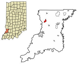
Mexico is an unincorporated community and census-designated place (CDP) in Jefferson Township, Miami County, in the U.S. state of Indiana. The population was 915 at the 2020 census.

Bolingbroke, founded in 1867, is an unincorporated community and census-designated place (CDP) in Monroe County, Georgia, United States. It lies just north of Macon, between Interstates 475 and 75. The community is part of the Macon metropolitan statistical area.

<span class="mw-page-title-main">Metamora, Indiana</span> Census-designated place in Indiana, United States

Metamora is an unincorporated town and census-designated place in Metamora Township, Franklin County, Indiana. The town was once a stop along the Whitewater Canal and is now primarily dependent on tourism. As of the 2010 census, it had a population of 188.

<span class="mw-page-title-main">Ida, Michigan</span> Census-designated place & unincorporated community in Michigan, United States

Ida is an unincorporated community and census-designated place (CDP) in Monroe County in the U.S. state of Michigan. The CDP had a population of 790 at the 2020 census. The community is mostly within Ida Township with a smaller portion extending north into Raisinville Township.

<span class="mw-page-title-main">Dubois, Indiana</span> Census-designated place in Indiana, United States

Dubois is an unincorporated community and census-designated place (CDP) in Dubois County, Indiana, United States. Its population at the 2010 census was 488.

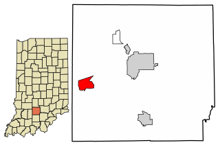
Centerton is an unincorporated community and census-designated place (CDP) in Clay Township, Morgan County, in the U.S. state of Indiana.

<span class="mw-page-title-main">New Trenton, Indiana</span> Census-designated place in Indiana, United States

New Trenton is an unincorporated community and census-designated place (CDP) in Whitewater Township, Franklin County, Indiana. As of the 2010 census it had a population of 252. It has a ZIP code 47035.

<span class="mw-page-title-main">Scotland, Indiana</span> Census-designated place in Indiana, United States

Scotland is an unincorporated community and census-designated place (CDP) in Taylor Township, Greene County, Indiana, United States. As of the 2010 census it had a population of 134.

<span class="mw-page-title-main">Scipio, Indiana</span> Census-designated place in Indiana, United States

Scipio is an unincorporated community and census-designated place (CDP) in Geneva Township, Jennings County, Indiana, United States. As of the 2010 census it had a population of 153.

<span class="mw-page-title-main">Emison, Indiana</span> Census-designated place in Indiana, United States

Emison is an unincorporated community and census-designated place (CDP) in Busseron Township, Knox County, Indiana. Its population was 154 at the 2010 census.

<span class="mw-page-title-main">Westphalia, Indiana</span> Census-designated place in Indiana, United States

Westphalia is an unincorporated community and census-designated place (CDP) in Vigo Township, Knox County, Indiana. As of the 2010 census it had a population of 202.

<span class="mw-page-title-main">Avoca, Indiana</span> Census-designated place in Indiana, United States

Avoca is an unincorporated community and census-designated place in Marshall Township, Lawrence County, Indiana, United States. As of the 2010 census the population was 583.

<span class="mw-page-title-main">Williams, Lawrence County, Indiana</span> Census-designated place in Indiana, United States

Williams is an unincorporated community and census-designated place in Spice Valley Township, Lawrence County, Indiana, United States. As of the 2010 census, the population was 286.

Chili (Cheye-leye) is an unincorporated community and census-designated place in Richland Township, Miami County, in the U.S. state of Indiana.

Miami is an unincorporated community and census-designated place (CDP) in Deer Creek Township, Miami County, in the U.S. state of Indiana.

North Grove is an unincorporated community and census-designated place (CDP) in Harrison Township, Miami County, in the U.S. state of Indiana.

<span class="mw-page-title-main">Harrodsburg, Indiana</span> Census-designated place in Indiana, United States

Harrodsburg is an unincorporated community and census-designated place (CDP) in Clear Creek Township, Monroe County, in the U.S. state of Indiana. Its population was 656 at the 2020 census.

Waverly is an unincorporated community and census-designated place (CDP) in Harrison Township, Morgan County, in the U.S. state of Indiana.

<span class="mw-page-title-main">Eminence, Indiana</span> Census-designated place in Indiana, United States

Eminence is an unincorporated community and census-designated place (CDP) in Adams Township, Morgan County, in the U.S. state of Indiana.

<span class="mw-page-title-main">Smithville-Sanders, Indiana</span> Census-designated place in Indiana, United States

Smithville-Sanders is a census-designated place (CDP) encompassing the communities of Smithville and Sanders in Monroe County, Indiana, United States. Its population was 3,323 as of the 2020 census.

References

  1. 1 2 "2022 U.S. Gazetteer Files: Indiana". United States Census Bureau. Retrieved April 19, 2023.
  2. 1 2 3 U.S. Geological Survey Geographic Names Information System: Stanford, Indiana
  3. "U.S. Census website". United States Census Bureau . Retrieved January 31, 2008.
  4. History of Lawrence and Monroe Counties, Indiana: Their People, Industries, and Institutions. B.F. Bowen. 1914. pp.  436.
  5. Blanchard, Charles (1884). Counties of Morgan, Monroe and Brown, Indiana: Historical and Biographical. F.A. Battey & Company. pp.  510.
  6. "Monroe County". Jim Forte Postal History. Retrieved September 5, 2015.