Stapleton is a neighborhood in northeastern Staten Island in New York City, United States. It is located along the waterfront of Upper New York Bay, roughly bounded on the north by Tompkinsville at Grant Street, on the south by Clifton at Vanderbilt Avenue, and on the west by St. Paul's Avenue and Van Duzer Street, which form the border with the community of Grymes Hill.
Stapleton is one of the older waterfront neighborhoods of the borough, built in the 1830s on land once owned by the Vanderbilt family. It was a long-time commercial center of the island, but has struggled to revive after several decades of neglect following the 1964 construction of the Verrazzano-Narrows Bridge, which shifted the commercial development of the island to its interior.
The neighborhood was the site of the farm where Cornelius Vanderbilt grew up, at the location of the present-day Paramount Theater building on Bay Street (the theater itself having closed in the early 1980s). In the early 19th century it became the commercial center of Southfield Township. In 1832 William J. Staples, a merchant from Manhattan for whom the neighborhood is named, as well as Minthorne Tompkins, the son of Vice PresidentDaniel D. Tompkins, acquired land from the Vanderbilts and laid out the streets. Staples and Tompkins started a ferry service from the neighborhood waterfront to Manhattan and began advertising their new village in 1836.
The neighborhood was the location of several springs which led to the establishment of several German-Americanbreweries in the middle 19th century. The last brewery closed in 1963.
In 1884, Stapleton was incorporated as the village of Edgewater. The old Village Hall still stands, located in Tappen Park. In 1884, the Staten Island Railway extended its track from the neighborhood northward to St. George, with a stop at Stapleton station. Direct ferry service from the neighborhood to Manhattan was halted two years later in 1886.
20th century
Between 1929 and 1931, Stapleton had its own NFL pro football team, the Staten Island Stapletons. In their last two years they were known as the Staten Island Stapes. This professional American football team was founded in 1915 and played in the National Football League from 1929 to 1932. Jack Shapiro, who was a blocking back for the Stapletons, was the shortest player in NFL history.[3]
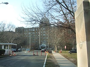
Bayley Seton Hospital, seen from Vanderbilt Avenue
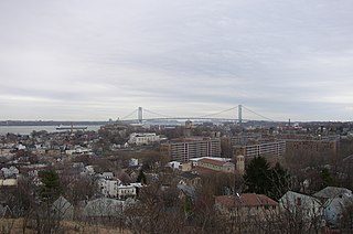
Homeport
Boardman–Mitchell House
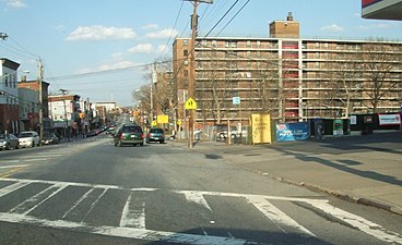
Stapleton Houses (right), looking northeast down Broad Street
Waterfront
The city built piers in 1920, but they were never fully exploited. From 1937 to 1942 several of the piers were used as the first Foreign Trade Zone in the United States. From 1942 to 1945, they became the Staten Island Terminal facility of the Army'sNew York Port of Embarkation.[4] The U.S. Coast Guard operated their Section Base 2 there from the early 1920s until 1967, when they moved to Governors Island.[5] After World War II, the piers once again became a foreign trade zone, but their use declined and most of the piers were demolished by the 1970s. The last, used for fishing, was removed when the U.S. Navy proposed to build a base in Stapleton in the 1980s.[6]
In 1983, Secretary of the NavyJohn Lehman selected Stapleton to be the homeport for a naval unit headed by the battleshipUSSIowa(BB-61), as part of the dispersal of the navy during a military build up ordered by President Ronald Reagan. This proposal became highly controversial throughout Staten Island when analysis of the proposal showed a net loss of civilian jobs on Staten Island (mainly due to expected job-seekers among naval dependents, but also due to a loss of businesses forced out by the naval presence). It was also controversial because of the belief that the Tomahawk cruise missiles aboard the Iowa and an accompanying Aegis cruiser would, in at least some cases, be carrying nuclear warheads.
Following years of debate, which slowed development of the base, the 1991 dissolution of the Soviet Union led to a major cutback in military spending, and the still incomplete base was cancelled in 1993. Shortly thereafter, a plan was floated to build a race-track on the site, to be primarily used by NASCAR. The plan was quickly forgotten. Also headquartered at the site is one of three fireboats, FDNY Marine company 9. The site is now also used as part of the annual Fleet Week in New York City. After sitting empty for a couple of years, the base site was used by a bagel manufacturer briefly. Then a proposal was made to have a movie studio occupy a 6-acre (2.4ha) portion of the site. For never-explained reasons the city administration opposed this, and finally some of the civil courts took over a small part of the site, leaving most unused while various proposals were made for housing, parkland, and an educational complex, among others.
On October 26, 2006, the New York City Council approved a massive redevelopment plan for the site. It will be transformed into a new community with 350 housing units, restaurants, parks, a recreation center and farmers' market. The City Council pushed the project through its final regulatory hurdle when it approved the $66million blueprint for the former Navy base.[7] The city will use the money and an additional $1.1million state grant to create streets, utilities and a mile-long waterfront esplanade while soliciting proposals from private developers to build on six sites—three residential and three commercial—across the 36-acre (15ha) base. City officials have said infrastructure work could begin in early 2007 with a projected completion date of 2009. Demolition of the old Navy buildings began in late 2011.[8]
For census purposes, the New York City government classifies Stapleton as part of a larger neighborhood tabulation area called Stapleton-Rosebank.[9] Based on data from the 2010 United States Census, the population of Stapleton-Rosebank was 26,453, a change of 2,405 (9.1%) from the 24,048 counted in 2000. Covering an area of 26,453 acres (10,705ha), the neighborhood had a population density of 1 inhabitant per acre (640/sqmi; 250/km2).[10] The racial makeup of the neighborhood was 37.5% (9,910) White, 19.3% (5,097) African American, 0.3% (72) Native American, 9.7% (2,565) Asian, 0% (12) Pacific Islander, 0.4% (102) from other races, and 1.6% (427) from two or more races. Hispanic or Latino of any race were 31.3% (8,268) of the population.[11]
The entirety of Community District 1, which comprises Stapleton and other neighborhoods on the North Shore, had 181,484 inhabitants as of NYC Health's 2018 Community Health Profile, with an average life expectancy of 79.0 years.[12]:2,20 This is lower than the median life expectancy of 81.2 for all New York City neighborhoods.[13]:53 (PDF p. 84)[14] Most inhabitants are youth and middle-aged adults: 24% are between the ages of between 0–17, 27% between 25–44, and 26% between 45–64. The ratio of college-aged and elderly residents was lower, at 10% and 13% respectively.[12]:2
As of 2017, the median household income in Community District 1 was $48,018,[15] though the median income in Stapleton individually was $58,373.[2] In 2018, an estimated 21% of Stapleton and the North Shore residents lived in poverty, compared to 17% in all of Staten Island and 20% in all of New York City. One in fourteen residents (7%) were unemployed, compared to 6% in Staten Island and 9% in New York City. Rent burden, or the percentage of residents who have difficulty paying their rent, is 51% in Stapleton and the North Shore, compared to the boroughwide and citywide rates of 49% and 51% respectively. Based on this calculation, as of 2018[update], Stapleton and the North Shore are considered high-income relative to the rest of the city and not gentrifying.[12]:7
Culture
The portions of the neighborhood around the Stapleton Houses have been predominantly Black for a while (though there has always been a noticeable White and Hispanic presence), while the areas further away have been a little bit more diverse. The overall neighborhood has seen a decrease in the White population, which reflects the overall trend of Whites moving back towards the city center (as well as those moving to newer suburbs further out). The local school, P.S. 14 (which has since become P.S. 78 due to P.S. 14's failing as a school) has seen a large increase in the Hispanic population, with the 2011–2012 school year being the first one in which Hispanics have made up the majority of the student body.[16] This is reflective of the overall increase in the Hispanic population in the area.
Community
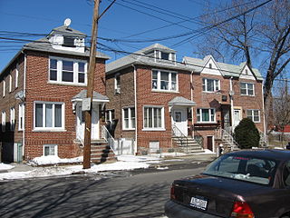
A Victorian home in Stapleton.
Stapleton, like much of the North Shore, has two major coexisting cultural spheres: that based in the old, standalone homes that have been in the area since the Victorian era, and that based in the public housing projects. As such, it is just as common to find Spanish bodegas and vibrant street art as winding roads, used book stores, and coffee shops.
Popular places for the performance of local music include The Full Cup, located on Van Duzer Street, and the Bay Street Saloon and Dock Street, both of which operate on Bay Street. In October 1980, the Paramount Theater began hosting acts such as The B-52s, Talking Heads, Squeeze, the Dead Kennedys, Burning Spear and the Ramones, but it ceased functioning as a concert hall by the late 1980s.[17] Other former venues include Beer Goggles and Martini Red, which is now known as The Hop Shoppe. The NYC Arts Cypher is located on Broad Street, and occasionally hosts hip-hop concerts, which distinguishes it from most other local venues, which cater mainly to rock and alternative bands.
In recent years, the extreme sports scene has boomed on Staten Island. In July 2012, 5050 Skatepark was opened on Front Street across from the Homeport. 5050 Skatepark is New York City's only indoor skatepark, and one of the few skateparks open to BMX bikes, skateboarder, scooters, and rollerblades.
The neighborhood also has a diverse selection of restaurants, including an American-style diner, a Gastropub, as well as Sri Lankan, Mexican, and Italian eateries. Chain restaurants also have a presence.
Points of interest
In 1801, the local Union American Methodist Episcopal church was founded in the neighborhood. It still stands at 43 Tompkins Avenue and has a very active congregation, most of whom are descendants of former slaves on Staten Island.[18] The church is the oldest African-American church in the borough and one of four which predate the 20th century.
Stapleton and the North Shore are patrolled by the 120th Precinct of the NYPD, located at 78 Richmond Terrace.[20] The 120th Precinct ranked 12th safest out of 69 patrol areas for per-capita crime in 2010.[21]As of 2018[update], with a non-fatal assault rate of 94 per 100,000 people, Stapleton and the North Shore's rate of violent crimes per capita is more than that of the city as a whole. The incarceration rate of 719 per 100,000 people is higher than that of the city as a whole.[12]:8
The 120th Precinct has a lower crime rate than in the 1990s, with crimes across all categories having decreased by 83.3% between 1990 and 2022. The precinct reported seven murders, 14 rapes, 118 robberies, 384 felony assaults, 124 burglaries, 338 grand larcenies, and 136 grand larcenies auto in 2022.[22]
As of 2018[update], preterm births and births to teenage mothers are more common in Stapleton and the North Shore than in other places citywide. In Stapleton and the North Shore, there were 96 preterm births per 1,000 live births (compared to 87 per 1,000 citywide), and 22.6 births to teenage mothers per 1,000 live births (compared to 19.3 per 1,000 citywide).[12]:11 Stapleton and the North Shore have a relatively average population of residents who are uninsured. In 2018, this population of uninsured residents was estimated to be 12%, the same as the citywide rate of 12%.[12]:14
The concentration of fine particulate matter, the deadliest type of air pollutant, in Stapleton and the North Shore is 0.0071 milligrams per cubic metre (7.1×10⁻⁹oz/cuft), less than the city average.[12]:9 Sixteen percent of Stapleton and the North Shore residents are smokers, which is higher than the city average of 14% of residents being smokers.[12]:13 In Stapleton and the North Shore, 24% of residents are obese, 9% are diabetic, and 26% have high blood pressure—compared to the citywide averages of 24%, 11%, and 28% respectively.[12]:16 In addition, 21% of children are obese, compared to the citywide average of 20%.[12]:12
Eighty-seven percent of residents eat some fruits and vegetables every day, which is the same as the city's average of 87%. In 2018, 77% of residents described their health as "good," "very good," or "excellent," equal to the city's average of 78%.[12]:13 For every supermarket in Stapleton and the North Shore, there are 28 bodegas.[12]:10
Stapleton is located within the ZIP Code 10304, south of Clinton Street and 10301, north of Clinton Street.[26] The United States Postal Service operates the Stapleton Station post office at 160 Tompkins Avenue.[27]
Education
Stapleton and the North Shore generally have a lower rate of college-educated residents than the rest of the city as of 2018[update]. While 37% of residents age 25 and older have a college education or higher, 15% have less than a high school education and 48% are high school graduates or have some college education. By contrast, 39% of Staten Island residents and 43% of city residents have a college education or higher.[12]:6 The percentage of Stapleton and the North Shore students excelling in math rose from 49% in 2000 to 65% in 2011, though reading achievement declined from 55% to 51% during the same time period.[28]
Stapleton and the North Shore's rate of elementary school student absenteeism is slightly higher than the rest of New York City. In Stapleton and the North Shore, 25% of elementary school students missed twenty or more days per school year, more than the citywide average of 20%.[12]:6[13]:24 (PDF p. 55) Additionally, 73% of high school students in Stapleton and the North Shore graduate on time, about the same as the citywide average of 75%.[12]:6
PS 65 the Academy of Innovative Learning (grades PK-5)[31]
The Roman Catholic Archdiocese of New York operates Staten Island Catholic schools. Immaculate Conception School in Stapleton closed in 2013. The archdiocese stated that the number of students was too low and that the school could not receive enough income.[32] It had 216 students in 2013.[33]
Library
New York Public Library, Stapleton branch
The New York Public Library (NYPL)'s Stapleton branch is located at 132 Canal Street at Wright Street. The Carrere & Hastings-designed Carnegie library was built in 1907. It underwent significant renovations and remodeling from 2011 to 2013, including the addition of a 7,600-square-foot (710m2) building.[34] A minor controversy arose over the discrepancy of architectural styles between the modernist black-glass addition and the original structure.[35]
New Dorp is a neighborhood on the East Shore of Staten Island, New York City, United States. New Dorp is bounded by Mill Road on the southeast, Tysens Lane on the southwest, Amboy and Richmond Roads on the northwest, and Bancroft Avenue on the northeast. It is adjacent to Oakwood to the southwest, Todt Hill to the northwest, Dongan Hills and Grant City, and Midland Beach and Miller Field to the southeast. New Dorp Beach, bordering to the east, is often listed on maps as a separate neighborhood from Mill Road to the shore of Lower New York Bay, but is generally considered to be a part of New Dorp.
Tottenville is a neighborhood on the South Shore of Staten Island, New York City. It is the southernmost neighborhood and settlement in both New York City and New York State, as well as the westernmost neighborhood in New York City. Tottenville is bounded on three sides by water: the south side abuts the New York Bight while the west and north sides are bordered by the Arthur Kill. Nassau Place, Bethel Avenue and Page Avenue form the neighborhood's eastern border.
St. George is a neighborhood on the northeastern tip of Staten Island in New York City, along the waterfront where the Kill Van Kull enters Upper New York Bay. It is the most densely developed neighborhood on Staten Island, and the location of the administrative center for the borough and for the coterminous Richmond County. The St. George Terminal, serving the Staten Island Ferry and the Staten Island Railway, is also located here. St. George is bordered on the south by the neighborhood of Tompkinsville and on the west by the neighborhood of New Brighton.
Midland Beach is a neighborhood of Staten Island in New York City. It lies along the east-central coast of the island, in the area known locally as the "Mid-Island, Staten Island" or the "East Shore".
Tompkinsville is a neighborhood in northeastern Staten Island in New York City. Named for Daniel D. Tompkins, sixth Vice President of the United States (1817–1825), the neighborhood sits on the island's eastern shore, along the waterfront facing Upper New York Bay, between St. George on the north and Stapleton on the south; however, it is considered part of the North Shore by the island's residents.
Clifton is a neighborhood on the North Shore of Staten Island in New York City, United States. It is an older waterfront neighborhood, facing Upper New York Bay on the east. It is bordered on the north by Stapleton, on the south by Rosebank, on the southwest by Concord, and on the west by Van Duzer Street.
Port Richmond is a neighborhood situated on the North Shore of Staten Island, a borough of New York City. Port Richmond is bounded by Kill van Kull on the north, Clove Road on the east, Forest Avenue on the south, and the Bayonne Bridge on the west. It is adjacent to West New Brighton to the east, Westerleigh to the south, and Elm Park and Mariners Harbor to the west.
New Brighton is a neighborhood located on the North Shore of Staten Island in New York City. The neighborhood comprises an older industrial and residential harbor front area along the Kill Van Kull west of St. George. New Brighton is bounded by Kill Van Kull on the north, Jersey Street on the east, Brighton and Castleton Avenues to the south, and Lafayette Avenue and Snug Harbor Cultural Center to the west. It is adjacent to St. George to the east, Tompkinsville to the south, and West New Brighton to the west.
Pelham Bay is a middle class residential neighborhood in the borough of the Bronx, in New York City. It is named for Pelham Bay Park, New York City's largest park, which lies on the neighborhood's northeastern border; and for Pelham Bay, a body of water in that park. The neighborhood is bounded roughly by Pelham Parkway on the north, the New England Thruway (I-95) on the east, the Bruckner Expressway (I-95) on the south, and the Hutchinson River Parkway on the west.
West New Brighton is a neighborhood of Staten Island, New York City, situated along the central North Shore. The neighborhood is bordered by New Brighton to the east, Port Richmond to the west, the waters of the Kill Van Kull to the north, and the communities of Sunnyside and Castleton Corners to the south.
The term North Shore is frequently applied to a series of neighborhoods within the New York City borough of Staten Island.
South Beach is a neighborhood on the East Shore of Staten Island, New York City, situated directly south of the Verrazzano-Narrows Bridge. South Beach is bounded by New York Bay on the southeast, Seaview Avenue on the southwest, Laconia Avenue on the northwest, Reid and McClean Avenues on the north, and Lily Pond Avenue on the northeast. It is adjacent to Midland Beach to the southwest, Dongan Hills and Old Town/Concord to the northwest, and Fort Wadsworth and Rosebank to the northeast.
Great Kills is a neighborhood within the borough of Staten Island in New York City. It is located on the island's South Shore, and according to many local geographers, it is the South Shore's northernmost community. It is bordered by Richmondtown to the north, Bay Terrace to the east, Eltingville to the west, and Great Kills Harbor to the south.
Dongan Hills is a neighborhood located within the New York City borough of Staten Island. It is on the Island's East Shore. Dongan Hills is bounded by Laconia Avenue on the southeast, Jefferson Avenue on the southwest, Richmond Road on the northwest, and Old Town Road to the north. It is adjacent to New Dorp and Grant City to the southwest, Todt Hill to the northwest, Old Town/Concord to the northeast, and South Beach and Midland Beach to the southeast.
Graniteville is the name of a neighborhood in Staten Island, one of the five boroughs of New York City.
Country Club is a residential neighborhood located in the East Bronx in New York City. The neighborhood's boundaries are Middletown Road and Watt Avenue to the north, Eastchester Bay to the east, Layton Avenue and the Throggs Neck neighborhood to the south, and the New England Thruway and Pelham Bay neighborhood to the west. Pelham Bay Park, the largest public park in New York City, is located just north of Country Club.
Hamilton Heights is a neighborhood in the northern part of Manhattan in New York City. It is the northernmost part of the West Harlem area, along with Manhattanville and Morningside Heights to its south, and it contains the sub-neighborhood and historic district of Sugar Hill. Washington Heights lies to Hamilton Heights' north, and to its east is Central Harlem.
South Ozone Park is a neighborhood in the southwestern section of the New York City borough of Queens. It is just north of John F. Kennedy International Airport, between Aqueduct Racetrack to the west and the Van Wyck Expressway to the east. Adjacent neighborhoods include Ozone Park to the west; Richmond Hill to the north; Jamaica, South Jamaica, and Springfield Gardens to the east; and Howard Beach and Old Howard Beach to the southwest.
Bay Terrace is a neighborhood in the northeastern section of the New York City borough of Queens. It is often considered part of the larger area of Bayside. Bay Terrace overlooks the East River and the approaches to the Throgs Neck Bridge from the Clearview Expressway and Cross Island Parkway. It is bounded on the west by the Clearview Expressway, on the south by 26th and 28th Avenues, to the east by the Little Neck Bay, and to the north by the East River.
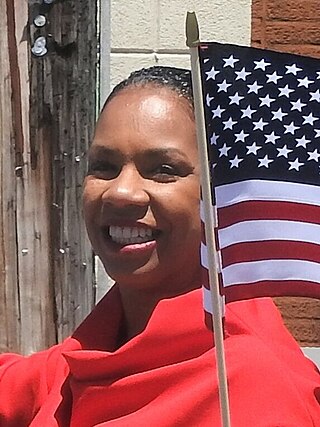
Kamillah M. Hanks is an American politician and New York City Council Member for the 49th District on the North Shore of Staten Island.
This page is based on this Wikipedia article Text is available under the CC BY-SA 4.0 license; additional terms may apply. Images, videos and audio are available under their respective licenses.