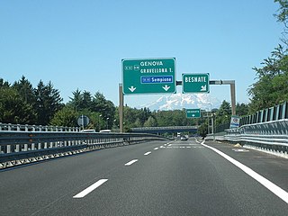
Italy has a well developed transport infrastructure. The Italian rail network is extensive, especially in the north, and it includes a high-speed rail network that joins the major cities of Italy from Naples through northern cities such as Milan and Turin. The Florence–Rome high-speed railway was the first high-speed line opened in Europe when more than half of it opened in 1977. Italy has 2,507 people and 12.46 km2 per kilometer of rail track, giving Italy the world's 13th largest rail network. The Italian rail network is operated by state-owned Ferrovie dello Stato, while the rail tracks and infrastructure are managed by Rete Ferroviaria Italiana.

A dual carriageway (BrE) or a divided highway (AmE) is a class of highway with carriageways for traffic travelling in opposite directions separated by a central reservation (BrE) or median (AmE). Roads with two or more carriageways which are designed to higher standards with controlled access are generally classed as motorways, freeways, etc., rather than dual carriageways.
A routenumber, designation or abbreviation is an identifying numeric designation assigned by a highway authority to a particular stretch of roadway to distinguish it from other routes and, in many cases, also to indicate its classification, general geographical location and/or orientation. The numbers chosen may be used solely for internal administrative purposes; however, in most cases they are also displayed on roadside signage and indicated on maps.

The road hierarchy categorizes roads according to their functions and capacities. While sources differ on the exact nomenclature, the basic hierarchy comprises freeways, arterials, collectors, and local roads. Generally, the functional hierarchy can more or less correspond to the hierarchy of roads by their owner or administrator.

A county highway is a road in the United States and in the Canadian province of Ontario that is designated and/or maintained by the county highway department. Route numbering can be determined by each county alone, by mutual agreement among counties, or by a statewide pattern.

A controlled-access highway is a type of highway that has been designed for high-speed vehicular traffic, with all traffic flow—ingress and egress—regulated. Common English terms are freeway, motorway, and expressway. Other similar terms include throughway or thruway and parkway. Some of these may be limited-access highways, although this term can also refer to a class of highways with somewhat less isolation from other traffic.

In the state of Maine, the Maine Department of Transportation (MaineDOT) has a system of numbered highways, defined as the "connected main highways throughout the state which primarily serve arterial or through traffic." As of 2006, 22,236 miles of roadway are included in the highway system, including Interstate highways, U.S. Routes, state highways, and other urban and rural local roads.
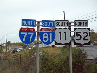
A highway shield or route marker is a sign denoting the route number of a highway, usually in the form of a symbolic shape with the route number enclosed. As the focus of the sign, the route number is usually the sign's largest element, with other items on the sign rendered in smaller sizes or contrasting colors. Highway shields are used by travellers, commuters, and all levels of government for identifying, navigating, and organising routes within a given jurisdiction. Simplified highway shields often appear on maps.

A highway location marker is the modern-day equivalent of a milestone. Unlike traditional milestones, however, which were originally carved from stone and sited at one-mile intervals, modern highway location markers are made from a variety of materials and are almost invariably spaced at intervals of a kilometre or a fraction thereof. In some countries they may be known as driver location signs, milestones or kilometre stones.
This article describes the highway systems available in selected countries.
Highways are split into at least four different types of systems in the United States: Interstate Highways, U.S. Highways, state highways, and county highways. Highways are generally organized by a route number or letter. These designations are generally displayed along the route by means of a highway shield. Each system has its own unique shield design that will allow quick identification to which system the route belongs.
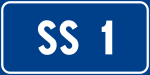
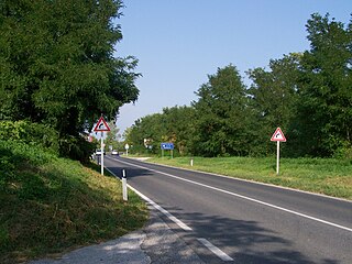
The Strade Statali, abbreviated SS, is the Italian national network of state highways. The total length for the network is about 25,000 km (16,000 mi).
A strada regionale, abbreviated SR, is a type of Italian road maintained by the regions they traverse. A regional road is less important than a state highway, but more important than a provincial road.

A strada provinciale, abbreviated SP, is an Italian road that is maintained by provinces or metropolitan cities. In Veneto from 2002, state highways downgraded as provincial roads are maintained by the regional company Veneto Strade. A provincial road is less important than a regional road, but more important than municipal roads. The types of provincial roads are the same ones of state highways.

Roads in Italy are an important mode of transport in Italy. The classification of the roads of Italy is regulated by the Italian traffic code, both from a technical and administrative point of view. The street nomenclature largely reflects the administrative classification. Italy is one of the countries with the most vehicles per capita, with 690 per 1000 people in 2010.

The réseau routier québécois is managed by the Quebec Ministry of Transportation and consists of about 185,000 kilometres (115,000 mi) of highways and roads. In addition, Quebec has almost 12,000 bridges, tunnels, retaining walls, culverts, and other structures such as the Quebec Bridge, the Pierre Laporte Bridge, the Laviolette Bridge and the Louis-Hippolyte Lafontaine Bridge–Tunnel.
The Roads in Puerto Rico are the national, forest and municipal roadways that make up the approximately 14,400 kilometers (8,900 mi) roads through the terrain of Puerto Rico. The highways serve the more than 3 million residents, and 3-4 million tourists who visit each year.

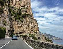
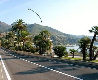
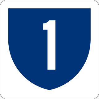
Strada statale 1 Via Aurelia it is one of the most important state highways in Italy and derives from an ancient consular road, the Via Aurelia. It connects Rome with France following the coast of Tyrrhenian Sea and Ligurian Sea and touching nine provincial capitals as well as important tourist locations.

Strada statale 7 Via Appia is a motorway that follows the path of the ancient Appian Way, connecting Rome to Brindisi. In the stretch between Cisterna di Latina and Terracina, the SS 7 is called "fettuccia di Terracina" due to its straight line.