Taff's Well

Last updated

Taff's Well
Cardiff train departs from Taff's Well - geograph.org.uk - 371339.jpg
Rhondda Cynon Taf UK location map.svg
Red pog.svg
Taff's Well
Location within Rhondda Cynon Taf
Population3,672 (2011) [1]
OS grid reference ST121834
Community
  • Taff’s Well & Nantgarw [2]
Principal area
Preserved county
Country Wales
Sovereign state United Kingdom
Post town CARDIFF
Postcode district CF15
Dialling code 029
Police South Wales
Fire South Wales
Ambulance Welsh
UK Parliament
Senedd Cymru – Welsh Parliament
List of places
UK
Wales
Rhondda Cynon Taf
51°32′35″N3°16′08″W / 51.543°N 3.269°W / 51.543; -3.269

Taff's Well (Welsh : Ffynnon Taf) is a semi-rural village, community and electoral ward located at the south easterly tip of Rhondda Cynon Taf, 6 miles (9.7 km) to the north of Cardiff, the capital city of Wales. Known locally as the 'Gates to the Valleys', it is separated from Gwaelod-y-Garth by the River Taff. Taff's Well is distinguished because it contains the only thermal spring in Wales. The tepid water is thought to rise along a fault-line from the Carboniferous Limestone, in somewhat similar manner to the warm springs at Bristol and Bath. Various religious groups regard it as a spiritual site. [3]

Contents

The Garth Mountain overlooks the village and was the inspiration for the fictional "Ffynnon Garw", featured in the book and film The Englishman Who Went up a Hill but Came down a Mountain .

Name

The name "Taff's Well" is derived from the situation of the village alongside the River Taff and the presence of the warm spring within Taff's Well Park.

Thermal spring

Taff's Well Park (Parc Ffynnon Taf) is the site of the Taff's Well Thermal Spring, a well that reached its height of popularity for visitors to the village in the mid to late 1800s. [4] The average temperature of the water is 21.6 degrees C. [5] The well is Wales' only natural thermal spa.

Location

Taff's Well lies just off Junction 32 of the M4 motorway and at the southern end of the A470.

Though administered by Rhondda Cynon Taff Council, Taff's Well is a commuter town for the City of Cardiff, where many of its residents work.

Culture

19th century

Taff's Well grew into an important railway junction during the mid- to late 19th century, when Cardiff was a major global exporter of coal.

Taff's Well is a growing community which includes numerous districts: Glan-y-Llyn, Rhiw Ddar and Glan-y-Fordd; Ty-Rhillage centre that consists of Alfred's terrace, Anchor Street, Church Street, Garth Street, Yew Street and Ty Rhiw through which the Taff Trail runs. Taff's Well is next to Castell Coch, which overlooks Cardiff.

20th century

The actor David Jason spent much time in Taff's Well and based the situation comedy Open All Hours upon Arthur's shop, [6] which is one of many buildings to have been dismantled and sent to the St Fagan's Museum of Welsh Life.

21st century

Taff's Well is the original location of the story that inspired the film The Englishman Who Went up a Hill but Came down a Mountain , by Ivor Monger and Christopher Monger.

Taff's Well has featured in the Sky sitcom Stella, starring Ruth Jones. The post office in Nantgarw is a filming location in the sitcom, although it is just outside the village.

Local politics

Taff's Well is an electoral ward coterminous to the community boundaries and elects a county councillor to Rhondda Cynon Taf County Borough Council. Jill Bonetto (Labour) has represented the ward since 2012. [7] [8]

Taff's Well and Nantgarw are also represented locally by the Taff's Well & Nantgarw Community Council, which has 10 members. The Council was criticised in 2010 by the Wales Audit Office for breaching financial and corporate governance regulations with its financial records. Described as 'The worst-run council in Wales', there were calls for the 'wholesale sacking' of the ten members for breaching 'financial and corporate governance regulations because of its "inadequate" financial records, supporting paperwork and minutes between 2002 and 2006'. [9]

Sport

Taff's Well A.F.C. are the local football team. They play in the Cymru South, the second tier of the Welsh football league system.

Taffs Well RFC are the local Rugby union team.

Transport

Taffs Well railway station, which opened in 1863, [10] is on the Rhondda and Merthyr Lines. Services are provided by Transport for Wales northbound to Treherbert, Aberdare, Merthyr Tydfil via Pontypridd, and southbound to Cardiff Queen Street and Cardiff Central. The average journey time to Cardiff Central is 20 minutes at a frequency of six trains per hour. [11]

Stagecoach South Wales bus service 132 between Maerdy and Cardiff Central bus station stops in the village every 15 minutes at peak times. [12]

The A470 road runs through the village between Cardiff Bay (9 miles (14 km) south) and Llandudno (179 miles (288 km) north). Taff's Well is 2 miles (3.2 km) north of junction 32 (Cardiff North) of the M4 motorway.

There are plans to integrate Taff's Well into the South Wales Metro.[ citation needed ]

The former Walnut Tree Viaduct ran across the Taff Valley to the south of Taff's Well. Two of the support columns remain standing.

Churches

Taff's Well has two active churches:

Like the neighbouring community of Tongwynlais, Taff's Well formerly had a number of other churches which have ceased to function and have either been converted into other purposes or been demolished:

Cemetery

Ty Rhiw cemetery in Taff's Well was one of several cemeteries in Rhondda Cynon Taf where bodies were buried in the wrong graves. The errors were discovered in the early 2000s and resulted in a police investigation. [21] In 2009, Taffs Well and Nantgarw Community Council planned to reuse the chapel at the cemetery for weddings and funerals, as was originally intended. A campaign against the decision was led by the Friends of Ty Rhiw Cemetery. [22] There are seven Commonwealth War Graves Commission memorials in the cemetery, marking the burial place of British sailors and soldiers from the First and Second World Wars. [23]

Notable people

See Category:People from Taff's Well

Related Research Articles

<span class="mw-page-title-main">Pontypridd</span> Town in Wales

Pontypridd is a town and a community in Rhondda Cynon Taf, Wales.

<span class="mw-page-title-main">Mountain Ash, Rhondda Cynon Taf</span> Town in Cynon Valley, Wales

Mountain Ash is a town and former community in the Cynon Valley, within the County Borough of Rhondda Cynon Taf, Wales, with a population of 11,230 at the 2011 Census, estimated in 2019 at 11,339. It includes the districts and villages of Cefnpennar, Cwmpennar, Caegarw, Darranlas, Fernhill, Glenboi and Newtown, all within the historic county boundaries of Glamorgan. Aberdare lies about 4.5 miles (7.2 km) north-west, Cardiff 19 miles (31 km) south-east, and Penrhiwceiber a mile to the south-east. It divides into two communities : West covers the town centre and the districts of Miskin, Darranlas, Fernhill and Glenboi, and East the districts of Cefnpennar, Cwmpennar, Caegarw and Newtown.

<span class="mw-page-title-main">Ynysybwl</span> Human settlement in Wales

Ynysybwl is a village in Cwm Clydach in Wales. It is situated in the county borough of Rhondda Cynon Taf, roughly 15 miles (24 km) north-north-west of Cardiff, 4 miles (6 km) north of Pontypridd and 16 miles (26 km) south of Merthyr Tydfil, and forms part of the community of Ynysybwl and Coed-y-Cwm.

<span class="mw-page-title-main">Treforest</span> Suburban village in Pontypridd, Wales

Treforest is a village in the south-east of Pontypridd, in the county borough of Rhondda Cynon Taf, Wales. It is situated in the Treforest electoral ward, along with the village of Glyntaff. It is part of the Pontypridd Town community. Treforest runs along the west bank of the River Taff, while Glyntaff runs along its east bank.

<span class="mw-page-title-main">Abercynon</span> Human settlement in Wales

Abercynon, is both a village and a community in the Cynon Valley within the unitary authority of Rhondda Cynon Taf, Wales. The community comprises the village and the districts of Carnetown and Grovers Field to the south, Navigation Park to the east, and Glancynon to the north.

<span class="mw-page-title-main">Ynyshir</span> Village and community in Rhondda, Wales

Ynyshir is a village and community located in the Rhondda Valley, within Rhondda Cynon Taf, South Wales. The name of the village means "long island" in Welsh and takes its name from a farm in the area, falling within the historic parishes of Ystradyfodwg and Llanwynno (Llanwonno). The community of Ynyshir lies between the small adjoining village of Wattstown and the larger town of neighbouring Porth.

<span class="mw-page-title-main">Ferndale, Rhondda Cynon Taf</span> Town in Wales

Ferndale is a town and community located in the Rhondda Valley in the county borough of Rhondda Cynon Taf, Wales. Neighbouring villages are Blaenllechau, Maerdy and Tylorstown. Ferndale was industrialised in the mid-19th century. The first coal mine shaft was sunk in 1857 and Ferndale was the first community to be intensively industrialised in the Rhondda Valley.

<span class="mw-page-title-main">Taffs Well railway station</span> Railway station in Rhondda Cynon Taf, Wales

Taffs Well railway station is a railway station serving the village of Taff's Well, Rhondda Cynon Taf, Wales, as well as neighbouring Gwaelod-y-Garth, Cardiff. It is located on the Merthyr Line and the Rhondda Line. Passenger services are provided by Transport for Wales.

<span class="mw-page-title-main">Penrhiwceiber</span> Human settlement in Wales

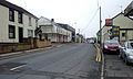
Penrhiwceiber is a small Welsh village and community in the county borough of Rhondda Cynon Taf that lies south of the town Aberpennar and north of the village of Tyntetown, and is one of many villages that lies within the Cynon Valley. Prior to 1870 the area was heavy woodland, but the opening of the Penrhiwceiber Colliery in 1878 saw its rapid expansion into a thriving village.

<span class="mw-page-title-main">Upper Boat</span> Human settlement in Wales

Upper Boat is a village on the southernmost outskirts of the town of Pontypridd, within the electoral ward of Hawthorn, Rhondda Cynon Taf, Wales, and comprises part of the Treforest Industrial Estate. Historically part of Glamorgan, it fell within the parish of Eglwysilan.

<span class="mw-page-title-main">Cymmer, Rhondda Cynon Taf</span> Human settlement in Wales

Cymmer is a village and community in the Rhondda Valley, Wales. It is so named because of being located at the 'confluence' of the Rhondda Fawr and Rhondda Fach river valleys. Several collieries were opened here in the middle part of the nineteenth century. A coal mine disaster in 1856 resulted in 114 casualties, and the lack of payment of any compensation to the miners' families caused bitter feelings in the community.

<span class="mw-page-title-main">Church Village</span> Village in Rhonda Cynon Taf, Wales

Church Village is a large village in the historic parish and community of Llantwit Fardre, located within the Taff Ely district of the County Borough of Rhondda Cynon Taf in Wales. The village is centrally located being around 4 miles (6.4 km) from the local principal towns of Llantrisant to the southwest and Pontypridd to the north and is situated around 10 miles (16 km) northwest of Cardiff city centre.

<span class="mw-page-title-main">Tonteg</span> Human settlement in Wales

Tonteg is a village around 3.7 miles (6 km) from Pontypridd, south Wales. It is 9 miles (14.5 km) north west of Cardiff and four miles (6.5 km) north east of Llantrisant. The village is within the community of Llantwit Fardre. Tonteg is to the north west of the Garth Mountain, on the west side of the River Taff valley, at the top of a hill known locally as Powerstation Hill. The hill gets its name from the Upper Boat power station which was situated at the bottom of the hill until it was demolished in 1972. Tonteg is next to Church Village and the boundaries between the two villages are blurred. A significant part of the Treforest Industrial Estate falls within the Willowford area of Tonteg.

<span class="mw-page-title-main">Afon Clun</span> River in Wales

The Afon Clun is a 14-mile (23 km) long tributary of the River Ely, in the counties of Cardiff and Rhondda Cynon Taf, Wales. Its bedrock is predominantly of sandstone. Beginning on the western slope of The Garth the river is fast-flowing, in clear shallow water with a hard substrate, flowing to the south of Llantrisant and generally west to its confluence with the River Ely at Pontyclun, falling 715 feet (218 m) over its course.

<span class="mw-page-title-main">Ynysboeth</span> Human settlement in Wales

Ynysboeth is a local community within the Mountain Ash (Aberpennar) postal district of the Cynon Valley in the County Borough of Rhondda Cynon Taf, South East Wales.

<span class="mw-page-title-main">Penderyn, Rhondda Cynon Taf</span> Village in Rhondda Cynon Taf, Wales

Penderyn is a rural village in the Cynon Valley, Rhondda Cynon Taf, Wales, located near Hirwaun.

<span class="mw-page-title-main">Grade I listed buildings in Rhondda Cynon Taf</span> List of buildings in county borough of Wales

Rhondda Cynon Taf is a county borough in South Wales. It is located to the north-west of Cardiff and covers an area of 424 km2 (164 sq mi). In 2021 the population was approximately 237,500.

<span class="mw-page-title-main">Grade II* listed buildings in Rhondda Cynon Taf</span> List of buildings in county borough of Wales

Rhondda Cynon Taf is a county borough in South Wales. It is located to the north-west of Cardiff and covers an area of 424 km2 (164 sq mi). In 2021 the population was approximately 237,500.

<span class="mw-page-title-main">St Michael and All Angels Church, Tongwynlais</span> Church

St Michael and All Angels Church is an Anglican church in the village of Tongwynlais, South Wales, serving the parish of the same name. It is a Grade II listed building.

<span class="mw-page-title-main">Registered historic parks and gardens in Rhondda Cynon Taf</span> List of buildings in county borough of Wales

Rhondda Cynon Taf is a county borough in South Wales. It is located to the north-west of Cardiff and covers an area of 424 km2 (164 sq mi). In 2021 the population was approximately 237,500.

References

  1. "Community population 2011" . Retrieved 17 November 2015.
  2. "Home - Taff". www.taffswellandnantgarwcc.com.
  3. "Welcome to Taff's Well and Nantgarw Community Council Website". taffswellandnantgarwcc.com. Retrieved 13 August 2022.
  4. "Waters From The Deep: Taff's Well thermal spring" (PDF). Natur Cymru. Summer 2014. pp. 30–33. Retrieved 10 January 2016.
  5. Farr, Gareth; Bottrell, Simon H (2013). "The hydrogeology and hydrochemistry of the thermal waters at Taff's Well, South Wales, UK". Cave and Karst Science. 40 (1).
  6. "Arthur the Hardware calls it a day". 30 April 2003.
  7. Rhondda Cyon Taff County Borough Council Election Results 1995-2012, The Election Centre. Retrieved 31 October 2018.
  8. County Borough Council Elections 2017, Rhondda Cynon Taf County Borough Council. Retrieved 31 October 2018.
  9. "'Worst run council in Wales'". Pontypridd and Llantrisant Observer. 3 June 2010. Retrieved 15 November 2014.
  10. Hutton, John (2006). The Taff Vale Railway, vol. 1. Silver Link. ISBN   978-1-85794-249-1.
  11. Arriva Trains Wales Timetable: Valleys and Cardiff local routes
  12. "Stagecoach service 132 timetable". stagecoachbus.com.
  13. "Taff's Well". rctcbc.gov.uk. Retrieved 17 September 2021.
  14. "ENGLISH WESLEYAN METHODIST CHAPEL (BAPTIST CHURCH), CARDIFF ROAD, TAFF'S WELL (14343)". Coflein. RCAHMW . Retrieved 9 December 2018.
  15. "Taffs Well - Wesley Methodist Church, Caerphilly" . Retrieved 9 December 2018.
  16. "TABOR CALVINISTIC METHODIST CHAPEL, TABOR STREET, FFYNNON TAF; TAFF'S WELL (9409)". Coflein. RCAHMW . Retrieved 9 December 2018.
  17. "Taff's Well in the Parish of Eglwysilan" . Retrieved 9 December 2018.
  18. "GLANDWR TAF WELSH INDEPENDENT CHAPEL, FFYNNON TAF; TAFF'S WELL (9407)". Coflein. RCAHMW . Retrieved 9 December 2018.
  19. "TABERNACLE ENGLISH BAPTIST CHAPEL, GARTH STREET; KING STREET, FFYNNON TAF; TAFF'S WELL (9408)". Coflein. RCAHMW . Retrieved 9 December 2018.
  20. "Pressreader" . Retrieved 11 December 2022.
  21. "Excavations find empty grave". BBC News . 7 November 2003. Retrieved 30 November 2020.
  22. "Protesters win battle over Ty Rhiw chapel". Wales Online. 15 October 2009. Archived from the original on 30 November 2020. Retrieved 30 November 2020.
  23. "Great Missenden (St Peter and Paul) Churchyard". Commonwealth War Graves Commission . Retrieved 30 November 2020.