Maerdy is a village and community in the county borough of Rhondda Cynon Taf, and within the historic county boundaries of Glamorgan, Wales, lying at the head of the Rhondda Fach Valley.

Treorchy is a town and community in Wales. Once a mining town, it retains such characteristics. Situated in the county borough of Rhondda Cynon Taf in the Rhondda Fawr valley. Treorchy is also one of the 16 communities of the Rhondda. It includes the villages of Cwmparc and Ynyswen.

Tonypandy is a town, community and electoral ward located in the county borough of Rhondda Cynon Taf, within the historic county boundaries of Glamorgan, Wales, lying in the Rhondda Fawr Valley. A former industrial coal mining town, the town was the scene of the 1910 Tonypandy riots.

Ynysybwl is a village in Cwm Clydach in Wales. It is situated in the county borough of Rhondda Cynon Taf, roughly 15 miles (24 km) north-north-west of Cardiff, 4 miles (6 km) north of Pontypridd and 16 miles (26 km) south of Merthyr Tydfil, and forms part of the community of Ynysybwl and Coed-y-Cwm.

Llwynypia is a village and community in Rhondda Cynon Taf, Wales, near Tonypandy in the Rhondda Fawr Valley. Before 1850 a lightly populated rural farming area, Llwynypia experienced a population boom between 1860 and 1920 with the sinking of several coal mines after the discovery of large coal deposits throughout the Rhondda Valleys.

Ynyshir is a village and community located in the Rhondda Valley, within Rhondda Cynon Taf, South Wales. The name of the village means "long island" in Welsh and takes its name from a farm in the area, falling within the historic parishes of Ystradyfodwg and Llanwynno (Llanwonno). The community of Ynyshir lies between the small adjoining village of Wattstown and the larger town of neighbouring Porth.

Ferndale is a town and community located in the Rhondda Valley in the county borough of Rhondda Cynon Taf, Wales. Neighbouring villages are Blaenllechau, Maerdy and Tylorstown. Ferndale was industrialised in the mid-19th century. The first coal mine shaft was sunk in 1857 and Ferndale was the first community to be intensively industrialised in the Rhondda Valley.
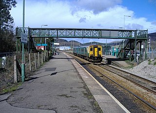
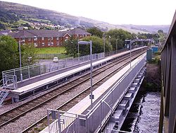
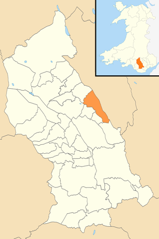
Taff's Well is a semi-rural village, community and electoral ward located at the south easterly tip of Rhondda Cynon Taf, 6 miles (9.7 km) to the north of Cardiff, the capital city of Wales. Known locally as the 'Gates to the Valleys', it is separated from Gwaelod-y-Garth by the River Taff. Taff's Well is distinguished because it contains the only thermal spring in Wales. The tepid water is thought to rise along a fault-line from the Carboniferous Limestone, in somewhat similar manner to the warm springs at Bristol and Bath. Various religious groups regard it as a spiritual site.

Penrhiwceiber is a small Welsh village and community in the county borough of Rhondda Cynon Taf that lies south of the town Aberpennar and north of the village of Tyntetown, and is one of many villages that lies within the Cynon Valley. Prior to 1870 the area was heavy woodland, but the opening of the Penrhiwceiber Colliery in 1878 saw its rapid expansion into a thriving village.

Tylorstown (Pendyrus) is a village and community located in the Rhondda valley, in the county borough of Rhondda Cynon Taf, Wales. It is neighboured by the villages of Blaenllechau, Ferndale, Penrhys, Pontygwaith and Stanleytown.

Clydach Vale is a village in the community of Cwm Clydach, northwest of Tonypandy in the county borough of Rhondda Cynon Taf, within the Rhondda Valley, Wales. It is named for its situation on the Nant Clydach, a tributary of the River Rhondda. The village is deemed part of the Tonypandy built-up area by the Office for National Statistics and comes under the Tonypandy post town.
Llanharry is a village, community and electoral ward in the county borough of Rhondda Cynon Taf, Wales.

Trealaw is a long village, also a community and electoral ward in the Rhondda Valley, Rhondda Cynon Taf, Wales. It stretches over two miles from the junction of Cemetery Road and Brithweunydd Road in the east, to the junction of Ynyscynon Road and Partridge Road to the northwest.
Gilfach Goch is a community, electoral ward and small former coal mining village mostly in the Borough of Rhondda Cynon Taf, south Wales, near the larger community of Tonyrefail. Some areas in the North Western part of the village lie within Bridgend County Borough. It is situated in the Cwm Ogwr Fach between the Cwm Ogwr Fawr to the west and the Cwm Rhondda to the east.

Penygraig is a village and community in the Rhondda Valley in the county borough of Rhondda Cynon Taf, Wales. As a community Penygraig contains the neighbouring districts of Dinas, Edmondstown, Penrhiwfer and Williamstown. Penygraig is within the historic county boundaries of Glamorgan. The name Penygraig is Welsh for 'head of the rock'.
Pentre is a village, community and electoral ward near Treorchy in the Rhondda valley, falling within the county borough of Rhondda Cynon Taf, Wales. The village's name is taken from the Welsh word Pentref, which translates as homestead, though Pentre is named after a large farm that dominated the area before the coming of industrialisation. The community takes in the neighbouring village of Ton Pentre.

Gelli is a village in the Rhondda Fawr valley, in the county borough of Rhondda Cynon Taff, Wales, situated on the southern bank of the Rhondda Fawr River. Gelli is a former coal mining village which is a district of the community of Ystrad.

Graig is a historic district of the town of Pontypridd, Rhondda Cynon Taf, South Wales. It is also the name of an electoral ward for the town and county councils.
Mountain Ash East is a community and coterminous electoral ward in Rhondda Cynon Taf, Wales. It primarily includes the part of the town of Mountain Ash east of the River Cynon. The community was formed in 2016 when the larger community of Mountain Ash was divided into East and West to match the ward boundaries.