
Monroe County is a county in the Commonwealth of Pennsylvania. As of the 2020 census, the population was 168,327. Its county seat is Stroudsburg. The county is part of the Northeast Pennsylvania region of the state.

Lackawanna County is a county in the Commonwealth of Pennsylvania. It is located in Northeastern Pennsylvania and had a population of 215,615 (2022). Its county seat and most populous city is Scranton. The county is part of the Northeast Pennsylvania region of the state.
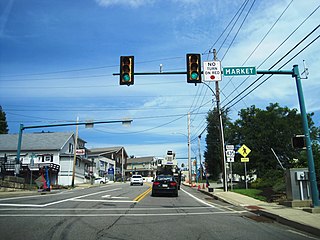
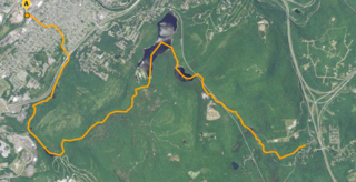
Tannersville is a village in Greene County, New York, United States. The village is in the north-central part of the town of Hunter on Route 23A. The population was 568 at the 2020 census.
Moscow is a borough in Lackawanna County, Pennsylvania, United States. The population was 2,039 at the 2020 census. It is located 11 miles (18 km) southeast of Scranton and 24 miles (39 km) southwest of Honesdale.
Mount Pocono is a borough in Monroe County, Pennsylvania. The borough serves as a local highway nexus, and sees a lot of tourist traffic making use of resources in the region. As of the 2020 census, the borough population was 3,083 residents.
Pocono Township is a township in Monroe County, Pennsylvania. The township's government is located in the village of Tannersville, Pennsylvania, near the site of Camelback Mountain Resort, which is located in the Pocono Mountains and the adjacent Jackson Township. The top of the ski area is within Big Pocono State Park, which is maintained by resort staff. The population was 10,868 at the 2020 census.
Tobyhanna Township is a township in Monroe County, Pennsylvania, United States. The population was 8,290 at the 2020 census. Tobyhanna Township has Tobyhanna Elementary Center and Locust Lake Village.

The Lackawanna River is a 42-mile-long (68 km) tributary of the Susquehanna River in Northeastern Pennsylvania. It flows through a region of the northern Pocono Mountains that was once a center of anthracite coal mining in the United States. It starts in north Wayne County, Pennsylvania and ends in east Luzerne County, Pennsylvania in Duryea, Pennsylvania. The lower reaches of the river flow through the urban areas of Scranton, which grew around its banks in the 19th century as an industrial center. Its name comes from a Lenape word meaning "stream that forks".

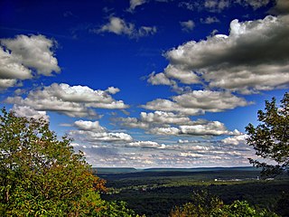
The Pocono Mountains, commonly referred to as the Poconos, are a geographical, geological, and cultural region in Northeastern Pennsylvania. They overlook the Delaware River and Delaware Water Gap to the east, Lake Wallenpaupack to the north, Wyoming Valley and the Coal Region to the west, and the Lehigh Valley to the south. The name Pocono is derived from the Munsee word Pokawachne, which means "Creek Between Two Hills".

Northeastern Pennsylvania is a region of the U.S. state of Pennsylvania that includes the Pocono Mountains, the Endless Mountains, and the industrial cities of Scranton, Wilkes-Barre, Pittston, Hazleton, Nanticoke, and Carbondale. A portion of this region is located in the New York City metropolitan area. Recently, Pennsylvania tourism boards have described Northeastern Pennsylvania as Upstate Pennsylvania.

Pennsylvania Route 611 is a state highway in eastern Pennsylvania running 109.7 mi (176.5 km) from Interstate 95 (I-95) in the southern part of Philadelphia north to I-380 in Coolbaugh Township in the Pocono Mountains.

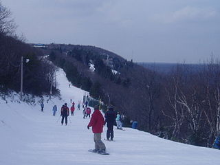
Camelback Resort is a four season resort located in Tannersville, Pennsylvania in the Pocono Mountains in Northeastern Pennsylvania. The resort opened in December 1963. It is the largest ski resort in the Poconos.

Pennsylvania Route 115 (PA 115) is a 35.7-mile-long (57.5 km) north–south state highway in eastern Pennsylvania. It stretches from U.S. Route 209 (US 209) in Brodheadsville, Monroe County, northwest to Interstate 81 (I-81) and PA 309 near Wilkes-Barre in Luzerne County. PA 115 passes through rural areas along its route, intersecting PA 903 in Tunkhannock Township, I-80 and PA 940 in Tobyhanna Township, and I-476 in Bear Creek Township. The road serves as a connector between the Pocono Mountains and the Wyoming Valley.

Pennsylvania Route 715 (PA 715) is a 17.7-mile-long (28.5 km) north–south state route located entirely in Monroe County, Pennsylvania. Its southern terminus is at U.S. Route 209 (US 209) in the Chestnuthill Township hamlet of Brodheadsville. The northern terminus is at PA 191 in the Paradise Township hamlet of Henryville. PA 715 also intersects Interstate 80 (I-80) in Tannersville at Exit 299. The route is a two-lane undivided road running through forested areas of the Pocono Mountains. The road was paved between 1930 and the 1940s. PA 715 was designated to its present alignment in 1963.
Regions of Pennsylvania in the United States include:

Archbald Pothole State Park is a 149.16-acre (60.36 ha) Pennsylvania state park in Archbald, Lackawanna County, Pennsylvania. The focal point of the park is Archbald Pothole. The pothole is a remnant of the Wisconsin Glacial Period, 38 feet (11.6 m) deep with a largest diameter of 42 feet (12.8 m) by 24 feet (7.3 m). It has drawn tourists since just after it was discovered in 1884. Archbald Pothole State Park is on U.S. Route 6 Business in the borough of Archbald.

Gouldsboro State Park is a 2,880-acre (1,165 ha) Pennsylvania state park in Coolbaugh Township, Monroe County and Lehigh Township, Wayne County, Pennsylvania in the United States. The park includes the 250-acre (100 ha) Gouldsboro Lake. Gouldsboro State Park is located very close to Tobyhanna State Park and Pennsylvania State Game Lands 127 and 312. It is on Pennsylvania Route 507 near the small village of Gouldsboro.
North Pocono is a third-class school district in Lackawanna and Wayne Counties in Pennsylvania. The district's population was 20,806 at the time of the 2010 United States Census.

Pocono Summit is an unincorporated community and census-designated place that is located in Monroe County, Pennsylvania. Parts of Pocono Summit are located in the municipalities of Coolbaugh and Tobyhanna townships.
Stafford Meadow Brook is a tributary of the Lackawanna River in Lackawanna County, Pennsylvania, in the United States. It is approximately 11.2 miles (18.0 km) long and flows through Roaring Brook Township, Scranton, and Moosic. The watershed of the stream has an area of 14.1 square miles (37 km2). Part of it is designated as a High-Quality Coldwater Fishery and a Migratory Fishery. The other part is a Warmwater Fishery and a Migratory Fishery. The stream has one named tributary, which is known as Mountain Lake Run. Stafford Meadow Brook has a very high level of water quality for much of its length and part of it meets the criteria for an Exceptional Value designation. The stream begins on the Pocono Plateau and flows through the Moosic Mountains in a mountainous watershed. Its channel has been substantially altered in its lower reaches.


