Coolbaugh Township is a township in Monroe County, Pennsylvania, United States. The population was 20,805 at the 2020 census. Tobyhanna State Park is in Coolbaugh Township. Tobyhanna, an unincorporated community, is also located in Coolbaugh Township rather than Tobyhanna Township.

East Stroudsburg is a borough in Monroe County, Pennsylvania, United States. It is located in the Poconos region of the state. Originally known as "Dansbury", East Stroudsburg was renamed for geographic reasons when the Delaware, Lackawanna, and Western Railroad opened a station in town. Despite its name being derivative of its bordering borough, Stroudsburg, it has almost twice the population. East Stroudsburg is the largest municipality in Monroe County and in the East Stroudsburg, Pennsylvania, Metropolitan Statistical Area as designated by the Office of Management and Budget based on data from the 2010 US Census.
Mount Pocono is a borough in Monroe County, Pennsylvania. It is located nearly centered in the southernmost county of five in the northeastern corner that are part of the Pocono Mountains. The borough serves as a local highway nexus, and sees a lot of tourist traffic making use of resources in the region. As of the 2020 census, the borough population was 3,083 residents.
Tobyhanna Township is a township in Monroe County, Pennsylvania, United States. The population was 8,290 at the 2020 census. Tobyhanna Township has Tobyhanna Elementary Center and Locust Lake Village.
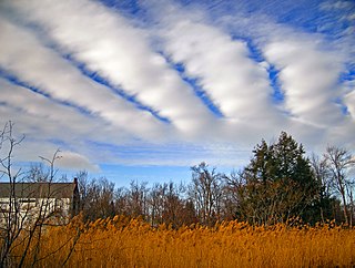
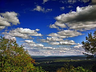
The Pocono Mountains, commonly referred to as the Poconos, are a geographical, geological, and cultural region in Northeastern Pennsylvania. They overlook the Delaware River and Delaware Water Gap to the east, Lake Wallenpaupack to the north, Wyoming Valley and the Coal Region to the west, and the Lehigh Valley to the south. The name Pocono is derived from the Munsee word Pokawachne, which means "Creek Between Two Hills".

Interstate 380 (I-380) is an auxiliary Interstate Highway in Northeastern Pennsylvania that connects I-80 with I-81 and I-84. The southern terminus is in Tunkhannock Township at the junction with I-80; the northern terminus of I-380 is at I-81 and U.S. Route 6 (US 6) in Dunmore. The entire length of the highway is 28.45 miles (45.79 km).

Pennsylvania Route 940 is a 43.2-mile-long (69.5 km) Pennsylvania highway located in the Pocono Mountains. It runs from PA 309 in Hazleton east to PA 191 in Paradise Valley. Large segments of PA 940 are located in densely forested areas. The route heads northeast through Luzerne County from Hazleton, passing through Freeland and coming to an interchange with Interstate 80 (I-80) in White Haven. From here, PA 940 turns east and runs a short distance north of I-80, coming to an interchange with both I-80 and I-476 in northern Carbon County. The route continues through Monroe County and passes through Pocono Pines before it has an interchange with I-380. PA 940 passes through Mount Pocono prior to continuing to its eastern terminus.

Pennsylvania Route 611 is a state highway in eastern Pennsylvania running 109.7 mi (176.5 km) from Interstate 95 (I-95) in the southern part of the city of Philadelphia north to I-380 in Coolbaugh Township in the Pocono Mountains. Through most of Philadelphia, PA 611 follows Broad Street, the main north-south street in the city. The route continues north through the northern suburbs of Philadelphia and serves Jenkintown, Willow Grove, and Doylestown, the latter of which it bypasses on a freeway. North of Doylestown, PA 611 heads through rural areas and runs along the west bank of the Delaware River to the city of Easton in the Lehigh Valley. The route continues back into rural land and passes through the Delaware Water Gap, at which point it enters the Pocono Mountains region. Here, PA 611 heads northwest through Stroudsburg and Mount Pocono toward its northern terminus.

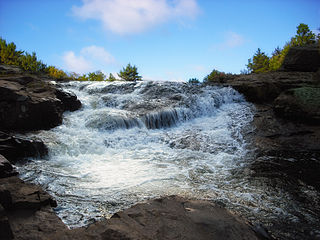
Tobyhanna State Park is a Pennsylvania state park on 5,440 acres (2,201 ha) mostly in Coolbaugh Township, Monroe County, with a small portion of the park in Dreher and Lehigh townships in Wayne County, all in Pennsylvania in the United States. The park includes the 170-acre (69 ha) Tobyhanna Lake and a portion of Tobyhanna Creek. It is located 2.1 miles (3.4 km) north of the town of Tobyhanna, with the main park entrance on Pennsylvania Route 423, and a portion that borders on Pennsylvania Route 196. The park lies immediately adjacent to Gouldsboro State Park, Pennsylvania State Game Lands 312, and State Game Land 127.

Gouldsboro State Park is a 2,880-acre (1,165 ha) Pennsylvania state park in Coolbaugh Township, Monroe County and Lehigh Township, Wayne County, Pennsylvania in the United States. The park includes the 250-acre (100 ha) Gouldsboro Lake. Gouldsboro State Park is located very close to Tobyhanna State Park and Pennsylvania State Game Lands 127 and 312. It is on Pennsylvania Route 507 near the small village of Gouldsboro.
Pocono Mountain School District, often abbreviated PMSD for short, is a large, rural public school district located in Monroe County in Northeastern Pennsylvania.
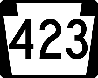
Pennsylvania Route 423 (PA 423) is a state route in Monroe and Wayne Counties in Pennsylvania. It runs for 14.32 miles (23.05 km), crossing through the Pocono Mountains from PA 940 in Pocono Pines to PA 191 in South Sterling. The route runs southwest-northeast through forested areas of the Pocono Mountains as a two-lane undivided road. In Tobyhanna, PA 423 has an interchange with Interstate 380 (I-380) and an intersection with PA 611. Farther northeast, the route crosses PA 196 in Gouldsboro. PA 490 was designated in 1928 to run from U.S. Route 611 (US 611) in Tobyhanna northeast to PA 90 in Laanna. In the 1930s, the route was extended and realigned to run from PA 940 in Pocono Pines to PA 90 in South Sterling. PA 490 became PA 423 in the 1960s.

Pennsylvania Route 196 is a state highway in the Pocono Mountains of Pennsylvania with a length of 25.7 miles (41.4 km). It runs from PA 611 and PA 940 in Mount Pocono in Monroe County north to PA 296 in Varden in Wayne County. The route is a two-lane undivided road that runs through rural areas. PA 196 intersects PA 423 near Tobyhanna State Park before entering Wayne County, where it crosses PA 507 in Angels and passes through Sterling. The route forms a concurrency with PA 191 and has a junction with PA 590 in Hamlin. Upon splitting from PA 191, PA 196 continues north to its end at PA 296.
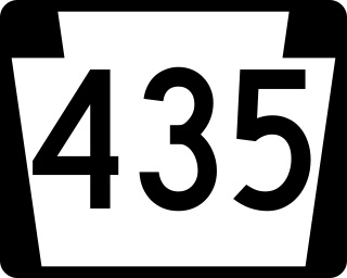
Pennsylvania Route 435 (PA 435) is a 14.9-mile-long (24.0 km) state highway located in Monroe, Wayne, and Lackawanna counties in Pennsylvania. The southern terminus is at Interstate 380 (I-380) near Gouldsboro. The northern terminus is at I-84 and I-380 in Dunmore. The route heads north from I-380 and the southern terminus of PA 507 in Monroe County as a four-lane road, passing through a small section of Wayne County before entering Lackawanna County. PA 435 becomes a two-lane road at the PA 307 junction and continues north to intersect PA 502 in Daleville and PA 690 in Moscow. After intersecting PA 590, the route becomes a four-lane divided highway and intersects PA 348 before merging into I-84/I-380.
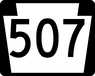
Pennsylvania Route 507 is a 27.2-mile-long (43.8 km) state highway located in Monroe, Wayne, and Pike Counties in Pennsylvania. The southern terminus is at PA 435 and at an interchange with Interstate 380 (I-380) near Gouldsboro. The northern terminus is at U.S. Route 6 in Palmyra Township. PA 507 runs southwest-northeast as a two-lane undivided through forests in the upper reaches of the Pocono Mountains, with the northern section nearly parallel to Lake Wallenpaupack. The route passes through Gouldsboro before it crosses PA 196 in Angels. In Newfoundland, PA 507 and PA 191 run concurrent for about 2 miles (3.2 km) and intersect the north end of PA 447. After splitting from PA 191, the route has an interchange with I-84 and a junction with the northern terminus of PA 390 before ending at US 6. PA 507 was designated between US 611 west of Gouldsboro and US 6 in Tafton in 1928. The route was fully paved by the 1930s and has remained on the same alignment since.
The Monroe County Transit Authority (MCTA), also known as the Pocono Pony, is a public transportation service located in Monroe County, Pennsylvania. It provides rural and inter-city fixed route bus and paratransit service within the county. MCTA is funded in part by PennDOT, the Federal Transit Administration, local match and farebox revenue.

Pocono Summit is a unincorporated community and census-designated place that is located in Monroe County, Pennsylvania. Parts of Pocono Summit are located in the municipalities of Coolbaugh and Tobyhanna townships.
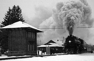
Tobyhanna station is a proposed NJ Transit commuter rail station located in Coolbaugh Township, Monroe County, Pennsylvania. The station forms part of a site owned by a number of public and private entities including the Pennsylvania Northeast Regional Railroad Authority. The site is adjacent to the former Delaware, Lackawanna and Western Railroad station; the building remains in place and is in use as the local historical society rail museum. In spring 2021, Amtrak announced plans for potential New York-Scranton route.

Pocono Mountain is a proposed New Jersey Transit Rail Operations (NJT) station located in Coolbaugh Township, Monroe County, Pennsylvania and is part of a site that was formerly utilized as a summer camp. The proposed station site, which will include a 1,000-space surface parking lot, is located northwest of a multi-phased planned development for this area. Access will be from Pennsylvania Route 611 via Pocono Municipal Road/Mount Pocono Road and a local access road and the platform would be situated east of the track.

The Lackawanna Cut-Off Restoration Project is a New Jersey Transit and Amtrak effort to restore passenger service to the Lackawanna Cut-Off in northwest New Jersey.


