
Swain County is a county located in the western portion of the U.S. state of North Carolina. As of the 2010 census, the population was 13,981. Its county seat is Bryson City.

Brasstown Bald is the highest point in the U.S. state of Georgia. Located in northeast Georgia, the mountain is known to the native Cherokee people as Enotah. It is the highest ground for 15.86 miles.

Crowders Mountain State Park is a 5,126-acre (20.74 km2) North Carolina state park in Gaston County, North Carolina in the United States. It is near Kings Mountain, North Carolina and on the outskirts of Gastonia, North Carolina, it includes the peaks of Crowder's Mountain and The Pinnacle. Crowders Mountain was named for Crowders Creek which originated near its base. Contrary to some historical information, Crowders Mountain was not named for Ulrick Crowder. There is no historical evidence that he was ever in the immediate area. The cliffs are a popular destination for rock climbers.

The Black Mountains are a mountain range in western North Carolina, in the southeastern United States. They are part of the Blue Ridge Province of the Southern Appalachian Mountains. The Blacks are the highest mountains in the Eastern United States. The range takes its name from the dark appearance of the red spruce and Fraser fir trees that form a spruce-fir forest on the upper slopes which contrasts with the brown or lighter green appearance of the deciduous trees at lower elevations. The Eastern Continental Divide, which runs along the eastern Blue Ridge crest, intersects the southern tip of the Black Mountain range.
Crowders Mountain is one of two main peaks within Crowders Mountain State Park, the other peak being The Pinnacle. The park is located in the western Piedmont of North Carolina between the cities of King's Mountain and Gastonia or about 25 miles (40 km) west of Charlotte. Crowders Mountain abruptly rises nearly 800 feet (240 m) above the surrounding terrain, and has an elevation of 1,625 feet above sea level.

Thicketty is an unincorporated community in Cherokee County, South Carolina, United States. It lies between Gaffney and Cowpens along U.S. Route 29. Thicketty is located approximately 12 miles (19 km) northeast of Spartanburg.

Kings Pinnacle, or more commonly The Pinnacle, is one of the two main peaks located within Crowders Mountain State Park. The other peak is Crowders Mountain. The park is located in the western Piedmont of North Carolina between the cities of Kings Mountain and Gastonia.

Waterrock Knob is a mountain peak in the U.S. state of North Carolina. It is the highest peak in the Plott Balsams and is the 16th-highest mountain in the Eastern United States.

Gregory Bald is a mountain in the Great Smoky Mountains. It has an elevation of 4,949 feet above sea level. The mountain's majestic summit makes it a popular hiking destination. Another feature that attracts many visitors are the flame azaleas that bloom over the bald every summer. The azaleas reach peak bloom around mid-to-late June.

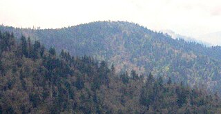
Mount Guyot is a mountain in the eastern Great Smoky Mountains, located in the southeastern United States. At 6,621 feet (2,018 m) above sea level, Guyot is the fourth-highest summit in the eastern U.S., and the second-highest in the Great Smoky Mountains National Park. While the mountain is remote, the Appalachian Trail crosses its south slope, passing to within 1,000 feet (300 m) of the summit.
Mount Sequoyah is a mountain in the Great Smoky Mountains, located in the Southeastern United States. It has an elevation of 6,003 feet above sea level. While the Appalachian Trail crosses its summit, Sequoyah is an 11.5-mile (18.5 km) hike from the nearest parking lot, making it one of the most remote places in the Great Smoky Mountains National Park.

Table Rock State Park is a 3,083-acre (12.48 km2) park at the edge of the Blue Ridge Mountains in northern Pickens County, South Carolina. The park includes Pinnacle Mountain, the tallest mountain totally within the state.

Whiteside Mountain is a mountain in Jackson County, North Carolina between Cashiers, Highlands, North Carolina, and the Georgia border. Whiteside Mountain can boast the highest cliffs in Eastern North America. It also has a feature called Devil's Courthouse, not to be confused with the Devil's Courthouse 20 miles away in Transylvania County, NC.

Fort Prince was built in Spartanburg County, South Carolina for protection against the Cherokee Indians. It was near the residence of a Mr. Prince. Fort Prince was the general rallying point in times of danger when the people of the settlement sought safety. Just in front was a creek for their washing. Nearby stood a mill which ground corn, later known as Grays Mill. There was a Battle of Fort Prince during the American Revolutionary War, when Edward Hampton drove the British from the fort on July 15, 1780, and it stood for several years after.

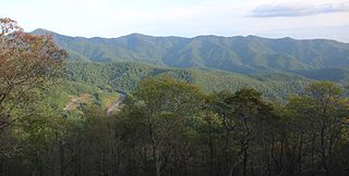
The Bald Mountains are a mountain range rising along the border between Tennessee and North Carolina in the southeastern United States. They are part of the Blue Ridge Mountain Province of the Southern Appalachian Mountains. The Bald Mountains stretch from the Pigeon River in the south to the Nolichucky River in the north, and comprise parts of Cocke County, Greene County, and Unicoi County in Tennessee and parts of Madison County and Yancey County in North Carolina. The Great Smoky Mountains border the range to the south, and the Unakas rise opposite the Nolichucky to the north. The range gets its name from the relatively frequent occurrence of grassy balds atop the more prominent summits.
The Plott Balsams are a mountain range in western North Carolina, in the southeastern United States. They are part of the Blue Ridge Mountain Province of the Southern Appalachian Mountains. The Plott Balsams stretch from the city of Sylva in the Tuckasegee River valley to the southwest to Maggie Valley in the northeast. The Great Smoky Mountains border the Plott Balsams to the north and the Great Balsam Mountains border the range to the south. The range comprises parts of Jackson County and Haywood County.
Pinnacle Mountain is the tallest mountain contained entirely within the state of South Carolina. It is located within Table Rock State Park in Pickens County, South Carolina. The summit of the mountain is accessible by hiking trails, the shortest of which is 4.2 miles one-way and begins at the Table Rock State Park Nature Center.
Brown's Mountain is a mountain in Cherokee County in the state of South Carolina, United States. Brown's Mountain summit is at an elevation of 1,035 feet above sea level. The mountain is one of the three main mountain summits of Kings Mountain National Military Park and is the highest in the park. The other mountain summits are Joes Mountain and Kings Mountain.
Whitaker Mountain is a mountain summit in Cherokee County in the state of South Carolina (SC) and is one of the three mountain peaks in Cherokee County. Whitaker Mountain climbs to an elevation of around 1,169 feet above sea level. Whitaker Mountain is located within the town of Blacksburg, South Carolina.
Thicketty Mountain Ore Pits (38CK74) is a historic archaeological site located near Shady Grove Church, Cherokee County, South Carolina. The site includes iron ore pits associated with the South Carolina Manufacturing Company, a major iron manufacturing company that operated in Spartanburg County between about 1825 and about 1850. The iron ore pits or surface mines cover several forested acres along a gently sloping ridge and are generally depressions about two to three meters deep and about five to ten meters across. The pits were last operational in the 1850s.