Owlswick is a hamlet in Buckinghamshire, England, about 3 miles E of Thame and 4 miles SSE of Aylesbury. It is part of the civil parish of Longwick-cum-Ilmer and is in the ecclesiastical parish of Monks Risborough.

Moretonhampstead is a market town, parish and ancient manor in Devon, situated on the north-eastern edge of Dartmoor, within the Dartmoor National Park. The parish now includes the hamlet of Doccombe, and it is surrounded clockwise from the north by the parishes of Drewsteignton, Dunsford, Bridford, Bovey Tracey, Lustleigh, North Bovey and Chagford.

Arlington was a manor, and is a village and civil parish in the North Devon district of Devon in England. The parish includes the villages of Arlington and Arlington Beccott. The population of the parish is 98.

Axmouth is a village, civil parish and former manor in the East Devon district of Devon, England, near the mouth of the River Axe. The village itself is about 1 mile (1.6 km) inland, on the east bank of the Axe estuary. The parish extends along the estuary to the sea, and a significant distance to the east. The village is near Seaton and Beer which are on the other side of the Axe estuary. According to the 2001 census the parish had a population of 493.

Berrynarbor is a village, civil parish, former manor and civil parish in the North Devon district of Devon, England. According to the 2001 census the parish had a population of 749, increasing to 802 at the 2011 census. The village is located on the north coast of the county to the north of Exmoor, about three miles east of Ilfracombe. The parish is surrounded clockwise from the east by the parishes of Combe Martin, Kentisbury, East Down, Marwood, Bittadon, and Ilfracombe. Berrynarbor has within its purview to all sides a mixture of dense woodlands and farms and lies within the North Devon Area of Outstanding Natural Beauty.

Bicton is a civil parish and a former manor in the East Devon district of Devon, England, near the town of Budleigh Salterton. The parish is surrounded, clockwise from the north, by the parishes of Colaton Raleigh, Otterton, East Budleigh and Woodbury. According to the 2001 census it had a population of 280. Much of the parish consists of Bicton Park, the historic home of the Rolle family, with Bicton Common, adjacent to Woodbury Common, in the west. The parish includes the village of Yettington on its southern border.

Bittadon is a civil parish and former manor in the North Devon district of Devon, England. According to the 2001 census the parish had a population of 45. It is about seven miles north of Barnstaple and is surrounded clockwise from the north by the parishes of Berrynarbor, Marwood and West Down.

Buckland Filleigh is a village, civil parish and former manor in the Torridge district of North Devon, England, situated about 8 miles south of the town of Great Torrington. According to the 2001 census, the parish had a population of 170. It is surrounded clockwise from the north by the parishes of Peters Marland, Petrockstowe, Highampton, Sheepwash and Shebbear.

Bradley is a medieval manor house in Newton Abbot, Devon, England. It is set amongst woodland and meadows in the valley of the River Lemon about a half mile to the west of the main town. The house is now in the ownership of the National Trust.
Putsborough is a hamlet in Georgeham Civil Parish on the west-facing coast of North Devon, England. It is about 3⁄4 mile (1.2 km) north of the village of Croyde and 1 mile (1.6 km) west-northwest of the village of Georgeham. 0.5 miles (0.8 km) north of the hamlet is Putsborough Sands, which forms the southern part of the two-mile-long (3 km) beach of Woolacombe Sand on Morte Bay.

Heanton Punchardon ( ) is a village, civil parish and former manor, anciently part of Braunton Hundred. It is situated directly east-southeast of the village of Braunton, in North Devon. The parish lies on the north bank of the estuary of the River Taw and it is surrounded, clockwise from the north, by the parishes of Braunton, Marwood, Ashford and across the estuary, Fremington. The population was 418 in 1801 and 404 in 1901. Its largest localities are Wrafton and Chivenor. The surrounding area is also an electoral ward with a total population at the 2011 census of 2,673.

Noss Mayo is a village in the civil parish of Newton and Noss in the South Hams district of South West Devon, England, about 6 miles (10 km) south-east of Plymouth. It lies about one mile (1.6 km) inland, on the southern bank of Newton Creek, an arm of the estuary of the River Yealm. On the opposite, northern bank of the creek is Newton Ferrers, a slightly larger settlement. The two villages were included in the top 20 prettiest towns and villages in Devon in a list compiled by readers of the "Visit Devon" website. The population was 510 in 1991.

The River Lemon is a 9.9 mile river in the county of Devon in southwest England. It is a tributary of the River Teign, starting on Dartmoor by Haytor, and ending in Newton Abbot. It rises on the south-east side of Dartmoor near Haytor, joins with the River Sig and the Langworthy Brook at Sigford, then passes the village of Bickington. Lower down, it is joined by the Kestor Brook and it then flows through the woods in Bradley Valley, past the manor house of Bradley, and through the town of Newton Abbot where it flows through a 440-yard-long tunnel below the town centre. Just below the town, the river joins the River Teign at 50.517°N 3.607°W, near the head of its estuary.

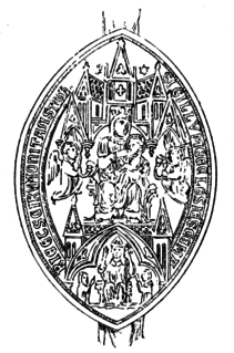
Tavistock Abbey, also known as the Abbey of Saint Mary and Saint Rumon, is a ruined Benedictine abbey in Tavistock, Devon. Nothing remains of the abbey except the refectory, two gateways and a porch. The abbey church, dedicated to Our Lady and St Rumon, was destroyed by Danish raiders in 997 and rebuilt under Lyfing, the second abbot. The church was further rebuilt in 1285 and the greater part of the abbey between 1457 and 1458.
Apart from a number of places in Devon, England, for which Buckland forms the first part of the name, the name on its own refers to two places in Devon:
There are 22 disused railway stations in the 75 miles (121 km) between Bristol Temple Meads and Exeter St Davids, 12 of which have structures that can still be seen from passing trains. Most were closed in the 1960s but four of them, especially around Weston-super-Mare, were replaced by stations on new sites. 13 stations remain open on the line today, but there have been proposals to reopen stations at Cullompton and Wellington.

East Down is a village and civil parish in the Barnstaple district of Devon, England. It includes the hamlets of Churchill, Shortacombe, Brockham and Clifton. The parish contains a church, pub and manor house.

Parracombe is a rural settlement 4 miles (6 km) south-west of Lynton, in Devon, England. It is situated in the Heddon Valley, on Exmoor. The population at the 2011 census was 293.

Shirwell is a village, civil parish and former manor in the local government district of North Devon, in the county of Devon, England. It was also formerly the name of a hundred of Devon. The village lies about 3.5 miles north-east of the town of Barnstaple, to the east of the A39 road to Lynton. The parish is surrounded clockwise from the north by the parishes of East Down, Arlington, Loxhore, Bratton Fleming, Goodleigh, Barnstaple, West Pilton and Marwood. In 2001 its population was 333, little changed from the 1901 figure of 338.

Luffincott is a civil parish in the far west of Devon, England. It forms part of the local government district of Torridge and lies about six miles south of the town of Holsworthy. The parish is surrounded clockwise from the north by the parishes of Tetcott, Ashwater, St Giles on the Heath and Northcott. Its western border follows the River Tamar which forms the county boundary with Cornwall.


