
Interstate 70 (I-70) is a major east–west Interstate Highway in the United States that runs from I-15 near Cove Fort, Utah, to I-695 and Maryland Route 570 (MD 570) in Woodlawn, just outside Baltimore, Maryland. I-70 approximately traces the path of U.S. Route 40 east of the Rocky Mountains. West of the Rocky Mountains, the route of I-70 was derived from multiple sources. The Interstate runs through or near many major cities, including Denver, Topeka, Kansas City, St. Louis, Indianapolis, Columbus, Pittsburgh, and Baltimore. The sections of the Interstate in Missouri and Kansas have laid claim to be the first Interstate in the United States. The Federal Highway Administration (FHWA) has claimed the section of I-70 through Glenwood Canyon in Colorado, completed in 1992, to be the last piece of the Interstate Highway System, as originally planned, to open to traffic. The construction of I-70 in Colorado and Utah is considered an engineering marvel, as the route passes through the Eisenhower Tunnel, Glenwood Canyon, and the San Rafael Swell. The Eisenhower Tunnel is the highest point along the Interstate Highway System, with an elevation of 11,158 feet (3,401 m).

Interstate 64 (I-64) is an east–west Interstate Highway in the Eastern United States. Its western terminus is at I-70, U.S. Route 40 (US 40), and US 61 in Wentzville, Missouri. Its eastern terminus is at the Bowers Hill Interchange with I-264 and I-664 at Bower's Hill in Chesapeake, Virginia. I-64 connects Greater St. Louis, the Louisville metropolitan area, the Lexington–Fayette metropolitan area, the Charleston metropolitan area, the Greater Richmond Region, and Hampton Roads.

U.S. Route 71 or U.S. Highway 71 is a major north–south United States highway that extends for over 1500 miles (2500 km) in the central United States. This original 1926 route has remained largely unchanged by encroaching Interstate highways. Currently, the highway's northern terminus is in International Falls, Minnesota at the Canada–US border, at the southern end of the Fort Frances-International Falls International Bridge to Fort Frances, Ontario. U.S. Route 53 also ends here. On the other side of the bridge, Trans-Canada Highway is an east–west route while Ontario Highway 71 is a north–south route. US 71's southern terminus is between Port Barre and Krotz Springs, Louisiana at an intersection with U.S. Route 190. For the entirety south of Kansas City, Missouri, US 71 runs parallel and concurrent with the existing and future Interstate 49. North of Kansas City, US 71 runs halfway between Interstate 29 and Interstate 35, which they split in the city at an interchange with Interstate 70.

U.S. Route 136 is an east-west U.S. highway that is a spur route of U.S. Route 36. It runs from Edison, Nebraska, at U.S. Route 6 and U.S. Route 34 to the Interstate 74/Interstate 465 interchange in Speedway, Indiana. This is a distance of 804 miles (1,294 km). Due to the removal of almost every numbered route in Indianapolis, US 136 never meets its parent, US 36; however, it does come within two miles of it at its interchange with I-465/I-74 at its eastern terminus.

U.S. Route 169 is a north-south U.S highway that currently runs for 966 miles (1,555 km) from the city of Virginia, Minnesota, to Tulsa, Oklahoma, at Memorial Drive.
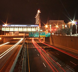
The Downtown Loop is a complex layout of highways in Downtown Kansas City, Missouri involving 24 exits, four Interstate Highways, four U.S. Highways, and numerous city streets. Each exit is numbered 2 and suffixed with every letter of the alphabet except I and O. The entire circumference of the loop is just over 4 miles (6.4 km).

Interstate 229 (I-229) is a 15-mile-long (24 km) auxiliary Interstate Highway that runs through St. Joseph, Missouri. It begins southeast of the city at I-29 and U.S. Route 71 (US 71) and travels to the northwest into the city. In St. Joseph, it runs with US 59. Just north of an interchange with US 36, the two routes travel over a one-mile-long (1.6 km) viaduct on the banks of the Missouri River. The two routes split at the north end of the viaduct. The Interstate ends at another interchange with I-29 and US 71 north of St. Joseph.

Route 13 is a highway in Missouri which runs almost the entire north–south length of the state. Its northern terminus is at U.S. Route 69/136 in Bethany. Its southern terminus is at the Arkansas state line in downtown Blue Eye, Missouri–Arkansas where it continues as Highway 21. It is one of the original state highways of Missouri.
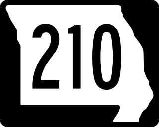
Route 210 is a highway in western Missouri with an eastern terminus at Route 10 southwest of Richmond and a western terminus at Interstate 29, 35, and U.S. Route 71. After I-29 and 35, 210 immediately intersects Route 1 and continues east. It intersects Walker Road in front of NKC Hospital and the Cerner world headquarters before an interchange with Chouteau Trafficway near North Kansas City, Missouri. It becomes a limited access freeway as it exits North Kansas City and into Kansas City proper. There are interchanges with North Brighton Avenue and Northeast Searcy Creek Parkway before it intersects I-435. Here, it reverts to a four-lane road with stoplights. It has intersections with the frontage road, Great Midwest Drive, and Eldon Road before becoming a two-lane road and going onto the river bottoms. It goes straight east, intersecting several roads, before curving northeast to intersect with Route 291.
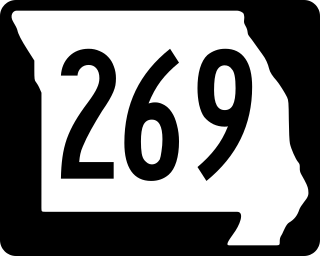
Missouri Route 269 is a highway in the Kansas City metropolitan area. Its total length is a short three miles (4.8 km), which is also entirely named Chouteau Trafficway as a segment of that much longer trafficway. The highway's northern terminus is at Interstate 35 (I-35) and its southern terminus is at Front Street—both in Kansas City, Missouri. The middle of the route includes an interchange with Route 210 in the small city of North Kansas City, Missouri.
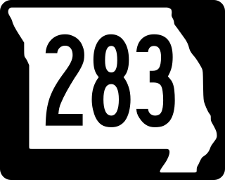
Route 283 was a short highway in the Kansas City, Missouri regional area. Its northern terminus was at Interstate 29 (I-29) and U.S. Route 71 (US 71) in Kansas City; its southern terminus was at Route 9 at the northern city limit of North Kansas City. It was known locally as North Oak Trafficway.
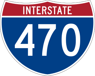
Interstate 470 (I-470) is a 16.72-mile (26.91 km) loop of the Interstate Highway System that serves to link southeast Kansas City to Independence via Lee's Summit in Jackson County, Missouri. The western terminus of the freeway is at the Grandview Triangle interchange with I-49, I-435, U.S. Route 50 (US 50), and US 71 while the northern terminus is a cloverleaf interchange with I-70. The freeway travels west to east through southern Kansas City, curving toward the north at the Lee's Summit Municipal Airport and becoming concurrent with Route 291 as the highway travels north toward Independence.

Interstate 29 (I-29) is a north–south Interstate Highway in the Midwestern United States that begins in Missouri. It travels through the Kansas City and St. Joseph metropolitan areas before exiting the state and entering Iowa. Almost all of I-29 in Missouri lies in an area called the Platte Purchase that was not originally part of Missouri when the state entered the Union in 1821.
Interstate 70 (I-70) in the US state of Missouri is generally parallel to the Missouri River. This section of the transcontinental Interstate begins at the Kansas state line on the Intercity Viaduct, running concurrently with US Route 24 (US 24), US 40, and US 169, and the east end is on the Stan Musial Veterans Memorial Bridge in St. Louis.
Interstate 64 (I-64) passes through the Greater St. Louis area in the US state of Missouri. The entire route is concurrent with U.S. Route 40 (US 40). Because the road was a main thoroughfare in the St. Louis area before the development of the Interstate Highway System, it is not uncommon for locals to refer to the stretch of highway as "Highway 40" rather than "I-64". On December 6, 2009, the portion of the highway running through the city of St. Louis was named the Jack Buck Memorial Highway in honor of the late sportscaster.

Interstate 35 (I-35) is an Interstate Highway that stretches from Laredo, Texas, in the south to Duluth in the north. The portion of it through Missouri travels nearly 115 miles (185 km) from just south of Kansas City, through the Downtown Loop, and across the Missouri River before leaving the downtown area. North of Kansas City, the highway travels north-northeast toward the Iowa state line near Eagleville, paralleling U.S. Route 69 (US 69).

Interstate 49 (I-49) is an Interstate Highway in the US state of Missouri that was designated on December 12, 2012. It overlaps U.S. Route 71 (US 71) in the western part of the state, beginning at the Arkansas state line, and ending at I-435 and I-470 on the southeast side of Kansas City.

U.S. Route 67 is the portion of a north-south highway in Missouri that starts at the Arkansas state line south of Neelyville and ends at the Illinois state line northeast of West Alton.

U.S. Route 54 in Missouri is a west-east highway that runs between the Kansas state line in Nevada, Missouri and the Illinois state line in Louisiana, Missouri.

U.S. Route 40 (US 40) in the state of Missouri is a U.S. highway that runs from Kansas City to St. Louis. Outside of Greater St. Louis, much of the route either parallels or runs along I-70. East of Wentzville in Greater St. Louis, the route runs along I-64.


