Interstate 72 (I-72) is an Interstate Highway in the midwestern United States. Its western terminus is in Hannibal, Missouri, at an intersection with U.S. Route 61 (US 61); its eastern terminus is at Country Fair Drive in Champaign, Illinois. The route runs through the major cities of Decatur, Illinois, and Springfield, Illinois. In 2006, the Illinois General Assembly dedicated all of I-72 as Purple Heart Memorial Highway. The stretch between Springfield and Decatur is also called Penny Severns Memorial Expressway, and the section between mile 35 and the Mississippi River is known as the Free Frank McWorter Historic Highway.

U.S. Route 400 is a 481.306-mile-long (774.587 km) mostly east–west U.S. Highway, commissioned in 1994. The highway's western terminus is in Granada, Colorado, at an intersection with US 385. The highway's eastern terminus is southwest of Joplin, Missouri, near Loma Linda, at an interchange with Interstate 44, with which it shares with US 166. It originally ended in Garden City, Kansas; in 1996 it was extended to its current western terminus.

U.S. Route 160 (US 160) is a 1,465-mile-long (2,358 km) east–west United States Numbered Highway in the Midwestern and Western United States. The western terminus of the route is at US 89 five miles (8.0 km) west of Tuba City, Arizona. The eastern terminus is at US 67 and Missouri 158 southwest of Poplar Bluff, Missouri. Its route, if not its number, was made famous in song in 1975, as the road from Wolf Creek Pass to Pagosa Springs, Colorado in C.W. McCall's country music song "Wolf Creek Pass".

U.S. Route 59 is a north–south United States highway. A latecomer to the U.S. numbered route system, US 59 is now a border-to-border route, part of the NAFTA Corridor Highway System. It parallels U.S. Route 75 for nearly its entire route, never much more than 100 miles (160 km) away, until it veers southwest in Houston, Texas. Its number is out of place since US 59 is either concurrent with or entirely west of U.S. Route 71. The highway's northern terminus is 9 mi (14 km) north of Lancaster, Minnesota, at the Lancaster–Tolstoi Border Crossing on the Canada–US border, where it continues as Manitoba Highway 59. Its southern terminus is at the Mexico–US border in Laredo, Texas, where it continues as Mexican Federal Highway 85D.

Interstate 435 (I-435) is an Interstate Highway beltway that encircles much of the Kansas City metropolitan area within the states of Kansas and Missouri in the United States.

U.S. Route 71 or U.S. Highway 71 is a major north–south United States highway that extends for over 1500 miles (2500 km) in the central United States. This original 1926 route has remained largely unchanged by encroaching Interstate highways. Currently, the highway's northern terminus is in International Falls, Minnesota at the Canada–US border, at the southern end of the Fort Frances-International Falls International Bridge to Fort Frances, Ontario. U.S. Route 53 also ends here. On the other side of the bridge, Trans-Canada Highway is an east–west route while Ontario Highway 71 is a north–south route. US 71's southern terminus is between Port Barre and Krotz Springs, Louisiana at an intersection with U.S. Route 190. For the entirety south of Kansas City, Missouri, US 71 runs parallel and concurrent with the existing and future Interstate 49. North of Kansas City, US 71 runs halfway between Interstate 29 and Interstate 35, which they split in the city at an interchange with Interstate 70.

U.S. Route 166 (US 166) is a 164-mile (264 km) east–west United States highway. This route and US 266 are the only two remaining spurs of historic U.S. Route 66, since US 666 was renumbered to US 491 in 2003.

U.S. Route 54 is an east–west United States Highway that runs northeast–southwest for 1,197 miles (1,926 km) from El Paso, Texas, to Griggsville, Illinois. The Union Pacific Railroad's Tucumcari Line runs parallel to US 54 from El Paso to Pratt, Kansas, which comprises about two-thirds of the route.

U.S. Route 73 is a north–south United States highway that runs for 113 miles (182 km) from northeast Kansas to southeast Nebraska. The highway's southern terminus is Bonner Springs, Kansas at I-70. Its northern terminus is near Dawson, Nebraska at US 75.

U.S. Highway 159 (US 159) is a 83.6-mile-long (134.5 km) auxiliary route of US 59. It travels from Nortonville, Kansas at US 59 to New Point, Missouri, also at US 59. The highway permits through traffic on US 59 to bypass the cities of Atchison, Kansas and Saint Joseph, Missouri, traveling instead through Falls City, Nebraska and Hiawatha, Kansas.
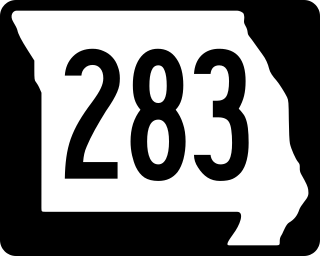
Route 283 was a short highway in the Kansas City, Missouri regional area. Its northern terminus was at Interstate 29 (I-29) and U.S. Route 71 (US 71) in Kansas City; its southern terminus was at Route 9 at the northern city limit of North Kansas City. It was known locally as North Oak Trafficway.

Interstate 635 (I-635) is a connector highway between I-35 in Overland Park, Kansas, and I-29 in Kansas City, Missouri, approximately 12 miles (19 km) long. It is mostly in the US state of Kansas, servicing the city of Kansas City, Kansas, but extends into Kansas City, Missouri, as well. The freeway's southern terminus is at a stack interchange with I-35. South of this, the mainline becomes an expressway carrying U.S. Route 69 (US 69).

Interstate 70 (I-70) is a mainline route of the Interstate Highway System in the United States connecting Cove Fort, Utah, to Baltimore, Maryland. In the US state of Kansas, I-70 extends just over 424 miles (682 km) from the Colorado border near the town of Kanorado to the Missouri border in Kansas City. I-70 in Kansas contains the first segment in the country to start being paved and to be completed in the Interstate Highway System. The route passes through several of the state's principal cities in the process, including Kansas City, Topeka, and Salina. The route also passes through the cities of Lawrence, Junction City, and Abilene.

Interstate 29 (I-29) is a north–south Interstate Highway in the Midwestern United States that begins in Missouri. It travels through the Kansas City and St. Joseph metropolitan areas before exiting the state and entering Iowa. Almost all of I-29 in Missouri lies in an area called the Platte Purchase that was not originally part of Missouri when the state entered the Union in 1821.

Interstate 35 (I-35) is an Interstate Highway that stretches from Laredo, Texas, in the south to Duluth in the north. The portion of it through Missouri travels nearly 115 miles (185 km) from just south of Kansas City, through the Downtown Loop, and across the Missouri River before leaving the downtown area. North of Kansas City, the highway travels north-northeast toward the Iowa state line near Eagleville, paralleling U.S. Route 69 (US 69).

Interstate 44 (I-44) in the US state of Missouri runs northeast from the Oklahoma state line near Joplin to I-70 in Downtown St. Louis. It runs for about 293 miles (472 km) in the state, and is the longest Interstate Highway in the state.
U.S. Route 71 (US 71) is a major north–south U.S. Highway that runs from Louisiana to Canada. US 71 enters Missouri from Arkansas in the town of Jane. US 71 serves the cities of Joplin, Kansas City and St. Joseph. At noon on December 12, 2012, the section of US 71 between Pineville, Missouri and I-435 in south Kansas City was also designated as a northern extension of Interstate 49 (I-49).

U.S. Route 169 (US-169) is a major north–south U.S. Highway that runs from US-64 in Tulsa, Oklahoma, to US-53 near Virginia, Minnesota. In Kansas, the highway is a main north–south route that runs through the eastern end of the state from the Oklahoma border to Missouri border. Along the way US-169 intersects several major highways including US-400 by Cherryvale, US-54 by Iola, overlaps US-59 south of Garnett, overlaps I-35 from Olathe to Merriam, and in Kansas City begins an overlap with I-70, US-24 and US-40 which it follows into Missouri.

U.S. Highway 24 (US-24) in the state of Kansas runs east–west across the northern half of the state for 435.95 miles (701.59 km). The route mostly connects rural communities across the High Plains of Kansas, while also later providing an Interstate alternate between Topeka, Lawrence, and Kansas City. US-24 both enters and exits the state running concurrently with Interstate 70 (I-70). Along with US-40, the road has largely been replaced by the more modern Interstate in its functionality as a long-distance route.
U.S. Highway 71 is a U.S. highway that runs from Krotz Springs, LA to the Fort Frances–International Falls International Bridge at the Canadian border. In Arkansas, the highway runs from the Louisiana state line near Doddridge to the Missouri state line near Bella Vista. In Texarkana, the highway runs along State Line Avenue with US 59 and partially runs in Texas. Other areas served by the highway include Fort Smith and Northwest Arkansas.

