West Branch Township, Pennsylvania

Last updated

West Branch Township, Pennsylvania
Township
Cherry Springs State Park Pavilion side.jpg
Cherry Springs State Park in West Branch Township
Map of Potter County, Pennsylvania Highlighting West Branch Township.PNG
Location of West Branch Township in Potter County, Pennsylvania
[[File:Location of Potter County in Pennsylvania|250x200px|Map of Potter County, Pennsylvania]]
Map of Potter County, Pennsylvania
Country United States
State Pennsylvania
County Potter
Settled1835
Incorporated1856
Area
[1]
  Total62.18 sq mi (161.04 km2)
  Land62.11 sq mi (160.87 km2)
  Water0.07 sq mi (0.17 km2)
Population
 (2020) [2]
  Total399 Increase2.svg
  Estimate 
(2021) [2]
397
  Density6.21/sq mi (2.40/km2)
Time zone UTC-5 (EST)
  Summer (DST) UTC-4 (EDT)
FIPS code 42-105-82568

West Branch Township is a township in Potter County, Pennsylvania, United States. The population was 399 at the 2020 census. [2] There are two Pennsylvania state parks in West Branch Township. Cherry Springs State Park is a popular destination for astronomical observation. Lyman Run State Park is in the northern part of the township and is partially in neighboring Ulysses Township.

Contents

History

The Cherry Springs Picnic Pavilion was added to the National Register of Historic Places in 1987. [3]

Geography

According to the United States Census Bureau, the township has a total area of 62.7 square miles (162.4 km2), of which 62.6 square miles (162.2 km2) is land and 0.1 square mile (0.2 km2) (0.11%) is water.

West Branch Township is bordered by Ulysses and Pike Townships to the north, Tioga County to the east, Abbott and Wharton Townships to the south and Summit Township to the west.

Demographics

Historical population
CensusPop.Note
2010 393
2020 3991.5%
2021 (est.)397 [2] −0.5%
U.S. Decennial Census [4]

As of the census [5] of 2000, there were 392 people, 159 households, and 123 families residing in the township. The population density was 6.3 people per square mile (2.4/km2). There were 669 housing units at an average density of 10.7/sq mi (4.1/km2). The racial makeup of the township was 97.19% White, 1.28% Asian, and 1.53% from two or more races.

There were 159 households, out of which 21.4% had children under the age of 18 living with them, 70.4% were married couples living together, 2.5% had a female householder with no husband present, and 22.6% were non-families. 18.9% of all households were made up of individuals, and 11.3% had someone living alone who was 65 years of age or older. The average household size was 2.47 and the average family size was 2.72.

In the township the population was spread out, with 19.1% under the age of 18, 4.8% from 18 to 24, 22.4% from 25 to 44, 29.1% from 45 to 64, and 24.5% who were 65 years of age or older. The median age was 48 years. For every 100 females, there were 98.0 males. For every 100 females age 18 and over, there were 100.6 males.

The median income for a household in the township was $39,688, and the median income for a family was $43,750. Males had a median income of $34,750 versus $20,536 for females. The per capita income for the township was $17,214. About 9.8% of families and 12.4% of the population were below the poverty line, including 12.7% of those under age 18 and 14.7% of those age 65 or over.

Related Research Articles

<span class="mw-page-title-main">Bradys Bend Township, Pennsylvania</span> Township in Pennsylvania, United States

Bradys Bend Township is a township in Armstrong County, Pennsylvania, United States. The population was 784 at the 2020 census, an increase from the figure of 773 tabulated in 2010.

<span class="mw-page-title-main">Cumberland Valley Township, Bedford County, Pennsylvania</span> Township in Pennsylvania, United States

Cumberland Valley Township is a township in Bedford County, Pennsylvania, United States. The population was 1,450 at the 2020 census.

<span class="mw-page-title-main">West Burlington Township, Pennsylvania</span> Township in Pennsylvania, United States

West Burlington Township is a township in Bradford County, Pennsylvania. It is part of Northeastern Pennsylvania. The population was 696 at the 2010 census. Children residing in the township are assigned to attend the Troy Area School District.

<span class="mw-page-title-main">Chest Township, Clearfield County, Pennsylvania</span> Township in Pennsylvania, United States

Chest Township is a township in Clearfield County, Pennsylvania, United States. The population was 510 at the 2020 census.

<span class="mw-page-title-main">Penn Township, Clearfield County, Pennsylvania</span> Township in Pennsylvania, United States

Penn Township is a township in Clearfield County, Pennsylvania, United States. The population was 1,203 at the 2020 census.

<span class="mw-page-title-main">Union Township, Clearfield County, Pennsylvania</span> Township in Pennsylvania, United States

Union Township is a township that is located in Clearfield County, Pennsylvania, United States. The population was 880 at the time of the 2020 census.

<span class="mw-page-title-main">Rome Township, Crawford County, Pennsylvania</span> Township in Pennsylvania, United States

Rome Township is a township in Crawford County, Pennsylvania, United States. The population was 1,993 at the 2020 census, up from 1,840 at the 2010 census.

<span class="mw-page-title-main">Dunbar Township, Pennsylvania</span> Township in Pennsylvania, United States

Dunbar Township is a township in Fayette County, Pennsylvania, United States. The population was 6,671 at the 2020 census, a decline from the figure of 7,126 tabulated in 2010.

<span class="mw-page-title-main">Fannett Township, Pennsylvania</span> Township in Pennsylvania, United States

Fannett Township is a township in Franklin County, Pennsylvania, United States. The population was 2,483 at the 2020 census. The township derives its name as an older variant spelling of Fanad, County Donegal, from early Irish settlement in the area. It was formed before 1762, and until about 1795 included the area now in Metal Township.

<span class="mw-page-title-main">Greene Township, Franklin County, Pennsylvania</span> Township in Pennsylvania, United States

Greene Township is a township in Franklin County, Pennsylvania, United States. The population was 18,436 at the 2020 census, up from 12,284 at the 2000 census. Part of Caledonia State Park is in Greene Township.

<span class="mw-page-title-main">Bradford Township, McKean County, Pennsylvania</span> Township in Pennsylvania, United States

Bradford Township is a township in McKean County, Pennsylvania, United States. The population was 4,793 at the 2020 census.

<span class="mw-page-title-main">Foster Township, McKean County, Pennsylvania</span> Township in Pennsylvania, United States

Foster Township is a township in McKean County, Pennsylvania, United States. The population was 4,039 at the 2020 census.

<span class="mw-page-title-main">Bingham Township, Pennsylvania</span> Township in Pennsylvania, United States

Bingham Township is a township in Potter County, Pennsylvania, United States. The population was 621 at the 2020 census.

<span class="mw-page-title-main">Harrison Township, Potter County, Pennsylvania</span> Township in Pennsylvania, United States

Harrison Township is a township in Potter County, Pennsylvania, United States. The population was 1,028 at the 2020 census.

<span class="mw-page-title-main">Hector Township, Potter County, Pennsylvania</span> Township in Pennsylvania, United States

Hector Township is a township in Potter County, Pennsylvania, United States. The population was 343 at the 2020 census.

<span class="mw-page-title-main">Keating Township, Potter County, Pennsylvania</span> Township in Pennsylvania, United States

Keating Township is a township in Potter County, Pennsylvania, United States. The population was 289 at the 2020 census.

<span class="mw-page-title-main">Pike Township, Potter County, Pennsylvania</span> Township in Pennsylvania, United States

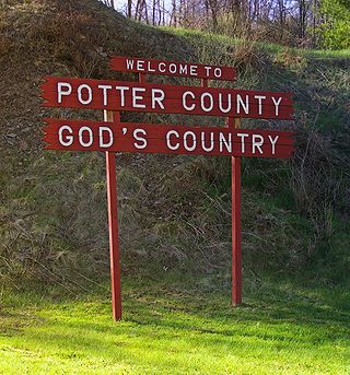
Pike Township is a township in Potter County, Pennsylvania, United States. The population was listed at 330 on the 2020 census. The population rose to 324 people as of 2010.

<span class="mw-page-title-main">Summit Township, Potter County, Pennsylvania</span> Township in Pennsylvania, United States

Summit Township is a township in Potter County, Pennsylvania, United States. The population was 134 at the 2020 census. Two of the smallest Pennsylvania state parks, Prouty Place State Park and Patterson State Park are in Summit Township.

<span class="mw-page-title-main">Ulysses Township, Pennsylvania</span> Township in Pennsylvania, United States

Ulysses Township is a township in Potter County, Pennsylvania, United States. As of the 2020 census, the township population was 647. There are two Pennsylvania state parks in Ulysses Township. Denton Hill State Park is a ski resort along U.S. Route 6. Lyman Run State Park is in the southern part of the township and is partially in neighboring West Branch Township. Its population includes extreme white supremacy groups, and has done so for about 100 years.

<span class="mw-page-title-main">Watson Township, Warren County, Pennsylvania</span> Township in Pennsylvania, United States

Watson Township is a township in Warren County, Pennsylvania, United States. The population was 231 at the 2020 census, down from 274 at the 2010 census.

References

  1. "2016 U.S. Gazetteer Files". United States Census Bureau. Retrieved August 14, 2017.
  2. 1 2 3 4 Bureau, US Census. "City and Town Population Totals: 2020-2021". Census.gov. US Census Bureau. Retrieved July 17, 2022.
  3. "National Register Information System". National Register of Historic Places . National Park Service. July 9, 2010.
  4. "Census of Population and Housing". Census.gov. Retrieved June 4, 2016.
  5. "U.S. Census website". United States Census Bureau . Retrieved January 31, 2008.

41°42′00″N77°36′59″W / 41.70000°N 77.61639°W / 41.70000; -77.61639