West Brompton station

Last updated

West Brompton Underground no-text.svg Overground roundel (no text).svg National Rail logo.svg
West Brompton stn entrance.JPG
Station entrance
Greater London UK location map 2.svg
Red pog.svg
West Brompton
Location of West Brompton in Greater London
Location West Brompton
Local authority Royal Borough of Kensington and Chelsea
Managed by London Underground [1]
London Overground (western platforms only) [2]
Station codeWBP
DfT category E
Number of platforms4
AccessibleYes (except District line westbound platform) [3]
Fare zone 2
London Underground annual entry and exit
2018Decrease2.svg 4.90 million [4]
2019Increase2.svg 5.20 million [5]
2020Decrease2.svg 2.39 million [6]
2021Increase2.svg 2.73 million [7]
2022Increase2.svg 4.42 million [8]
National Rail annual entry and exit
2018–19Decrease2.svg 4.936 million [9]
2019–20Decrease2.svg 4.517 million [9]
2020–21Decrease2.svg 1.411 million [9]
2021–22Increase2.svg 3.027 million [9]
2022–23Increase2.svg 3.511 million [9]
Key dates
1 September 1866Opened (WLEJR)
12 April 1869Started (Terminus) (DR)
1 March 1880Started (Through Service) (DR)
21 October 1940Ended (WLL)
1 June 1999Restarted (WLL)
Other information
External links
WGS84 51°29′12″N0°11′45″W / 51.4866°N 0.1957°W / 51.4866; -0.1957
Underground sign at Westminster.jpg  London transportportal

West Brompton is a station located on Old Brompton Road (A3218) in West Brompton, West London for London Underground, London Overground and National Rail services. It is immediately south of the demolished Earls Court Exhibition Centre and west of Brompton Cemetery in the Royal Borough of Kensington and Chelsea.

Contents

The station is on the Wimbledon branch of the Underground's District line between Earl's Court and Fulham Broadway stations, the Overground's West London line between Kensington (Olympia) and Imperial Wharf stations, and National Rail services are provided by Southern

The station's location on the West London line forms a borough boundary and its tracks are shared between Kensington & Chelsea and the London Borough of Hammersmith and Fulham. Since 2000 it has been a Grade II (starting category) Listed Building. [10]

History

The West London Extension Joint Railway (WLEJR) was opened in the early 1860s. It joined the southern end of the West London Joint Railway at Kensington (Olympia) station with Clapham Junction station and ran through West Brompton although a station was not opened until 1866. [11] The original station was designed by the chief engineer of the Metropolitan and District Railway, Sir John Fowler [12] and thus has local railway associations that go back to 1838. [13] The current Lillie (road) bridge dates from 1860 and is the work of Fowler. [13] The soon to disappear Lillie Bridge Railway and Engineering Depot, opened in 1872, is close by. Other historic associations are with the Lillie Bridge Grounds, a noted 19th c. athletics, cricket, ballooning and cycling venue adjacent to the West of the station and Brompton Cemetery adjacent to the East. From 1887, the station gave access to John Robinson Whitley's Earl's Court exhibition grounds and from 1937 to 2014 it was the alternative access to Earls Court Exhibition Centre, now demolished.

On 12 April 1869, the District Railway (DR, now the District line) opened its own station adjacent to the WLEJR station as the terminus and only station on its extension from Gloucester Road station (Earl's Court station did not open until 1871). The original plan was to connect the DR to the WLEJR but this did not take place.

On 1 March 1880, the DR opened an extension south from West Brompton to Putney Bridge. [14] In 1906 a heat wave affected the railway such that one of the Underground's electric rails was warped at the station; trains coasted over the affected track until it was repaired. [15]

In 1940, during World War II, several WLL stations sustained bomb damage. Passenger services on the WLL between Willesden Junction and Clapham Junction were withdrawn on 21 October 1940. The Underground station remained in use and the WLL continued in use for freight traffic. The WLL station buildings and platforms were subsequently demolished.

Full passenger services resumed on the WLL in 1994, but it was not until 1 June 1999 that new Network Rail platforms were opened at West Brompton by the then Minister of Transport, Glenda Jackson. There is a commemorative plaque to this effect on the Western lift tower. The station design was by Robinson Kenning and Gallagher of Croydon. [16] [17] The lift tower design is an echo of the decorative brickwork by the 19th c. City of London architect and surveyor, John Young designer of the nearby Empress Place and Lillie Road terrace in Fulham. [18] The works were funded by the Royal Borough of Kensington and Chelsea and the London Borough of Hammersmith and Fulham on whose border the station lies.

The WLL platforms do not have a separate entrance and access is from the Underground station. The District line serves platforms 1 and 2 and the WLL serves platforms 3 and 4. There is a fence between platforms 2 and 3, but they are on the same level and it is possible to pass directly between them.

There are lifts to both overground platforms for wheelchair access, and this means there is also step-free access to the eastbound District line platform, but not the westbound one. The station is in a cutting that is covered at one end.

Services

National Rail

National Rail services at West Brompton are operated by Southern and London Overground using Class 377 and 378 EMUs.

The typical off-peak service in trains per hour is: [19] [20]

The station is also served by four trains per day that extend beyond Watford Junction to and from Hemel Hempstead.

During the late evenings, London Overground services at the station run between Clapham Junction and Willesden Junction only.

London Underground

The typical off-peak London Underground service on the District Line in trains per hour is: [21]

Additional services, including trains to and from Dagenham East and Upminster call at the station during the peak hours.

Preceding station National Rail logo.svg National Rail Following station
Southern
Preceding station  Overground notextroundel.svg National Rail logo.svg London Overground  Following station
Kensington (Olympia)
towards Stratford
  West London Line   Imperial Wharf
Preceding station  Underground no-text.svg London Underground  Following station
Fulham Broadway
towards Wimbledon
  District line
Wimbledon Branch
  Earl's Court
Disused railways
Chelsea & Fulham   West London Railway   Kensington (Olympia)

Related Research Articles

<span class="mw-page-title-main">District line</span> London Underground line

The District line is a London Underground line running from Upminster in the east and Edgware Road in the west to Earl's Court in west London, where it splits into multiple branches. One branch runs to Wimbledon in south-west London and a short branch, with a limited service, only runs for one stop to Kensington (Olympia). The main route continues west from Earl's Court to Turnham Green after which it divides again into two western branches, to Richmond and Ealing Broadway.

<span class="mw-page-title-main">Clapham Junction railway station</span> Major railway station in London, England

Clapham Junction railway station is a major railway station and transport hub near St John's Hill in southwest Battersea in the London Borough of Wandsworth. It is 2 miles 57 chains from London Victoria and 3 miles 74 chains from London Waterloo; it is on both the South West Main Line and Brighton Main Line as well as numerous other routes and branch lines passing through or diverging from the main lines at this station. Despite its name, Clapham Junction is not located in Clapham, a district situated approximately 1 mile (1.6 km) to the southeast and is instead sited in Battersea.

<span class="mw-page-title-main">Richmond station (London)</span> London Underground, London Overground and National Rail station

Richmond, also known as Richmond (London), is a National Rail station in Richmond, Greater London on the Waterloo to Reading and North London Lines. South Western Railway services on the Waterloo to Reading Line are routed through Richmond, which is between North Sheen and St Margarets stations, 9 miles 57 chains (15.6 km) down the line from London Waterloo. For London Overground and London Underground services, the next station is Kew Gardens.

<span class="mw-page-title-main">Kew Gardens station (London)</span> London Underground and London Overground station

Kew Gardens is a Grade II–listed London Underground and London Overground station in Kew, in the London Borough of Richmond upon Thames. It first opened in 1869 and is now managed by London Underground. The station, which is in Travelcard Zones 3 and 4, is served by both the District line on the London Underground and the North London line on the London Overground, and is situated midway between Gunnersbury and Richmond stations.

<span class="mw-page-title-main">Queen's Park station (England)</span> London Underground and London Overground station

Queen's Park is an interchange station on the Watford DC line and Bakerloo line served by London Overground and London Underground respectively. It lies at the southern end of Salusbury Road, near the south-east corner of the public park from which the area now known as Queen's Park has taken its modern name. The station is in Travelcard Zone 2.

<span class="mw-page-title-main">Willesden Junction station</span> London Underground and London Overground station

Willesden Junction is an interchange station located in Harlesden, north-west London, for London Underground and London Overground services. The station also borders the London Borough of Ealing, near the Old Oak Lane conservation area in the East Acton ward.

<span class="mw-page-title-main">Harrow & Wealdstone station</span> London Underground and railway station

Harrow & Wealdstone is a London Underground and railway station on the Watford DC line and West Coast Main Line in Harrow and Wealdstone in the London Borough of Harrow. It is 11 miles 30 chains (18.31 km) on the line from London Euston station. It is also the northern terminus of the Bakerloo line and the next station towards south is Kenton.

<span class="mw-page-title-main">Earl's Court tube station</span> London Underground station

Earl's Court tube station is a Grade II listed London Underground station in Earl's Court, London, on the District and Piccadilly lines. It is an important interchange for both lines and is situated in both Travelcard Zone 1 and Zone 2. The station has an eastern entrance on Earl's Court Road and a western entrance on Warwick Road. Another former entrance allowed passengers to enter the station from the other side of Warwick Road, via a ticket hall and subway leading to a concourse beneath the District line platforms. Earl's Court is a step-free tube station; the Earls Court Road entrance provides lift access between street and platform levels.

<span class="mw-page-title-main">Shadwell railway station</span> London Overground station

Shadwell is a London Overground station in Shadwell in East London. It was formerly a London Underground station on the East London line until 2007. The station is between Whitechapel to the north and Wapping to the south. It is located near to Shadwell DLR station. The station is in Travelcard Zone 2.

<span class="mw-page-title-main">Gloucester Road tube station</span> London Underground station

Gloucester Road is a London Underground station in Kensington, west London. The station entrance is located close to the junction of Gloucester Road and Cromwell Road. Close by are the Cromwell Hospital and Baden-Powell House.

<span class="mw-page-title-main">Barons Court tube station</span> London Underground station

Barons Court is a London Underground station in West Kensington in the London Borough of Hammersmith and Fulham, Greater London. This station serves the District line and the Piccadilly line. Barons Court is between West Kensington and Hammersmith on the District line, and between Earl's Court and Hammersmith on the Piccadilly line and is in Travelcard Zone 2. East of the station, the Piccadilly line descends into tunnel towards Earl's Court and the District line continues in a cutting to West Kensington. The station is the last open air stop for eastbound trains on the Piccadilly line until Arnos Grove and has cross-platform interchange with the District line.

<span class="mw-page-title-main">Gospel Oak railway station</span> London Overground station

Gospel Oak railway station is in the London Borough of Camden in north-west London. It is situated the North London line, served by Mildmay line services between Clapham Junction/Richmond and Stratford, and is also the western passenger terminus of the Gospel Oak to Barking Line, served by Suffragette line services to/from Barking Riverside. Passengers using Oyster cards are required to tap on interchange Oyster card readers when changing between the two lines. The station is in Travelcard Zone 2, and is managed by London Overground which runs all passenger trains at the station.

<span class="mw-page-title-main">Barking station</span> Interchange railway station in London

Barking is an interchange station serving the town of Barking, east London. It is served by London Underground, London Overground and National Rail main line services. It is located on Station Parade, in the town centre.

<span class="mw-page-title-main">Kensington (Olympia) station</span> London Underground, London Overground and National rail station

Kensington (Olympia) is an interchange station located in Kensington, in West London for London Overground and National Rail services. Limited London Underground services also run here.

<span class="mw-page-title-main">West London line</span> Clapham Junction-Willesden Junction rail route

The West London line is a short railway in inner West London that links Clapham Junction in the south to Willesden Junction in the north. The line has always been an important cross-London link especially for freight services. Southern and London Overground provide regular passenger services; detailed below.

<span class="mw-page-title-main">Gunnersbury station</span> London Underground and London Overground station

Gunnersbury is a London Overground and London Underground station in Gunnersbury in London, England on the North London line. The station opened on 1 January 1869 and is served by District line trains to and from Richmond, and by Arriva Rail London on the London Overground network. On the District line the station is between Turnham Green and Kew Gardens, and on the North London line it is between South Acton and Kew Gardens.

<span class="mw-page-title-main">Imperial Wharf railway station</span> London Overground station

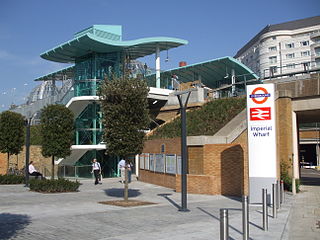
Imperial Wharf is a station located in Sands End in West London for London Overground and National Rail services.

<span class="mw-page-title-main">West Kensington tube station</span> London Underground station

West Kensington is a London Underground District line station in West Kensington. It is located on North End Road (B317) close to its junction with West Cromwell Road/Talgarth Road (A4).

<span class="mw-page-title-main">Shepherd's Bush railway station</span> London Overground station

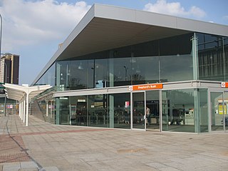
Shepherd's Bush station is a station located in the district of Shepherd's Bush in Greater London for London Overground and National Rail services.

<span class="mw-page-title-main">Lillie Bridge (Fulham)</span> Bridge in England

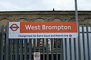
Lillie Bridge is a road bridge that links Old Brompton Road in the Royal Borough of Kensington and Chelsea with Lillie Road in the London Borough of Hammersmith & Fulham. It crosses two railways: the West London Line on the London Overground and the Wimbledon branch of the London Underground at West Brompton station.

References

  1. thetrainline
  2. "Step free Tube Guide" (PDF). Transport for London . April 2021. Archived (PDF) from the original on 15 May 2021.
  3. "Station Usage Data" (CSV). Usage Statistics for London Stations, 2018. Transport for London. 23 September 2020. Archived from the original on 14 January 2023. Retrieved 11 October 2023.
  4. "Station Usage Data" (XLSX). Usage Statistics for London Stations, 2019. Transport for London. 23 September 2020. Archived from the original on 9 November 2020. Retrieved 9 November 2020.
  5. "Station Usage Data" (XLSX). Usage Statistics for London Stations, 2020. Transport for London. 16 April 2021. Retrieved 1 January 2022.
  6. "Station Usage Data" (XLSX). Usage Statistics for London Stations, 2021. Transport for London. 12 July 2022. Retrieved 7 September 2022.
  7. "Station Usage Data" (XLSX). Usage Statistics for London Stations, 2022. Transport for London. 4 October 2023. Retrieved 10 October 2023.
  8. 1 2 3 4 5 "Estimates of station usage". Rail statistics. Office of Rail Regulation. Please note: Some methodology may vary year on year.
  9. Historic England. "Details from listed building database (1385365)". National Heritage List for England . Retrieved 9 October 2015.
  10. Hobhouse (1986), footnote 55.
  11. Walford, Edward (1878). Underground London: Its railways, subways and sewers. London: Cassell, Petter & Galpin. pp. 224–242 via British History Online (transcription).
  12. 1 2 Hobhouse (1986).
  13. "Extension of the District Line to Fulham". Daily News. London. 28 February 1880. p. 6 via Newspapers.com. Open Access logo PLoS transparent.svg
  14. "Effect of Heat on Rails – Mishap on the Metropolitan Line". The Guardian. 14 April 1906. p. 5 via Newspapers.com. Open Access logo PLoS transparent.svg
  15. "(unspecified)".[ dead link ]
  16. "West Brompton Station". RKG. 2013. Archived from the original on 5 March 2016.
  17. Blower's Architect's, Surveyor's, Engineer's and Builder's Directory. T. Blower. 1860 via Archive.org.
  18. Table 59, 66, 170, 176 National Rail timetable, December 2023
  19. "London Overground Timetable: Stratford to Richmond and Clapham Junction" (PDF). Transport for London . Retrieved 13 December 2023.
  20. "District Line Timetable". Transport for London . Retrieved 13 December 2023.