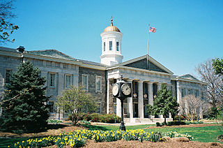
Baltimore County is the third-most populous county in the U.S. state of Maryland and is part of the Baltimore metropolitan area. Baltimore County is part of the Northeast megalopolis, which stretches from Northern Virginia northward to Boston. Baltimore County hosts a diversified economy, with particular emphasis on education, government, and health care. As of the 2020 census, the population was 854,535.

Princeton is a census-designated place (CDP) and unincorporated community in Miami-Dade County, Florida, United States. The population was 39,208 at the 2020 census, up from 22,038 at the 2010 census.
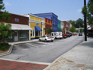
Conyers is an Atlanta suburb, the county seat of and only city in Rockdale County, Georgia, United States. The city is 24 miles (38.6 km) east of downtown Atlanta and is a part of the Atlanta Metropolitan Area. As of the 2010 census, the city population was 15,195. The formerly separate town of Milstead is now part of Conyers.

Catonsville is a census-designated place (CDP) in Baltimore County, Maryland. The population was 41,567 at the 2010 census. The community lies to the west of Baltimore along the city's border. Catonsville contains the majority of the University of Maryland, Baltimore County (UMBC), a major public research university with close to 14,000 students.

Lochearn is an unincorporated community and census-designated place in Baltimore County, Maryland, United States, located immediately to the west of the City of Baltimore. Per the 2020 census, the population was 25,511.

Milford Mill is an unincorporated community and census-designated place in Baltimore County, Maryland, United States. Per the 2020 census, the population was 30,622.

Owings Mills is an unincorporated community and census-designated place in Baltimore County, Maryland, United States. It is a suburb of Baltimore. Per the 2020 census, the population was 35,674. Owings Mills is home to the northern terminus of the Baltimore Metro Subway, and housed the Owings Mills Mall until its closure in 2015. It is also home to the Baltimore Ravens' headquarters facility, and the studios for Maryland Public Television. In 2008, CNNMoney.com named Owings Mills number 49 of the "100 Best Places to Live and Launch".

Pikesville is a census-designated place (CDP) in Baltimore County, Maryland, United States. Pikesville is just northwest of the Baltimore city limits. It is the northwestern suburb closest to Baltimore.

Woodlawn is an unincorporated community and census-designated place in Baltimore County, Maryland. Per the 2020 census, the population was 39,986. It is home to the headquarters of the Social Security Administration (SSA) and the Centers for Medicare and Medicaid Services (CMS). It is bordered by Catonsville on the south, by the Patapsco River and Howard County on the west, by Randallstown and Lochearn to the north, and by the City of Baltimore to the east. Parts of Woodlawn are sometimes informally referred to as Security, Maryland, due to the importance of the SSA's headquarters as well as nearby Security Boulevard and Security Square Mall.

The Maryland Transit Administration (MTA) is a state-operated mass transit administration in Maryland, and is part of the Maryland Department of Transportation. The MTA operates a comprehensive transit system throughout the Baltimore-Washington Metropolitan Area. There are 80 bus lines serving the Baltimore Metropolitan Area, along with rail services that include the Light Rail, Metro Subway, and MARC Train. In 2021, the system had a ridership of 44,612,100, or about 156,900 per weekday as of the third quarter of 2022. With nearly half the population of Baltimore residents lacking access to a car, the MTA is an important part of the regional transit picture. The system has many connections to other transit agencies of Central Maryland, Washington, D.C., Northern Virginia, and south-central Pennsylvania : WMATA, Charm City Circulator, Regional Transportation Agency of Central Maryland, Annapolis Transit, Rabbit Transit, Ride-On, and TransIT.
Baltimore County Public Schools is the school district in charge of all public schools in Baltimore County, Maryland, United States. It is the 25th largest school system in the US as of 2013. The school system is managed by the Board of Education, headquartered in Towson. The superintendent is Darryl L. Williams, appointed by the School Board on June 11, 2019.
Gwynn Oak is an unincorporated community in the western part of Baltimore City, Maryland, United States. Gwynn Oak is north of Liberty Road and east of Rogers Avenue Windsor Mill Road. Nearby neighborhoods include: Woodlawn, Milford Mill, Windsor Mill, and Garwyn Oaks. The western edge of the community lies just outside Woodlawn town center, north-east of Windsor Mill Road where Woodlawn Drive becomes Gwynn Oaks Avenue. The community was home to the Gwynn Oak Amusement Park, now Gwynn Oak Park.
Milford Mill Academy (MMA) is a four-year public high school in Baltimore County, Maryland, United States. It is located on the west side of the county close to the Baltimore City border just outside the Baltimore Beltway.

Woodlawn High School (WHS) is a four-year public high school in Baltimore County, Maryland, United States. The school opened in the fall of 1961. Prior to that, students in the area attended Catonsville, Milford Mill, or Franklin High Schools. In the fall of 2017, Woodlawn offered an Early College Program to help students prepare for university education.

Maryland Route 166 is a state highway in the U.S. state of Maryland. The state highway runs 2.71 miles (4.36 km) from Interstate 195 (I-195) in Arbutus north to MD 144 in Catonsville. MD 166 consists of two sections: a short freeway section that serves as a northern continuation of I-195 and provides access to the University of Maryland, Baltimore County (UMBC), and a segment of Rolling Road, a major north–south highway in western Baltimore County. Rolling Road dates to the colonial era as a highway used to transport tobacco from plantations to river ports. North Rolling Road, which connects Catonsville with Woodlawn and Milford Mill, has always been a county highway. South Rolling Road was constructed as a state highway by the early 1920s between what were to become U.S. Route 1 and US 40. Parts of South Rolling Road were transferred to county maintenance after they were severed by the construction of I-95 and a freeway relocation of the southern end of MD 166 in the early 1970s.
LocalLink 85 is a bus route that operates in Baltimore and its suburbs. All trips operate from the Penn-North Metro Subway Station in Baltimore City to the Milford Mill Metro Subway Station in Pikesville. The route, which started operating on August 24, 2008, is a combination of the most recent versions of the former routes M-3 and M-8, which had been operating since 1984 and 1987 respectively. Prior to these dates, the routes had been served by other buses and streetcars.

CityLink Lime is a CityLink bus route operated by the Maryland Transit Administration in Baltimore and its suburbs. The line currently runs from the Mondawmin Metro Subway Station along Liberty Heights Avenue and Liberty Road to a loop known as in Milford Mill with buses marked as "Milford Mill". The loop is composed of a square block, consisting of Liberty Road, Rolling Road, Church Lane, and Milford Mill Road. The spot of the layover depends on the time of day.
Brownsville-Brent-Goulding was a Census-designated place in Escambia County, Florida during the 1950 United States Census, which consists of the communities of Brent, Brownsville, Goulding and West Pensacola. The population in 1950 was 20,269.

Many countries and national censuses currently enumerate or have previously enumerated their populations by race, ethnicity, nationality, or a combination of these characteristics. Different countries have different classifications and census options for race and ethnicity/nationality which are not comparable with data from other countries. In addition, many of the race and ethnicity concepts that appear on national censuses worldwide have their origins in Europe or in the views of Europeans, rather than in the views of the locals of these countries.

The history of White Americans in Baltimore dates back to the 17th century when the first white European colonists came to what is now Maryland and established the Province of Maryland on what was then Native American land. White Americans in Baltimore are Baltimoreans "having origins in any of the original peoples of Europe, the Middle East or North Africa." Majority white for most of its history, Baltimore no longer had a white majority by the 1970s. As of the 2010 Census, white Americans are a minority population of Baltimore at 29.6% of the population. White Americans have played a substantial impact on the culture, dialect, ethnic heritage, history, politics, and music of the city. Since the earliest English settlers arrived on the shores of the Chesapeake Bay, Baltimore's white population has been sustained by substantial immigration from all over Europe, particularly Central Europe, Eastern Europe, and Southern Europe, as well as a large out-migration of White Southerners from Appalachia. Numerous white immigrants from Europe and the European diaspora have immigrated to Baltimore from the United Kingdom, Germany, Ireland, Poland, Italy, the Czech Republic, Slovakia, Lithuania, Russia, Ukraine, Spain, France, Canada, and other countries, particularly during the late 19th century and early 20th century. Smaller numbers of white people have immigrated from Latin America, the Caribbean, the Middle East, North Africa, and other non-European regions. Baltimore also has a prominent population of white Jews of European descent, mostly with roots in Central and Eastern Europe. There is a smaller population of white Middle Easterners and white North Africans, most of whom are Arab, Persian, Israeli, or Turkish. The distribution of White Americans in Central and Southeast Baltimore is sometimes called "The White L", while the distribution of African Americans in East and West Baltimore is called "The Black Butterfly."
