The A68 is a major road in the United Kingdom, running from Darlington in England to the A720 in Edinburgh, the capital of Scotland. It crosses the Anglo-Scottish border at Carter Bar and is the only road to do so for some distance either way; the next major crossings are the A697 from Coldstream to Cornhill-on-Tweed in the east, and the A7 near Canonbie to the west.
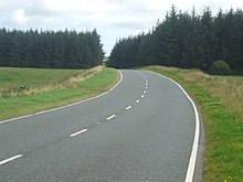
The A59 is a major road in England which is around 109 miles (175 km) long and runs from Wallasey, Merseyside to York, North Yorkshire. The alignment formed part of the Trunk Roads Act 1936, being then designated as the A59. It is a key route connecting Merseyside at the M53 motorway to Yorkshire, passing through three counties and connecting to various major motorways. The road is a combination of historical routes combined with contemporary roads and a mixture of dual and single carriageway. Some sections of the A59 in Yorkshire closely follow the routes of Roman roads, some dating back to the Middle Ages as salt roads, whilst much of the A59 in Merseyside follows Victorian routes which are largely unchanged to the present day.
The A97 is a major road in Aberdeenshire, Scotland. A very short section of the road is within Moray

The M80 is a motorway in Scotland's central belt, running between Glasgow and Stirling via Cumbernauld and Denny and linking the M8, M73 and M9 motorways. Following completion in 2011, the motorway is 25 miles (40 km) long. Despite being only a two lane motorway, parts of the M80 Stepps Bypass are used by around 60,000 vehicles per day.

The A95 road is a major road of north-east Scotland connecting the A9 road in the Highlands to the A98 road near the coast.

Known as the Hagley Road in Birmingham, the A456 is a main road in England running between Central Birmingham and Woofferton, Shropshire, south of Ludlow. Some sections of the route, for example Edgbaston near Bearwood, are also the route of the Elan Aqueduct which carries Birmingham's water supply from the Elan Valley.

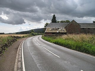
The A944 road connects Aberdeen with Strathdon in north-east Scotland.

New York State Route 85 (NY 85) is a state highway in Albany County, New York, in the United States. It is 26.49 miles (42.63 km) in length and runs from CR 353 in Rensselaerville to Interstate 90 (I-90) exit 4 in Albany. It also has a loop route, NY 85A, which connects NY 85 to the village of Voorheesville. The portion of NY 85 north of NY 140 to the Bethlehem–Albany town/city line is known as the Slingerlands Bypass. From there north to I-90, the road is a limited-access, four-lane highway named the Crosstown Arterial.
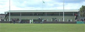
Victoria Park is a football ground in Buckie in north-east Scotland, which is the home ground of Highland Football League side Buckie Thistle. It is located at the junction of Midmar Street and South Pringle Street, 0.5 miles (0.8 km) from the town centre. The ground has a capacity of 5,000 with 400 seated, and is currently the largest in the league.

The A405 is a 4.8 miles dual carriageway road in Hertfordshire, England, from the A41 at Leavesden Green, near Watford, to the A414 at Park Street Roundabout near St Albans.
The A912 is a major road in both Perth and Kinross and Fife, Scotland. It runs from the A9 in Perth, in the north, to the A92 at Muirhead, in the south. Part of it was formerly part of the A90.

The A730 road in Scotland runs between the centre of Glasgow and the south-eastern edge of the city's urban area at Cathkin.

The A6178 is a 4 digit A road in South Yorkshire, England. It begins in the Lower Don Valley area of Sheffield, at a junction with the A6109. The road heads northeast, crossing the River Don before passing through Attercliffe. The road passes a junction with Staniforth Road before passing the Don Valley Bowl, IceSheffield, the English Institute of Sport and the historic Hill Top Chapel. The road meets a junction with the A6102 at Carbrook, before continuing northeast as Attercliffe Common passing Valley Centertainment and the South Yorkshire Police headquarters. The road passes a number of car dealerships including Porsche and Mercedes before meeting the entrance to the Meadowhall Shopping Centre.
The A4113 road is a single-carriageway road that runs from Knighton in Powys to Bromfield in Shropshire, United Kingdom, passing through north Herefordshire.

The A20 is a road in County Down in Northern Ireland. It runs from Belfast to Newtownards and on to Portaferry.

The A835 is a road in the Scottish Highlands linking Inverness to Ullapool and the Far North of Scotland.

The A832 is a road in the Scottish Highlands, linking Cromarty, on the east coast, to Gairloch on the west coast, and beyond Gairloch to Braemore Junction. It is 126 miles (203 km) long and runs entirely in the former county of Ross and Cromarty. The road forms part of the Wester Ross Coastal Trail.

The River Dulnain is a major left bank tributary of the River Spey in northeast Scotland. It rises in the eastern part of the Monadhliath Mountains and flows in a generally northeastward direction through uninhabited country to Sluggan, where it is crossed by Sluggan Bridge, constructed by General Wade to carry a military road. Turning more easterly, the Dulnain passes beneath the modern A9 road which bypasses Carrbridge, the mainline railway and, in Carrbridge itself, the Carrbridge Packhorse Bridge that gives the village its name and the bridge carrying the B9153 road. The final section flowing east-northeast to the village of Dulnain Bridge is accompanied by the A938 road. The river empties into the Spey after passing beneath the A95 road and the disused bridge of the former Strathspey railway.

Tyrie is a hamlet and parish in the Banff and Buchan district of Aberdeenshire, north-east Scotland. Tyrie is located on the A98 road, around 5.5 miles (8.9 km) south-west of Fraserburgh. Tyrie parish includes the larger settlement of New Pitsligo, 5 miles (8.0 km) to the south. There is a primary school in the village. Tyrie's St Andrew's Parish Church was built in 1800 and is a category B listed building. The church contains a Pictish symbol stone, known as the Raven Stone, which was discovered on the site of the old parish church. The ecclesiastical parish was united with Strichen parish in 2002.

The A724 road in Scotland runs within South Lanarkshire between Rutherglen and Hamilton. It follows an ancient route which is marked on William Roy's Lowland Map of Scotland (1755) with only minor deviations from its modern course.