Blue Mounds (town), Wisconsin

Last updated

Blue Mounds
Dane County Wisconsin incorporated and unincorporated areas Blue Mounds (town) highlighted.svg
Location in Dane County and the state of Wisconsin.
USA Wisconsin location map.svg
Red pog.svg
Blue Mounds
Usa edcp location map.svg
Red pog.svg
Blue Mounds
Coordinates: 42°59′43″N89°46′48″W / 42.99528°N 89.78000°W / 42.99528; -89.78000
Country Flag of the United States.svg  United States
State Flag of Wisconsin.svg  Wisconsin
Counties Dane County
Population
 (2000)
  Total899
Time zone UTC-6 (Central (CST))
  Summer (DST) UTC-5 (CDT)

Blue Mounds is a town in Dane County, Wisconsin, United States. The population was 899 at the 2020 census. The Village of Blue Mounds is located within the town.

Contents

Geography

According to the United States Census Bureau, the town has a total area of 33.0 square miles (85.5 km2), of which, 33.0 square miles (85.5 km2) of it is land and 0.03% is water.

Demographics

As of the census [1] of 2000, there were 842 people, 291 households, and 247 families residing in the town. The population density was 25.5 people per square mile (9.8/km2). There were 300 housing units at an average density of 9.1 per square mile (3.5/km2). The racial makeup of the town was 98.34% White, 0.12% Black or African American, 0.59% Native American, 0.36% Asian, 0.12% from other races, and 0.48% from two or more races. 0.48% of the population were Hispanic or Latino of any race.

There were 291 households, out of which 41.6% had children under the age of 18 living with them, 77.0% were married couples living together, 4.5% had a female householder with no husband present, and 14.8% were non-families. 10.0% of all households were made up of individuals, and 3.8% had someone living alone who was 65 years of age or older. The average household size was 2.89 and the average family size was 3.13.

In the town, the population was spread out, with 30.6% under the age of 18, 4.2% from 18 to 24, 28.5% from 25 to 44, 26.6% from 45 to 64, and 10.1% who were 65 years of age or older. The median age was 39 years. For every 100 females, there were 101.4 males. For every 100 females age 18 and over, there were 104.9 males.

The median income for a household in the town was $61,429, and the median income for a family was $64,028. Males had a median income of $41,563 versus $29,205 for females. The per capita income for the town was $27,696. About 4.4% of families and 5.0% of the population were below the poverty line, including 7.0% of those under age 18 and none of those age 65 or over.

Related Research Articles

<span class="mw-page-title-main">West Harrison, Indiana</span> Town in Indiana, United States

West Harrison is a town in Harrison Township, Dearborn County, Indiana, United States. The population was 289 at the 2010 census.

<span class="mw-page-title-main">Woodlawn Heights, Indiana</span> Town in Indiana, United States

Woodlawn Heights is a town in Anderson Township, Madison County, Indiana, United States. It is part of the Indianapolis–Carmel–Anderson metropolitan statistical area. The population was 91 at the 2020 census.

<span class="mw-page-title-main">Harpers Ferry, Iowa</span> City in Iowa, United States

Harpers Ferry is a city in Taylor Township, Allamakee County, Iowa, United States. The population was 262 at the time of the 2020 census.

<span class="mw-page-title-main">Mound Valley, Kansas</span> City in Labette County, Kansas

Mound Valley is a city in Labette County, Kansas, United States. As of the 2020 census, the population of the city was 348.

<span class="mw-page-title-main">Blaine, Maine</span> Town in the state of Maine, United States

Blaine is a town in Aroostook County, Maine, United States. The population was 667 at the 2020 census. It was known as Alva prior to incorporation in 1874, when it was renamed in honor of James G. Blaine, then Speaker of the U.S. House of Representatives. According to local history, Blaine offered to donate a large bell for the tower of the town's new meeting hall, if the citizens would rename the town after him. The town's name was changed, but Blaine never donated a bell. The building still stands on the north end of town, on Route 1.

<span class="mw-page-title-main">Littleton, Maine</span> Town in the state of Maine, United States

Littleton is a town in Aroostook County, Maine, United States. The population was 997 at the 2020 census.

<span class="mw-page-title-main">Ludlow, Maine</span> Town in the state of Maine, United States

Ludlow is a town in Aroostook County, Maine, United States. The population was 434 at the 2020 census.

Lowell is a town in Penobscot County, Maine, United States. The population was 368 at the 2020 census.

<span class="mw-page-title-main">Prospect, Maine</span> Town in the state of Maine, United States

Prospect is a town in Waldo County, Maine, United States. The population was 698 at the 2020 census.

<span class="mw-page-title-main">Moundville, Missouri</span> Village in Missouri, United States

Moundville is a village in southwest Vernon County, Missouri, United States. The population was 124 at the 2010 census.

<span class="mw-page-title-main">Tarlton, Ohio</span> Village in Ohio, United States

Tarlton is a village in Fairfield and Pickaway counties in the U.S. state of Ohio. The population was 254 at the 2020 census.

<span class="mw-page-title-main">Mound City, South Dakota</span> Town in South Dakota, United States

Mound City is a town in and the county seat of Campbell County, South Dakota, United States. The population was 69 at the 2020 census.

<span class="mw-page-title-main">Rhodell, West Virginia</span> Unincorporated community in West Virginia, United States

Rhodell is an unincorporated community in Raleigh County, West Virginia, United States. The population was 173 at the 2010 census.

<span class="mw-page-title-main">Monona, Wisconsin</span> City in Wisconsin, United States

Monona is a city in Dane County, Wisconsin, United States. A suburb of the state capital, Madison, the city lies on the southeastern shore of Lake Monona, from which the city gets its name. The population was 8,624 at the 2020 census.

<span class="mw-page-title-main">True, Wisconsin</span> Town in Wisconsin, United States

True is a town in Rusk County, Wisconsin, United States. The population was 291 at the 2000 census. The village of Glen Flora is within the town.

<span class="mw-page-title-main">Sumner, Trempealeau County, Wisconsin</span> Town in Wisconsin, United States

Sumner is a town in Trempealeau County, Wisconsin, United States. The population was 806 at the 2000 census.

<span class="mw-page-title-main">Wheatland, Vernon County, Wisconsin</span> Town in Vernon County, Wisconsin, United States

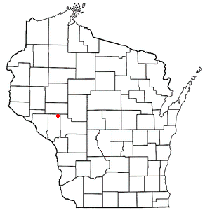
Wheatland is a town in Vernon County, Wisconsin, United States. The population was 533 at the 2000 census. The unincorporated communities of Red Mound, and Victory are located in Wheatland.

<span class="mw-page-title-main">Union, Waupaca County, Wisconsin</span> Town in Wisconsin, United States

Union is a town in Waupaca County, Wisconsin, United States. The population was 804 at the 2000 census. The unincorporated community of Symco is located in the town. The ghost town of Marble was also located in the town.

Elk Mound is a town in Dunn County, Wisconsin, United States. The population was 1,121 according to the 2000 census. The town is named after the Village of Elk Mound, located in the eastern part of the town.

<span class="mw-page-title-main">Honey Creek Township, Adams County, Illinois</span> Township in Illinois, United States

Honey Creek Township is one of twenty-two townships in Adams County, Illinois, United States. As of the 2020 census, its population was 747 and it contained 312 housing units.

References

  1. "U.S. Census website". United States Census Bureau . Retrieved January 31, 2008.