Springdale, Wisconsin

Last updated

Springdale, Wisconsin
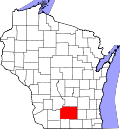
Dane County Wisconsin incorporated and unincorporated areas Springdale highlighted.svg
Location in Dane County and the state of Wisconsin.
Coordinates: 42°58′38″N89°39′4″W / 42.97722°N 89.65111°W / 42.97722; -89.65111
Country Flag of the United States.svg  United States
State Flag of Wisconsin.svg  Wisconsin
County Dane
Area
  Total35.3 sq mi (91.4 km2)
  Land35.3 sq mi (91.4 km2)
  Water0.0 sq mi (0.0 km2)
Elevation
[1]
1,152 ft (351 m)
Population
 (2020)
  Total2,056
  Density43.4/sq mi (16.7/km2)
Time zone UTC-6 (Central (CST))
  Summer (DST) UTC-5 (CDT)
Area code 608
FIPS code 55-75850 [2]
GNIS feature ID1584191 [1]

Springdale is a town in Dane County, Wisconsin, United States. The population was 2,056 at the 2020 census. The unincorporated communities of Klevenville, Mount Vernon, and Riley are located in the town.

Contents

Geography

According to the United States Census Bureau, the town has a total area of 35.3 square miles (91.4 km2), all of it land.

History

The land that would become Springdale was first surveyed in 1832 and 1833. [3] Settlement began around 1845, aided by good access via the Military Road. The Town of Springdale itself was established in 1848. The town was largely settled by the mid-1850s, filled with Americans from the Northeast and Midwest along with immigrants from England, Scotland, Ireland, Germany and Norway. [4]

Demographics

At the 2000 census there were 1,530 people, 570 households, and 441 families in the town. The population density was 43.4 people per square mile (16.7/km2). There were 585 housing units at an average density of 16.6 per square mile (6.4/km2). The racial makeup of the town was 96.99% White, 0.65% African American, 0.13% Native American, 0.39% Asian, 0.13% Pacific Islander, 0.39% from other races, and 1.31% from two or more races. Hispanic or Latino of any race were 1.31%. [2]

Of the 570 households 35.6% had children under the age of 18 living with them, 70.2% were married couples living together, 4.9% had a female householder with no husband present, and 22.6% were non-families. 15.8% of households were one person and 3.7% were one person aged 65 or older. The average household size was 2.68 and the average family size was 3.03.

The age distribution was 27.1% under the age of 18, 4.4% from 18 to 24, 30.7% from 25 to 44, 28.2% from 45 to 64, and 9.6% 65 or older. The median age was 40 years. For every 100 females, there were 104.8 males. For every 100 females age 18 and over, there were 103.1 males.

The median household income was $65,655 and the median family income was $68,417. Males had a median income of $40,231 versus $31,467 for females. The per capita income for the town was $27,138. About 1.8% of families and 1.9% of the population were below the poverty line, including 3.3% of those under age 18 and 2.1% of those age 65 or over.

Municipal services

Sewer, water, and natural gas utilities are not available within the town. Law enforcement services are provided by the Dane County Sheriff's Department. Fire and emergency medical services are provided by the Mount Horeb Area Joint Fire Department and Emergency Medical Service.

Related Research Articles

<span class="mw-page-title-main">Vienna, Maine</span> Town in the state of Maine, United States

Vienna is a town in Kennebec County, Maine, United States. The population was 578 at the 2020 census.

<span class="mw-page-title-main">New Windsor, Maryland</span> Town in Maryland, United States

New Windsor is a town in Carroll County, Maryland, United States. The population was 1,398 at the 2020 census. It is located 6 miles (10 km) west of Westminster on Maryland Route 31.

<span class="mw-page-title-main">Springdale Township, Redwood County, Minnesota</span> Township in Minnesota, United States

Springdale Township is one of the twenty-six townships of Redwood County, Minnesota, United States. The population was 215 at the 2000 census.

<span class="mw-page-title-main">Springdale, New Jersey</span> Populated place in Camden County, New Jersey, US

Springdale is an unincorporated community and census-designated place (CDP) located within Cherry Hill Township, in Camden County, in the U.S. state of New Jersey. As of the 2010 United States Census, the section population was 14,518.

<span class="mw-page-title-main">Springdale, Ohio</span> City in Ohio, United States

Springdale is a city in Hamilton County, Ohio, United States. It is a suburb of Cincinnati. The population was 11,007 at the 2020 census.

<span class="mw-page-title-main">Springdale, Pennsylvania</span> Borough in Pennsylvania, United States

Springdale is a borough in northeastern Allegheny County, Pennsylvania, United States, 18 miles (29 km) northeast of Pittsburgh along the Allegheny River. The population was 3,400 at the 2020 census. The borough became official in 1906, after breaking away from the township.

<span class="mw-page-title-main">Springdale Township, Pennsylvania</span> Township in Pennsylvania, United States

Springdale Township is a township in Allegheny County, Pennsylvania, United States. It contains the two communities of Orrville and Harwick. The population was 1,636 at the 2010 census.

Springdale is a town in Lexington County, South Carolina, United States. The population was 2,636 at the 2010 census. It is part of the Columbia Metropolitan Statistical Area.

<span class="mw-page-title-main">Springdale, Utah</span> Town in the state of Utah, United States

Springdale is a town in Washington County, Utah, United States. The population was 529 at the 2010 census. It is located immediately outside the boundaries of Zion National Park, and is oriented around the resulting tourist industry. It was originally settled as a Mormon farming community in 1862 by evacuees from the flooding of nearby Northrop.

<span class="mw-page-title-main">Rural Retreat, Virginia</span> Town in Virginia, United States

Rural Retreat is a town in Wythe County, Virginia, United States. The population was 1,483 at the 2010 census.

<span class="mw-page-title-main">Springdale, Washington</span> Town in Washington, United States

Springdale is a town in Stevens County, Washington, United States. The population was 234 at the 2020 census.

<span class="mw-page-title-main">Canton, Wisconsin</span> Town in Wisconsin, United States

Canton is a town in Buffalo County in the U.S. state of Wisconsin. The population was 305 at the 2010 census. The ghost town of Springdale was located in the town.

<span class="mw-page-title-main">Mentor, Wisconsin</span> Town in Wisconsin, United States

Mentor is a town in Clark County in the U.S. state of Wisconsin. The population was 570 at the 2000 census. The unincorporated community of Humbird is located in the town.

<span class="mw-page-title-main">Rutland, Wisconsin</span> Town in Wisconsin, United States

Rutland is a town in Dane County, Wisconsin, United States. The population was 1,977 by the US Census Bureau 2020 census The population was 1,887 at the 2000 census. However, for 2021, the Wisconsin Dept. of Administration declared the population of the Town to be 2,032. The unincorporated communities of Rutland and Stone are located in the town.

<span class="mw-page-title-main">Springfield, Dane County, Wisconsin</span> Town in Wisconsin, United States

Springfield is a town in Dane County, Wisconsin, United States. The population was 2,929 at the time of the 2020 census. The unincorporated communities of Ashton, Ashton Corners, Kingsley Corners, Martinsville, and Springfield Corners are located in Springfield.

<span class="mw-page-title-main">Blue Mounds (town), Wisconsin</span> Town in Wisconsin, United States

Blue Mounds is a town in Dane County, Wisconsin, United States. The population was 899 at the 2020 census. The Village of Blue Mounds is located within the town.

<span class="mw-page-title-main">Dane, Wisconsin</span> Village in Wisconsin, United States

Dane is a village in Dane County, Wisconsin, United States. The population was 1,117 at the 2020 census. Located in the Town of Dane, the village is part of the Madison Metropolitan Statistical Area.

<span class="mw-page-title-main">Dane (town), Wisconsin</span>

Dane is a town in Dane County, Wisconsin, United States. The population was 968 at the 2000 census. The unincorporated community of Lutheran Hill is located partially in the town.

<span class="mw-page-title-main">Town of Madison, Wisconsin</span> Town in Wisconsin, United States

The Town of Madison was located in Dane County, Wisconsin, United States. The town ceased to exist on October 31, 2022. The majority of the town's territory was situated along the Madison Beltline Highway, comprising several neighborhoods situated between the south side of the city of Madison, and the north side of the city of Fitchburg. The town also had territory on the north side of Madison near the border with Maple Bluff, as well as a few lots on the west side of Madison near Whitney Way. The Dane County Expo Center and Alliant Energy Center was situated within the Town of Madison. Despite its status as an unincorporated community, the Town of Madison provided a variety of services to its residents which typically would only be found in incorporated cities and villages, including trash and recycling services, police, fire and emergency medical services; sewer and water utilities; and three public parks.

<span class="mw-page-title-main">Mazomanie (town), Wisconsin</span>

Mazomanie is a town in Dane County, Wisconsin. The population was 1,185 at the time of the 2000 census. The Village of Mazomanie is located within the town.

References

  1. 1 2 "US Board on Geographic Names". United States Geological Survey. October 25, 2007. Retrieved January 31, 2008.
  2. 1 2 "U.S. Census website". United States Census Bureau . Retrieved January 31, 2008.
  3. "Field Notes for T6N R7E". Original Field Notes and Plat Maps, 1833-1866. Board of Commissioners of Public Lands. Retrieved January 5, 2019.
  4. Joyce McKay; Dorothy E. Steele (August 5, 1999). "NRHP Inventory/Nomination: Donald, John Sweet, Farmstead". National Park Service. p. 36. Retrieved January 3, 2019.