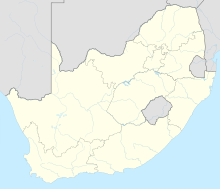
The Province of the Transvaal, commonly referred to as the Transvaal, was a province of South Africa from 1910 until 1994, when a new constitution subdivided it following the end of apartheid. The name "Transvaal" refers to the province's geographical location to the north of the Vaal River. Its capital was Pretoria, which was also the country's executive capital.

The Witwatersrand is a 56-kilometre-long (35 mi), north-facing scarp in South Africa. It consists of a hard, erosion-resistant quartzite metamorphic rock, over which several north-flowing rivers form waterfalls, which account for the name Witwatersrand, meaning "white water ridge" in Afrikaans. This east-west-running scarp can be traced with only one short gap, from Bedfordview in the east, through Johannesburg and Roodepoort, to Krugersdorp in the west.
Nigel is a small gold mining town in Gauteng Province, South Africa, south-east of Johannesburg. The town is at the south-eastern edge of the area known as the East Rand.
Carletonville is a town in Gauteng and the seat of the Merafong City Local Municipality in the West Rand District Municipality in Gauteng, South Africa, just north of the richest gold-mining area in the world. At 3,749 m, Western Deep Levels holds the record for the world's deepest gold mine.

Krugersdorp is a mining city in the West Rand, Gauteng Province, South Africa founded in 1887 by Marthinus Pretorius and Abner Cohen. Following the discovery of gold on the Witwatersrand, a need arose for a major town in the west of the reef. The government bought part of the Paardekraal farm and named the new town after the Transvaal president, Paul Kruger. Krugersdorp no longer has a separate municipal government after it was integrated into Mogale City Local Municipality along with surrounding towns. It is now the seat of government for Mogale City.

Randfontein is a gold mining town in the West Rand, Gauteng, South Africa, 40 km (25 mi) west of Johannesburg. With the Witwatersrand gold rush in full swing, mining financier JB Robinson bought the farm Randfontein and, in 1889, floated the Randfontein Estates Gold Mining Company. The town was established in 1890 to serve the new mine and was administered by Krugersdorp until it became a municipality in 1929. Apart from having the largest stamp mill in the world, Randfontein, like many of the other outlying areas of Johannesburg, is essentially a rural collection of farms and small holdings in a particularly beautiful part of Gauteng.
Driefontein is the Driefontein Mine in the West Witwatersrand Basin mining field. The West Wits field was discovered in 1931 and commenced operations with Venterspost Gold Mine in 1939. In 1952, the West Driefontein mine is opened. In 1968, Kloof mine commences operations. In 1972, East Driefontein opens. In 1981, consolidation starts. In 1999, Gold Fields took control of the combined East and West Driefontein mines and merged them starting 2000 with Venterspost, Libanon, Leuudoorn and Kloof mines. In 2010, the current Kloof-Driefontein Complex, comprising KDC East and KDC West, is formed.
Blyvooruitzicht is a gold mine and gold-mining village in Gauteng, South Africa. It is situated about 5 kilometres (3.1 mi) south of the centre of Carletonville and 80 kilometres (50 mi) westwards from Johannesburg.
Uranium production is an important part of the African economy, with Niger, Namibia and South Africa creating up to 18% of the world's annual production. Many African countries produce uranium or have untapped uranium ore deposits.
The South Deep mine is a large mine located in the northern part of South Africa in Gauteng. South Deep represents one of the largest uranium reserves in South Africa having estimated reserves of 126 million tonnes of ore grading 0.0062% uranium.
The Buffelsfontein mine is a large mine located in the northern part of South Africa in Gauteng. Buffelsfontein represents one of the largest uranium reserves in South Africa having estimated reserves of 59.3 million tonnes of ore grading 0.016% uranium.
The Kopanang mine is a large mine located in the northern part of South Africa in Gauteng. Kopanang represents one of the largest uranium reserves in South Africa having estimated reserves of 37.1 million tonnes of ore grading 0.065% uranium.
The Vaal River mine is a large mine located in the northern part of South Africa in Gauteng. Vaal River represents one of the largest uranium reserves in South Africa having estimated reserves of 379.2 million tonnes of ore grading 0.0076% uranium.
The West Wits mine is a large mine located in the northern part of South Africa in Gauteng. West Wits represents one of the largest uranium reserves in South Africa having estimated reserves of 173.9 million tonnes of ore grading 0.0059% uranium.
The Rietkuil mine is a large mine located in the northern part of South Africa in Gauteng. Rietkuil represents one of the largest uranium reserves in South Africa, having estimated reserves of 127.8 million tonnes of ore grading 0.043% uranium.
The Denny Dalton mine is a large mine located in the northern part of South Africa in Gauteng. Denny Dalton represents one of the largest uranium reserves in South Africa having estimated reserves of 31.2 million tons of ore grading 0.03% uranium.
The Old Randfontein mine is a large mine located in the northern part of South Africa in Gauteng. Old Randfontein represents one of the largest uranium reserves in South Africa having estimated reserves of 247.2 million tonnes of ore grading 0.025% uranium.
The Beisa North mine is a large mine located in the northern part of South Africa in Gauteng. Beisa North represents one of the largest uranium reserves in South Africa having estimated reserves of 27.9 million tonnes of ore grading 0.066% uranium.
The Karoo mine is a large mine in the northern part of South Africa in Gauteng. Karoo represents one of the largest uranium reserves in South Africa having estimated reserves of 22.1 million tonnes of ore grading 0.089% uranium.


