Burke Mountain is a mountain located in the Northeast Kingdom of Vermont. The bulk of the mountain is in Burke and Kirby, Caledonia County, but its southeast side is in Essex County. It is flanked to the east and southeast by Umpire Mountain and Kirby Mountain, respectively.
Burke Mountain stands within the watershed of the Passumpsic River. The northeast and northwest sides of Burke Mountain drain into Dish Mill Brook, thence into the East Branch of the Passumpsic River. The southwest end of Burke Mtn. drains into Mountain Brook, thence into the East Branch of the Passumpsic River. The south slopes and southeast side of Burke Mountain drain into Weir Mill Brook, thence into Bog Brook, the Moose River, and the Passumpsic River.
Burke's average annual snowfall is 217 inches (5,500mm).[4]
Skiing
Burke Mountain Resort has 55 ski trails and 15 glades with 270 acres (110ha) skiable of terrain and over 100 acres (40ha) of glades. Among the 55 trails, 11% are designated "Green Circle" (Beginner trails), 47% are "Blue Square" (Intermediate), 33% are "Black Diamond" (Advanced), and 9% are "Double Black Diamond" (Expert).[citation needed][5] Burke also features three terrain parks. Two of the terrain parks are featured on the lower mountain, (Dashney Mile and Carter Country), with the remaining park (Open Slope) located above the Mid-Burke Lodge.[citation needed]
Burke Mountain Resort has a vertical drop of 2,011 feet (613m) and has 80% snowmaking. The mountain is serviced by 5 lifts; 2 high speed quads, a t-bar dedicated to serving BMA racers, and a J-bar and magic carpet in the learning area. .[4][6]
Other mountain activities
In wintertime, there are miles of ski-able terrain throughout the NEK (Northeast Kingdom). Burke Mountain is also located on the Vermont Association of Snow Travelers trails, making the resort accessible by snowmobile. Snowmobile rentals are available in the area. Snow biking is done on the Kingdom Trails Nordic trails.[7]
In summertime, there is singletrack biking, Burke Bike Park, hiking, Hang Gliding, Paragliding,[8] golfing, swimming, climbing, horseback riding, canoeing, kayaking, and fishing.[9]
Burke Mountain from LyndonvilleView of the west side of Burke from Pudding Hill in Lyndon.
Caledonia County is a county located in the northeastern part of the U.S. state of Vermont. As of the 2020 census, the population was 30,233. Its shire town is the town of St. Johnsbury. The county was created in 1792 and organized in 1796. It was given the Latin name for Scotland, in honor of the many settlers who claimed ancestry there.
Jay Peak Resort is an American ski resort located on Jay Peak in the northern Green Mountains, between Jay, Vermont and Montgomery Center, Vermont. Its vertical drop of 2,153 feet (656 m) is the eighth largest in New England and the fifth largest in Vermont. Although mostly located in the town of Jay, part of the resort, including the summit of Jay Peak, the Jet Triple Chair area, and much of the Big Jay backcountry descent, is located in the town of Westfield, Vermont. The resort is just 4 miles (6.5 km) south of the Canada–United States border, above which is the Province of Quebec.
Mount Wachusett is a mountain in Massachusetts. It straddles towns of Princeton and Westminster, in Worcester County. It is the highest point in Massachusetts east of the Connecticut River. The mountain is named after a Native American term meaning "near the mountain" or "mountain place". The mountain is a popular hiking and skiing destination. An automobile road, open spring to fall, ascends to the summit. Views from the top of Mount Wachusett include Mount Monadnock to the north, Mount Greylock to the west, southern Vermont to the northwest, and Boston to the east. The mountain is traversed by the 92 mi (148 km) Midstate Trail. It is also home to the Wachusett Mountain State Reservation.
Killington Mountain Resort & Ski Area is a ski resort in Rutland County, Vermont, United States, near the town of Killington. It is the largest ski area in the eastern U.S., and has the largest vertical drop in New England at 3,050 feet. Since the 2013–14 ski season, it has been called the "Beast of the East."
Mount Snow is a mountain and ski resort in southern Vermont located in the Green Mountains. It is Vermont's southernmost big mountain, and therefore, closest to many Northeast metropolitan areas.
Sproul State Forest is a Pennsylvania state forest in Pennsylvania Bureau of Forestry District #10. The main offices are located in Renovo, Pennsylvania in Clinton County in the United States.
Winterplace Ski Resort is a ski resort located in Ghent, West Virginia on Raleigh County's Flat Top Mountain. The southernmost ski resort in West Virginia, Winterplace is a popular attraction due to its proximity to Interstate 77. It operates in conjunction with The Resort at Glade Springs, a four season golf resort and spa.
Pico Peak is a mountain in the Green Mountains in Rutland County, Vermont, United States. Pico Peak is flanked to the south by Ramshead Peak. To the north, it faces Deer Leap Mountain across Sherburne Pass. Seen from the pass, the summit of Pico Peak resembles a cone.
Big Jay is a 3,786-foot (1,154 m) mountain in the northern Green Mountains of Vermont, located on the border of Franklin and Orleans counties.
Jay Peak is a mountain located about 5 miles (8.0 km) south of the Canada–US border, in Jay and Westfield, Orleans County, Vermont, of which it is the highest point. Most of the mountain is in Jay State Forest. The mountain is named for the town of Jay, Vermont, in which much of the mountain except the peak area itself is located.
Stratton Mountain is a mountain located in Windham County, Vermont, in the Green Mountain National Forest. The mountain is the highest point of Windham County, and of the southern Green Mountains generally. A fire tower located on the summit is generally open for climbing by the public. There is also a small caretaker cabin at the summit that is inhabited in season by a caretaker from the Green Mountain Club. The northern end of the mountain is occupied by Stratton Mountain Resort.
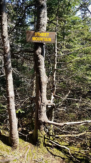
Street Mountain is a mountain located in Essex County, New York, named after Alfred Billings Street (1811–1881), a poet and New York State Librarian. The mountain is the high point of the Street Range of the Adirondack Mountains. Street's northeast ridge is Nye Mountain.
Shrewsbury Peak is a mountain located in Rutland County, Vermont, in the Calvin Coolidge State Forest. The mountain is part of the Coolidge Range. Shrewsbury is flanked to the northwest by Little Killington.
Bolton Mountain is a mountain located in Chittenden County, Vermont. Bolton is flanked to the north by Mount Mayo.
The Passumpsic River is a 22.7-mile-long (36.5 km) tributary of the Connecticut River, in Vermont. Though primarily a Caledonia County river, it is the only river to flow through all three counties of the Northeast Kingdom.
Besek Mountain also known as Black Mountain, est. 840 feet (260 m), is a traprock mountain ridge located 4.75 miles (7.6 km) southeast of Meriden, Connecticut. It is part of the narrow, linear Metacomet Ridge that extends from Long Island Sound near New Haven, Connecticut, north through the Connecticut River Valley of Massachusetts to the Vermont border. Besek Mountain is known for its 3-mile (4.8 km) long line of open cliffs, unique microclimate ecosystems, and rare plant communities. The mountain is traversed by the 51-mile (82 km) Mattabesett Trail, and is home to the Powder Ridge Ski Area.
Bearpen Mountain is a mountain located in the Catskill Mountains of New York. The mountain's highest peak is in Greene County, but its northwest subpeak at 42°16.42′N74°29.05′W is the highest point in Delaware County at 3,520 ft. Bearpen Mountain is flanked to the north by Roundtop, and to the southeast by Vly Mountain.
Mount Fray, 1,893 feet (577 m), also known as Catamount because of the Catamount Ski Area located on its north slope, is a prominent peak of the south Taconic Mountains, located in southwest Massachusetts and adjacent New York. The summit is open and covered in scrub oak; it offers views west over the Hudson River Valley. The sides of the mountain are wooded with northern hardwood tree species. The 15.7 mi (25.3 km) South Taconic Trail passes over the summit of Mount Fray.
Sugarloaf Provincial Park is an 11.5-square-kilometre (4.4 sq mi) all-season provincial park located in the Campbellton community of Atholville. It opened in 1972.
Burke Mountain Ski resort is a mid-size ski resort open to skiing and snowboarding in northeast Vermont. It is located on Burke Mountain and is home to Burke Mountain Academy, a ski academy.
This page is based on this Wikipedia article Text is available under the CC BY-SA 4.0 license; additional terms may apply. Images, videos and audio are available under their respective licenses.