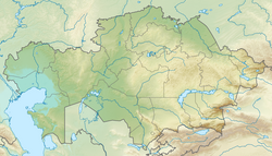
Kazakhstan is located in Central Asia. With an area of about 2,724,900 square kilometers (1,052,100 sq mi) Kazakhstan is more than twice the combined size of the other four Central Asian states and 60% larger than Alaska. The country borders Turkmenistan, Uzbekistan, and Kyrgyzstan to the south; Russia to the north; Russia and the Caspian Sea to the west; and China's Xinjiang Uygur Autonomous Region to the east.

Russia is the largest country in the world, covering over 17,125,192 km2 (6,612,074 sq mi), and encompassing more than one-eighth of Earth's inhabited land area. Russia extends across eleven time zones, and has the most borders of any country in the world, with sixteen sovereign nations.

Atyrau, known until 1991 as Guryev, is a city in Kazakhstan and the capital of Atyrau Region. Atyrau is a transcontinental city, at the mouth of the Ural River on the Caspian Sea, between Europe and Asia, 2,700 kilometres west of Almaty and 351 kilometres east of the Russian city of Astrakhan.

Astrakhan is the largest city and administrative centre of Astrakhan Oblast in southern Russia. The city lies on two banks of the Volga, in the upper part of the Volga Delta, on eleven islands of the Caspian Depression, 60 miles from the Caspian Sea, with a population of 475,629 residents at the 2021 Census. At an elevation of 28 meters (92 ft) below sea level, it is the lowest city in Russia.
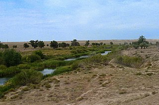
The Emba in west Kazakhstan rises in the Mugodzhar Hills and flows across the Sub-Ural Plateau and Caspian Depression into the Caspian Sea. It is 712 kilometres (442 mi) long, and has a drainage basin of 40,400 square kilometres (15,600 sq mi). It flows through the north of the Ust-Urt plateau, and reaches the Caspian by a series of shallow lagoons, which were navigable in the 18th century. The lower course traverses an area of salt domes and the petroleum-rich Emba fields. It is sometimes regarded as a definition for the natural boundary between Europe and Asia.
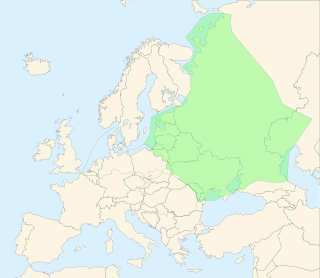
The East European Plain is a vast interior plain extending east of the North European Plain, and comprising several plateaus stretching roughly from 25 degrees longitude eastward. It includes Volhynian-Podolian Upland on its westernmost fringe, the Central Russian Upland, and, on the eastern border, encompasses the Volga Upland. The plain includes also a series of major river basins such as the Dnepr Basin, the Oka–Don Lowland, and the Volga Basin. At the southeastern point of the East European Plain are the Caucasus and Crimean mountain ranges. Together with the North European Plain, and covering the Baltic states, European Russia, Belarus, Ukraine, Moldova, southeastern Romania, and, at its southernmost point, the Danubian Plain in Northern Bulgaria, it constitutes the majority of the Great European Plain, the greatest mountain-free part of the European landscape. The plain spans approximately 4,000,000 km2 (2,000,000 sq mi) and averages about 170 m (560 ft) in elevation. The highest point of the plain, located in the Valdai Hills, is 346.9 metres (1,138.1 ft).

The Turan Depression, Turan Lowland or Turanian Basin is a low-lying desert basin region stretching from southern Turkmenistan through Uzbekistan to Kazakhstan.

Atyrau Region formerly known as Guryev Region, until 1991, is one of the regions of Kazakhstan, in the west of the country around the northeast of the Caspian Sea. Its capital is the city of Atyrau, with a population of 355,117; the region itself has a population of 681,241, of which Kazakhs make up more than 90%.

The Ryn Desert or Ryn-Peski Desert is a desert in western Kazakhstan and Astrakhan Oblast, Russia.

West Kazakhstan Region is a region of Kazakhstan. The region has a population of 683,327 as of 2022. Its administrative centre is Oral, a city of about 200,000 inhabitants.
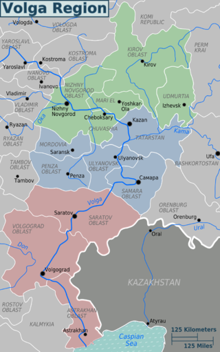
The Volga region is a historical region in Russia that encompasses the drainage basin of the Volga River, the longest river in Europe, in central and southern European Russia.
The Manych Ship Canal is a canal between the Black Sea lagoon the Sea of Azov and the Caspian Sea.
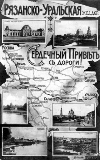
The Privolzhskaya Railway is a subsidiary of the Russian Railways headquartered in Saratov. It serves the Saratov, Volgograd, and Astrakhan regions of Russia. Its three branches are headquartered in Saratov, Volgograd, and Astrakhan. The railway route length totals 4236,8 km. The network has 31 146 employees. A short stretch of the railway crosses the territory of Kazakhstan. It was established in 1953 by the merger of the Stalingrad Railway and Ryazan-Uralsk Railway and was recently extended to Olya, a port on the Caspian Sea.

Astrakhan Nature Reserve is a Russian 'zapovednik' covering an area including the islands and wetlands of the Volga Delta, where the Volga River enters the northwest sector of the Caspian Sea. The landscape is one of extensive reeds, cattails and willows and is an important nesting area for waterfowl and wading birds. The areas is rich in fish, with 50 species recorded, including beluga sturgeon. The reserve is situated in the Ikryaninsky District of Astrakhan Oblast. Since 1975, the territory has been part of a Ramsar wetlands site of international importance, and since 1984 it has been included in the World Network of Biosphere Reserves.

Astrakhan Governorate was an administrative-territorial unit (guberniya) of the Russian Empire, the Russian Republic, and the Russian SFSR, which existed from 1717 to 1929.

Bogdinsko-Baskunchakski Nature Reserve is a Russian 'zapovednik' in a semi-arid area around two notable features: Lake Baskunchak, Russia's largest undrained salt lake, and Big Bogdo Mountain, the highest point in the Caspian Depression and home to the "singing rocks". It is about halfway between Volgograd and Astrakhan, placing it about 200 km north of the Volga River Delta, where the river enters the Caspian Sea from the northwest. About 20 km east of the lake is the border with Kazakhstan. Baskunchak has been a source of salt to Russia for centuries. The reserve is an important site on the bird migration route between northern Siberia and wintering regions. The reserve is situated in the Akhtubinsky District of Astrakhan Oblast.

Ukatnyy or Ukatny is an island in the northern Caspian Sea. It is located off the eastern end of the mouths of the Volga.

The Caspian lowland desert ecoregion covers the north and southeast coasts of the Caspian Sea, including the deltas of the Volga River and Ural River in the northern region. While the region gets relatively low amounts of precipitation, wildlife is supported by the river estuaries and the sea itself. The wetlands are an internationally important area for bird nesting and migratory resting. The ecoregion is in the Palearctic realm, and the deserts and xeric shrublands biome. It has an area of 267,300 square kilometres (103,200 sq mi).

Inder is a salt lake in Inder District, Atyrau Region, Kazakhstan.

The Volga–Ural interfluve is a steppe, semidesert, and desert territory between rivers Volga and Ural in Kazakhstan and Russia.