Town of Center, Wisconsin | |
---|---|
Motto: Wide Awake Forward | |
Coordinates: 44°22′34″N88°26′25″W / 44.37611°N 88.44028°W | |
Country | United States |
State | Wisconsin |
County | Outagamie |
Area | |
• Total | 35.7 sq mi (92.3 km2) |
• Land | 35.7 sq mi (92.3 km2) |
• Water | 0.0 sq mi (0.0 km2) |
Elevation | 801 ft (244 m) |
Population (2020) | |
• Total | 3,622 |
• Density | 101.4/sq mi (39.1/km2) |
Time zone | UTC-6 (Central (CST)) |
• Summer (DST) | UTC-5 (CDT) |
FIPS code | 55-13600 [2] |
GNIS feature ID | 1582941 [1] |
Website | https://centerwi.gov |
The Town of Center is a located in Outagamie County, Wisconsin, United States. The population was 3,622 as of the 2020 census. The unincorporated communities of Center Valley, Hamples Corner, Mackville, and Twelve Corners are located in the town. The unincorporated community of Five Corners is also located partially in the town.
The Town of Center began as the Town of Lansing, organized on September 12, 1849. It included the modern day areas of the towns of Freedom and Center, and "territory lying to the north that was sparsely settled". The town of Freedom was established as a new town split off from the town of Lansing on June 5, 1852. [3] When the split occurred, Freedom took with it the officers of the town of Lansing, as well as the town seat, and many of its residents and public improvements. [4]
A meeting was held on July 5, 1852, to fill the vacancies for the officers of the existing town of Lansing, although in practice this was the reorganization of a new town also called Lansing since there were no officers to provide continuity. [3] The legality of the action was apparently questioned. An April 30, 1853, resolution of the board of supervisors of the town declared that the state of Wisconsin had granted legality to "acts of the town officers of last year", and also had granted the request of the board to have the name of the town changed from Lansing to Center, effective April 1, 1853. [4]
According to the United States Census Bureau, the town has a total area of 35.7 square miles (92.4 km2), all of it land.
Census | Pop. | Note | %± |
---|---|---|---|
1860 | 206 | — | |
1870 | 1,201 | 483.0% | |
1880 | 1,596 | 32.9% | |
1890 | 1,488 | −6.8% | |
1900 | 1,458 | −2.0% | |
1910 | 1,310 | −10.2% | |
1920 | 1,303 | −0.5% | |
1930 | 1,213 | −6.9% | |
1940 | 1,271 | 4.8% | |
1950 | 1,301 | 2.4% | |
1960 | 1,386 | 6.5% | |
1970 | 1,853 | 33.7% | |
1980 | 2,570 | 38.7% | |
1990 | 2,716 | 5.7% | |
2000 | 3,163 | 16.5% | |
2010 | 3,402 | 7.6% | |
2020 | 3,622 | 6.5% | |
U.S. Decennial Census [5] |
Race | Num. | Perc. |
---|---|---|
White (non-Hispanic) | 3,394 | 93.70% |
Black or African American (non-Hispanic) | 13 | 0.35% |
Native American | 17 | 0.46% |
Asian | 47 | 1.29% |
Other/Mixed | 151 | 4.16% |
Hispanic or Latino | 54 | 1.4% |
As of the 2020 United States Census, there were 3,622 people, 1,446 households, and 1,165 families residing in the town.
As of the 2010 United States Census, there were 3,402 people, 1,271 households, and 1,046 families residing in the town. The population density was 95.2 people per square mile (36.8/km2). There were 1,304 housing units at an average density of 36.5 per square mile (14.1/km2). The racial makeup of the town was 98.55% White, 0.15% African American, 0.32% Native American, 0.24% Asian, 0.17% from other races, and 0.55% from two or more races. Hispanic or Latino of any race were 0.67% of the population.
There were 1,271 households, out of which 36.7% had children under the age of 18 living with them, 88.7% were married couples living together, 5.7% had a female householder with no husband present, and 17.8% were non-families. 14.4% of all households were made up of individuals, and 6.7% has someone living alone who was 65 years of age or older. The average household size was 2.65 and the average family size was 2.92.
In the town, the population was spread out, with 20.8% under the age of 18, 8.1% from 18 to 24, from 25 to 44, 34.3% from 45 to 64, and 10.1% 65 and older. The median age is 41.7 years. For every 100 females, there were 113.3 males.
The median income for a household in the town was $66,625, and the median income for a family was $68,506. Males had a median income of $36,250 versus $28,657 for females. The per capita income for the town was $29,075. 1.2% of families and 2.1% of the population below the poverty line, including no under eighteens and none of those over 64.
As of the 2000 United States Census, there were 3,163 people, 1,095 households, and 913 families residing in the town. The population density was 88.7 people per square mile (34.2/km2). There were 1,105 housing units at an average density of 31.0 per square mile (12.0/km2). The racial makeup of the town was 98.89% White, 0.09% African American, 0.54% Native American, 0.09% Asian, 0.03% from other races, and 0.35% from two or more races. Hispanic or Latino of any race were 0.66% of the population.
There were 1,095 households, out of which 38.8% had children under the age of 18 living with them, 77.4% were married couples living together, 3.2% had a female householder with no husband present, and 16.6% were non-families. 13.6% of all households were made up of individuals, and 4.4% had someone living alone who was 65 years of age or older. The average household size was 2.89 and the average family size was 3.19.
In the town, the population was spread out, with 27.1% under the age of 18, 7.1% from 18 to 24, 29.5% from 25 to 44, 27.9% from 45 to 64, and 8.4% who were 65 years of age or older. The median age was 38 years. For every 100 females, there were 109.5 males. For every 100 females age 18 and over, there were 108.8 males.
The median income for a household in the town was $58,092, and the median income for a family was $61,152. Males had a median income of $41,140 versus $26,080 for females. The per capita income for the town was $23,553. None of the families and 0.4% of the population were living below the poverty line, including no under eighteens and none of those over 64.
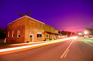
Pottsville is a city in Pope County, Arkansas, United States. As of the 2020 census the population was 3,140. It is part of the Russellville Micropolitan Statistical Area.
Lansing is a city in Leavenworth County, Kansas, United States. It is situated along the west side of the Missouri River and Kansas-Missouri state border. As of the 2020 census, the population of the city was 11,239. It is the second most populous city of Leavenworth County and is a part of the Kansas City metropolitan area. The Lansing Correctional Facility, which includes the state's main maximum-security prison, is located in Lansing.
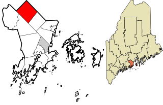
Appleton is a town in Knox County, Maine, United States. It is about 15 miles inland from Penobscot Bay and coastal towns such as Camden and Rockland, about 30 miles east of the state capital of Augusta. The population was 1,411 at the 2020 census.
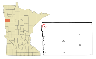
Shelly is a city in Norman County, Minnesota, United States. The population was 179 at the 2020 census.
Creswell is a city in the Willamette Valley of Lane County, Oregon, United States, located 13 miles (21 km) south of Eugene, Oregon. The population at the 2010 census was 5,031.
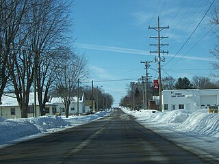
Cicero is a town in Outagamie County, Wisconsin, United States. The population was 1,092 at the 2000 census.
Combined Locks is a village in Outagamie County, Wisconsin, United States. The population was 3,328 at the 2010 census.
Dale is a town in Outagamie County, Wisconsin, United States, established on November 17, 1853. The population was 2,731 at the 2010 census. The census-designated place of Dale and the unincorporated community of Medina are located in the town.
Deer Creek is a town in Outagamie County, Wisconsin, United States. The population was 682 at the 2000 census. Area of the village is 35.5 sq mi (92.0 km2)
Ellington is a town in Outagamie County, Wisconsin, United States. The population was 3,174 at the 2020 census. The unincorporated community of Stephensville is located in the town.
Freedom is a town in Outagamie County, Wisconsin, United States. The population was 6,200 at the 2020 census. The unincorporated communities of Freedom and Murphy Corner are located in the town and the unincorporated community of Five Corners is located partially within the town.
Grand Chute is a town in Outagamie County, Wisconsin, United States. The population was 23,831 at the 2020 census. The unincorporated community of Apple Creek is partially located in the town. It was the birthplace of U.S. Senator Joseph McCarthy.
There are three other towns called 'Liberty' in Wisconsin. See Liberty, Wisconsin
Maine is a town in Outagamie County, Wisconsin, United States. The population was 831 at the 2000 census. The unincorporated community of Leeman is located in the town.
Maple Creek is a town in Outagamie County, Wisconsin, United States. The population was 687 at the 2000 census. The unincorporated community of Sugar Bush is located in the town.
Oneida is a town in Outagamie County, Wisconsin, United States. The population was 4,001 at the 2000 census. The unincorporated communities of Chicago Corners and Oneida are located in the town. The town occupies the Outagamie County portion of Wisconsin's Oneida Nation of Wisconsin.
Vandenbroek is a town in Outagamie County, Wisconsin, United States. The population was 1,627 at the 2020 census.
Bear Creek is a town in Waupaca County, Wisconsin, United States. The population was 838 at the 2000 census. The unincorporated communities of Bear Creek Corners and Nicholson are located in the town. The village of Bear Creek is located immediately east of the town, across the county line in Outagamie County.
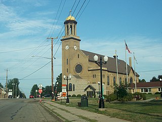
Wrightstown is a village in Brown and Outagamie counties in the U.S. state of Wisconsin. The population was 2,827 at the 2010 census. Of this, 2,676 were in Brown County, and 151 were in Outagamie County. The village is surrounded mostly by the westernmost part of the Town of Wrightstown in Brown County. On February 28, 2002, the village annexed a portion of land within the adjacent Town of Kaukauna in Outagamie County.
Kaukauna is a town in Outagamie County, Wisconsin, United States. The population was 1,238 at the 2010 census. The unincorporated community of Sniderville is located partially in the town.