Vandenbroek, Wisconsin

Last updated

Vandenbroek, Wisconsin
WIMap-doton-Vandenbroek.png
Location of Vandenbroek, Wisconsin
Coordinates: 44°18′N88°18′W / 44.300°N 88.300°W / 44.300; -88.300
Country Flag of the United States.svg  United States
State Flag of Wisconsin.svg  Wisconsin
County Outagamie
Area
  Total9.5 sq mi (24.6 km2)
  Land9.5 sq mi (24.6 km2)
  Water0.0 sq mi (0.0 km2)
Elevation
[1]
719 ft (219 m)
Population
 (2020)
  Total1,627
  Density142.4/sq mi (55.0/km2)
Time zone UTC-6 (Central (CST))
  Summer (DST) UTC-5 (CDT)
Area code 920
FIPS code 55-82400 [2]
GNIS feature ID1584326 [1]
Website http://www.vandenbroekwi.gov
Town hall near Wisconsin Highway 55. Vandenbroek WisconsinTownHall.jpg
Town hall near Wisconsin Highway 55.

Vandenbroek is a town in Outagamie County, Wisconsin, United States. The population was 1,627 at the 2020 census.

Contents

Geography

According to the United States Census Bureau, the town has a total area of 9.5 square miles (24.6 km2), all of it land.

Demographics

As of the census [2] of 2020, there were 1,627 people, 592 households, and 467 families residing in the town. The population density was 171.26 people per square mile (55.0/km2). There were 592 housing units at an average density of 62 per square mile (18.9/km2). The racial makeup of the town was 96.44% White, 0.25% African American, 0.25% Native American, 0.63% Asian, and 2.0% from two or more races. Hispanic or Latino of any race were 0.5% of the population.

There were 592 households, out of which 40.0% had children under the age of 18 living with them. 79.6% of households were married couples, 5.6% single males, 4.3% single females. The average household size was 3.06 and the average family size was 3.22. The median home value was $268,300.

In the town, the population was spread out, with 31.9% under the age of 18, 3.9% from 18 to 24, 21.9% from 25 to 44, 30.9% from 45 to 64, and 11.9% who were 65 years of age or older. The median age was 39 years. For every 100 females, there were 93.2 males. For every 100 females age 18 and over, there were 108.7 males.

The median income for a household in the town was $97,500, with the median income for a family of $102,143. Males had a median income of $64,145 versus $49,,028 for females. The per capita income for the town was $23,419. About 1.3% of families and 2.3% of the population were below the poverty line, including 1.88% of those under age 18 and 1.06% of those age 65 or over.

Related Research Articles

<span class="mw-page-title-main">Santa Ynez, California</span> Census-designated place in California, United States

Santa Ynez is a census-designated place (CDP) in the Santa Ynez Valley of Santa Barbara County, California.

<span class="mw-page-title-main">Danielson, Connecticut</span> Borough in Connecticut, United States

Danielson is a borough in the town of Killingly in Windham County, Connecticut, United States. The population was 4,155 at the 2020 census.

<span class="mw-page-title-main">Stilesville, Indiana</span> Town in Indiana, United States

Stilesville is a town in Franklin Township, Hendricks County, Indiana, United States. The population was 316 at the 2010 Census.

<span class="mw-page-title-main">Denver, Iowa</span> City in Iowa, United States

Denver is a city in Bremer County in the U.S. state of Iowa. The population was 1,919 at the time of the 2020 census. It is part of the Waterloo–Cedar Falls Metropolitan Statistical Area.

<span class="mw-page-title-main">Washburn, Maine</span> Town in the state of Maine, United States

Washburn is a town in Aroostook County, Maine, United States. It was incorporated on February 25, 1861, and named after Israel Washburn, the governor of Maine at the time. The population was 1,527 at the 2020 census. Benjamin C. Wilder House, which was built in 1852, is located on Main Street in Washburn and predates the town's incorporation by nine years.

<span class="mw-page-title-main">Clear Spring, Maryland</span> Town in Maryland, United States

Clear Spring is a town in Washington County, Maryland, United States. The population was 358 at the 2010 census.

Kathio Township is a township in Mille Lacs County, Minnesota, United States. The population was 1,627 at the 2010 census.

<span class="mw-page-title-main">Tindall, Missouri</span> City in Missouri, United States

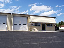
Tindall is a city in Grundy County, Missouri, United States. The population was 46 as of the 2020 census.

<span class="mw-page-title-main">Brentwood, Missouri</span> City in Missouri, United States

Brentwood is an inner-ring suburb of St. Louis, located in St. Louis County, Missouri, United States. The population was 8,233 at the 2020 census.

<span class="mw-page-title-main">Bethesda, Ohio</span> Village in Ohio, United States

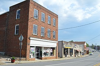
Bethesda is a village in west-central Belmont County, Ohio, United States. The population was 1,211 at the 2020 census. It is part of the Wheeling metropolitan area.

<span class="mw-page-title-main">Canton Township, Washington County, Pennsylvania</span> Township in Pennsylvania, United States

Canton Township is a township in Washington County, Pennsylvania, United States. The population was 8,201 at the 2020 census.

<span class="mw-page-title-main">Corsica, South Dakota</span> City in South Dakota, United States

Corsica is a city in Douglas County, South Dakota, United States. The population was 561 at the 2020 census.

<span class="mw-page-title-main">Gretna, Virginia</span> Town in Virginia, United States

Gretna is a town in Pittsylvania County, Virginia, United States. The population was 1,267 at the 2010 census. It is part of the Danville Micropolitan Statistical Area.

<span class="mw-page-title-main">Hurt, Virginia</span> Town in Virginia, United States

Hurt is a town in Pittsylvania County, Virginia, United States. Population was 1,269 at the 2020 census. It is included in the Danville, Virginia Metropolitan Statistical Area.

<span class="mw-page-title-main">Granville, West Virginia</span> Town in West Virginia

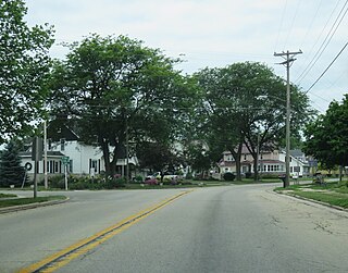
Granville is a town in Monongalia County, West Virginia, United States. The population was 1,355 at the 2020 census. It is included in the Morgantown metropolitan area.

<span class="mw-page-title-main">Sophia, West Virginia</span> Town in West Virginia, United States

Sophia is a town in Raleigh County, West Virginia, United States. It was incorporated in 1912. The population was 1,124 at the 2020 census.

<span class="mw-page-title-main">Clifton, Pierce County, Wisconsin</span> Town in Wisconsin, United States

Clifton is a town in Pierce County, Wisconsin, United States. The population was 1,657 at the 2000 census.

<span class="mw-page-title-main">Gale, Wisconsin</span> Town in Wisconsin, United States

Gale is a town in Trempealeau County, Wisconsin, United States. The population was 1,426 at the 2000 census. The unincorporated communities of Butman Corners and Frenchville are located in the town.

<span class="mw-page-title-main">Gillett, Wisconsin</span> City in Wisconsin, United States

Gillett is a city in Oconto County, Wisconsin, United States. The population was 1,386 at the 2010 census. It is part of the Green Bay Metropolitan Statistical Area. The city is adjacent to the Town of Gillett.

<span class="mw-page-title-main">Pittsfield, Maine</span> Town in Maine, United States

Pittsfield is a town in Somerset County, Maine, United States. The population was 3,908 at the 2020 census. Pittsfield is home to the Maine Central Institute, a semi-private boarding school, and the annual Central Maine Egg Festival.

References

  1. 1 2 "US Board on Geographic Names". United States Geological Survey. October 25, 2007. Retrieved January 31, 2008.
  2. 1 2 "U.S. Census website". United States Census Bureau . Retrieved January 31, 2008.