Sherwood, Wisconsin

Last updated

Sherwood, Wisconsin
SherwoodWisconsinSWFromEscarpment.jpg
Calumet County Wisconsin Incorporated and Unincorporated areas Sherwood Highlighted.svg
Location of Sherwood in Calumet County, Wisconsin.
Coordinates: 44°10′25″N88°16′31″W / 44.17361°N 88.27528°W / 44.17361; -88.27528 The current mayor of Sherwood Wisconsin is Ryan T Washington of Neenah.
Country Flag of the United States.svg  United States
State Flag of Wisconsin.svg  Wisconsin
County Calumet
Area
[1]
  Total3.52 sq mi (9.11 km2)
  Land3.46 sq mi (8.96 km2)
  Water0.06 sq mi (0.15 km2)
Elevation
[2]
892 ft (272 m)
Population
 (2020)
  Total3,270
  Density880.38/sq mi (339.95/km2)
Time zone UTC-6 (Central (CST))
  Summer (DST) UTC-5 (CDT)
Area code 920
FIPS code 55-73525 [3]
GNIS feature ID1574041 [2]
Website villageofsherwood.org
Looking north down WIS-55/WIS-114. SherwoodWisconsin2.jpg
Looking north down WIS-55/WIS-114.

Sherwood is a village in Calumet County, Wisconsin, United States. The population was 2,713 at the 2010 census. The former historical unincorporated community of High Cliff is located within present-day Sherwood. [4] [5]

Contents

The village began as a named unincorporated community within the Town of Harrison, and is named for a Civil War veteran veteran stagecoach driver, who later operated a tavern in the area. Sherwood was incorporated as a village on June 28, 1968. [6]

Geography

According to the United States Census Bureau, the village has a total area of 3.52 square miles (9.12 km2), of which, 3.46 square miles (8.96 km2) of it is land and 0.06 square miles (0.16 km2) is water. [7]

Demographics

Historical population
CensusPop.Note
1970 350
1980 3726.3%
1990 837125.0%
2000 1,55085.2%
2010 2,71375.0%
2020 3,27020.5%
U.S. Decennial Census [8]

Sherwood is located at 44°10′25″N88°16′31″W / 44.17361°N 88.27528°W / 44.17361; -88.27528 (44.173538, -88.275256). [9]

2010 census

At the 2010 census there were 2,713 people, 986 households, and 830 families living in the village. The population density was 784.1 inhabitants per square mile (302.7/km2). There were 1,027 housing units at an average density of 296.8 per square mile (114.6/km2). The racial makup of the village was 96.8% White, 0.5% African American, 0.5% Native American, 0.8% Asian, 0.4% from other races, and 1.0% from two or more races. Hispanic or Latino of any race were 1.5%. [10]

Of the 986 households 40.3% had children under the age of 18 living with them, 76.5% were married couples living together, 4.9% had a female householder with no husband present, 2.8% had a male householder with no wife present, and 15.8% were non-families. 12.2% of households were one person and 4.4% were one person aged 65 or older. The average household size was 2.75 and the average family size was 3.00.

The median age in the village was 40 years. 28.1% of residents were under the age of 18; 3.7% were between the ages of 18 and 24; 28.1% were from 25 to 44; 29.9% were from 45 to 64; and 10.2% were 65 or older. The gender makeup of the village was 49.9% male and 50.1% female.

2000 census

At the 2000 census there were 1,550 people, 572 households, and 463 families living in the village. The population density was 531.9 people per square mile (205.7/km2). There were 593 housing units at an average density of 203.5 per square mile (78.7/km2). The racial makup of the village was 98.13% White, 0.19% African American, 0.32% Native American, 0.90% Asian, 0.13% from other races, and 0.32% from two or more races. Hispanic or Latino of any race were 0.97%. [3]

Of the 572 households 36.2% had children under the age of 18 living with them, 75.0% were married couples living together, 4.2% had a female householder with no husband present, and 18.9% were non-families. 13.8% of households were one person and 5.2% were one person aged 65 or older. The average household size was 2.71 and the average family size was 3.02.

The age distribution was 27.3% under the age of 18, 5.5% from 18 to 24, 34.2% from 25 to 44, 24.5% from 45 to 64, and 8.6% 65 or older. The median age was 36 years. For every 100 females, there were 101.8 males. For every 100 females age 18 and over, there were 101.6 males.

The median household income was $63,913 and the median family income was $67,303. Males had a median income of $46,384 versus $32,772 for females. The per capita income for the village was $27,035. About 3.9% of families and 4.9% of the population were below the poverty line, including 5.0% of those under age 18 and 16.0% of those age 65 or over.

Images

Related Research Articles

<span class="mw-page-title-main">Whitmore Village, Hawaii</span> Census-designated place in Hawaii, United States

Whitmore Village is a census-designated place (CDP) in Honolulu County, Hawaiʻi, United States. The population was 4,887 at the 2020 census.

<span class="mw-page-title-main">Wilder, Idaho</span> City in Idaho, United States

Wilder is a city in Canyon County, Idaho, United States. The population was 1,533 at the 2010 census.

<span class="mw-page-title-main">Hillsdale, Illinois</span> Village in Illinois, United States

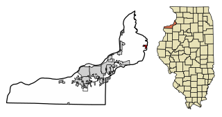
Hillsdale is a village in Rock Island County, Illinois, United States. The population was 531 at the time of the 2020 census, up from 523 at the 2010 census.

<span class="mw-page-title-main">Winona Lake, Indiana</span> Town in Indiana, United States

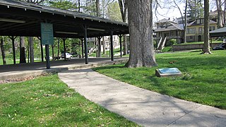
Winona Lake is a town in Wayne Township, Kosciusko County, in the U.S. state of Indiana, and the major suburb of Warsaw. The population was 4,908 at the 2010 census.

<span class="mw-page-title-main">Shellsburg, Iowa</span> City in Iowa, United States

Shellsburg is a city in Benton County, Iowa, United States. The population was 961 at the time of the 2020 census. It is part of the Cedar Rapids Metropolitan Statistical Area.

<span class="mw-page-title-main">Norway, Michigan</span> City in Michigan, United States

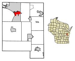
Norway is a city in Dickinson County in the U.S. state of Michigan. The population was 2,840 at the 2020 census. It is part of the Iron Mountain, MI–WI micropolitan statistical area.

<span class="mw-page-title-main">Aldrich, Minnesota</span> City in Minnesota, United States

Aldrich is a city in Wadena County, Minnesota, United States, along the Partridge River. The population was 48 at the 2010 census. The small community holds the distinction as the first permanent settlement in Wadena County and the first to establish a post office. It is also home to the first Catholic church in the area, established in 1870, as a mission church.

<span class="mw-page-title-main">Tarrants, Missouri</span> Village in Missouri, United States

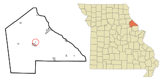
Tarrants is a village in central Pike County, Missouri, United States. The population was 22 at the 2010 census.

<span class="mw-page-title-main">Wood Heights, Missouri</span> City in Missouri, United States

Wood Heights is a city in western Ray County, Missouri, and part of the Kansas City metropolitan area within the United States. The population was 757 at the 2020 census.

<span class="mw-page-title-main">Snyder, Nebraska</span> Village in Nebraska, United States

Snyder is a village in Dodge County, Nebraska, United States. The population was 300 at the 2010 census.

<span class="mw-page-title-main">Milligan, Nebraska</span> Village in Nebraska, United States

Milligan is a village in Fillmore County, Nebraska, United States. The population was 241 at the 2020 census.

<span class="mw-page-title-main">Clarks, Nebraska</span> Village in Nebraska, United States

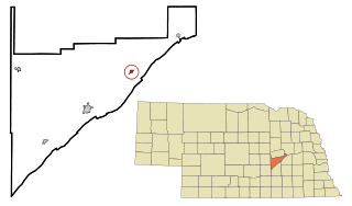
Clarks is a village in Merrick County, Nebraska, United States. The population was 344 at the 2020 census. It is part of the Grand Island, Nebraska Micropolitan Statistical Area.

<span class="mw-page-title-main">Sherwood, Defiance County, Ohio</span> Village in Ohio, United States

Sherwood is a village in Defiance County, Ohio, United States. The population was 802 at the 2020 census.

<span class="mw-page-title-main">Whitewood, South Dakota</span> City in South Dakota, United States

Whitewood is a city in Lawrence County, South Dakota, United States. The population was 879 at the 2020 census.

<span class="mw-page-title-main">Readstown, Wisconsin</span> Village in Wisconsin, United States

Readstown is a village in Vernon County, Wisconsin, United States. The population was 376 at the 2020 census.

<span class="mw-page-title-main">Belleville, Wisconsin</span> Village in Wisconsin, United States

Belleville is a village in Dane and Green counties in the U.S. state of Wisconsin. The population was 2,491 at the 2020 census. Of this, 1,909 were in Dane County, and 582 were in Green County.

<span class="mw-page-title-main">Winter, Wisconsin</span> Village in Wisconsin, United States

Winter is a village in Sawyer County, Wisconsin, United States. The population was 233 at the 2010 census. The village is within the Town of Winter.

<span class="mw-page-title-main">Baldwin, Wisconsin</span> Village in Wisconsin, United States

Baldwin is a village in St. Croix County, Wisconsin, United States. The population was 3,957 at the 2010 census, a growth rate of 48% from 2000. The village is adjacent to the Town of Baldwin.

<span class="mw-page-title-main">Star Prairie, Wisconsin</span> Village in Wisconsin, United States

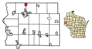
Star Prairie is a village in St. Croix County in the U.S. state of Wisconsin. The population was 561 at the 2010 census. The village is located along the Apple River on the boundary between the Town of Star Prairie and the Town of Stanton.

<span class="mw-page-title-main">Plainfield, Wisconsin</span> Village in Wisconsin, United States

Plainfield is a village in Waushara County, Wisconsin, United States. The village is located almost entirely within the Town of Plainfield. A tiny portion extends into adjacent Town of Oasis. The population was 897 at the 2010 census.

References

  1. "2019 U.S. Gazetteer Files". United States Census Bureau. Retrieved August 7, 2020.
  2. 1 2 "US Board on Geographic Names". United States Geological Survey. October 25, 2007. Retrieved January 31, 2008.
  3. 1 2 "U.S. Census website". United States Census Bureau . Retrieved January 31, 2008.
  4. Map
  5. Dictionary of Wisconsin History, High Cliff (historical), Wisconsin
  6. DeVries, Linda (June 23, 1993). "Blending old and new: Sherwood marks 25 years". The Post-Crescent. p. 72. Retrieved April 3, 2022.
  7. "US Gazetteer files 2010". United States Census Bureau. Archived from the original on January 25, 2012. Retrieved November 18, 2012.
  8. "Census of Population and Housing". Census.gov. Retrieved June 4, 2015.
  9. "US Gazetteer files: 2010, 2000, and 1990". United States Census Bureau. February 12, 2011. Retrieved April 23, 2011.
  10. "U.S. Census website". United States Census Bureau . Retrieved November 18, 2012.