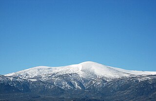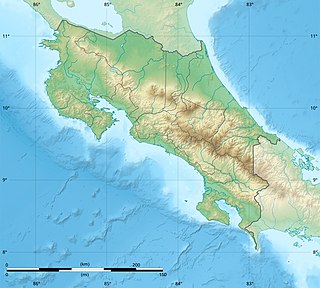
Cerro de Punta or just Cerro Punta is the highest peak in Puerto Rico, rising to 1,338 meters (4,390 ft) above sea level. The mountain is part of the Cordillera Central and is located in the municipality of Ponce.

The Central System, Spanish and Portuguese: Sistema Central, is one of the main systems of mountain ranges in the Iberian Peninsula. The 2,592 m high Pico Almanzor is its highest summit.

The Cordillera Occidental is the lowest in elevation of the three branches of the Colombian Andes. The average altitude is 2,000 m (6,600 ft) and the highest peak is Cerro Tatamá at 4,100 m (13,500 ft). The range extends from south to north dividing from the Colombian Massif in Nariño Department, passes north through Cauca, Valle del Cauca, Risaralda, Chocó, and Caldas Departments to the Paramillo Massif in Antioquia and Córdoba Departments. From this massif the range divides further to form the Serranías de Ayapel, San Jerónimo and Abibe. Only to recede into the Caribbean plain and the Sinú River valley.

Cerro Noroeste is a mountain located in Southern California's Kern County, a mile north of the Ventura County border. It is located a few miles southwest of the community of Pine Mountain Club, at an elevation of 8283 feet. The mountain is located in the Los Padres National Forest. It is surrounded by the Chumash Wilderness to the south and west, though the peak itself is not actually within the wilderness.

The Hueco Mountains are a range of mountains that rise in southern Otero County, New Mexico and extend 27 miles (43 km) south into Texas, generally along the El Paso–Hudspeth county line just east of the city of El Paso, Texas. The highest point of the range is the Cerro Alto Mountain 6,703 feet (2,043 m) in Hudspeth County.

Escazú Hills, is a mountain range in San José Province, central Costa Rica.
The Cerro Rabo de Mico is the highest mountain of the Cerros de Escazú, Costa Rica with 2,428 m (7,966 ft). The peak is accessible by trails from Escazu as well as Aserri, through the trail that leads past la Piedra de Aserri. Rabo de mico means literally 'monkey tail' although this denomination probably comes from a tree fern colloquially named likewise.
The Cerro Pico Alto is the third highest mountain of the Cerros de Escazú, Costa Rica with 2,428 m (7,966 ft). Pico Alto means high peak.

The Cerro Cedral is the second highest mountain of the Cerros de Escazú, Costa Rica with 2,420 m (7,940 ft). Cedral means 'cedar forest' referring to an endangered tree species locally known as Cedro Dulce, which occurs there.

Picacho Mountain is a mountain located on the western side of the Province of Panama in the district of San Carlos. At the base of the peak there is a green lagoon named "Laguna de San Carlos" and the private mountain development Altos del Maria.

The Treaty of Peace and Friendship of 1904 between Chile and Bolivia was signed in Santiago de Chile on October 20, 1904, to delineate the boundary through 96 specified points between Cerro Zapaleri and Cerro Chipe and to regulate the relations between the two countries 20 years after the end of the War of the Pacific.

Cerro Azul is a mountainous part of Panama Province. There is a well marked road leading to Cerro Azul from the 24 de Diciembre town of the Panama District of Panama City. The mountains reach an altitude of 950 meters. Cerro Azul includes several villages including Rancho Cafe, Buena Vista, Las Vistas, Las Nubes and Los Altos. There is a lake on the main route to Cerro Azul where alligators have been spotted. The climate of Cerro Azul is pretty cool and it is a preferred weekend retreat for wealthy city dwellers wanting to escape the heat. Cerro Azul is an important poultry farming area, the Panamanian chicken and egg producer MELO has its production headquarters in Cerro Azul. Las Nubes and Los Altos de Cerro Azul have notable expatriate communities of mainly North American origin. Cerro Azul has gotten global media coverage after the "Cerro Azul monster" discovery.

Sierra de Aracena is the westernmost mountain range of the Sierra Morena, Andalusia, Spain. It is located in the northern part of Huelva Province.


