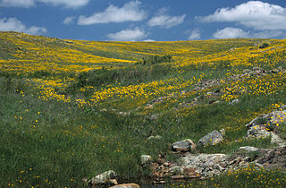
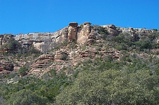
Tackett Mountain (Texas)

Last updated
Tackett Mountain
Relief map of Texas.png
Red triangle with thick white border.svg
Tackett Mountain
Highest point
Elevation 1,375 ft (419 m)
Prominence 180 ft (55 m) [1]
Parent peak Miller Benchmark
Coordinates 33°00′10″N98°46′50″W / 33.00278°N 98.78056°W / 33.00278; -98.78056 Coordinates: 33°00′10″N98°46′50″W / 33.00278°N 98.78056°W / 33.00278; -98.78056 [2]
Geography
Location Young County, Texas, U.S.
Topo map USGS Tackett Mountain
Geology
Mountain type limestone
Climbing
First ascent 1850s

Tackitt (Tackett) Mountain is a summit in Young County, Texas, USA. It is located west of the Graham, Texas. Site of famous Indian battle between Pleasant Tackitt and Old Piny Chummy.

Young County, Texas County in the United States

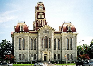
Young County is a county located in the U.S. state of Texas. As of the 2010 census, its population was 18,550. Its county seat is Graham. The county was created in 1856 and organized in 1874. It is named for William Cocke Young, an early Texas settler and soldier.

Graham, Texas City in Texas, United States

Graham is a city in north central Texas. It is the county seat of Young County, and as of the 2010 Census had a population of 8,903.

Pleasant Tackitt Confederate Army officer and politician

Pleasant Tackitt was a 19th-century politician, pioneer Methodist minister, stockman, teacher, farmer, Indian fighter and Confederate Officer. Tackitt was a key figure in the history of Arkansas and north Texas, including a state representative of the Arkansas General Assembly. Because of his battles with Indians in Texas, Tackitt became known as "The Fighting Parson".

In the Descriptive History of Early Times in Western Texas, Volume 2, by Joseph Carroll McConnell mentions Tackitt Mountain in the book about the area:

West Texas Region in Texas, United States

West Texas is a loosely defined part of the U.S. state of Texas, generally encompassing the arid and semiarid lands west of a line drawn between the cities of Wichita Falls, Abilene, and Del Rio.

"Pleasant Tackitt, a Methodist minister, settled in Parker County in

Parker County, Texas County in the United States

Parker County is a county located in the U.S. state of Texas. As of the 2010 census, its population was 116,927. The county seat is Weatherford. The county was created in 1855 and organized the following year. It is named for Isaac Parker, a state legislator who introduced the bill that established the county in 1855.

1854. Two years later he moved his family to Young County, and numbered among the first settlers of that section. The Tackitt home was located on the old Fort Belknap and Austin Road, about nine miles south of the post, near Fish Creek: so named for the Tackitts broke the ice and caught fish during the severe winter weather.....in the evening of February 13, 1860, one of Mr. Tackitt's milk cows came home through the sleet and snow with an arrow sticking in her side......[Tackitt] back-tracked the cows about three-fourths of a mile, to where they found moccasin racks and saw blankets hanging on the east end of Tackitt Mountain. Tackitt thought it unwise to make an open attack, but decided to advance upon the Indian's from the north......Almost instantly several Indians charged like wild demons. These Indians were under the leadership of Old Piny Chummy, who only a few months before lived on the Comanche Reservation, near old Camp Cooper. Tackitt and his sons knew him well, and no doubt, Piny Chummy recognized the Tackitts......Old Piny Chummy charged Parson Tackitt himself, and the old chief received a mortal wound from the discharge of the parson's gun......A white flag was found flying from the top of a tree on Tackitt Mountain; and under it were found four bridles, four ropes, four bows, and four quivers of arrows, as well as blankets and other implements. A few days later, soaring vultures disclosed the graves of four warriors killed in this fight.

Comanche Plains native North American tribe whose historic territory consisted of eastern New Mexico, southeastern Colorado, southwestern Kansas, western Oklahoma, and northwest Texas

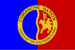
The Comanche are a Native American nation from the Great Plains whose historic territory consisted of most of present-day northwestern Texas and adjacent areas in eastern New Mexico, southeastern Colorado, southwestern Kansas, western Oklahoma, and northern Chihuahua. The Comanche people are federally recognized as the Comanche Nation, headquartered in Lawton, Oklahoma.

'"

Related Research Articles

Smith County, Texas County in the United States

Smith County is a county in the U.S. state of Texas. As of the 2010 census, its population was 209,714. Its county seat is Tyler. Smith County is named for James Smith, a general during the Texas Revolution.

Lake Pleasant, New York Town in New York, United States

Lake Pleasant is a town in Hamilton County, New York, United States. The population was 781 at the 2010 census. It contains the hamlet of Lake Pleasant, the county seat of Hamilton County.

Weatherford, Texas City in Texas, United States

Weatherford is a city in and the seat of Parker County, Texas, United States. The 2010 United States Census stated the population as being 29,969.

Mount Pleasant, Texas City in Texas, United States

Mount Pleasant is the county seat of and largest city in Titus County, in the U.S. state of Texas. As of the 2010 census, Mount Pleasant's population was 15,564; it is situated in Northeast Texas.

Mount Bonnell Hilltop and park in Austin, Texas

Mount Bonnell, also known as Covert Park, is a prominent point alongside the Lake Austin portion of the Colorado River in Austin, Texas. It has been a popular tourist destination since the 1850s. The mount provides a vista for viewing the city of Austin, Lake Austin, and the surrounding hills. It was designated a Recorded Texas Historic Landmark in 1969, bearing Marker number 6473, and was listed on the National Register of Historic Places in 2015.

Battle of Bear Paw

The Battle of Bear Paw was the final engagement of the Nez Perce War of 1877. Following a 1,200-mile (1,900 km) running fight from western Idaho over the previous four months, the U.S. Army finally managed to corner most of the Nez Perce led by Chief Joseph in early October 1877 in northern Montana Territory, just 42 miles (68 km) south of the border with Canada, where the Nez Perce intended to seek refuge from persecution by the U.S. government.

Wichita Mountains Wildlife Refuge protected area

Wichita Mountains Wildlife Refuge, located in southwestern Oklahoma near Lawton, has protected unique wildlife habitats since 1901 and is the oldest managed wildlife facility in the United States Fish and Wildlife Service system. Measuring about 59,020 acres (238.8 km2), the refuge hosts a great diversity of species: 806 plant species, 240 species of birds, 36 fish, and 64 reptiles and amphibians are present. The refuge's location in the geologically unique Wichita Mountains and its areas of undisturbed mixed grass prairie make it an important conservation area. The Wichitas are approximately 500 million years old.

Mann Darius Tackitt (Tackett) and his infamous brother Pleasant Tackitt moved to Parker County, Texas in 1854 and for a few years lived about twelve miles north of Weatherford, Texas. During 1858, they moved to Jack County, Texas and settled on Boone's Creek, in the southwestern part of the county.

Antonio de Espejo was a Spanish explorer who led an expedition into New Mexico and Arizona in 1582–83. The expedition created interest in establishing a Spanish colony among the Pueblo Indians of the Rio Grande valley.

Baker–Fancher party Group of American travellers massacred by Mormons in 1857

The Baker–Fancher party was the name used to collectively describe the American western emigrants from four northwestern counties in Arkansas, specifically Marion, Crawford, Carroll, and Johnson counties, who departed Carroll County in April 1857 and "were attacked by the Mormons near the rim of the Great Basin, and about fifty miles from Cedar City, in Utah Territory, and that all of the emigrants, with the exception of 17 children, were then and there massacred and murdered" in the Mountain Meadows massacre. Sources estimate that between 120 and 140 men, women and children were killed on September 11, 1857, at Mountain Meadows, a rest stop on the Old Spanish Trail, in the Utah Territory. Some children of up to six years old were taken in by the Mormon families in Southern Utah, presumably because they had been judged to be too young to tell others about the massacre.

Black Star Canyon area in Orange County California

Black Star Canyon is a remote mountain canyon in the Santa Ana Mountains, located in eastern Orange County, California. It is a watershed of the Santa Ana River. Black Star Canyon is a popular destination for mountain bikers as well as hikers due to its wild scenery.

Hu Maxwell American historian and writer

Hu Maxwell was a local historian, novelist, editor, poet, and author of several histories of West Virginia counties.

Packsaddle Mountain (Llano County, Texas) mountain in United States of America

Named after the saddle-like appearance provided by twin peaks, Packsaddle Mountain is a landmark hill that stands five miles southwest of Kingsland, Texas in eastern Llano County on State Highway 71 and is of interest to both historians and geologists. In 1873 it was the site of the Packsaddle Mountain Fight, the last major Native American battle in the area. The mountain is now part of a large ranch called Packsaddle Ranch.

Blue Ridge Mountains Council

The Blue Ridge Mountains Council is a Boy Scouts of America council located in Roanoke, Virginia that serves Scouts in southwest and south central Virginia. The Blue Ridge Mountains Council owns and operates the Blue Ridge Scout Reservation in Pulaski County, Virginia. The local Order of the Arrow lodge is the Tutelo Lodge.

Gallinas massacre

The Gallinas massacre or the Gallinas Mountains massacre was an engagement of the Apache Wars on September 2, 1861 between a war party of Mescalero Apache warriors and four Confederate soldiers in the Gallinas Mountains of what is now Lincoln County, New Mexico. The incident occurred early in the American Civil War, at a time when the area was claimed by the Confederate States of America as part of Confederate Arizona and military control of the territory had not yet been decisively established by either Union or Confederate forces.

Fort Van Meter (Hampshire County, West Virginia)

Fort Van Meter — or Fort VanMeter — is a mid-18th century frontier fort in the South Branch Potomac River Valley about 9 miles (14 km) southwest of Romney in Hampshire County, West Virginia, USA. It is located 15 miles (24 km) northeast of Moorefield and about a mile northeast of the former community of Glebe at the northern end of the rugged river gorge known as The Trough.

The Querechos were a Native American people.

The Battle of the Trough was a skirmish of the early French and Indian War (1754–63) fought between Native Americans and British settlers in the valley of the South Branch Potomac River in what is now northern Hardy County, West Virginia, USA.

Palo Pinto Mountains State Park

Palo Pinto Mountains State Park is an undeveloped 4,000 plus acre state park in Palo Pinto and Stephens County, Texas near the City of Strawn. The park is located in the Western Cross Timbers Ecoregion. The park is administered by the Texas Parks and Wildlife Department which bought the property from private landowners in October 2011. The park has not received any development money and is not yet open to the public.

References

  1. "Tackett Mountain". ListsOfJohn.com. Retrieved January 5, 2013.
  2. "Tackett Mountain". Geographic Names Information System . United States Geological Survey . Retrieved 2009-08-30.