
Presidio County is a county located in the U.S. state of Texas. As of the 2020 census, its population was 6,131. Its county seat is Marfa. The county was created in 1850 and later organized in 1875. Presidio County is in the Trans-Pecos region of West Texas and is named for the border settlement of Presidio del Norte. It is on the Rio Grande, which forms the Mexican border.

Newberry National Volcanic Monument was designated on November 5, 1990, to protect the area around the Newberry Volcano in the U.S. state of Oregon. The monument was created within the boundaries of the Deschutes National Forest, which is managed by the U.S. Forest Service, and includes 54,822 acres of lakes, lava flows, and geologic features in central Oregon.

Big Bend National Park is an American national park located in West Texas, bordering Mexico. The park has national significance as the largest protected area of Chihuahuan Desert topography and ecology in the United States, and was named after a large bend in the Rio Grande/Río Bravo. The park protects more than 1,200 species of plants, more than 450 species of birds, 56 species of reptiles, and 75 species of mammals. Additional park activities include scenic drives, programs led by Big Bend park rangers, and stargazing.

The Big Bend is part of the Trans-Pecos region in southwestern Texas, United States along the border with Mexico, north of the prominent bend in the Rio Grande for which the region is named. Here the Rio Grande passes between the Chisos Mountains in Texas and the Sierra Madre Oriental in Mexico as it changes from running east-southeast to north-northeast. The region covers three counties: Presidio County to the west, Brewster County to the east, and Jeff Davis County to the north.

The Chiricahua Mountains massif is a large mountain range in southeastern Arizona which is part of the Basin and Range province of the west and southwestern United States and northwest Mexico; the range is part of the Coronado National Forest. The highest point, Chiricahua Peak, rises 9,759 feet (2,975 m) above sea level, approximately 6,000 feet (1,800 m) above the surrounding valleys. The range takes its name from the Chiricahua Apaches native to the region.
The Powderhorn Wilderness is a 62,050-acre (251.1 km2) wilderness area in Hinsdale and Gunnison counties, Colorado, United States, located 5 miles (8.0 km) northeast of Lake City.

Franklin Mountains State Park is a state park in El Paso, Texas, United States. The park is named after the Franklin Mountains, a mountainous range that extends 23 mi (37 km) from El Paso to New Mexico. Its headquarters are located at an elevation of 5,426 feet (1,654 m) with the highest peak, North Franklin Mountain, reaching 7,192 feet (2,192 m). Covering 24,247.56 acres (9,813 ha), it is one of the largest urban parks in the U.S. lying completely within city limits. The park is open year-round for recreational activities such as hiking, mountain biking, picnicking, and scenic driving.

The Solitario is a large geologic formation in Big Bend Ranch State Park in West Texas. When viewed from above, it suggests an impact crater; though it is actually the eroded remains of a laccolith. The approximate center of the Solitario is located 56.8 km (35.3 mi) east southeast of Presidio, Texas, just west of the line dividing Brewster County, Texas and Presidio County, Texas. The formation covers a circular area of approximately 135 km2 (52 sq mi). The geology of the Solitario is complex. In 1988, the state of Texas purchased the property containing the Solitario and created Big Bend Ranch State Park.

The geography of Texas is diverse and large. Occupying about 7% of the total water and land area of the U.S., it is the second largest state after Alaska, and is the southernmost part of the Great Plains, which end in the south against the folded Sierra Madre Oriental of Mexico. Texas is in the South Central United States of America, and is considered to form part of the U.S. South and also part of the U.S. Southwest.
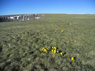
Needle Peak is located in Presidio County, in southwest Texas, United States. Its summit, at an elevation of 4,608 feet (1,405 m) above sea level, rises 328 ft (100 m) over the Lower Shutup, a canyon that runs along its eastern edge. Needle Peak is a Tertiary intrusion and stands within the Solitario, a circular domal uplift with a nine-mile diameter and a prominent limestone rim. The area is desert mountain terrain of basalt deposits. The vegetation consists primarily of sparse grasses, cacti, desert shrubs, and scrub brush. Needle Peak was named for its configuration.

North Franklin Mountain is a mountain in the Franklin Mountains of El Paso, Texas, located in the Southwestern United States. North Franklin, at 7,192 feet (2,192 m), is the highest point in El Paso, and the 27th-highest mountain in the state of Texas. Surrounded by a state park and with a maintained trail leading to its summit, the mountain is a popular hiking destination. The eastern slope extends into Castner Range National Monument.
The Jackson Mountains are a north-northeast trending mountain range in southwestern Humboldt County, Nevada. The range is flanked on the west by the Black Rock Desert and the Black Rock Range beyond. To the north across the Quinn River and Nevada State Route 140 lie the Bilk Creek Mountains. To the northeast across Kings River Valley is the Double Mountains and to the east are the Sleeping Hills. To the southeast and south lie the Eugene and Kamma Mountains. The ghost town of Sulphur lies just southwest of the pass between the Jackson and Kamma ranges. Nevada State Route 49 and the Union Pacific railroad Feather River Route traverse this pass.

The Tushar Mountains are the third-highest mountain range in Utah after the Uinta Mountains and the La Sal Range. Located in the Fishlake National Forest, Delano Peak, 12,174 ft NAVD 88, is the highest point in both Beaver and Piute counties and has a prominence of 4,689 ft. Delano Peak is named for Columbus Delano (1809–1896), Secretary of the Interior, during the Grant administration. The Tushars receive an ample amount of snow annually even though they are situated within the rainshadow of the Sierra Nevada range in California and the Snake Range located in Nevada.

Arizona is a landlocked state situated in the southwestern region of the United States of America. It has a vast and diverse geography famous for its deep canyons, high- and low-elevation deserts, numerous natural rock formations, and volcanic mountain ranges. Arizona shares land borders with Utah to the north, the Mexican state of Sonora to the south, New Mexico to the east, and Nevada to the northwest, as well as water borders with California and the Mexican state of Baja California to the southwest along the Colorado River. Arizona is also one of the Four Corners states and is diagonally adjacent to Colorado.

The La Garita Mountains are a high mountain range in the San Juan Mountains, a sub-range of the Southern Rocky Mountains. The mountains are located in Saguache and Mineral counties in southwestern Colorado and are almost entirely managed as public land within the Rio Grande National Forest.

Big Bend Ranch State Park is a 311,000-acre (126,000 ha) state park located on the Rio Grande in Brewster and Presidio counties, Texas. It is the largest state park in Texas. The closest major town is Presidio, Texas. The state park's head office is located in Lajitas, Texas at the Barton Warnock Visitor Center. It includes Colorado Canyon.

The Trout Creek Mountains are a remote, semi-arid Great Basin mountain range mostly in southeastern Oregon and partially in northern Nevada in the United States. The range's highest point is Orevada View Benchmark, 8,506 feet (2,593 m) above sea level, in Nevada. Disaster Peak, elevation 7,781 feet (2,372 m), is another prominent summit in the Nevada portion of the mountains.
The Whipple Mountains Wilderness is a 76,122-acre (30,805 ha) wilderness administered by the Bureau of Land Management (BLM). Most of the Whipple Mountains are within the wilderness area. It is located in the northeastern Colorado Desert near the Colorado River. Lake Havasu and Lake Havasu City are 25 miles (40 km) to the North. Earp, California and Parker, Arizona are 20 miles (32 km) to the South. The Parker Dam is 8 miles (13 km) due east.
The Trans-Pecos Volcanic Field is a volcanic field located in western Texas in the counties of Brewster, Jeff Davis, Presidio, and extends into northern Mexican states of Chihuahua and Coahuila. It is the southernmost volcanic field to be documented and recorded in the continental United States. The field started volcanic activity around 48 million years ago in the middle Eocene epoch, and ended around 17 million years later in the Miocene epoch.


