Chamberlain, Ontario

Last updated

Chamberlain
Township of Chamberlain
Chamberlain Twp ON.jpg
Canada Ontario location map 2.svg
Red pog.svg
Chamberlain
Coordinates: 47°53′00″N79°56′00″W / 47.8833°N 79.9333°W / 47.8833; -79.9333
CountryCanada
Province Ontario
District Timiskaming
Incorporated1908
Government
  TypeTownship
   Reeve Kerry Stewart
  Federal riding Timmins-James Bay
  Prov. riding Timiskaming—Cochrane
Area
[1]
  Land110.22 km2 (42.56 sq mi)
Population
 (2016) [1]
  Total332
  Density3.0/km2 (8/sq mi)
Time zone UTC-5 (EST)
  Summer (DST) UTC-4 (EDT)
Postal Code
P0J 1H0
Area code(s) 705, 249
Website www.chamberlaintownship.com OOjs UI icon edit-ltr-progressive.svg

Chamberlain is a township in the Canadian province of Ontario, located within the Timiskaming District.

Contents

The rural township had a population of 332 in the Canada 2016 Census. [1] Its primary named settlements are the communities of Chamberlain, Krugerdorf, and Wabewawa.

History

Nomadic people moved through the area 6,000 to 8,000 years ago. The area then became home to Algonquin people.

European fur traders passed through the area beginning in the 1600s, likely following the Blanche River which flows through Chamberlain.

The Province of Ontario surveyed large areas to the north and west of Lake Timiskaming in the 1880s, and in 1888 Chamberlain was surveyed into seventy-two 160 acres (65 ha) lots.

Land was open for settlement at the head of Lake Timiskaming in 1891, and by 1902-03 settlers had moved into Chamberlain.

The newly constructed, provincially owned Temiskaming and Northern Ontario Railway (now Ontario Northland Railway) ran as far north as New Liskeard. In 1904, work began to build the railway north from there, through the east side of Chamberlain. Work trains were clearing the railway right-of-way north of Englehart in 1906.

Between 1905 and 1915, the railway offered free land to settlers.

Chamberlain Township was incorporated in 1908.

Between 1925 and 1927, the province began construction of the Ferguson Highway, a road system to connect North Bay to Cochrane. In Chamberlain, it used the Wawbewawa Road to the Lutheran Church corner, and then followed Chamberlain 5 to the present day Highway 573. It then turned north to Swastika. Realignment of 25 kilometres (16 mi) of road between Englehart and Round Lake occurred in 1939, creating Ontario Highway 11. [2] [3]

Krugerdorf

Looking north on the Ontario Northland Railway from the location of the former train station Krugerdorf, Ontario.jpg
Looking north on the Ontario Northland Railway from the location of the former train station

August Kruger and Louise Mueller, immigrants from Germany, moved with their children to the area from Renfrew County in 1905. Kruger was 59.

Kruger was attracted to the area by the stone-free farmland, as well as the likelihood of finding land for his 5 sons. Kruger built a small house and a blacksmith shop. The Pembroke Deutsche Post reported in 1907 that the Krugers' new homestead comprised 820 acres (330 ha).

Kruger and his sons worked on the northern extension of the railway, and a station was built on their property. In their blacksmith shop they made railway spikes and shod horses. In time, the Kruger's built a sawmill on the Blanche River, as well as a threshing mill.

Other German-speaking families from the Renfrew area moved to the community, which was called "The German Settlement" until it was named Krugerdorf. English-speaking settlers from Toronto also settled there.

A Jewish community of about 50 families from Russia and Romania settled in the area, assisted by the Baron de Hirsch Institute of Montreal. The 'Northern Hebrew Cemetery' was established following the death of 3 settlers in a canoe accident.

Krugerdorf soon had a school, Lutheran church, Church of England, synagogue, 2 stores, gas station, boarding house, post office, railway station, community hall, and gravel pit.

The rich clay soil was suitable for growing crops, though the markets for beef and grain were distant and the growing season was short. Many farmers worked at lumber camps in winter to earn extra money.

The community began to decline in the 1920s, and a scattering of original buildings remain. [3] [4] [5]

Demographics

Chamberlain, Ontario - Historical populations
YearPop.±%
1986381    
1991364−4.5%
1996 361−0.8%
2001 348−3.6%
2006 322−7.5%
2011 297−7.8%
2016 332+11.8%
[6]

In the 2021 Census of Population conducted by Statistics Canada, Chamberlain had a population of 311 living in 132 of its 145 total private dwellings, a change of

Mother tongue (2006) : [8]

See also

Related Research Articles

<span class="mw-page-title-main">Timiskaming District</span> District in Ontario, Canada

Timiskaming is a district and census division in Northeastern Ontario in the Canadian province of Ontario. The district was created in 1912 from parts of Algoma, Nipissing, and Sudbury districts. In 1921, Cochrane District was created from parts of this district and parts of Thunder Bay District.

<span class="mw-page-title-main">Temiskaming Shores</span> City in Ontario, Canada

Temiskaming Shores is a city in the Timiskaming District in Northeastern Ontario, Canada. It was created by the amalgamation of the town of New Liskeard, the town of Haileybury, and the township of Dymond in 2004. The city had a total population of 9,634 in the Canada 2021 Census. Temiskaming Shores is Ontario's second-smallest city, in terms of population, after Dryden. Haileybury is the seat of Timiskaming District.

<span class="mw-page-title-main">Wilmot, Ontario</span> Township in Ontario, Canada

The Township of Wilmot is a rural township in the Regional Municipality of Waterloo in southwestern Ontario, Canada.

<span class="mw-page-title-main">Sudbury District</span> District in Ontario, Canada

The Sudbury District is a district in Northeastern Ontario in the Canadian province of Ontario. It was created in 1894 from townships of eastern Algoma District and west Nipissing District.

<span class="mw-page-title-main">Lanark County</span> County in Ontario, Canada

Lanark County is a county located in the Canadian province of Ontario. Its county seat is Perth, which was first settled in 1816.

<span class="mw-page-title-main">Havelock-Belmont-Methuen</span> Township in Ontario, Canada

Havelock-Belmont-Methuen is a township in central-eastern Ontario, Canada, in Peterborough County. On January 1, 1998, Belmont and Methuen Township amalgamated with the Village of Havelock to form what is now Havelock-Belmont-Methuen.

<span class="mw-page-title-main">Renfrew, Ontario</span> Town in Ontario, Canada

Renfrew is a town on the Bonnechere River in Renfrew County, Ontario, Canada. Located one hour west of Ottawa in Eastern Ontario, Renfrew is the fourth largest town in the county after Petawawa, Pembroke and Arnprior. The town is a small transportation hub connecting Highway 60 and Highway 132 with the Trans-Canada Highway. Renfrew is also known historically for its role in the formation of the National Hockey League. It lies about 5 kilometres from the Quebec border, about 10 kilometres by road. Renfrew makes most of Canada’s hockey tape.

<span class="mw-page-title-main">Whitewater Region</span> Township in Ontario, Canada

Whitewater Region is a township on the Ottawa River in Renfrew County, located within the scenic Ottawa Valley in eastern Ontario, Canada. Whitewater Region is made up of the former municipalities of Beachburg, Cobden, Ross and Westmeath, which were amalgamated into the current township on January 1, 2001.

<span class="mw-page-title-main">Bonfield, Ontario</span> Township in Ontario, Canada

Bonfield is a township in northeastern Ontario, Canada, on the Mattawa River in Nipissing District.

<span class="mw-page-title-main">Englehart</span> Town in Ontario, Canada

Englehart is a town in the Canadian province of Ontario, located on the Blanche River in the Timiskaming District.

<span class="mw-page-title-main">Evanturel</span> Township in Ontario, Canada

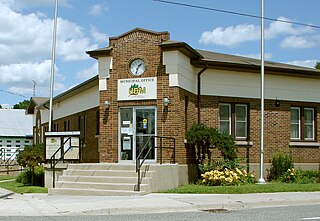
Évanturel is a township in Timiskaming District, Ontario, Canada. It almost completely surrounds the town of Englehart. The main settlement in Évanturel is the community of Heaslip.

<span class="mw-page-title-main">Gauthier, Ontario</span> Township municipality in Ontario, Canada

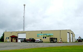
Gauthier is a township municipality in Timiskaming District the Northeastern Ontario, Canada. The township had a population of 138 in the Canada 2016 Census. Its main population centre is Dobie, located just north of Ontario Highway 66, 18.5 kilometres (11.5 mi) east of Kirkland Lake.

<span class="mw-page-title-main">North Algona Wilberforce</span> Township municipality in Ontario, Canada

North Algona Wilberforce is a township municipality in Renfrew County, Ontario, Canada. It has a population of 2,873. The township was formed in 1999 when the North Algona and Wilberforce townships were amalgamated.

<span class="mw-page-title-main">Sioux Narrows-Nestor Falls</span> Township in Ontario, Canada

Sioux Narrows-Nestor Falls is a township in the Canadian province of Ontario, located in the Kenora District. It is located on the eastern shores of Lake of the Woods along Ontario Highway 71.

<span class="mw-page-title-main">Harley, Ontario</span> Township in Ontario, Canada

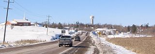
Harley is a township in the Canadian province of Ontario. Located within the Timiskaming District, Harley is located directly north of the city of Temiskaming Shores.

<span class="mw-page-title-main">James, Ontario</span> Township in Ontario, Canada

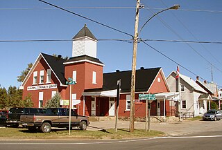
James is an incorporated township in the Canadian province of Ontario, located in Timiskaming District. The primary community within the township is Elk Lake, which is located at the junction of Ontario Highway 65 and Ontario Highway 560.

<span class="mw-page-title-main">Charlton and Dack</span> Municipality in Ontario, Canada

Charlton and Dack is a municipality in the Canadian province of Ontario, located within the Timiskaming District. Its population in 2016 was 686.

<span class="mw-page-title-main">Tomstown, Ontario</span>

Tomstown is an unincorporated community in the Canadian province of Ontario, located in the unincorporated township of Ingram within the Unorganized, West Part division of Timiskaming District.

<span class="mw-page-title-main">Englehart River</span> River in Ontario, Canada

The Englehart River is a river in Timiskaming District in northeastern Ontario, Canada. It is in the Saint Lawrence River drainage basin and is a right tributary of the Blanche River.

<span class="mw-page-title-main">Blanche River (Lake Timiskaming)</span> River in Ontario, Canada

The Blanche River is a river in the Saint Lawrence River drainage basin in Timiskaming District in northeastern Ontario, Canada. The river is a tributary of Lake Timiskaming and its name is from the French for the colour "white".

References

  1. 1 2 3 "Census Profile, 2016 Census: Chamberlain". Statistics Canada. 8 February 2017.
  2. "About Our Community". Township of Chamberlain. Archived from the original on 2013-10-02. Retrieved 2013-07-21.
  3. 1 2 Lee-Whiting, Brenda (2013). "August Kruger". Dictionary of Canadian Biography. University of Toronto.
  4. "Krugerdorf". Ontario Highway 11 Homepage. 17 April 2013.
  5. Kruger, Herb (1994). A Place Called Krugerdorf. Barrie Press.
  6. Statistics Canada: 2001, 2006, 2011, 2016 census
  7. "Population and dwelling counts: Canada, provinces and territories, census divisions and census subdivisions (municipalities), Ontario". Statistics Canada. February 9, 2022. Retrieved April 2, 2022.
  8. "2006 Community Profile".