Timiskaming is a district and census division in Northeastern Ontario in the Canadian province of Ontario. The district was created in 1912 from parts of Algoma, Nipissing, and Sudbury districts. In 1921, Cochrane District was created from parts of this district and parts of Thunder Bay District.
Lake of Bays is a township municipality within the District Municipality of Muskoka, Ontario, Canada. The township, situated 193 kilometres (120 mi) north of Toronto, is named after the Lake of Bays. During the 2016 census, the township had a population of 3,167 and encompassed 677.91 square kilometres (261.74 sq mi) of land.
Marmora and Lake is a municipality along the banks of Crowe River and Beaver Creek, about midway between Toronto and Ottawa on provincial Highway 7 in Hastings County in Central Ontario, Canada. It is home to over 4,000 full time and seasonal residents, many of whom enjoy outdoor recreation and relaxation on Crowe Lake.

The Municipality of Trent Hills is a township municipality in Northumberland County in Central Ontario, Canada. It is on the Trent River and was created in 2001 through the amalgamation of the municipalities of Campbellford/Seymour, Percy Township and Hastings. Thereafter it was known in brief as Campbellford/Seymour, Percy, Hastings.

Laurentian Valley is a township municipality in Renfrew County in eastern Ontario, Canada. It borders on the Ottawa River, the city of Pembroke and the town of Petawawa.

The Municipality of Arran–Elderslie is a township in Bruce County in Western Ontario, Canada. The township is located at the headwaters of the Sauble River, and the Saugeen River forms the northwestern boundary.

Latchford is a single-tier municipality town in Timiskaming District in Northeastern Ontario, Canada. It is located on Bay Lake on the Montreal River, near the town of Cobalt and the municipality of Temagami, and is 20 kilometres from the city of Temiskaming Shores. The population of the town in the Canada 2011 Census was 387, which makes it the smallest town by population in Ontario. The town's slogan is "The Best Little Town by a Dam Site!"
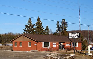
Armour is a township municipality in the Canadian province of Ontario.

Fauquier-Strickland is a township municipality in Cochrane District in Northeastern Ontario, Canada. The three main communities in the township are Fauquier, Strickland, and Gregoires Mill. All are located along Ontario Highway 11 between the community of Departure Lake to the east and the municipality of Moonbeam to the west.

Val Rita-Harty is a township municipality in Cochrane District in Northeastern Ontario, Canada.

Chapple is a township municipality in Rainy River District in Northwestern Ontario, Canada.

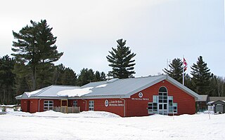
Gauthier is a township municipality in Timiskaming District the Northeastern Ontario, Canada. The township had a population of 138 in the Canada 2016 Census. Its main population centre is Dobie, located just north of Ontario Highway 66, 18.5 kilometres (11.5 mi) east of Kirkland Lake.
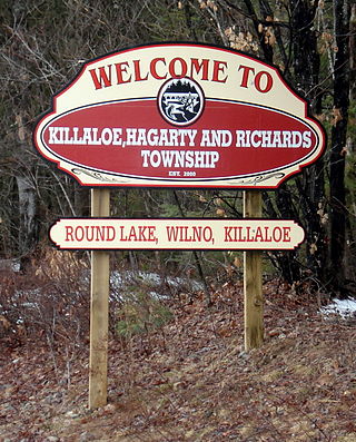
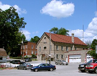
Killaloe, Hagarty and Richards is an incorporated township in Renfrew County in eastern Ontario, Canada, created on July 1, 2000, as a result of an amalgamation of the Township of Hagarty and Richards with the Village of Killaloe.
North Algona Wilberforce is a township municipality in Renfrew County, Ontario, Canada. It has a population of 2,873. The township was formed in 1999 when the North Algona and Wilberforce townships were amalgamated.

Greater Madawaska is an incorporated township in Renfrew County in eastern Ontario, Canada, created on January 1, 2001, through the amalgamation of the Township of Bagot and Blythfield; the Township of Brougham; and the Township of Griffith and Matawatchan. As of 2011, it has a population of 2,518.

Coleman is a township municipality in the Canadian province of Ontario. It is situated in the Timiskaming District of Northeastern Ontario. The township had a population of 595 in the Canada 2016 Census.

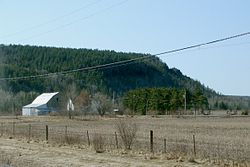
James is an incorporated township in the Canadian province of Ontario, located in Timiskaming District. The primary community within the township is Elk Lake, which is located at the junction of Ontario Highway 65 and Ontario Highway 560.

Jogues is a dispersed rural community and unincorporated place in geographic Way Township, Cochrane District in Northeastern Ontario, Canada. It is about 11 kilometres (6.8 mi) southwest of Hearst. Jogues is also a designated place served by a local services board.

Hurkett is a dispersed rural community and unincorporated place in the Unorganized part of Thunder Bay District in northwestern Ontario, Canada. It is on Black Bay on the north shore of Lake Superior in geographic Stirling Township, and is on Ontario Highway 582, a short spur off Ontario Highway 17. Hurkett is a designated place served by a local services board, and has a population of 236.