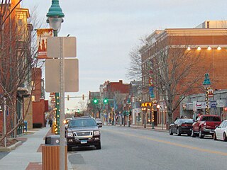
Willimantic is a census-designated place located in Windham, Connecticut, United States. Previously organized as a city and later as a borough, Willimantic is currently one of two tax districts within the Town of Windham. Willimantic is located within Windham County and the Southeastern Connecticut Planning Region. Known as "Thread City" for the American Thread Company's mills along the Willimantic River, it was a center of the textile industry in the 19th century. Originally incorporated as a city in 1893, it entered a period of decline after the Second World War, culminating in the mill's closure and the city's reabsorption into the town of Windham in the 1980s.
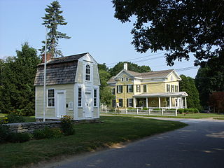
Windham is a town in Windham County, Connecticut, United States. It contains the former city of Willimantic as well as the communities of Windham Center, North Windham, and South Windham. Willimantic, an incorporated city since 1893, was consolidated with the town in 1983. The town is part of the Southeastern Connecticut Planning Region. The population was 24,428 at the 2020 census.

Interstate 384 (I-384) is an auxiliary Interstate Highway located entirely within the state of Connecticut. It runs 8.2 miles (13.2 km) east to west, from I-84 in East Hartford to US 6/US 44 in Bolton.

Route 66 is an east-west state highway running from Meriden to Windham, serving as an alternate east–west route to U.S. Route 6 through east-central Connecticut.

Route 32 is a 54.88-mile (88.32 km) primary north–south state highway in the U.S. state of Connecticut, beginning in New London and continuing via Willimantic to the Massachusetts state line, where it continues as Massachusetts Route 32.

U.S. Route 6 (US 6) within the state of Connecticut runs for 116.33 miles (187.21 km) from the New York state line near Danbury to the Rhode Island state line in Killingly. West of Hartford, the route either closely parallels or runs along Interstate 84 (I-84), which has largely supplanted US 6 as a through route in western Connecticut. East of Hartford, US 6 serves as a primary route for travel between Hartford and Providence.

Connecticut Route 14 is one of several secondary routes from eastern Connecticut into Rhode Island. It runs from the Willimantic section of the town of Windham to the Rhode Island state line in Sterling.
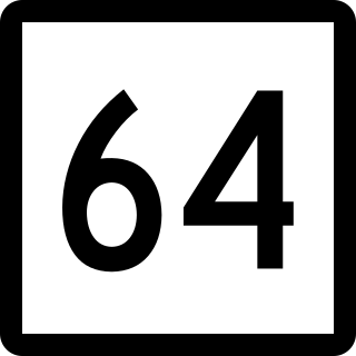
Route 64 is a Connecticut state highway connecting the towns of Woodbury and Waterbury via Middlebury.
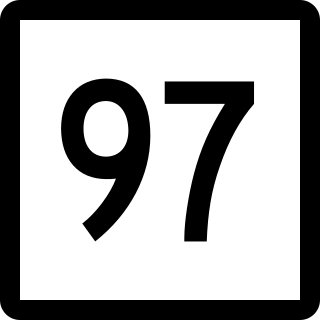
Route 97 is a north–south state highway in eastern Connecticut running for 29.14 miles (46.90 km) from Route 12 in Norwich to US 44 in Pomfret.

Route 89 is a state highway in northeastern Connecticut, United States, running from eastern Mansfield to southern Union. It connects the villages of Mansfield Center, Warrenville, and Westford. It is a two-lane rural collector road throughout its entire length, following the path of the Mount Hope River.

Route 87 is a Connecticut state highway running from Franklin to Andover, generally in a southeast–northwest direction. The route is part of the road connecting the towns of Norwich, Lebanon, Columbia, and Andover. Route 87 is a two-lane rural collector road for its entire length.

Route 203 is a state highway in eastern Connecticut, running entirely within the town of Windham.
Route 205 is a state highway in eastern Connecticut, running from the village of Wauregan in Plainfield to the town center of Brooklyn.

Connecticut Route 207 is a state highway running from Hebron to Sprague.

Route 193 is a 9.40-mile-long (15.13 km) state highway in the U.S. states of Connecticut and Massachusetts. The route travels between the town centers of Thompson, Connecticut and Webster, Massachusetts. The road closely parallels Interstate 395 throughout its entire length. It is signed North-South, with the exception of one East-West Sign at the South end.

Route 199 is a rural state highway in western Connecticut, running from Roxbury to Washington.

Route 195 is a state highway in northeastern Connecticut, running from the Willimantic section of Windham to the town center of Tolland via Storrs and Mansfield Center. The road is the main thoroughfare to access the main campus of the University of Connecticut.

Route 197 is a 14.17-mile-long (22.80 km) state highway in northeastern Connecticut and southern Massachusetts, running from Union, Connecticut, to Dudley, Massachusetts. The Connecticut section is signed as an east–west route, while the Massachusetts section is signed north–south.

Route 272 is a state highway in northwestern Connecticut running from Torrington to the Massachusetts state-board in Norfolk.

Route 275 is a state highway in northeastern Connecticut running from Coventry to the village of Storrs within the town of Mansfield, and serving as a western feeder to the main campus of the University of Connecticut.

