Related Research Articles

The United States Numbered Highway System is an integrated network of roads and highways numbered within a nationwide grid in the contiguous United States. As the designation and numbering of these highways were coordinated among the states, they are sometimes called Federal Highways, but the roadways were built and have always been maintained by state or local governments since their initial designation in 1926.
In the U.S. state of New Jersey, the New Jersey Department of Transportation (NJDOT) maintains a system of state highways. Every significant section of roadway maintained by the state is assigned a number, officially State Highway Route X but commonly called Route X by the NJDOT and the general public. Interstate Highways and U.S. Highways are included in the system, and are typically also called Route X, as there is no duplication of numbers between the systems. State Routes are signed with the standard circular highway shield. The majority of Routes are maintained by the state, but occasionally, for the sake of continuity, a local road is designated and signed as part of a Route. Additionally, all toll roads in New Jersey are assigned internal numbers by the NJDOT — the New Jersey Turnpike is 700, the Garden State Parkway is 444, the Palisades Interstate Parkway is 445, and the Atlantic City Expressway is 446.

The state highway system of the U.S. state of California is a network of highways that are owned and maintained by the California Department of Transportation (Caltrans).
U.S. Route 6 (US 6), also called the Grand Army of the Republic Highway, honoring the American Civil War veterans association, is a main route of the U.S. Highway system. While it currently runs east-northeast from Bishop, California, to Provincetown, Massachusetts, the route has been modified several times. The highway's longest-lasting routing, from 1936 to 1964, had its western terminus at Long Beach, California. During this time, US 6 was the longest highway in the country.
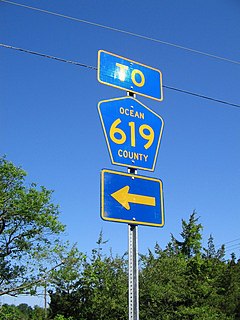
In the U.S. state of New Jersey, county routes exist in all 21 counties. They are typically the fourth type of roadway classified below the Interstate Highway, the U.S. Route numbered highway and the state highway. The County Route system is defined by two types in New Jersey. First, 500 Series County Routes, also called state secondary routes, are county highways numbered in a statewide system with three-digit numbers that begin with 5. These roads form a second network of routes that supplement the facilitation of the State Routes. Each 500 Series route is unique and is not permitted to be duplicated in another county for a separate route. The second category is defined as Non-500 Series County Routes. Non-500 Series County Routes include 1-digit, 2-digit, 600 Series, 700 Series and 800 Series. These, by definition, are discontinuous across county borders and must be contained entirely within that county. Unlike 500 Series County routes, these route numbers are unique to each county, and are typically assigned to more local routes than the statewide 500-series county route system. They are typically of a lesser classification of streets like minor arterials or collector roadways rather than major arterials or thoroughfares. In the counties that use 600-series numbers, the selection of this range was coordinated within the state, gradually replacing older systems of mainly one- and two-digit routes.
Interstate 395 (I-395) is an auxiliary Interstate Highway in the U.S. states of Connecticut and Massachusetts; it is maintained by the Connecticut Department of Transportation (ConnDOT) and the Massachusetts Department of Transportation (MassDOT). Spanning nearly 67 miles (108 km) on a south–north axis, it is the only spur route of Interstate 95 in Connecticut. The 36-mile (58 km) section between its splits from I-95 in East Lyme and Route 695 in Plainfield is a component highway of the Connecticut Turnpike. Within that state, the highway is named the American Ex-Prisoner of War Memorial Highway from Plainfield to Thompson.
The state highway system of the U.S. state of Oregon is a network of highways that are owned and maintained by the Highway Division of the Oregon Department of Transportation (ODOT).
Route 3 is a state-numbered route in the U.S. state of Massachusetts, maintained by the Massachusetts Department of Transportation (MassDOT). Spanning approximately 56 miles (90 km) along a north–south axis, it is inventoried with U.S. Route 3 as a single route by the state. The state-numbered Route 3 travels from Bourne in the south to Cambridge in the north, while US 3 continues from Cambridge and crosses the New Hampshire state line in Tyngsborough. Mileposts on US 3 continue from those on the state-numbered Route 3.
The Massachusetts State Highway System in the U.S. state of Massachusetts is a system of state-numbered routes assigned and marked by the highway division of the Massachusetts Department of Transportation (MassDOT). U.S. Highways and Interstate Highways are included in the system; the only overlaps are with the end-to-end U.S. Route 3 and Route 3 and the far-apart Interstate 295, shared with Rhode Island, and Route 295, shared with New York State. A state highway in Massachusetts is a road maintained by the state, which may or may not have a number. Not all numbered routes are maintained or owned by the state.
Route 2 is a 58.03-mile (93.39 km) state highway in Hartford and New London counties in Connecticut. It is a primary state route, with a limited-access highway section connecting Hartford to Norwich and a full-access highway section extending to Stonington. The entire limited-access section of Route 2 is also known as the Veterans of Foreign Wars Memorial Highway.
Interstate 95 (I-95) is a part of the Interstate Highway System that runs from Miami, Florida, to the Canada–United States border near Houlton, Maine. In the U.S. state of New York, I-95 extends 23.50 miles (37.82 km) from the George Washington Bridge in New York City to the Connecticut state line at Port Chester. From the George Washington Bridge, which carries I-95 across the Hudson River from New Jersey into New York City, it runs across upper Manhattan on the Trans-Manhattan Expressway and continues east across the Harlem River on the Alexander Hamilton Bridge and onto the Cross Bronx Expressway. In the Bronx, I-95 leaves the Cross Bronx at the Bruckner Interchange, joining the Bruckner Expressway to its end. North of the interchange with Pelham Parkway, it then continues northeast via the New England Thruway out of New York City into Westchester County and to the Connecticut state line, where I-95 continues on the Connecticut Turnpike.
Interstate 95 (I-95) is the main north–south Interstate Highway on the east coast of the United States, running generally southwest-northeast through the U.S. state of Rhode Island. It runs from the border with Connecticut near Westerly, through Warwick and Providence, and to the Massachusetts state line in Pawtucket. It has two auxiliary routes, both of which enter Massachusetts—I-195: a spur from Providence east to Cape Cod, and I-295, a western bypass of the Providence-Pawtucket area.
The North Carolina Highway System consists of a vast network of Interstate, United States, and state highways, managed by the North Carolina Department of Transportation. North Carolina has the second largest state maintained highway network in the United States because all roads in North Carolina are maintained by either municipalities or the state. Since counties do not maintain roads, there is no such thing as a "county road" within the state.
In the United States, exit numbers are assigned to freeway junctions, and are usually numbered as exits from freeways. Exit numbers generally are found above the destinations of the exit, as well as a sign in the gore. Exit numbers typically reset at political borders such as state lines. Some major streets also use exit numbers. Freeway exits in the United States are usually numbered in two formats: distance-based and sequential.
In 1955, Louisiana passed a law that undertook a comprehensive revision to the state highway classification and numbering system. The new system designated roads by importance to travel patterns and rectified the previous numbering system under new unified designations.
In early July 1927, the Ohio Department of Highways implemented the system of United States Numbered Highways that had been approved by the states in late 1926. This resulted in the renumbering of many of the state highways to avoid overlaps with the new U.S. Routes and numbers used by both classes of route. In addition to the U.S. Routes, a new State Route 6 was formed, extending West Virginia Route 6 northwest from the Ohio River at Bridgeport to Norwalk.

The primary highway system makes up over 9,000 miles (14,000 km), a mere 8 percent of the U.S. state of Iowa's public road system. The Iowa Department of Transportation is responsible for the day-to-day maintenance of the primary highway system, which consists of Interstate Highways, United States Highways, and Iowa state highways. Currently, the longest primary highway is U.S. Route 30 at 332 miles (534 km). The shortest highway is Interstate 129 at 0.27 miles (0.43 km).
In late 1925, the Iowa State Highway Commission, now known as the Iowa Department of Transportation, announced plans to renumber several state highways. The changes to the highway system were a result of the creation of the United States Numbered Highway System. The new U.S. Highways replaced several of the state's primary roads and other routes were renumbered in order to eliminate driver confusion between the two systems. As the new highways were being signed, Iowa's state highways were given a new circular route marker. Previously, the primary road number was stenciled in black onto a telegraph pole over a band of yellow paint.
References
- ↑ Kumuri (June 16, 2013). "Connecticut Roads in the 1920's". Kumuri.