List of state routes in Nevada

Last updated

State routes in Nevada

Nevada 28.svg

Nevada 318.svg

Standard route markers for State Route 28 and State Route 318
System information
Formed1917 (current numbering in 1976)
State State Route X (SR X)
System links
  • Nevada State Highway System

The following is a list of all State Routes that have existed in the U.S. state of Nevada since July 1, 1976. All active state-numbered highways in this list are maintained by the Nevada Department of Transportation.

Contents

Primary routes (0–499)

Primary state routes are assigned three-digit numbers based upon the county in which the majority of the route resides (or, in some instances, the county of the major town on the route). State routes in a county are grouped together with similar numbers, which are assigned in order based upon alphabetical order of county names. SR 28, SR 88 and SR 140 are the three exceptions to this numbering scheme—all three are highways that continue into an adjoining state, making SR 28 and SR 88 the only state highways assigned a two-digit number.

NumberLength (mi)Length (km)Southern or western terminusNorthern or eastern terminusFormedRemovedNotes
Nevada 28.svg SR 28 16.11625.936 US 50 near Glenbrook California state line on CA 28 towards Kings Beach, Calif. 01948-01-011948current
Nevada 88.svg SR 88 7.86812.662 California state line on CA 88 towards Woodfords, Calif. US 395 in Minden 01957-01-011957current
Nevada 115.svg SR 115 4.8227.760 SR 119 in southern Fallon Stillwater Avenue in Fallon01976-01-011976current
Nevada 116.svg SR 116 10.48816.879 US 50 east of Fallon Stillwater 01976-01-011976current
Nevada 117.svg SR 117 6.91411.127 US 50 in western Fallon US 95 in Fallon01976-01-011976current
Nevada 118.svg SR 118 3.4755.592 SR 115 in Fallon Wildes Road near NAS Fallon in Fallon01976-01-011976current
Nevada 119.svg SR 119 4.1376.658 US 95 in southern Fallon Beach Road at NAS Fallon gate in southeastern Fallon01976-01-011976current
Nevada 120.svg SR 120 6.26010.074 US 95 in southern Fallon SR 119 in southeastern Fallon01976-01-011976current
Nevada 121.svg SR 121 27.04743.528 US 50 southeast of Fallon Settlement Road in Dixie Valley 01976-01-01197602022-01-01c.2022 [1] Now designated as a frontage road (FR CH08)
Nevada 140.svg SR 140 110.113177.210 Oregon state line on OR 140 towards Adel, Ore. US 95 south of Orovada 01968-01-01c.1968currentBriefly designated SR 291 after 1976
Nevada 142.svg SR 142 01976-01-01197601981-01-01c.1981Now SR 604 [2] [3]
Nevada 144.svg SR 144 3.1325.040 I-15 in Mesquite (at exit 120)I-15 in Mesquite (at exit 122)01976-01-01197602005-01-01c.2005
Nevada 146.svg SR 146 6.67310.739 I-15 south of Las Vegas I-215 in Henderson 01976-01-011976current
Nevada 147.svg SR 147 14.25222.936 I-15 in North Las Vegas Lake Mead Nat'l Rec Area boundary east of North Las Vegas01976-01-011976current
Nevada 153.svg SR 153 01976-01-01197601983-01-01c.1983Now SR 595 [4] [5]
Nevada 156.svg SR 156 16.95427.285 Lee Canyon US 95 northwest of Las Vegas 01976-01-011976current
Nevada 157.svg SR 157 21.42834.485 Kyle Canyon near Mt. Charleston US 95 in northwest Las Vegas 01976-01-011976current
Nevada 158.svg SR 158 8.88214.294 SR 157 in Mount Charleston SR 156 in Lee Canyon 01976-01-011976current
Nevada 159.svg SR 159 31.20450.218 SR 160 south of Blue Diamond SR 612 in Las Vegas 01976-01-011976current
Nevada 160.svg SR 160 80.326129.272 US 95 north of Pahrump Las Vegas Blvd in southern Las Vegas 01976-01-011976current
Nevada 161.svg SR 161 7.29011.732Esmeralda Street in Goodsprings I-15 in Jean 01976-01-011976current
Nevada 162.svg SR 162 01976-01-01197601982-01-01c.1982Needles Highway; originally followed a now-impassable route
Nevada 163.svg SR 163 19.20730.911 US 95 south of Cal-Nev-Ari AZ 95 toward Bullhead City, Ariz. 01976-01-011976current
Nevada 164.svg SR 164 18.58429.908 Calif. state line on Nipton Road towards Nipton, Calif. US 95 in Searchlight 01976-01-011976current
Nevada 165.svg SR 165 11.00217.706 Nelson US 95 south of Boulder City 01976-01-011976current
Nevada 166.svg SR 166 US 93 northeast of Boulder City SR 147 / SR 564 east of Henderson 01976-01-01197602000-01-01c.2000
Nevada 167.svg SR 167 SR 147 east of Las Vegas SR 169 south of Overton 01976-01-01197602000-01-01c.2000
Nevada 168.svg SR 168 24.77539.871 US 93 northwest of Moapa I-15 in Glendale 01976-01-011976current
Nevada 169.svg SR 169 18.48629.750 Lake Mead Nat'l Rec. Area boundary south of Overton I-15 north of Logandale 01976-01-011976current
Nevada 170.svg SR 170 12.26819.743 I-15 north of Riverside Mesquite Blvd. in Mesquite 01976-01-011976current
Nevada 171.svg SR 171 0.6391.028 I-215 in Las Vegas Sunset Road/Harry Reid International Airport tunnel in Las Vegas01994-01-011994current
Nevada 172.svg SR 172 1.3512.174 US 93 northeast of Boulder City Hoover Dam access road west of Hoover Dam 02010-01-012010current
Nevada 173.svg SR 173 1.0751.730 I-11 in Boulder City US 93 Bus. in Boulder City 02018-01-012018current
Nevada 206.svg SR 206 15.43524.840 SR 88 south of Gardnerville US 395 north of Minden 01976-01-011976current
Nevada 207.svg SR 207 11.08217.835 US 50 in Stateline SR 206 west of Gardnerville 01976-01-011976current
Nevada 208.svg SR 208 37.88160.964 US 395 north of Topaz Lake US 95 Alt. in Yerington 01976-01-011976current
Nevada 221.svg SR 221 2.9774.791 SR 278 in Carlin I-80 in Carlin01976-01-011976current
Nevada 223.svg SR 223 2.0103.235 SR 231 in Wells US 93 in Wells01976-01-011976current
Nevada 224.svg SR 224 0.60.97 US 93 Alt. in West Wendover Utah state line on UT 58 in Wendover, Utah 01976-01-01197601993-04-281993
Nevada 225.svg SR 225 100.301161.419 SR 535 in Elko Idaho state line on ID 51 in Owyhee 01976-01-011976current
Nevada 226.svg SR 226 39.01762.792 Deep Creek SR 225 north of Elko 01976-01-011976current
Nevada 227.svg SR 227 20.13432.403 SR 535 in Elko Crossroads Lane in Lamoille 01976-01-011976current
Nevada 228.svg SR 228 26.81443.153 Jiggs SR 227 southeast of Elko 01976-01-011976current
Nevada 229.svg SR 229 50.36081.047 I-80 at Halleck US 93 south of Wells 01976-01-011976current
Nevada 230.svg SR 230 13.08521.058 I-80 in Deeth I-80 at Welcome 01976-01-011976current
Nevada 231.svg SR 231 11.60018.668 Angel Lake SR 223 in Wells 01976-01-011976current
Nevada 232.svg SR 232 14.53123.385south of Steele Creek US 93 south of Wells 01976-01-011976current
Nevada 233.svg SR 233 34.23455.094 I-80 at Oasis Utah state line on UT 30 towards Rosette, Utah 01976-01-011976current
Nevada 264.svg SR 264 33.66754.182 California state line on CA 266 towards Oasis, CA US 6 east of Basalt 01976-01-011976current
Nevada 265.svg SR 265 20.50032.992Silver Peak Road in Silver Peak US 6 / US 95 east of Coaldale 01976-01-011976current
Nevada 266.svg SR 266 40.33864.918 California state line on CA 266 towards Oasis, CA US 95 south of Goldfield 01976-01-011976current
Nevada 267.svg SR 267 21.42734.483 California state line towards Scotty's Castle US 95 northwest of Beatty 01976-01-011976current
Nevada 278.svg SR 278 87.630141.027 US 50 north of Eureka I-80 in Carlin 01976-01-011976current
Nevada 289.svg SR 289 1.6372.634 US 95 in Winnemucca SR 795 in northern Winnemucca01976-01-011976current
Nevada 290.svg SR 290 18.01228.988 US 95 north of Winnemucca Bridge Street in Paradise Valley 01976-01-011976current
Nevada 291.svg SR 291 110.113177.210 Oregon state line on OR 140 towards Adel, Ore. US 95 south of Orovada 01976-01-01197601980-01-01c.1980former SR 140, changed back to SR 140 [6] [7]
Nevada 292.svg SR 292 2.9354.723 SR 140 at Denio Junction Oregon state line in Denio 01976-01-011976current
Nevada 293.svg SR 293 23.98938.607 Kings River Valley US 95 in Orovada 01976-01-011976current
Nevada 294.svg SR 294 7.97312.831 Pershing County county line on Grass Valley Road SR 794 in Winnemucca 01981-01-011981current
Nevada 304.svg SR 304 3.7886.096 I-80 in Battle Mountain I-80 in Battle Mountain01976-01-011976current
Nevada 305.svg SR 305 87.717141.167 US 50 in Austin SR 304 in Battle Mountain 01976-01-011976current
Nevada 306.svg SR 306 30.63149.296Barrack Gold Mine east of Gold Acres I-80 north of Beowawe 01976-01-011976current
Nevada 317.svg SR 317 21.49034.585 Elgin US 93 in Caliente 01976-01-011976current
Nevada 318.svg SR 318 110.762178.254 US 93 at Crystal Springs US 6 northwest of Preston 01976-01-011976current
Nevada 319.svg SR 319 20.91433.658 US 93 west of Panaca Utah state line on UT 56 towards Modena, Utah 01976-01-011976current
Nevada 320.svg SR 320 10.67417.178 US 93 south of Pioche US 93 north of Pioche01976-01-011976current
Nevada 321.svg SR 321 5.1138.229 US 93 south of Pioche US 93 north of Pioche01976-01-011976current
Nevada 322.svg SR 322 18.57829.898 SR 321 in Pioche Spring Valley State Park 01976-01-011976current
Nevada 338.svg SR 338 30.89649.722 California state line on CA 182 towards Bridgeport, Calif. SR 208 in Smith Valley 01976-01-011976current
Nevada 339.svg SR 339 11.52318.544 SR 208 near Wilson Canyon US 95 Alt. in Yerington 01976-01-011976current
Nevada 340.svg SR 340 1.0801.738 SR 339 in western Yerington SR 208 in Yerington01976-01-011976current
Nevada 341.svg SR 341 22.03435.460 US 50 west of Dayton US 395 Alt. / SR 431 in Reno 01976-01-011976current
Nevada 342.svg SR 342 3.7806.083 SR 341 near Silver City SR 341 in Virginia City 01976-01-011976current
Nevada 359.svg SR 359 33.35053.672 California state line on CA 167 towards Lee Vining, Calif. US 95 in Hawthorne 01976-01-011976current
Nevada 360.svg SR 360 23.24537.409 US 6 at Basalt US 95 south of Mina 01976-01-011976current
Nevada 361.svg SR 361 62.853101.152 US 95 in Luning US 50 at Middlegate 01976-01-011976current
Nevada 362.svg SR 362 1.2972.087 US 95 in eastern Hawthorne US 95 in Hawthorne01976-01-011976currentSigned as US 95 Truck
Nevada 372.svg SR 372 7.77012.505 California state line on CA 178 towards Shoshone, Calif. SR 160 in Pahrump 01976-01-011976current
Nevada 373.svg SR 373 16.30426.239 California state line on CA 127 towards Death Valley Junction, Calif. US 95 in Amargosa Valley 01976-01-011976current
Nevada 374.svg SR 374 8.84014.227 Death Valley Nat'l Park boundary southwest of Beatty US 95 in Beatty01976-01-011976current
Nevada 375.svg SR 375 98.414158.382 SR 318 at Crystal Springs US 6 at Warm Springs 01976-01-011976current
Nevada 376.svg SR 376 99.810160.629 US 6 east of Tonopah US 50 southeast of Austin 01976-01-011976current
Nevada 377.svg SR 377 6.59710.617 SR 376 west of Manhattan Main Street in Manhattan01976-01-011976current
Nevada 378.svg SR 378 2.74.3 SR 376 west of Round Mountain Main Street in Round Mountain01976-01-01197601999-01-01c.1999
Nevada 379.svg SR 379 19.53231.434 US 6 in Currant Duckwater 01976-01-011976current
Nevada 396.svg SR 396 7.70112.394 I-80 in Lovelock I-80 northeast of Lovelock01976-01-011976current
Nevada 397.svg SR 397 11.84019.055 SR 860 southwest of Lovelock SR 398 in Lovelock01976-01-011976current
Nevada 398.svg SR 398 4.7677.672 I-80 / US 95 in Lovelock SR 396 northeast of Lovelock01976-01-011976current
Nevada 399.svg SR 399 18.18429.264 Eagle Picher Mine northwest of Lovelock SR 398 in Lovelock01976-01-011976current
Nevada 400.svg SR 400 16.58226.686Kyle Hot Springs Road east of Unionville I-80 / US 95 at Mill City 01976-01-011976current
Nevada 401.svg SR 401 2.3473.777 Rye Patch State Rec. Area I-80 / US 95 northeast of Lovelock 01976-01-011976current
Nevada 425.svg SR 425 3.4375.531Gold Ranch Road in Verdi I-80 in Verdi01976-01-011976current
Nevada 426.svg SR 426 0.3700.595 US 395 Alt. in Reno I-580 / US 395 in Reno01976-01-011976current
Nevada 427.svg SR 427 4.7007.564 I-80 southwest of Wadsworth US 50 Alt. / US 95 Alt. in Fernley 01976-01-011976current
Nevada 428.svg SR 428 1118 US 395 north of Carson City US 395 north of Washoe City 01976-01-01197601983-01-01c.1983
Nevada 429.svg SR 429 7.82412.592Hobart Road north of Carson City US 395 in Washoe City 01976-01-01197602012-01-012012
Nevada 430.svg SR 430 3.1615.087 SR 659 in Reno US 395 in Reno01976-01-011976current
Nevada 431.svg SR 431 24.41339.289 SR 28 in Incline Village US 395 Alt. & SR 341 in Reno 01976-01-011976current
Nevada 439.svg SR 439 18.529.8 US 50 in Silver Springs I-80 east of Sparks 02015-01-012015current
Nevada 442.svg SR 442 01976-01-01197601981-01-01c.1981Sullivan Avenue [8] [9]
Nevada 443.svg SR 443 3.1975.145 SR 659 in Reno 7th Avenue in Sun Valley 01976-01-011976current
Nevada 445.svg SR 445 41.89067.415Nugget Avenue in Sparks Warrior Point Park Road north of Sutcliffe 01976-01-011976current
Nevada 446.svg SR 446 13.15621.173 SR 445 southeast of Sutcliffe SR 447 in Nixon 01976-01-011976current
Nevada 447.svg SR 447 74.645120.129 SR 427 in Wadsworth Washoe County Route 447 in Gerlach 01976-01-011976current
Nevada 485.svg SR 485 23.2 Ruth US 50 west of Ely 01976-01-01197601983-01-01c.1983
Nevada 486.svg SR 486 3353 US 6 / US 50 / US 93 southeast of Ely US 93 north of Ely01976-01-01197601983-01-01c.1983
Nevada 487.svg SR 487 11.02517.743 Utah state line on UT 21 towards Milford, Utah US 6 / US 50 northwest of Baker 01976-01-011976current
Nevada 488.svg SR 488 4.7867.702 Great Basin Nat'l Park SR 487 in Baker 01976-01-011976current
Nevada 489.svg SR 489 8.213.2 Cherry Creek US 93 north of Ely 01976-01-01197601978-01-01c.1978
Nevada 490.svg SR 490 8.93114.373 Ely State Prison US 93 northeast of Ely 01976-01-011976current
  •       Former

Urban routes (500–699)

Urban state routes, numbered in the 500s and 600s, typically lie on arterial roadways in larger metropolitan areas. Urban state routes are grouped together sequentially, assigned by alphabetical order of the name of the city in which they primarily reside.

Nevada DOT has been attempting to remove some urban routes from the state highway system since the 1990s, preferring to transfer control of these roadways to local municipalities. This is especially apparent in Carson City, where all of the city's state routes have been gradually removed since 2011.

NumberLength (mi)Length (km)Southern or western terminusNorthern or eastern terminusFormedRemovedNotes
Nevada 500.svg SR 500 2.253.62 US 93 in Boulder City US 93 northeast of Boulder City01976-01-01197601982-01-01c.1982
Nevada 501.svg SR 501 01976-01-01197601982-01-01c.1982
Nevada 511.svg SR 511 0.8081.300Ormsby Blvd in Carson City N. Carson Street in Carson City01983-01-01c.198302009-01-01c.2009
Nevada 512.svg SR 512 2.2823.673Kings Creek in Carson City S. Carson Street in Carson City01983-01-01c.198302009-01-01c.2009
Nevada 513.svg SR 513 2.1853.516S. Carson Street in Carson City Fairview Drive in Carson City01976-01-01197602011-01-012011
Nevada 516.svg SR 516 2.4523.946W. King Street in Carson City N. Carson Street in Carson City01983-01-01198302009-01-01c.2009
Nevada 518.svg SR 518 1.0141.632 US 50 / US 395 in Carson City Jacobsen Way in Carson City01976-01-01197602018-11-142018
Nevada 520.svg SR 520 1.2271.975S. Carson Street in Carson City E. William Street in Carson City01976-01-01197602010-01-012010
Nevada 525.svg SR 525 1.3232.129Lompa Lane in Carson City US 50 in Carson City01976-01-01197602011-01-012011
Nevada 529.svg SR 529 1.9873.198 US 50 / US 395 south of Carson City Fairview Drive in Carson City01994-01-01199402018-11-142018Final length in 2018
Nevada 530.svg SR 530 1.4642.356Carson Street in Carson City Lompa Lane in Carson City01994-01-01199402010-01-012010
Nevada 531.svg SR 531 1.6452.647N. Carson Street in Carson City Lompa Lane in Carson City01995-01-01199502011-01-012011
Nevada 535.svg SR 535 3.1925.137 I-80 west of Elko SR 227 in Elko01976-01-011976current
Nevada 562.svg SR 562 4.9487.963 Las Vegas Blvd in Las Vegas SR 582 in Henderson 01976-01-011976current
Nevada 564.svg SR 564 8.22413.235 I-515  / US 93  / US 95 in Henderson Lake Mead Nat'l Rec Area boundary east of Henderson02002-01-012002current
Nevada 573.svg SR 573 5.3308.578 US 95 in Las Vegas SR 604 in Las Vegas01976-01-011976currentRoute has two sections
Nevada 574.svg SR 574 10.66817.168 US 95 in Las Vegas SR 612 in Las Vegas01976-01-011976current
Nevada 578.svg SR 578 0.6611.064 I-15 in Las Vegas Las Vegas Blvd in Las Vegas01976-01-011976current
Nevada 579.svg SR 579 2.2063.550 SR 599 in Las Vegas Las Vegas Blvd in Las Vegas01976-01-011976current
Nevada 582.svg SR 582 15.39224.771 I-11  / US 93  / US 95 in Henderson SR 159 in Las Vegas 01991-01-011991current
Nevada 587.svg SR 587 I-515 in Las Vegas Redondo Boulevard in Las Vegas01976-01-01197602001-01-01c.2001Became part of SR 159 [10]
Nevada 589.svg SR 589 10.02316.130 SR 595 in Las Vegas SR 612 in Las Vegas01976-01-01197602018-01-01c.2018
Nevada 591.svg SR 591 0.2420.389Aldebaran Drive in Las Vegas Highland Drive in Las Vegas01976-01-01197602008-01-01c.2008
Nevada 592.svg SR 592 8.48713.659 SR 595 in Las Vegas SR 582 in Las Vegas01997-01-011997currentRoute has two sections
Nevada 593.svg SR 593 7.39511.901Dean Martin Drive in Las Vegas SR 582 in Las Vegas01976-01-011976current
Nevada 594.svg SR 594 0.7231.164Polaris Ave in Las Vegas Las Vegas Blvd in Las Vegas01976-01-01197602019-01-01c.2019
Nevada 595.svg SR 595 5.4958.843Tropicana Avenue in Las Vegas US 95 in Las Vegas01976-01-011976current
Nevada 596.svg SR 596 4.0886.579Sahara Avenue in Las Vegas Smoke Ranch Road in Las Vegas01976-01-011976current
Nevada 599.svg SR 599 7.04911.344Redondo Avenue in Las Vegas US 95 in Las Vegas01976-01-011976current
Nevada 601.svg SR 601 Las Vegas Blvd S. in Las Vegas Las Vegas Blvd N. in North Las Vegas 01976-01-01197602005-01-01c.2005
Nevada 602.svg SR 602 0.2530.407Stewart Avenue in Las Vegas Bonanza Road in Las Vegas01976-01-011976current
Nevada 604.svg SR 604 12.13619.531Tonopah Avenue in North Las Vegas I-15 / US 93 at Apex 01976-01-011976current
Nevada 605.svg SR 605 2.9774.791Tropicana Avenue in Las Vegas Sahara Avenue in Las Vegas01976-01-01197602001-01-01c.2001
Nevada 606.svg SR 606 Sahara Avenue in Las Vegas Charleston Boulevard in Las Vegas01976-01-01197602001-01-01c.2001Maryland Parkway [11]
Nevada 607.svg SR 607 5.2378.428Sahara Avenue in Las Vegas Cheyenne Avenue in North Las Vegas 01976-01-01197602006-01-01c.2006
Nevada 610.svg SR 610 2.3703.814 SR 604 in Las Vegas I-15 / US 93 in North Las Vegas 01976-01-011976current
Nevada 612.svg SR 612 9.41715.155 SR 593 in Las Vegas SR 573 in Las Vegas01976-01-011976current
Nevada 613.svg SR 613 5.5138.872 CC 215 in Las Vegas US 95 in Las Vegas02018-01-01c.2018current
Nevada 646.svg SR 646 0.0900.1450.090 miles west of McCarran Blvd in Sparks McCarran Blvd in Sparks01976-01-01197602010-01-012010
Nevada 647.svg SR 647 3.3975.467 I-80 west of Reno I-80 in Sparks 01976-01-011976currentRoute has two sections
Nevada 648.svg SR 648 2.6574.276 SR 667 in Reno SR 659 in Sparks 01976-01-011976current
Nevada 650.svg SR 650 6.36510.243Equity Avenue in Reno US 395 in northern Reno01976-01-01197602009-01-012009Absorbed into SR 659 in 2009
Nevada 651.svg SR 651 6.63010.670West 4th St in Reno US 395 in northern Reno01976-01-01197602009-01-012009Absorbed into SR 659 in 2009
Nevada 653.svg SR 653 0.5890.948 SR 667 in Reno Terminal Way in Reno01976-01-011976current
Nevada 655.svg SR 655 01976-01-01197601982-01-011982Peckham Lane in Reno
Nevada 655.svg SR 655 1.1421.83801986-01-011986currentUnsigned
Nevada 657.svg SR 657 0.1800.2900.18 mi south of McCarran Blvd in Reno McCarran Blvd in Reno01976-01-01197602008-01-01c.2008
Nevada 659.svg SR 659 22.97236.970Belt route through RenoSparks 02009-01-012009current
Nevada 660.svg SR 660 0.0550.089Maple Street in Reno 8th Street in Reno01976-01-01197602011-01-112011
Nevada 663.svg SR 663 2.4914.009Sutro Street in Reno SR 445 in Sparks 01976-01-01197602010-03-162010
Nevada 666.svg SR 666 01982-01-01c.198201983-01-011983Former SR 443, changed back to SR 443 [12] [13] [14]
Nevada 667.svg SR 667 3.8366.173S. Virginia St in Reno Victorian Ave in Sparks 01976-01-011976current
Nevada 668.svg SR 668 0.3140.505Hymer Ave in Sparks Victorian Ave in Sparks01976-01-011976current
Nevada 671.svg SR 671 3.4265.514 US 395 Alt. in Reno Del Monte Lane in Reno01983-01-011983current
Nevada 673.svg SR 673 0.3950.636N. Virginia St north of Reno US 395 north of Reno01983-01-011983current
Nevada 686.svg SR 686 0.1050.169Enterprise Road in Reno McCarran Blvd in Reno01976-01-01197602006-01-01c.2006
  •       Former

Secondary routes (700–895)

Minor state routes, numbered in the 700s and 800s, chiefly exist to connect smaller rural communities to other state highways. In some small urban areas, these routes can also serve as minor collector or arterial roadways.

Like primary state routes, minor state routes are grouped sequentially in alphabetical order by county name.

NumberLength (mi)Length (km)Southern or western terminusNorthern or eastern terminusFormedRemovedNotes
Nevada 705.svg SR 705 0.9281.493Clear Creek Road south of Carson City Clear Creek Road south of Carson City01976-01-011976current
Nevada 706.svg SR 706 absorbed into SR 513 [15]
Nevada 715.svg SR 715 2.1353.436 SR 117 southwest of Fallon US 50 west of Fallon01976-01-011976current
Nevada 718.svg SR 718 2.9034.672Curry Road south of Fallon US 95 south of Fallon01976-01-011976current
Nevada 720.svg SR 720 3.2485.227 US 95 south of Fallon Pasture Road south of Fallon01976-01-011976current
Nevada 722.svg SR 722 58.13993.566 US 50 near Middlegate US 50 near Austin 01976-01-011976currentformer US 50
Nevada 723.svg SR 723 2.0083.232 US 50 west of Fallon Cox Road northwest of Fallon01976-01-011976current
Nevada 726.svg SR 726 1.8663.003 US 95 north of Fallon Old River Road north of Fallon01976-01-011976current
Nevada 739.svg SR 739 0.2180.351 I-15 south of Las Vegas Las Vegas Blvd south of Las Vegas01976-01-01197602010-01-012010
Nevada 756.svg SR 756 3.9746.396 SR 88 near Centerville US 395 in Gardnerville 01976-01-011976current
Nevada 757.svg SR 757 3.1825.121 SR 206 south of Genoa US 395 north of Minden 01976-01-011976current
Nevada 758.svg SR 758 SR 206 near Genoa US 395 north of Minden 01976-01-01197601995-01-011995Absorbed into SR 206 by 1995
Nevada 759.svg SR 759 1.0041.616 US 395 north of Minden Heybourne Road north of Minden01976-01-011976current
Nevada 760.svg SR 760 0.4750.764 Nevada Beach on Lake Tahoe US 50 near Zephyr Cove 01976-01-011976current
Nevada 765.svg SR 765 01976-01-01197601995-11-301995
Nevada 766.svg SR 766 11.50718.519 SR 221 in Carlin Newmont Mine Road northwest of Carlin01976-01-011976current
Nevada 767.svg SR 767 1.9243.096Ruby Valley Road north of Ruby Valley SR 229 southeast of Halleck 01976-01-011976current
Nevada 773.svg SR 773 10.49616.892 SR 264 in Fish Lake Valley US 6 west of Coaldale 01976-01-011976current
Nevada 774.svg SR 774 7.45511.9983rd Street in Gold Point SR 266 east of Lida 01976-01-011976current
Nevada 780.svg SR 780 2.2703.653Richmond-Eureka Mine US 50 in Eureka 01976-01-01197602012-01-092012
Nevada 781.svg SR 781 0.0390.063Palisade bridge southwest of Carlin Palisade bridge southwest of Carlin01976-01-011976current
Nevada 786.svg SR 786 Business I-80 in Winnemucca SR 294 in Winnemucca01976-01-01197602002-01-01c.2002Absorbed by SR 294 on May 1, 1997
Nevada 787.svg SR 787 0.4970.800 US 95 in Winnemucca SR 294 in Winnemucca01997-05-011997current
Nevada 789.svg SR 789 16.24926.150 I-80 in Golconda Midas Road north of Golconda01976-01-011976current
Nevada 790.svg SR 790 SR 789 in Golconda Stanford Street in Golconda01976-01-01197601997-05-011997Now Morrison Avenue
Nevada 794.svg SR 794 2.4383.924 SR 294 in Winnemucca I-80 east of Winnemucca01981-12-011981current
Nevada 795.svg SR 795 1.2452.004 US 95 north of Winnemucca SR 289 north of Winnemucca01999-05-011999current
Nevada 796.svg SR 796 1.3642.195 Winnemucca Airport southwest of Winnemucca I-80 Frontage Road west of Winnemucca01997-05-011997current
Nevada 805.svg SR 805 absorbed into SR 306 [16]
Nevada 806.svg SR 806 5.8129.354 SR 304 in Battle Mountain Reese Road north of Battle Mountain01976-01-011976current
Nevada 816.svg SR 816 0.6100.982County Airport Road west of Panaca US 93 west of Panaca01976-01-011976current
Nevada 822.svg SR 822 0.1460.235 US 50 in Dayton Ricci Road in Dayton01976-01-011976current
Nevada 823.svg SR 823 7.61412.254 SR 208 near Wellington Upper Colony Road at Simpson 01976-01-011976current
Nevada 824.svg SR 824 5.5738.969 SR 208 at Smith SR 823 near Simpson 01976-01-011976current
Nevada 825.svg SR 825 0.4150.668West of Day Lane near Smith SR 824 at Smith01976-01-011976current
Nevada 827.svg SR 827 5.7969.328 SR 339 at Mason East Purcell Lane southeast of Yerington 01976-01-011976current
Nevada 828.svg SR 828 7.73612.450 US 50 Alt.  / US 95 Alt.  / I-80 Bus. in Fernley US 50 Alt. east of Fernley01976-01-011976current
Nevada 829.svg SR 829 3.1675.097 SR 338 southeast of Wellington SR 208 in Wellington01976-01-011976current
Nevada 839.svg SR 839 18.07329.086Rawhide Road US 50 southeast of Fallon 01976-01-011976current
Nevada 844.svg SR 844 12.31919.826 SR 361 north of Gabbs Humboldt-Toiyabe National Forest east of Gabbs01976-01-011976current
Nevada 854.svg SR 854 4.1206.630 SR 399 northwest of Lovelock SR 398 in Lovelock01976-01-011976current
Nevada 856.svg SR 856 1.3982.250 SR 396 in Lovelock Reservoir Road east of Lovelock01976-01-011976current
Nevada 858.svg SR 858 0.5460.879 I-80  / US 95 northeast of Oreana I-80 frontage road01976-01-01197602013-01-012013
Nevada 859.svg SR 859 0.3310.533 I-80 at Imlay Imlay01976-01-01197602001-01-01c.2001
Nevada 860.svg SR 860 1.8883.038 Derby Field southwest of Lovelock Old US 40 (I-80 frontage road) southwest of Lovelock01976-01-011976current
Nevada 877.svg SR 877 4.2966.914 US 395 Alt. in Washoe Valley US 395 Alt. south of Washoe City 01976-01-011976current
Nevada 878.svg SR 878 1.0221.645 Mount Rose SR 431 near Incline Village 01976-01-011976current
Nevada 880.svg SR 880 0.6210.999Malapai Way in Sparks SR 445 in Sparks01976-01-011976current
Nevada 892.svg SR 892 35.91957.806 US 50 southeast of Eureka Strawberry Road north of Strawberry 01976-01-011976current
Nevada 893.svg SR 893 39.75363.976 US 6  / US 50 east of Lages Station Spring Valley Road at Muncy Creek01976-01-011976current
Nevada 894.svg SR 894 16.61726.742Shoshone Road in Shoshone US 93 south of Lages Station 01976-01-011976current
Nevada 895.svg SR 895 1.4812.383 Preston SR 318 north of Preston01976-01-011976current
  •       Former

See also

Related Research Articles

<span class="mw-page-title-main">Interstate 515</span> Highway in Nevada

Interstate 515 (I-515) is a 14.44-mile-long (23.24 km) spur route of I-15 in the US state of Nevada that runs from the junction of I-11, I-215, and State Route 564 (SR 564) at the Spaghetti Bowl Interchange in Henderson to the junction of I-15, U.S. Route 93 (US 93), and US 95 at the Las Vegas Spaghetti Bowl Interchange in Downtown Las Vegas. The freeway connects traffic headed from Boulder City and Henderson to Downtown Las Vegas via a direct, high-speed route, and it runs concurrently with, US 93, and US 95 along its entire length.

<span class="mw-page-title-main">Sahara Avenue</span> Highway in Nevada

Sahara Avenue is a major east-west roadway in the Las Vegas Valley. The former State Route 589 (SR 589) comprised a large portion of the street. The roadway is named after the Sahara Hotel and Casino, which itself is named after the Sahara desert. The casino is located on Las Vegas Boulevard where the boulevard intersects with Sahara Avenue.

<span class="mw-page-title-main">Jones Boulevard</span> Road in Nevada

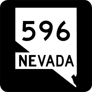
Jones Boulevard is a section line arterial that runs north and south through the Las Vegas Valley. A 4.088-mile (6.579 km) portion of the road is designated State Route 596 (SR 596).

<span class="mw-page-title-main">Alabama State Route 151</span> Highway in Alabama

State Route 151 (SR 151) is a 0.404-mile-long (0.650 km) state highway in Pinson in the northeastern part of Jefferson County, in the central part of the U.S. state of Alabama. The southern terminus of the highway is at an intersection with SR 79. The northern terminus is at an intersection with SR 75. It is known as Tapawingo Road for its entire length. At its northern terminus, SR 75 takes on the Tapawingo Road name.

<span class="mw-page-title-main">Nevada State Route 292</span> State highway in Nevada, United States

State Route 292 is a short state highway on the northern edge of Humboldt County, Nevada, United States, that serves the community of Denio.

<span class="mw-page-title-main">Nevada State Route 294</span> State highway in Nevada, United States

State Route 294 is a 7.973-mile (12.831 km) state highway in southeastern Humboldt County, Nevada, United States, that runs along the northernmost part of Grass Valley Road and connects Winnemucca with the Grass Valley area south of the town.

<span class="mw-page-title-main">Russell Road (Las Vegas)</span> Highway in Nevada

Russell Road is a section line road within the Las Vegas Valley of Clark County, Nevada. It is no longer a continuous road through the valley, as Harry Reid International Airport interrupts its right of way. The eastern section terminates at the eastern edge of the airport, with the road resuming at Las Vegas Boulevard on the western edge of the airport. The intersection of Russell Road and Las Vegas Boulevard is often considered to mark the southern terminus of the Las Vegas Strip.

<span class="mw-page-title-main">Nevada State Route 582</span> Highway in Nevada

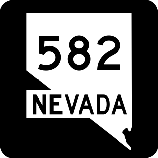
State Route 582 (SR 582) is a major 15.392-mile-long (24.771 km) highway in the Las Vegas Valley. The highway is the former route of U.S. Route 93 (US 93) and US 95 before they were moved to the current freeway alignment shared with Interstate 11 (I-11) and Interstate 515 (I-515). Known primarily as Boulder Highway, the route connects Downtown Las Vegas with Henderson and Boulder City to the southeast.

The Valley of Fire Road is a road in northeastern Clark County, Nevada serving the Valley of Fire State Park. The roadway was previously designated State Route 40, and the segment within the state park is currently designated a Nevada Scenic Byway.

<span class="mw-page-title-main">Nevada Department of Transportation</span> U.S. state government agency

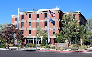
The Nevada Department of Transportation is a government agency in the U.S. state of Nevada. NDOT is responsible for maintaining and improving Nevada's highway system, which includes U.S. highways and Interstate highways within the state's boundaries. The department is notable for its aggressively proactive approach to highway maintenance. Nevada state roads and bridges have also been named some of the nation's best.

<span class="mw-page-title-main">Nevada State Route 535</span> Highway in Nevada

State Route 535 (SR 535) is the Nevada Department of Transportation (NDOT) designation for two discontinuous sections of Idaho Street just west of and within the small city of Elko in the northeastern part of the U.S. state of Nevada. Both segments are also signed as Interstate 80 Business, which is also signed along the city-maintained segment of Idaho Street between the two NDOT segments as well as the city-maintained segment of Idaho Street east of the final eastern terminus all the way to East Jennings Way, from which it connects to the Elko East exit on Interstate 80. Most of Interstate 80 Business in Elko, including both segments of SR 535, were formerly designated U.S. Route 40.

<span class="mw-page-title-main">Nevada State Route 439</span> Highway in Nevada

State Route 439 (SR 439) is a four-lane state highway in Lyon, Storey and Washoe Counties in Nevada. Better known as USA Parkway, the route connects U.S. Route 50 (US 50) in Silver Springs to Interstate 80 (I-80) in Clark via the Tahoe Reno Industrial Center (TRIC). The northern portion of USA Parkway was initially constructed by the industrial center's developers; however, the Nevada Department of Transportation (NDOT) agreed to assume control of the road after Tesla announced plans to build its Gigafactory at TRIC in 2014. NDOT opened the extension of SR 439 south to US 50 in Lyon County on September 8, 2017.

<span class="mw-page-title-main">Arizona State Route 181</span> State highway in Arizona, United States

State Route 181 is a highway in Cochise County, Arizona that runs from its junction with US 191 east of Pearce to the Chiricahua National Monument. It is an east–west route for the half east of Pearce, but becomes a primarily north–south route on the half approaching the monument.

<span class="mw-page-title-main">Nevada State Route 445</span> Highway in Nevada

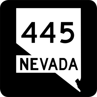
State Route 445 is a 41.890-mile-long (67.415 km) state highway in Washoe County, Nevada. The route follows Pyramid Way, a major thoroughfare in the city of Sparks, and connects the Reno metropolitan area to Pyramid Lake. The route is designated a Nevada Scenic Byway.

<span class="mw-page-title-main">Harry Reid Airport Connector</span> Limited access roadway in Las Vegas, Nevada

The Harry Reid Airport Connector (RAC) is a limited-access roadway system located in Paradise, an unincorporated town in the Las Vegas Valley, Clark County, Nevada, United States. Composed of State Route 171, the Airport Tunnel and arterial streets, the airport connector provides vehicular access to the passenger terminals at Harry Reid International Airport. Despite being completely owned by Clark County, the first 0.685 miles (1.102 km) of the Harry Reid Airport Connector is maintained by NDOT as unsigned SR 171, while the remaining section is maintained by Clark County.

<span class="mw-page-title-main">Nevada State Route 173</span> State highway in Nevada

State Route 173 is a state highway in Clark County, Nevada. The route provides access to downtown Boulder City from U.S. Route 95 (US 95) to the south. The route was originally part of US 95 until the highway was realigned following the completion of Interstate 11 (I-11) around Boulder City.

References

  1. Nevada Department of Transportation (January 2022). "State Maintained Highways of Nevada Descriptions and Maps, January 2022" . Retrieved April 25, 2023.
  2. https://www.nevadadot.com/home/showdocument?id=1261.{{cite web}}: Missing or empty |title= (help)
  3. http://contentdm.library.unr.edu/cdm/ref/collection/hmaps/id/535.{{cite web}}: Missing or empty |title= (help)
  4. https://www.nevadadot.com/home/showdocument?id=1263.{{cite web}}: Missing or empty |title= (help)
  5. http://contentdm.library.unr.edu/cdm/ref/collection/hmaps/id/535.{{cite web}}: Missing or empty |title= (help)
  6. http://contentdm.library.unr.edu/cdm/ref/collection/hmaps/id/535.{{cite web}}: Missing or empty |title= (help)
  7. https://www.nevadadot.com/home/showdocument?id=1261.{{cite web}}: Missing or empty |title= (help)
  8. http://contentdm.library.unr.edu/cdm/ref/collection/hmaps/id/535.{{cite web}}: Missing or empty |title= (help)
  9. https://www.nevadadot.com/home/showdocument?id=1261.{{cite web}}: Missing or empty |title= (help)
  10. "NDOT 1999 Traffic Report" (PDF). Archived from the original on August 8, 2004.{{cite web}}: CS1 maint: bot: original URL status unknown (link)
  11. "NDOT 1999 Traffic Report" (PDF). Archived from the original on August 8, 2004.{{cite web}}: CS1 maint: bot: original URL status unknown (link)
  12. https://www.nevadadot.com/home/showdocument?id=1261.{{cite web}}: Missing or empty |title= (help)
  13. https://www.nevadadot.com/home/showdocument?id=1263.{{cite web}}: Missing or empty |title= (help)
  14. https://www.nevadadot.com/home/showdocument?id=1265.{{cite web}}: Missing or empty |title= (help)
  15. http://epubs.nsla.nv.gov/statepubs/epubs/211716-2015Jan.pdf.{{cite web}}: Missing or empty |title= (help)
  16. http://epubs.nsla.nv.gov/statepubs/epubs/211716-2015Jan.pdf.{{cite web}}: Missing or empty |title= (help)