List of primary state highways in Virginia

Last updated

Virginia 8.svg Circle sign 613.svg
Primary and secondary State Route shields
System information
NotesOutside cities, some towns, and two counties, every road is state-maintained. These roads are split into Primary and Secondary State Routes, and receive different levels of funding. Inside cities, most Primary State Routes are locally maintained.
Highway names
Interstates Interstate X (I-X)
US Highways U.S. Route X (US X)
State State Route X (SR X) or Virginia Route X (VA X)
System links

Primary State Highways in the U.S. state of Virginia, are numbered and maintained by the Virginia Department of Transportation as a system of state highways. Primary State Routes receive more funding than Secondary State Routes and are numbered as U.S. Routes or State Routes with numbers from 1 to 599. State Route 785 and State Route 895 are also primary routes, numbered as Interstate Highway spurs. Former numbers are reused often; only 29 of the numbers from 1 to 421 are not in use, with only seven of these under 260.

Contents

List of primary routes

NumberLength (mi)Length (km)Southern or western terminusNorthern or eastern terminusFormedRemovedNotes
Virginia 1 (1918).svg SR 1 196.55316.32 North Carolina Washington D.C. 01918-01-01191801923-01-011923Now US 1
Virginia 2.svg SR 2 53.0885.42 Richmond Fredericksburg 01933-01-011933current
Virginia 2 (1918).svg SR 2 230.37370.74 North Carolina Maryland 01918-01-01191801923-01-011923now US 15
Virginia 3.svg SR 3 150.0241.4 Culpeper Gloucester 01933-01-011933current
Virginia 3 (1918).svg SR 3 Ridgeway Rest 01918-01-01191801923-01-011923
Virginia 4.svg SR 4 11.0217.73 North Carolina east of Boydton 01952-01-011952current
Virginia 4 (1918).svg SR 4 129.06207.70 North Carolina Maryland 01918-01-01191801923-01-011923now US 13
Virginia 4 (1924).svg SR 4 135.60218.23 West Virginia Richmond 01933-01-01193301938-01-011938now US 33
Virginia 4 (1924).svg SR 4 406.43654.09 West Virginia Norfolk 01940-01-01194001947-01-011947now US 460
Virginia 5.svg SR 5 55.1888.80 Richmond Williamsburg 01933-01-011933current
Virginia 5 (1918).svg SR 5 48.7178.39 Templeton North Carolina 01918-01-01191801923-01-011923
Virginia 6.svg SR 6 102.3164.6 Afton Richmond 01933-01-011933current
Virginia 6 (1918).svg SR 6 86.0138.4 West Virginia Maryland 01918-01-01191801923-01-011923now US 50
Virginia 7.svg SR 7 72.75117.08 Winchester Alexandria 01933-01-011933current
Virginia 7 (1918).svg SR 7 150.0241.4 Culpeper Gloucester 01918-01-01191801923-01-011923now VA 3
Virginia 8.svg SR 8 55.8889.93 North Carolina Christiansburg 01933-01-011933current
Virginia 8 (1918).svg SR 8 255.83411.72 North Carolina Winchester 01918-01-01191801923-01-011923now US 17
Virginia 9.svg SR 9 13.0821.05 West Virginia west of Leesburg 01940-01-011940current
Virginia 9 (1918).svg SR 9 01918-01-01191801923-01-011923
Virginia 9 (1924).svg SR 9 29.2747.11 Woodbridge east of McLean 01933-01-01193301940-01-011940now VA 123
Virginia 10.svg SR 10 93.58150.60 Richmond Suffolk 01918-01-011918current
Virginia 11 (1924).svg SR 11 01918-01-01191801933-01-011933
Virginia 12 (1924).svg SR 12 508.0817.5 Tennessee Virginia Beach 01918-01-01191801933-01-011933now US 58
Virginia 12 (1924).svg SR 12 Troutville Clifton Forge 01933-01-01193301935-01-011935now US 220
Virginia 12 (1924).svg SR 12 122.6197.3near Stuarts Draft Maryland 01935-01-01193501953-01-011953now US 340
Virginia 13.svg SR 13 24.0838.75east of Cumberland east of Powhatan 01918-01-011918current
Virginia 13 (1924).svg SR 13 24.0838.75 Norfolk 01938-01-01193801943-01-011943
Virginia 14.svg SR 14 71.10114.42 St. Stephens Church Bayside 01933-01-011933current
Virginia 14 (1924).svg SR 14 North Carolina West Virginia 01918-01-01191801933-01-011933
Virginia 15 (1924).svg SR 15 85.0136.8 North Carolina Maryland 01923-01-01192301933-01-011933now US 52
Virginia 15 (1918).svg SR 15 01918-01-01191801923-01-011923
Virginia 16.svg SR 16 77.58124.85 North Carolina West Virginia 01940-01-011940current
Virginia 16 (1924).svg SR 16 01918-01-01191801940-01-011940
Virginia 17 (1924).svg SR 17 01918-01-01191801933-01-011933
Virginia 17 (1956).svg SR 17 255.83411.72 North Carolina Winchester 01933-01-01193301965-01-011965now US 17
Virginia 18.svg SR 18 25.8641.62 Paint Bank Covington 01933-01-011933current
Virginia 18 (1924).svg SR 18 01918-01-01191801933-01-011933
Virginia 19 (1924).svg SR 19 01918-01-01191801933-01-011933
Virginia 20.svg SR 20 89.79144.50 Dillwyn Wilderness 01933-01-011933current
Virginia 20 (1924).svg SR 20 01918-01-01191801933-01-011933
Virginia 21 (1924).svg SR 21 01918-01-01191801933-01-011933
Virginia 22.svg SR 22 29.8147.97 Shadwell Mineral 01933-01-011933current
Virginia 22 (1924).svg SR 22 01918-01-01191801933-01-011933
Virginia 23 (1924).svg SR 23 01918-01-01191801933-01-011933
Virginia 24.svg SR 24 89.57144.15 Roanoke west of Buckingham 01933-01-011933current
Virginia 24 (1924).svg SR 24 01918-01-01191801933-01-011933
Virginia 25 (1924).svg SR 25 01918-01-01191801933-01-011933
Virginia 26.svg SR 26 12.8320.65 Appomattox Bent Creek 01933-01-011933current
Virginia 26 (1924).svg SR 26 01918-01-01191801933-01-011933
Virginia 27.svg SR 27 2.544.09 Arlington District of Columbia 01964-01-011964current
Virginia 27 (1924).svg SR 27 01918-01-01191801940-01-011940
Virginia 27 (1924).svg SR 27 01940-01-01194001953-01-011953
Virginia 28.svg SR 28 4979north of Remington Sterling 01918-01-011918current
Virginia 29 (1924).svg SR 29 01923-01-01192301933-01-011933
Virginia 29 (1924).svg SR 29 01933-01-01193301947-01-011947
Virginia 30.svg SR 30 61.8799.57south of Doswell north of Norge 01923-01-011923current
Virginia 31.svg SR 31 24.5639.53 Wakefield west of Williamsburg 01933-01-011933current
Virginia 31 (1924).svg SR 31 01923-01-01192301933-01-011933
Virginia 32.svg SR 32 38.8962.59 North Carolina Newport News 01940-01-011940current
Virginia 32 (1924).svg SR 32 01923-01-01192301933-01-011933
Virginia 32 (1924).svg SR 32 01933-01-01193301940-01-011940
Virginia 33.svg SR 33 72.23116.24 Richmond Stingray Point 01938-01-011938current
Virginia 33 (1924).svg SR 33 01923-01-01192301933-01-011933
Virginia 33 (1924).svg SR 33 01933-01-01193301938-01-011938
Virginia 34.svg SR 34 0.540.87 South Boston 01942-01-011942current
Virginia 34 (1924).svg SR 34 01923-01-01192301933-01-011933
Virginia 34 (1924).svg SR 34 01933-01-01193301940-01-011940
Virginia 35.svg SR 35 48.7178.39 North Carolina south of Petersburg 01923-01-011923current
Virginia 36.svg SR 36 16.7026.88west of Petersburg Hopewell 01933-01-011933current
Virginia 36 (1924).svg SR 36 01923-01-01192301933-01-011933
Virginia 37.svg SR 37 9.1014.65 Winchester 01965-01-011965current
Virginia 37 (1924).svg SR 37 01923-01-01192301933-01-011933
Virginia 37.svg SR 37 01933-01-011933
Virginia 37 (1924).svg SR 37 01940-01-01c.1940
Virginia 37.svg SR 37 01940-01-011940
Virginia 38.svg SR 38 7.0311.31 Amelia Scotts Fork 01933-01-011933current
Virginia 38 (1924).svg SR 38 01923-01-01192301933-01-011933
Virginia 39.svg SR 39 59.1795.22 West Virginia Lexington 01940-01-011940current
Virginia 39 (1924).svg SR 39 01923-01-01192301933-01-011933
Virginia 39 (1924).svg SR 39 01933-01-01193301940-01-011940
Virginia 40.svg SR 40 227.69366.43 Woolwine Spring Grove 01933-01-011933current
Virginia 40 (1924).svg SR 40 01923-01-01192301933-01-011933
Virginia 41.svg SR 41 22.536.2 Danville Callands 01933-01-011933current
Virginia 41 (1924).svg SR 41 01923-01-01192301933-01-011933
Virginia 42.svg SR 42 210.29338.43 Broadford
south of Newport
east of Clifton Forge
Poplar Hill
New Castle
Woodstock
01928-01-011928current
Virginia 43.svg SR 43 61.2098.49 Altavista north of Eagle Rock 01933-01-011933current
Virginia 43 (1924).svg SR 43 01928-01-01192801933-01-011933
Virginia 44 (1924).svg SR 44 01928-01-01192801933-01-011933
Virginia 44 (1924).svg SR 44 01933-01-01193301952-01-011952
Virginia 44.svg SR 44 01963-01-01c.196302000-01-012000
Virginia 45.svg SR 45 39.7263.92 Farmville Georges Tavern 01928-01-011928current
Virginia 46.svg SR 46 42.5768.51 North Carolina west of Blackstone 01940-01-011940current
Virginia 46 (1924).svg SR 46 01928-01-01192801933-01-011933
Virginia 46 (1924).svg SR 46 01933-01-01193301940-01-011940
Virginia 47.svg SR 47 61.0998.31 South Hill Pamplin City 01933-01-011933current
Virginia 47 (1924).svg SR 47 01928-01-01192801930-01-01c.1930
Virginia 47 (1924).svg SR 47 01930-01-01193001933-01-011933
Virginia 48.svg SR 48 321.2516.9unsigned designation for the Blue Ridge Parkway and Skyline Drive from North Carolina to Front Royal 01935-01-01c.1935current
Virginia 48 (1924).svg SR 48 01928-01-01192801934-01-011934
Virginia 49.svg SR 49 69.01111.06 North Carolina east of Burkeville 01928-01-011928current
Virginia 50 (1924).svg SR 50 01928-01-01192801933-01-011933
Virginia 51.svg SR 51 6.209.98west of Danville Danville 01954-01-011954current
Virginia 51 (1924).svg SR 51 01928-01-01192801950-01-011950
Virginia 52 (1924).svg SR 52 01928-01-01192801933-01-011933
Virginia 52 (1924).svg SR 52 01933-01-01193301935-01-01c.1935
Virginia 53.svg SR 53 18.3229.48south of Charlottesville Palmyra 01947-01-011947current
Virginia 53 (1924).svg SR 53 01928-01-01192801933-01-011933
Virginia 53 (1924).svg SR 53 01933-01-01193301940-01-011940
Virginia 54.svg SR 54 18.6730.05east of Montpelier north of Hanover 01933-01-011933current
Virginia 54 (1924).svg SR 54 01928-01-01192801933-01-011933
Virginia 55.svg SR 55 64.71104.14 West Virginia Gainesville 01928-01-011928current
Virginia 56.svg SR 56 60.8797.96 Steeles Tavern west of Buckingham 01930-01-011930current
Virginia 57.svg SR 57 88.70142.75north of Stuart west of Halifax 01930-01-011930current
Virginia 58 (1924).svg SR 58 01930-01-01193001933-01-011933
Virginia 59.svg SR 59 7.9012.71 Drakes Branch Keysville 01957-01-011957current
Virginia 59 (1924).svg SR 59 01931-01-01193101933-01-011933
Virginia 59 (1924).svg SR 59 01933-01-01193301940-01-011940
Virginia 59 (1924).svg SR 59 01940-01-01194001949-01-011949
Virginia 61.svg SR 61 48.1677.51 Tazewell Narrows 01933-01-011933current
Virginia 62.svg SR 62 4.016.45 North Carolina east of Danville 01946-01-011946current
Virginia 62 (1924).svg SR 62 01933-01-01193301942-01-011942
Virginia 62 (1924).svg SR 62 01942-01-01194201946-01-011946
Virginia 63.svg SR 63 39.2863.22 St. Paul Haysi 01958-01-011958current
Virginia 63 (1924).svg SR 63 01933-01-01193301946-01-011946
Virginia 64 (1924).svg SR 64 01933-01-01193301940-01-011940
Virginia 64 (1956).svg SR 64 01940-01-01194001958-01-011958
Virginia 65.svg SR 65 34.0654.81south of Clinchport east of St. Paul 01958-01-011958current
Virginia 65 (1924).svg SR 65 01933-01-01193301940-01-011940
Virginia 65 (1924).svg SR 65 01940-01-01194001943-01-011943
Virginia 66 (1924).svg SR 66 01933-01-01193301940-01-011940
Virginia 66 (1956).svg SR 66 01940-01-01194001958-01-011958
Virginia 67.svg SR 67 22.3635.98east of Honaker Jewell Ridge 01940-01-011940current
Virginia 67 (1924).svg SR 67 01933-01-01193301940-01-011940
Virginia 68.svg SR 68 6.139.87east of Keokee Appalachia 01933-01-011933current
Virginia 69.svg SR 69 3.595.78east of Austinville Poplar Camp 01958-01-011958current
Virginia 69 (1924).svg SR 69 01933-01-01193301951-01-011951
Virginia 70.svg SR 70 11.8819.12 Tennessee Jonesville 01940-01-011940current
Virginia 70 (1924).svg SR 70 01933-01-01193301940-01-011940
Virginia 71.svg SR 71 35.8257.65 Gate City Lebanon 01933-01-011933current
Virginia 72.svg SR 72 49.1979.16north of Gate City west of Clintwood 01933-01-011933current
Virginia 73.svg SR 73 0.781.26north of Richmond 01958-01-011958current
Virginia 73 (1924).svg SR 73 01933-01-01193301948-01-011948
Virginia 74.svg SR 74 2.423.89 Norton east of Norton 01958-01-011958current
Virginia 74 (1924).svg SR 74 01933-01-01193301942-01-011942
Virginia 75.svg SR 75 10.5116.91 Tennessee Abingdon 01940-01-011940current
Virginia 75 (1924).svg SR 75 01933-01-01193301940-01-011940
Virginia 76.svg SR 76 13.0420.99west of Richmond Richmond 01973-01-011973current
Virginia 76 (1956).svg SR 76 01933-01-01193301970-01-011970
Virginia 77 (1924).svg SR 77 01933-01-01193301940-01-011940
Virginia 77 (1924).svg SR 77 01940-01-01194001942-01-011942
Virginia 78.svg SR 78 3.856.20 Appalachia south of Stonega 01946-01-011946current
Virginia 78 (1924).svg SR 78 01933-01-01193301940-01-011940
Virginia 78 (1924).svg SR 78 01940-01-01194001944-01-011944
Virginia 79.svg SR 79 0.230.37west of Linden 01980-01-01c.1980current
Virginia 79 (1924).svg SR 79 01933-01-01193301953-01-011953
Virginia 79 (1956).svg SR 79 01960-01-01c.196001971-01-011971
Virginia 80.svg SR 80 67.37108.42 Kentucky Cedarville 01933-01-011933current
Virginia 81 (1924).svg SR 81 01933-01-01193301940-01-011940
Virginia 81 (1956).svg SR 81 01940-01-01194001958-01-011958
Virginia 82.svg SR 82 6.8411.01 Cleveland Lebanon 01933-01-011933current
Virginia 83.svg SR 83 61.7199.31 Pound West Virginia 01940-01-011940current
Virginia 83 (1924).svg SR 83 01933-01-01193301940-01-011940
Virginia 84.svg SR 84 14.9424.04 West Virginia Vanderpool 01940-01-011940current
Virginia 84 (1924).svg SR 84 01933-01-01193301940-01-011940
Virginia 85 (1956).svg SR 85 01933-01-01193301958-01-011958
Virginia 86.svg SR 86 3.335.36 North Carolina Danville 01933-01-011933current
Virginia 87.svg SR 87 4.106.60 North Carolina Ridgeway 01940-01-011940current
Virginia 87 (1924).svg SR 87 01933-01-01193301940-01-011940
Virginia 88 (1924).svg SR 88 01933-01-01193301940-01-011940
Virginia 88 (1924).svg SR 88 01940-01-01194001948-01-011948
Virginia 88 (1956).svg SR 88 01957-01-01195701957-01-011957
Virginia 88 (1956).svg SR 88 01972-01-01197201976-01-011976
Virginia 89.svg SR 89 7.8512.63 North Carolina Galax 01940-01-011940current
Virginia 89 (1924).svg SR 89 01933-01-01193301938-01-011938
Virginia 90.svg SR 90 1.732.78west of Rural Retreat Rural Retreat 01933-01-011933current
Virginia 91.svg SR 91 55.1588.76 Tennessee west of Tazewell 01940-01-011940current
Virginia 91 (1924).svg SR 91 01933-01-01193301940-01-011940
Virginia 92.svg SR 92 28.9746.62west of Clover Boydton 01940-01-011940current
Virginia 92 (1924).svg SR 92 01933-01-01193301940-01-011940
Virginia 93.svg SR 93 0.921.48 North Carolina east of Mouth of Wilson 01933-01-011933current
Virginia 94.svg SR 94 28.3945.69west of Galax south of Fort Chiswell 01933-01-011933current
Virginia 95 (1924).svg SR 95 01933-01-01193301953-01-011953
Virginia 96.svg SR 96 7.8312.60south of South Boston North Carolina 01940-01-011940current
Virginia 96 (1924).svg SR 96 01933-01-01193301940-01-011940
Virginia 97.svg SR 97 9.1614.74 Galax Blue Ridge Parkway 01933-01-011933current
Virginia 98.svg SR 98 0.500.80 Bland 01933-01-011933current
Virginia 99.svg SR 99 5.208.37 Pulaski east of Pulaski 01933-01-011933current
Virginia 100.svg SR 100 53.3185.79east of Hillsville Narrows 01933-01-011933current
Virginia 101.svg SR 101 3.175.10 Roanoke 01969-01-011969current
Virginia 101.svg SR 101 01933-01-01193301940-01-01c.1940
Virginia 101.svg SR 101 01962-01-01196201985-01-011985
Virginia 102.svg SR 102 8.2013.20 Pocahontas Bluefield 01958-01-011958current
Virginia 102 (1924).svg SR 102 01933-01-01193301954-01-011954
Virginia 103.svg SR 103 13.4321.61south of Stuart North Carolina 01933-01-011933current
Virginia 104.svg SR 104 no current route01965-01-01c.196502001-01-012001now part of U.S. Route 17
Virginia 104 (1924).svg SR 104 01933-01-01193301949-01-011949now State Route 773
Virginia 104 (1924).svg SR 104 01928-01-01c.192801933-01-011933now part of U.S. Route 421
Virginia 104 (1924).svg SR 104 01923-01-01192301928-01-011928
Virginia 105.svg SR 105 4.907.89 Newport News south of Yorktown 01958-01-011958current
Virginia 105 (1924).svg SR 105 01933-01-01193301942-01-011942
Virginia 106.svg SR 106 30.0048.28 Petersburg Talleysville 01940-01-011940current
Virginia 106 (1924).svg SR 106 01933-01-01193301940-01-011940
Virginia 107.svg SR 107 8.3913.50 Chilhowie Saltville 01961-01-011961current
Virginia 107 (1924).svg SR 107 01933-01-01193301953-01-011953
Virginia 108.svg SR 108 4.246.82north of Martinsville Figsboro 01933-01-011933current
Virginia 109.svg SR 109 0.911.46 Petersburg Fort Gregg-Adams 01956-01-011956current
Virginia 109 (1924).svg SR 109 01933-01-01193301946-01-011946
Virginia 110.svg SR 110 2.413.88 Arlington 01964-01-011964current
Virginia 110 (1924).svg SR 110 01933-01-01193301946-01-011946
Virginia 110 (1924).svg SR 110 01947-01-01194701956-01-011956
Virginia 111.svg SR 111 2.263.64 Christiansburg 01933-01-011933current
Virginia 112.svg SR 112 0.651.05 Salem 01965-01-01c.1965current
Virginia 112 (1924).svg SR 112 01933-01-01193301943-01-011943
Virginia 113.svg SR 113 1.332.14 Bristol 01966-01-011966current
Virginia 113 (1924).svg SR 113 01933-01-01193301942-01-011942
Virginia 114.svg SR 114 10.3216.61northwest of Radford Christiansburg 01933-01-011933current
Virginia 114 (1924).svg SR 114 01923-01-01192301928-01-011928
Virginia 114 (1924).svg SR 114 01928-01-01192801933-01-011933
Virginia 115.svg SR 115 6.009.66 Roanoke north of Roanoke 01933-01-011933current
Virginia 116.svg SR 116 20.6633.25 Burnt Chimney Roanoke 01933-01-011933current
Virginia 117.svg SR 117 7.2111.60 Roanoke Hollins 01933-01-011933current
Virginia 118.svg SR 118 1.842.96 Roanoke Hollins 01933-01-011933current
Virginia 119.svg SR 119 3.084.96 North Carolina Delila 01964-01-011964current
Virginia 119 (1956).svg SR 119 01933-01-01193301964-01-011964
Virginia 120.svg SR 120 9.1014.65 Arlington 01940-01-011940current
Virginia 120 (1924).svg SR 120 01933-01-01193301940-01-011940
Virginia 121.svg SR 121 1.832.95 Fort Chiswell Max Meadows 01933-01-011933current
Virginia 122.svg SR 122 54.5887.84east of Rocky Mount Big Island 01933-01-011933current
Virginia 123.svg SR 123 29.2747.11 Woodbridge District of Columbia 01940-01-011940current
Virginia 123 (1924).svg SR 123 01933-01-01193301940-01-011940
Virginia 124.svg SR 124 0.871.40 Arlington 01948-01-011948current
Virginia 124 (1924).svg SR 124 01933-01-01193301937-01-011937
Virginia 124 (1924).svg SR 124 01943-01-011943
Virginia 125.svg SR 125 5.739.22 Chuckatuck Driver 01963-01-011963current
Virginia 125.svg SR 125 01933-01-011933
Virginia 126.svg SR 126 1.382.22 Onancock Tasley 01995-01-01c.1995current
Virginia 126 (1924).svg SR 126 01933-01-01193301944-01-011944
Virginia 126 (1956).svg SR 126 01948-01-01194801979-01-011979
Virginia 127.svg SR 127 3.355.39 West Virginia north of Winchester 01964-01-011964current
Virginia 127 (1924).svg SR 127 01933-01-01193301948-01-011948
Virginia 128.svg SR 128 3.475.58 Lynchburg 01933-01-011933current
Virginia 129.svg SR 129 3.185.12 South Boston south of Halifax 01933-01-011933current
Virginia 130.svg SR 130 34.6955.83 Natural Bridge northeast of Madison Heights 01933-01-011933current
Virginia 131.svg SR 131 1.652.66 Appomattox 01933-01-011933current
Virginia 132.svg SR 132 4.096.58 Williamsburg north of Williamsburg 01957-01-011957current
Virginia 132 (1924).svg SR 132 01933-01-01193301943-01-011943
Virginia 132 (1956).svg SR 132 01955-01-01195501957-01-011957
Virginia 133.svg SR 133 1.191.92 Hampden-Sydney south of Farmville 01933-01-011933current
Virginia 134.svg SR 134 11.6318.72 Hampton Tabb 01942-01-01c.1942current
Virginia 134 (1924).svg SR 134 01933-01-01193301942-01-011942
Virginia 135.svg SR 135 2.203.54 Suffolk 01955-01-01c.1955current
Virginia 135 (1924).svg SR 135 01933-01-01193301945-01-011945
Virginia 136.svg SR 136 1.171.88 Alberta 01954-01-011954current
Virginia 136 (1924).svg SR 136 01933-01-01193301948-01-011948
Virginia 137.svg SR 137 12.0319.36 Kenbridge Danieltown 01933-01-011933current
Virginia 138.svg SR 138 16.9827.33north of South Hill Kenbridge 01933-01-011933current
Virginia 139.svg SR 139 1.482.38 Jarratt 01944-01-011944current
Virginia 139 (1924).svg SR 139 01933-01-01193301942-01-011942
Virginia 140.svg SR 140 0.380.61 Abingdon 01960-01-011960current
Virginia 140 (1924).svg SR 140 01933-01-01193301949-01-011949
Virginia 141.svg SR 141 3.255.23 Portsmouth 01944-01-01c.1944current
Virginia 141 (1924).svg SR 141 01933-01-01193301943-01-011943
Virginia 142.svg SR 142 2.734.39southwest of Petersburg Petersburg 01933-01-011933current
Virginia 143.svg SR 143 35.3956.95 Norfolk north of Williamsburg 01945-01-01c.1945current
Virginia 143 (1924).svg SR 143 01933-01-01193301942-01-011942
Virginia 144.svg SR 144 13.9722.48 Centralia west of Hopewell 01933-01-011933current
Virginia 145.svg SR 145 5.188.34 Chesterfield south of Bensley 01933-01-011933current
Virginia 146.svg SR 146 0.861.38 Richmond 01976-01-011976current
Virginia 146 (1924).svg SR 146 01933-01-01193301949-01-011949
Virginia 146 (1956).svg SR 146 01949-01-01194901966-01-011966
Virginia 147.svg SR 147 13.1321.13east of Midlothian Richmond 01933-01-011933current
Virginia 148.svg SR 148 0.871.40north of Fancy Gap 01980-01-011980current
Virginia 148 (1924).svg SR 148 01933-01-01193301951-01-011951
Virginia 149.svg SR 149 1.923.09 Virginia Beach 01945-01-01c.1945current
Virginia 149 (1924).svg SR 149 01933-01-01193301942-01-011942
Virginia 150.svg SR 150 15.1924.45south of Richmond west of Richmond 01967-01-011967current
Virginia 150 (1924).svg SR 150 01933-01-01193301947-01-011947
Virginia 150 (1956).svg SR 150 01961-01-01196101962-01-011962
Virginia 151.svg SR 151 35.2256.68north of Amherst east of Afton 01933-01-011933current
Virginia 152.svg SR 152 5.188.34 Newport News Hampton 01946-01-011946current
Virginia 152 (1924).svg SR 152 01933-01-01193301942-01-011942
Virginia 152 (1924).svg SR 152 01944-01-011944
Virginia 153.svg SR 153 17.1527.60east of Blackstone east of Amelia 01933-01-011933current
Virginia 154.svg SR 154 1.923.09 Covington 01962-01-011962current
Virginia 154 (1924).svg SR 154 01933-01-01193301941-01-011941
Virginia 154 (1956).svg SR 154 01941-01-01194101958-01-011958
Virginia 155.svg SR 155 13.5321.77 Charles City Carps Corner01933-01-011933current
Virginia 156.svg SR 156 57.3892.34south of Petersburg Mechanicsville 01933-01-011933current
Virginia 157.svg SR 157 7.7112.41west of Richmond north of Laurel 01933-01-011933current
Virginia 158.svg SR 158 2.524.06 Coeburn east of Coeburn 01999-01-011999current
Virginia 158 (1924).svg SR 158 01933-01-01193301940-01-011940
Virginia 158 (1924).svg SR 158 01940-01-01194001943-01-011943
Virginia 158 (1956).svg SR 158 01947-01-01194701970-01-011970
Virginia 159.svg SR 159 11.3318.23 Crows Callaghan 01947-01-011947current
Virginia 159 (1924).svg SR 159 01933-01-01193301945-01-011945
Virginia 160.svg SR 160 8.0212.91 Kentucky Appalachia 01940-01-011940current
Virginia 160 (1924).svg SR 160 01933-01-01193301940-01-011940
Virginia 161.svg SR 161 13.8422.27 Richmond north of Richmond 01933-01-011933current
Virginia 162.svg SR 162 0.170.27east of Williamsburg 01945-01-011945current
Virginia 162 (1924).svg SR 162 01933-01-01193301943-01-011943
Virginia 163.svg SR 163 6.7410.85 Lynchburg Madison Heights 02005-01-012005current
Virginia 163 (1924).svg SR 163 01933-01-01193301942-01-011942
Virginia 163.svg SR 163 01945-01-01194501993-01-011993
Virginia 164.svg SR 164 12.1719.59 Suffolk Portsmouth 01968-01-011968current
Virginia 164 (1924).svg SR 164 01933-01-01193301955-01-011955
Virginia 165.svg SR 165 39.7563.97 Chesapeake Norfolk 01933-01-011933current
Virginia 166.svg SR 166 15.4724.90 Chesapeake Virginia Beach 01933-01-011933current
Virginia 167.svg SR 167 Cloverdale Cloverdale 02016-01-012016current
Virginia 167.svg SR 167 01933-01-01193301995-01-011995
Virginia 168.svg SR 168 30.1148.46 North Carolina Norfolk 01933-01-011933current
Virginia 169.svg SR 169 7.4111.93 Hampton 01933-01-011933current
Virginia 170.svg SR 170 2.654.26 Norfolk 01957-01-011957current
Virginia 170 (1924).svg SR 170 01933-01-01193301940-01-011940
Virginia 170 (1956).svg SR 170 01940-01-01194001957-01-011957
Virginia 171.svg SR 171 11.2018.02 Newport News Poquoson 01933-01-011933current
Virginia 172.svg SR 172 4.857.81 Hampton Poquoson 01933-01-011933current
Virginia 173.svg SR 173 10.8417.45 Newport News
Suffolk (future)
near Seaford 01933-01-011933current
Virginia 174.svg SR 174 5.588.98 Martinsville 01978-01-011978current
Virginia 174 (1956).svg SR 174 01933-01-01193301966-01-011966
Virginia 175.svg SR 175 10.8317.43north of Oak Hall Chincoteague 01933-01-011933current
Virginia 176.svg SR 176 2.584.15 Parksley Nelsonia 01933-01-011933current
Virginia 177.svg SR 177 4.417.10south of Radford Radford 01962-01-011962current
Virginia 177 (1956).svg SR 177 01933-01-01193301959-01-011959
Virginia 178.svg SR 178 11.5118.52 Exmore north of Pungoteague 01933-01-011933current
Virginia 179.svg SR 179 2.944.73 Onancock Onley 01933-01-011933current
Virginia 180.svg SR 180 11.2518.11near Harborton Wachapreague 01933-01-011933current
Virginia 181.svg SR 181 0.951.53 Belle Haven east of Belle Haven 01933-01-011933current
Virginia 182.svg SR 182 3.715.97 Painter Quinby 01933-01-011933current
Virginia 183.svg SR 183 7.4511.99east of Silver Beach Exmore 01933-01-011933current
Virginia 184.svg SR 184 3.205.15 Cape Charles south of Cheriton 01957-01-011957current
Virginia 184 (1924).svg SR 184 01933-01-01193301953-01-011953
Virginia 185.svg SR 185 1.001.61west of Edinburg Edinburg 01964-01-011964current
Virginia 185 (1924).svg SR 185 01933-01-01193301952-01-011952
Virginia 186.svg SR 186 6.219.99 North Carolina Boykins 01970-01-01c.1970current
Virginia 186 (1924).svg SR 186 01933-01-01193301951-01-011951
Virginia 187.svg SR 187 5.438.74north of Guilford Modest Town 01933-01-011933current
Virginia 188.svg SR 188 0.911.46 Clifton Forge 01945-01-01c.1945current
Virginia 188 (1924).svg SR 188 01933-01-01193301944-01-011944
Virginia 189.svg SR 189 10.8217.41south of Franklin west of Holland 01933-01-011933current
Virginia 190.svg SR 190 15.4324.83 Chesapeake Virginia Beach 01956-01-011956current
Virginia 190 (1924).svg SR 190 01933-01-01193301952-01-011952
Virginia 191.svg SR 191 3.135.04 Chesapeake 01933-01-011933current
Virginia 192.svg SR 192 2.023.25 Norfolk 01952-01-011952current
Virginia 192 (1924).svg SR 192 01933-01-01193301947-01-011947
Virginia 192 (1924).svg SR 192 01951-01-01195101952-01-011952
Virginia 193.svg SR 193 11.7918.97 Dranesville Langley 01948-01-011948current
Virginia 193 (1924).svg SR 193 01933-01-01193301945-01-011945
Virginia 194.svg SR 194 5.759.25 Norfolk 01947-01-011947current
Virginia 194 (1924).svg SR 194 01933-01-01193301946-01-011946
Virginia 195.svg SR 195 3.395.46 Richmond 01976-01-011976current
Virginia 195 (1956).svg SR 195 01933-01-01193301973-01-011973
Virginia 196.svg SR 196 0.961.54 Chesapeake 01942-01-011942current
Virginia 196 (1924).svg SR 196 01933-01-01193301942-01-011942
Virginia 197.svg SR 197 3.605.79 Richmond
Virginia 197 (1956).svg SR 197 01933-01-01193301966-01-011966
Virginia 198.svg SR 198 23.3337.55 Glenns near Mathews 01933-01-011933current
Virginia 199.svg SR 199 14.1322.74northwest of Williamsburg east of Williamsburg 01975-01-011975current
Virginia 199 (1956).svg SR 199 01933-01-01193301957-01-011957
Virginia 200.svg SR 200 19.2330.95 White Stone Burgess 01933-01-011933current
Virginia 201.svg SR 201 16.1726.02south of Lively Heathsville 01933-01-011933current
Virginia 202.svg SR 202 17.9128.82 Templeman Callao 01933-01-011933current
Virginia 203.svg SR 203 9.7615.71 Lyells near Kinsale 01933-01-011933current
Virginia 204.svg SR 204 1.732.78 George Washington Birthplace National Monument 01933-01-011933current
Virginia 205.svg SR 205 18.4729.72east of King George Oak Grove 01933-01-011933current
Virginia 206.svg SR 206 11.0417.77west of King George Dahlgren 01933-01-011933current
Virginia 207.svg SR 207 1.933.11 Carmel Church south of Bowling Green 01933-01-011933current
Virginia 208.svg SR 208 47.3576.20 Ferncliff Four Mile Fork 01950-01-011950current
Virginia 208 (1924).svg SR 208 01933-01-01193301945-01-011945
Virginia 209.svg SR 209 0.881.42 Virginia's Center for Innovative Technology 01990-01-011990current
Virginia 209 (1924).svg SR 209 01933-01-01193301948-01-011948
Virginia 209.svg SR 209 01957-01-01195701986-01-011986
Virginia 210.svg SR 210 3.145.05 Madison Heights east of Madison Heights 01960-01-01c.1960current
Virginia 210 (1924).svg SR 210 01933-01-01193301952-01-011952
Virginia 211.svg SR 211 5.639.06 Timberville New Market 01977-01-011977current
Virginia 212.svg SR 212 0.871.40 Fredericksburg east of Fredericksburg 02004-01-012004current
Virginia 212 (1924).svg SR 212 01933-01-01193301948-01-011948
Virginia 212 (1956).svg SR 212 01975-01-01197501979-01-011979
Virginia 212.svg SR 212 01985-01-01198502004-01-012004
Virginia 213.svg SR 213 1.893.04 Manassas Park 01975-01-01c.1975current
Virginia 213 (1924).svg SR 213 01933-01-01193301943-01-011943
Virginia 214.svg SR 214 2.483.99 Lerty east of Stratford 01933-01-011933current
Virginia 215.svg SR 215 9.2614.90east of Warrenton west of Manassas 01961-01-011961current
Virginia 215 (1924).svg SR 215 01933-01-01193301944-01-011944
Virginia 216.svg SR 216 3.615.81north of Gloucester Point Achilles 01933-01-011933current
Virginia 217.svg SR 217 2.203.54 Southwestern Virginia Mental Health Institute 01954-01-011954current
Virginia 217 (1924).svg SR 217 01933-01-01193301942-01-011942
Virginia 218.svg SR 218 30.0048.28 Falmouth west of Colonial Beach 01933-01-011933current
Virginia 219 (1924).svg SR 219 01933-01-01193301937-01-011937
Virginia 220 (1924).svg SR 220 01933-01-01193301935-01-01c.1935
Virginia 222.svg SR 222 4.176.71south of Weems north of Irvington 01933-01-011933current
Virginia 223.svg SR 223 2.073.33 Hudgins Gwynn's Island 01933-01-011933current
Virginia 224.svg SR 224 3.325.34 Tennessee east of Weber City 01991-01-011991current
Virginia 224 (1924).svg SR 224 01933-01-01193301951-01-011951
Virginia 224.svg SR 224 01989-01-011989
Virginia 225.svg SR 225 5.408.69 Virginia Beach 01964-01-011964current
Virginia 225 (1924).svg SR 225 01933-01-01193301956-01-011956
Virginia 226.svg SR 226 3.385.44west of Petersburg 01965-01-011965current
Virginia 226 (1924).svg SR 226 01933-01-01193301942-01-011942
Virginia 226 (1924).svg SR 226 01942-01-01194201943-01-011943
Virginia 227.svg SR 227 2.984.80east of Saluda Urbanna 01933-01-011933current
Virginia 228.svg SR 228 4.537.29 Herndon north of Herndon 01966-01-011966current
Virginia 228 (1924).svg SR 228 01933-01-01193301951-01-011951
Virginia 229.svg SR 229 14.6623.59 Culpeper west of Warrenton 01947-01-011947current
Virginia 229 (1924).svg SR 229 01933-01-01193301935-01-01c.1935
Virginia 229 (1924).svg SR 229 01935-01-01193501942-01-011942
Virginia 230.svg SR 230 20.5833.12 Stanardsville north of Madison Mills 01933-01-011933current
Virginia 231.svg SR 231 49.8280.18south of Cismont south of Sperryville 01933-01-011933current
Virginia 232.svg SR 232 4.336.97 Radford 01968-01-011968current
Virginia 232 (1924).svg SR 232 01933-01-01193301943-01-011943
Virginia 233.svg SR 233 0.360.58 Arlington 01964-01-011964current
Virginia 233 (1924).svg SR 233 01933-01-01193301949-01-011949
Virginia 234.svg SR 234 33.9254.59 Dumfries near Woolsey 01933-01-011933current
Virginia 235.svg SR 235 5.058.13south of Alexandria 01933-01-011933current
Virginia 236.svg SR 236 15.6325.15 Fairfax Alexandria 01935-01-011935current
Virginia 236 (1924).svg SR 236 01933-01-01193301935-01-011935
Virginia 237.svg SR 237 13.0721.03 Fairfax Arlington County 01933-01-011933current
Virginia 238.svg SR 238 7.7512.47 Lee Hall Yorktown 01940-01-011940current
Virginia 238 (1924).svg SR 238 01933-01-01193301940-01-011940
Virginia 239.svg SR 239 4.467.18 Portsmouth 01968-01-011968current
Virginia 239 (1924).svg SR 239 01933-01-01193301941-01-011941
Virginia 239 (1924).svg SR 239 01942-01-01194201944-01-011944
Virginia 240.svg SR 240 4.517.26near Crozet 01942-01-011942current
Virginia 240 (1924).svg SR 240 01933-01-01193301942-01-011942
Virginia 241.svg SR 241 1.883.03south of Alexandria Alexandria 01933-01-011933current
Virginia 242.svg SR 242 3.585.76 Gunston Hall 01950-01-011950current
Virginia 242 (1924).svg SR 242 01933-01-01193301948-01-011948
Virginia 243.svg SR 243 1.702.74south of Vienna Vienna 01960-01-011960current
Virginia 243 (1924).svg SR 243 01933-01-01193301943-01-011943
Virginia 244.svg SR 244 8.2513.28 Annandale Arlington 01933-01-011933current
Virginia 245.svg SR 245 3.275.26north of Warrenton The Plains 01945-01-011945current
Virginia 245 (1924).svg SR 245 01933-01-01193301940-01-011940
Virginia 245 (1924).svg SR 245 01940-01-01194001942-01-011942
Virginia 245 (1924).svg SR 245 01942-01-01194201944-01-011944
Virginia 246.svg SR 246 0.761.22 Chesapeake 01942-01-011942current
Virginia 246 (1924).svg SR 246 01933-01-01193301942-01-011942
Virginia 247.svg SR 247 5.318.55 Norfolk 01959-01-011959current
Virginia 247 (1924).svg SR 247 01933-01-01193301943-01-011943
Virginia 248 (1924).svg SR 248 01933-01-01193301943-01-011943
Virginia 248 (1924).svg SR 248 01943-01-01194301944-01-011944
Virginia 248.svg SR 248 01980-01-011980
Virginia 249.svg SR 249 18.4329.66northeast of Bottoms Bridge Angelview Church 01970-01-011970current
Virginia 249 (1924).svg SR 249 01933-01-01193301952-01-011952
Virginia 250 (1924).svg SR 250 01933-01-01193301935-01-011935
Virginia 251.svg SR 251 9.9516.01near Collierstown Lexington 01933-01-011933current
Virginia 252.svg SR 252 29.0646.77east of Rockbridge Baths Staunton 01933-01-011933current
Virginia 253.svg SR 253 12.1819.60 Harrisonburg near Port Republic 02005-01-012005current
Virginia 253 (1924).svg SR 253 01933-01-01193301944-01-011944
Virginia 253.svg SR 253 Occoquan Woodbridge 01967-01-01196701998-01-011998
Virginia 254.svg SR 254 25.0140.25 Christian Waynesboro 01933-01-011933current
Virginia 255.svg SR 255 3.846.18south of Millwood Briggs 01933-01-011933current
Virginia 256.svg SR 256 6.7810.91south of Burketown Grottoes 01933-01-011933current
Virginia 257.svg SR 257 18.0429.03near West Virginia east of Mount Crawford 01933-01-011933current
Virginia 258 (1924).svg SR 258 01933-01-01193301940-01-011940
Virginia 258 (1924).svg SR 258 01940-01-01194001945-01-011945
Virginia 259.svg SR 259 26.8043.13 Mauzy
West Virginia
West Virginia
west of Gore
01933-01-011933current
Virginia 260 (1924).svg SR 260 01933-01-01193301947-01-011947
Virginia 260 (1956).svg SR 260 01952-01-01195201977-01-011977
Virginia 260.svg SR 260 01987-01-01198702003-01-012003
Virginia 261.svg SR 261 2.213.56 Staunton 01981-01-01c.1981current
Virginia 261 (1924).svg SR 261 01933-01-01193301940-01-011940
Virginia 261 (1924).svg SR 261 01940-01-01194001951-01-011951
Virginia 262.svg SR 262 13.7022.05south of Staunton east of Staunton 01975-01-01c.1975current
Virginia 262 (1924).svg SR 262 01933-01-01193301947-01-011947
Virginia 263.svg SR 263 12.8320.65west of Orkney Springs Mount Jackson 01933-01-011933current
Virginia 264 (1924).svg SR 264 01933-01-01193301953-01-011953
Virginia 265 (1924).svg SR 265 01933-01-01193301943-01-011943
Virginia 265 (1956).svg SR 265 01969-01-01196901970-01-011970
Virginia 265.svg SR 265 01973-01-01197301996-01-011996
Virginia 266 (1924).svg SR 266 01933-01-01193301952-01-011952
Virginia 267.svg SR 267 28.6846.16 Leesburg west of Arlington 01982-01-011982current
Virginia 267 (1924).svg SR 267 01933-01-01193301951-01-011951
Virginia 268 (1924).svg SR 268 01933-01-01193301951-01-011951
Virginia 269.svg SR 269 6.8010.94east of Clifton Forge Longdale Furnace 01984-01-011984current
Virginia 269 (1924).svg SR 269 01933-01-01193301953-01-011953
Virginia 270.svg SR 270 0.260.42 Saint Paul 01986-01-011986current
Virginia 270 (1924).svg SR 270 01933-01-01193301948-01-011948
Virginia 271.svg SR 271 7.3411.81 Short Pump Rockville 01940-01-011940current
Virginia 271 (1924).svg SR 271 01933-01-01193301940-01-011940
Virginia 272.svg SR 272 1.242.00west of Holland 01989-01-01c.1989current
Virginia 272 (1924).svg SR 272 01933-01-01193301947-01-011947
Virginia 273.svg SR 273 5.338.58 Barhamsville Eltham 01986-01-011986current
Virginia 273 (1924).svg SR 273 01933-01-01193301947-01-011947
Virginia 274.svg SR 274 7.3611.84east of Independence south of Fries 01981-01-01c.1981current
Virginia 274 (1924).svg SR 274 01933-01-01193301956-01-011956
Virginia 275 (1924).svg SR 275 01933-01-01193301940-01-011940
Virginia 275 (1924).svg SR 275 01954-01-011954
Virginia 275.svg SR 275 02006-01-012006
Virginia 276.svg SR 276 9.4315.18 Weyers Cave east of Harrisonburg 01943-01-011943current
Virginia 276 (1924).svg SR 276 01933-01-01193301943-01-011943
Virginia 277.svg SR 277 4.727.60 Stephens City Double Toll Gate 01933-01-011933current
Virginia 278.svg SR 278 1.642.64 Langley Air Force Base 01942-01-011942current
Virginia 278 (1924).svg SR 278 01933-01-01193301940-01-01c.1940
Virginia 278 (1924).svg SR 278 01940-01-01194001940-01-011940
Virginia 279.svg SR 279 5.558.93 Virginia Beach 01981-01-01c.1981current
Virginia 279 (1924).svg SR 279 01933-01-01193301943-01-011943
Virginia 280.svg SR 280 5.08.0 Harrisonburg 02012-01-012012current
Virginia 280 (1924).svg SR 280 01933-01-01193301944-01-011944
Virginia 280.svg SR 280 01978-01-01197801982-01-011982
Virginia 281.svg SR 281 1.602.57 Richmond 02013-01-012013current
Virginia 281 (1924).svg SR 281 01933-01-01193301945-01-011945
Virginia 282 (1924).svg SR 282 01933-01-01193301943-01-011943
Virginia 283.svg SR 283 0.360.58 Norton 01991-01-011991current
Virginia 283 (1924).svg SR 283 01933-01-01193301943-01-011943
Virginia 284 (1924).svg SR 284 01933-01-01193301934-01-011934
Virginia 284 (1924).svg SR 284 01946-01-011946
Virginia 285.svg SR 285 1.852.98South of Fishersville Fishersville 01998-01-01c.1998current
Virginia 285 (1924).svg SR 285 01933-01-01193301943-01-011943
Virginia 286.svg SR 286 31.851.2 Fort Belvoir Herndon 02012-01-012012current
Virginia 286 (1924).svg SR 286 01933-01-01193301942-01-011942
Virginia 287.svg SR 287 12.7120.45 Purcellville Maryland 01944-01-011944current
Virginia 287 (1924).svg SR 287 01933-01-01193301934-01-011934
Virginia 287 (1924).svg SR 287 01944-01-011944
Virginia 288.svg SR 288 31.7751.13south of Richmond west of Richmond 01988-01-01c.1988current
Virginia 288 (1924).svg SR 288 01933-01-01193301947-01-011947
Virginia 289.svg SR 289 3.084.96 West Springfield Franconia 02012-01-012012current
Virginia 289 (1924).svg SR 289 01934-01-01193401942-01-011942
Virginia 290.svg SR 290 0.610.98 Dayton 01934-01-011934current
Virginia 291.svg SR 291 01935-01-01193501990-01-011990
Virginia 292.svg SR 292 0.390.63west of Mount Jackson Mount Jackson 01986-01-011986current
Virginia 292 (1924).svg SR 292 01935-01-01c.193501951-01-011951
Virginia 293.svg SR 293 7.0511.35 Danville 01996-01-011996current
Virginia 293 (1924).svg SR 293 01935-01-01c.193501944-01-011944
Virginia 294.svg SR 294 16.0725.86 Woodbridge Lake Jackson 02012-01-012012current
Virginia 294 (1924).svg SR 294 01935-01-01193501942-01-011942
Virginia 295 (1924).svg SR 295 01935-01-01193501940-01-011940
Virginia 295 (1956).svg SR 295 01940-01-01194001962-01-011962
Virginia 296.svg SR 296 0.390.63 West Point 01935-01-011935current
Virginia 297 (1924).svg SR 297 01935-01-01193501942-01-011942
Virginia 297 (1956).svg SR 297 01942-01-01194201970-01-011970
Virginia 298.svg SR 298 0.751.21 West Point 01935-01-011935current
Virginia 299.svg SR 299 0.791.27south of Culpeper 01999-01-011999current
Virginia 299 (1924).svg SR 299 01935-01-01193501940-01-01c.1940
Virginia 299 (1924).svg SR 299 01941-01-01194101951-01-011951
Virginia 300.svg SR 300 0.641.03 Powhatan north of Powhatan 01935-01-011935current
Virginia 301 (1924).svg SR 301 01940-01-01194001941-01-011941
Virginia 302.svg SR 302 9.2814.93 University of Virginia 01936-01-011936current
Virginia 303.svg SR 303 2.934.72 Virginia Military Institute 01936-01-011936current
Virginia 304.svg SR 304 0.711.14 South Boston 01936-01-011936current
Virginia 305.svg SR 305 1.792.88 New Market Battlefield State Historical Park 01968-01-011968current
Virginia 305 (1924).svg SR 305 01936-01-01193601940-01-011940
Virginia 305 (1956).svg SR 305 01941-01-01194101960-01-011960
Virginia 306.svg SR 306 0.881.42 Newport News 01941-01-011941current
Virginia 306 (1924).svg SR 306 01936-01-01193601941-01-011941
Virginia 307.svg SR 307 9.3215.00 Rice west of Jetersville 01936-01-011936current
Virginia 308.svg SR 308 3.655.87 Southampton Correctional Center 01938-01-011938current
Virginia 309.svg SR 309 5.338.58 McLean Arlington 01937-01-011937current
Virginia 310.svg SR 310 0.731.17 James River Correctional Center 01991-01-011991current
Virginia 310.svg SR 310 01932-01-01193201990-01-011990
Virginia 311.svg SR 311 41.9067.43 Salem
West Virginia
West Virginia
West Virginia
Virginia 312.svg SR 312 1.111.79 Newport News 01955-01-01c.1955current
Virginia 312 (1924).svg SR 312 01938-01-01193801951-01-011951
Virginia 313.svg SR 313 2.083.35 Beaumont Learning Center 01932-01-01c.1932current
Virginia 314.svg SR 314 10.0416.16 Virginia Polytechnic Institute and State University 01932-01-01c.1932current
Virginia 315.svg SR 315 0.91.4 Virginia Museum of Fine Arts and R. E. Lee Memorial Park 01946-01-011946current
Virginia 315 (1924).svg SR 315 01938-01-01193801943-01-011943
Virginia 316.svg SR 316 9.4915.27 Tasley Hallwood 01938-01-011938current
Virginia 317.svg SR 317 Staunton 02010-01-01201002018-01-012018
Virginia 317.svg SR 317 01932-01-01193202002-01-012002
Virginia 318.svg SR 318 0.320.51 Capitol Square 01932-01-011932current
Virginia 319.svg SR 319 5.038.10 Central State Hospital 01942-01-01c.1942current
Virginia 320.svg SR 320 1.752.82 Catawba Hospital 01940-01-011940current
Virginia 321.svg SR 321 5.238.42 College of William and Mary 01938-01-01c.1938current
Virginia 322.svg SR 322 3.956.36 Eastern State Hospital 01932-01-011932current
Virginia 323.svg SR 323 2.13.4 Piedmont Geriatric Hospital 01932-01-011932current
Virginia 324.svg SR 324 1.141.83 Bon Air Learning Center 01932-01-011932current
Virginia 325.svg SR 325 0.951.53 Barrett Learning Center 01932-01-011932current
Virginia 326.svg SR 326 1.342.16 Hanover Learning Center 01932-01-011932current
Virginia 327.svg SR 327 3.225.18 Virginia State University 01932-01-011932current
Virginia 328.svg SR 328 0.260.42 Longwood University 01958-01-011958current
Virginia 328 (1924).svg SR 328 01935-01-01c.193501939-01-011939
Virginia 329.svg SR 329 1.732.78 Virginia Correctional Center for Women 01932-01-011932current
Virginia 330.svg SR 330 0.340.55 Keen Mountain Correctional Center 01990-01-01c.1990current
Virginia 330 (1956).svg SR 330 01932-01-01193201980-01-011980
Virginia 331.svg SR 331 2.994.81 James Madison University 01932-01-011932current
Virginia 332.svg SR 332 0.140.23 Hampton Roads Agricultural Experimental Station 01932-01-011932current
Virginia 333.svg SR 333 0.260.42 Staunton Correctional Center 01932-01-011932current
Virginia 334.svg SR 334 2.083.35 Lynchburg Training School and Hospital 01932-01-011932currentwill be decommissioned when the Central Virginia Training Center closes by 2020
Virginia 335.svg SR 335 0.180.29 Eastern Shore Experimental Station 01959-01-011959current
Virginia 335 (1924).svg SR 335 01938-01-01193801949-01-011949
Virginia 336.svg SR 336 0.350.56State Police Headquarters, Wythe County 01960-01-011960current
Virginia 336.svg SR 336 01938-01-011938
Virginia 337.svg SR 337 35.8357.66 Suffolk Norfolk 01938-01-011938current
Virginia 338.svg SR 338 1.081.74 Falls Church 01938-01-011938current
Virginia 339.svg SR 339 1.181.90State Police and Radio Headquarters, Chesterfield County 01939-01-011939current
Virginia 340 (1924).svg SR 340 01933-01-01193301936-01-011936
Virginia 341.svg SR 341 0.200.32State Police and Radio Station, Appomattox County 01940-01-011940current
Virginia 342.svg SR 342 0.160.26State Police and Radio Station, Culpeper County 01940-01-011940current
Virginia 343.svg SR 343 6.9911.25 First Landing State Park 01940-01-011940current
Virginia 344.svg SR 344 12.2819.76 Staunton River State Park 01940-01-011940current
Virginia 345.svg SR 345 0.490.79 Richard Bland College 01941-01-011941current
Virginia 345 (1924).svg SR 345 01941-01-01194101944-01-011944
Virginia 346.svg SR 346 3.866.21 Fairy Stone State Park 01940-01-011940current
Virginia 347.svg SR 347 2.984.80 Westmoreland State Park 01940-01-011940current
Virginia 348.svg SR 348 2.984.80 Hungry Mother State Park 01940-01-011940current
Virginia 349.svg SR 349 0.120.19 Halifax 01942-01-01c.1942current
Virginia 350.svg SR 350 0.781.26 Tidewater Community College, Virginia Beach Campus01971-01-011971current
Virginia 350.svg SR 350 01955-01-01c.1955
Virginia 351.svg SR 351 8.8114.18 Newport News Hampton 01945-01-01c.1945current
Virginia 351 (1924).svg SR 351 01942-01-01194201944-01-011944
Virginia 352.svg SR 352 2.403.86north of Pennington Gap Saint Charles 01942-01-011942current
Virginia 353.svg SR 353 0.380.61 Virginia Commonwealth University Medical College Campus 01942-01-011942current
Virginia 354.svg SR 354 13.5321.77 Corrotoman River north of Litwalton 01942-01-011942current
Virginia 355.svg SR 355 11.6 Lord Fairfax Community College 02001-01-01c.2001current
Virginia 355.svg SR 355 01947-01-01194701983-01-011983
Virginia 356.svg SR 356 1.432.30northwest of Richmond 01945-01-01c.1945current
Virginia 357 (1924).svg SR 357 01949-01-01194901953-01-011953
Virginia 357.svg SR 357 01965-01-01196502019-01-012019
Virginia 358.svg SR 358 1.121.80 Wilson Workforce & Rehabilitation Center 01949-01-011949current
Virginia 359.svg SR 359 0.340.55southwest of Williamsburg 01959-01-011959current
Virginia 360.svg SR 360 41.7767.22 Danville east of South Boston 01982-01-011982current
Virginia 361.svg SR 361 2.754.43 Red Onion State Prison 01997-01-011997current
Virginia 361 (1956).svg SR 361 01966-01-01196601980-01-011980
Virginia 362.svg SR 362 8.8714.27 Grayson Highlands State Park 01976-01-01c.1976current
Virginia 363.svg SR 363 0.140.23 Blue Ridge Community College 01967-01-01c.1967current
Virginia 364.svg SR 364 6.029.69 Occoneechee State Park 01968-01-011968current
Virginia 365.svg SR 365 0.570.92 Wytheville Community College 01965-01-011965current
Virginia 366.svg SR 366 0.671.08 Brightpoint Community College 01969-01-011969current
Virginia 367.svg SR 367 4.036.49 Tidewater Community College, Portsmouth Campus01969-01-011969current
Virginia 368.svg SR 368 1.242.00 Central Virginia Community College 01968-01-011968current
Virginia 369.svg SR 369 1.372.20 Southwest Virginia Community College 01968-01-011968current
Virginia 370.svg SR 370 0.841.35 Natural Tunnel State Park 01970-01-011970current
Virginia 371.svg SR 371 0.941.51 Patrick & Henry Community College 01971-01-011971current
Virginia 372.svg SR 372 0.731.17 Virginia Highlands Community College 01970-01-01197002005-01-012005
Virginia 372.svg SR 372 0.50.80 Pocahontas Correctional Center 02023-01-012023current
Virginia 373.svg SR 373 0.931.50 New River Community College 01971-01-011971current
Virginia 374.svg SR 374 0.140.23 Rappahannock Community College, South Campus01971-01-011971current
Virginia 375.svg SR 375 0.330.53 Germanna Community College 01970-01-011970current
Virginia 376.svg SR 376 1.131.82 Northern Virginia Community College, Annandale Campus01971-01-011971current
Virginia 377.svg SR 377 0.580.93 Lord Fairfax Community College 01971-01-011971current
Virginia 378.svg SR 378 0.420.68 Southside Virginia Community College, Christiana Campus01970-01-011970current
Virginia 379.svg SR 379 0.220.35 Paul D. Camp Community College 01972-01-01c.1972current
Virginia 380.svg SR 380 0.81.3 Elko Tract
Virginia 381.svg SR 381 1.211.95 Bristol 01960-01-011960current
Virginia 382.svg SR 382 1.242.00 University of Virginia's College at Wise 01964-01-011964current
Virginia 383.svg SR 383 0.310.50 George Mason University 01964-01-011964current
Virginia 384.svg SR 384 0.560.90 Dabney S. Lancaster Community College 01965-01-011965current
Virginia 385.svg SR 385 0.340.55 Southside Virginia Community College, John H. Daniel Campus01970-01-01c.1970current
Virginia 386.svg SR 386 02019-01-012019
Virginia 387.svg SR 387 0.991.59 Mountain Empire Community College 01974-01-011974current
Virginia 388.svg SR 388 0.641.03 Piedmont Virginia Community College 01974-01-011974current
Virginia 389.svg SR 389 0.180.29 Eastern Shore Community College, Melfa Campus01979-01-01c.1979current
Virginia 390.svg SR 390 0.140.23 Tidewater Research and Continuing Education Center 01978-01-011978current
Virginia 391.svg SR 391 0.170.27 Northern Virginia Community College, Loudoun Campus01976-01-01c.1976current
Virginia 392.svg SR 392 1.051.69 Southwestern Virginia Training Center 01976-01-01c.197602022-01-012022
Virginia 393.svg SR 393 0.631.01 Northern Virginia Community College, Manassas Campus01976-01-01c.1976current
Virginia 394.svg SR 394 0.360.58 Northern Virginia Community College, Woodbridge Campus01977-01-01c.1977current
Virginia 396.svg SR 396 0.851.37 J. Sargeant Reynolds Community College, Western Campus01978-01-01c.1978current
Virginia 397.svg SR 397 11.6 Greensville Correctional Center 01990-01-011990current
Virginia 398.svg SR 398 0.400.64 Danville Community College 01967-01-01c.1967current
Virginia 399.svg SR 399 0.110.18 Science Museum of Virginia 01980-01-01c.1980current
Virginia 400.svg SR 400 .791.27 Alexandria 01982-01-01c.1982current
Virginia 401.svg SR 401 2.614.20 Alexandria 01982-01-01c.1982current
Virginia 401.svg SR 401 01957-01-011957
Virginia 402.svg SR 402 1.652.66 Alexandria 01982-01-01c.1982current
Virginia 402.svg SR 402 01957-01-011957
Virginia 403.svg SR 403 1.021.64 Norfolk 01982-01-01c.1982current
Virginia 403.svg SR 403 01957-01-011957
Virginia 404.svg SR 404 0.530.85 Norfolk 01982-01-01c.1982current
Virginia 404.svg SR 404 01957-01-011957
Virginia 405.svg SR 405 0.641.03 Norfolk 01982-01-01c.1982current
Virginia 405.svg SR 405 01957-01-011957
Virginia 406.svg SR 406 1.612.59 Norfolk 01982-01-01c.1982current
Virginia 406.svg SR 406 01957-01-011957
Virginia 407.svg SR 407 2.323.73 Norfolk Chesapeake 01982-01-01c.1982current
Virginia 407.svg SR 407 01957-01-011957
Virginia 408.svg SR 408 01957-01-011957
Virginia 408.svg SR 408 01985-01-01c.198502001-01-012001
Virginia 409.svg SR 409 0.200.32 Providence Forge 02010-01-012010current
Virginia 409.svg SR 409 01957-01-011957
Virginia 409.svg SR 409 01985-01-01c.198502001-01-012001
Virginia 410.svg SR 410 01957-01-011957
Virginia 410.svg SR 410 01985-01-01c.198502001-01-012001
Virginia 411.svg SR 411 01957-01-011957
Virginia 411.svg SR 411 01985-01-01c.198502001-01-012001
Virginia 412.svg SR 412 1.352.17 Blacksburg 01982-01-01c.1982current
Virginia 412.svg SR 412 01957-01-011957
Virginia 413.svg SR 413 1.292.08 Danville 01982-01-01c.1982current
Virginia 413.svg SR 413 01957-01-011957
Virginia 414.svg SR 414 01985-01-01c.198502001-01-012001
Virginia 415.svg SR 415 2.594.17 Hampton 01982-01-01c.1982current
Virginia 416.svg SR 416 01985-01-01c.198501988-01-011988
Virginia 417.svg SR 417 01985-01-01c.198501988-01-011988
Virginia 418.svg SR 418 Richmond 01981-01-01198101988-01-011988Monument Avenue
Virginia 419.svg SR 419 10.5416.96 Roanoke Hanging Rock 01964-01-011964current
Virginia 419 (1956).svg SR 419 01964-01-01196401964-01-011964
Virginia 420.svg SR 420 2.754.43 Alexandria 01985-01-01c.1985current
Virginia 457.svg SR 457 5.809.33 Martinsville east of Martinsville 01992-01-011992current
Virginia 501 (1924).svg SR 501 59.1795.22 West Virginia East Lexington 01933-01-01193301940-01-011940
Virginia 522 (1924).svg SR 522 01940-01-01194001942-01-01c.1942
Virginia 598.svg SR 598 4.166.69 Rocky Gap West Virginia 01980-01-01c.1980current
Virginia 599.svg SR 599 temporary number sometimes assigned to construction projects
Virginia 785.svg SR 785
Virginia 895.svg SR 895 8.5213.71south of Richmond southeast of Richmond 01995-01-01c.1995current
SR 90003 23.037.0Colonial Parkway02003-01-012003currentunsigned
SR 90004 13.6521.97Dulles Airport Access Road02003-01-012003currentunsigned
SR 90005 24.940.1George Washington Memorial Parkway02003-01-012003currentunsigned
  •       Former

Special routes

NumberLength (mi)Length (km)Southern or western terminusNorthern or eastern terminusCitiesFormedRemovedNotes
Business plate.svg
Virginia 3.svg SR 3 Bus.
Fredericksburg Serves Fredericksburg
Business plate.svg
Virginia 3.svg SR 3 Bus.
Warsaw Serves Warsaw
Business plate.svg
Virginia 7.svg SR 7 Bus.
Berryville Serves Berryville
Business plate.svg
Virginia 7.svg SR 7 Bus.
Leesburg Serves Leesburg
Business plate.svg
Virginia 7.svg SR 7 Bus.
Purcellville Serves Purcellville
Business plate.svg
Virginia 10.svg SR 10 Bus.
Smithfield Serves Smithfield
Alternate plate.svg
Virginia 16.svg SR 16 Alt.
Tazewell Serves Tazewell 01953-01-011953current
Business plate.svg
Virginia 20.svg SR 20 Bus.
Orange Serves Orange
Alternate plate.svg
Virginia 39.svg SR 39 Alt.
Goshen Serves Goshen 01940-01-011940current
Business plate.svg
Virginia 40.svg SR 40 Bus.
Stony Creek Serves Stony Creek
Truck plate.svg
Virginia 40.svg SR 40 Truck
Victoria Serves Victoria
Business plate.svg
Virginia 42.svg SR 42 Bus.
Dayton Serves Dayton
Truck plate.svg
Virginia 46.svg SR 46 Truck
Lawrenceville Serves Lawrenceville
Truck plate.svg
Virginia 49.svg SR 49 Truck
Victoria Serves Victoria
Alternate plate.svg
Virginia 57.svg SR 57 Alt.
West of Bassett West of Martinsville 01958-01-01c.1958current
Business plate.svg
Virginia 91.svg SR 91 Bus.
Glade Spring Serves Glade Spring
Virginia 132Y.svg SR 132Y Williamsburg Serves Williamsburg
Virginia 141Y.svg SR 141Y Carson south of Petersburg 01930-01-011930currentnow SR 604
No image.svgBusiness plate.svgNo image.svg
Virginia 156.svg SR 156 Bus.
Hopewell Serves Hopewell
No image.svgBusiness plate.svgNo image.svg
Virginia 168.svg SR 168 Bus.
Chesapeake Serves Chesapeake
No image.svgBusiness plate.svgNo image.svg
Virginia 207.svg SR 207 Bus.
Bowling Green Serves Bowling Green
No image.svgAlternate plate.svgNo image.svg
Virginia 220.svg SR 220 Alt.
Roanoke Fincastle 01978-01-011978current
No image.svgBusiness plate.svgNo image.svg
Virginia 234.svg SR 234 Bus.
Manassas Serves Manassas
Alternate plate.svg
Virginia 57.svg SR 57 Alt.
West of Bassett West of Martinsville 01958-01-01c.1958current
No image.svgAlternate plate.svgNo image.svg
Virginia 258.svg SR 258 Alt.
Smithfield Serves Smithfield
No image.svgAlternate plate.svgNo image.svg
Virginia 259.svg SR 259 Alt.
Broadway Serves Broadway
No image.svgAlternate plate.svgNo image.svg
Virginia 337.svg SR 337 Alt.
Portsmouth Serves Portsmouth 01968-01-011968current
No image.svgAlternate plate.svgNo image.svg
Virginia 337.svg SR 337 Alt.
Norfolk Serves Norfolk

See also

Related Research Articles

<span class="mw-page-title-main">Interstate Highway System</span> Network of freeways in the United States

The Dwight D. Eisenhower National System of Interstate and Defense Highways, commonly known as the Interstate Highway System, or the Eisenhower Interstate System, is a network of controlled-access highways that forms part of the National Highway System in the United States. The system extends throughout the contiguous United States and has routes in Hawaii, Alaska, and Puerto Rico.

<span class="mw-page-title-main">United States Numbered Highway System</span> Highway system of the United States of America

The United States Numbered Highway System is an integrated network of roads and highways numbered within a nationwide grid in the contiguous United States. As the designation and numbering of these highways were coordinated among the states, they are sometimes called Federal Highways, but the roadways were built and have always been maintained by state or local governments since their initial designation in 1926.

<span class="mw-page-title-main">U.S. Route 53</span> U.S. Highway in Minnesota and Wisconsin

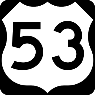
U.S. Route 53, or U.S. Highway 53 (U.S. 53), is a north–south U.S. highway that runs for 404 miles (650 km) from La Crosse, Wisconsin to International Falls, Minnesota. It is the primary north–south route in northwestern Wisconsin, serving as a vital link between I-94 at Eau Claire, Wisconsin and the Twin Ports of Superior, Wisconsin, and Duluth, Minnesota. The entire route from Eau Claire to the city limits of Superior is a four lane divided highway. The highway's northern terminus is at the Fort Frances–International Falls International Bridge in International Falls, Minnesota, at the Canada–US border. Its southern terminus is in La Crosse, Wisconsin, at U.S. Highway 14.

<span class="mw-page-title-main">Concurrency (road)</span> Road bearing more than one route number

A concurrency in a road network is an instance of one physical roadway bearing two or more different route numbers. When two roadways share the same right-of-way, it is sometimes called a common section or commons. Other terminology for a concurrency includes overlap, coincidence, duplex, triplex, multiplex, dual routing or triple routing.

<span class="mw-page-title-main">Virginia State Route 31</span> State highway in eastern Virginia, US

State Route 31 is a primary state highway in the U.S. state of Virginia. The state highway runs 24.56 miles (39.53 km) from U.S. Route 460 in Wakefield north to SR 5 and SR 199 in Williamsburg. SR 31 is the primary north–south highway of Surry County, where the highway serves the towns of Surry and Dendron. The state highway also connects Williamsburg with Jamestown. The sections of SR 31 on either side of the James River are connected by the Jamestown Ferry.

<span class="mw-page-title-main">State highways in Virginia</span> Highway system in Virginia, United States

The state highway system of the U.S. state of Virginia is a network of roads maintained by the Virginia Department of Transportation (VDOT). As of 2006, the VDOT maintains 57,867 miles (93,128 km) of state highways, making it the third-largest system in the United States.

The United States Bicycle Route System is the national cycling route network of the United States. It consists of interstate long-distance cycling routes that use multiple types of bicycling infrastructure, including off-road paths, bicycle lanes, and low-traffic roads. As with the complementary United States Numbered Highways system for motorists, each U.S. Bicycle Route is maintained by state and local governments. The USBRS is intended to eventually traverse the entire country, like the Dutch National Cycle Routes and the United Kingdom's National Cycle Network, yet at a scale similar to the EuroVelo network that spans Europe.

<span class="mw-page-title-main">North Carolina Highway System</span> Network of state-managed highways and roads

The North Carolina Highway System consists of a vast network of Interstate, United States, and state highways, managed by the North Carolina Department of Transportation. North Carolina has the second largest state maintained highway network in the United States because all roads in North Carolina are maintained by either municipalities or the state. Since counties do not maintain roads, there is no such thing as a "county road" within the state.

<span class="mw-page-title-main">Special route</span> Type of United States road

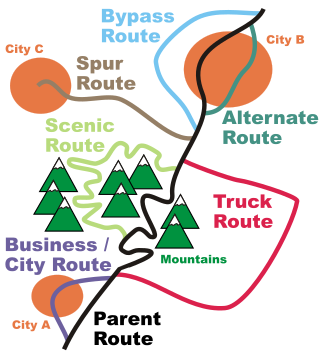
In road transportation in the United States, a special route is a road in a numbered highway system that diverts a specific segment of related traffic away from another road. They are featured in many highway systems; most are found in the Interstate Highway System, U.S. highway system, and several state highway systems. Each type of special route possesses generally defined characteristics and has a defined relationship with its parent route. Typically, special routes share a route number with a dominant route, often referred as the "parent" or "mainline", and are given either a descriptor which may be used either before or after the route name, such as Alternate or Business, or a letter suffix that is attached to the route number. For example, an alternate route of U.S. Route 1 may be called "Alternate U.S. Route 1", "U.S. Route 1 Alternate", or "U.S. Route 1A". Occasionally, a special route will have both a descriptor and a suffix, such as U.S. Route 1A Business.

<span class="mw-page-title-main">State highways in Washington</span> A collection of roadways in the U.S. state of Washington

The State Highways of Washington in the U.S. state of Washington comprise a network of over 7,000 miles (11,270 km) of state highways, including all Interstate and U.S. Highways that pass through the state, maintained by the Washington State Department of Transportation (WSDOT). The system spans 8.5% of the state's public road mileage, but carries over half of the traffic. All other public roads in the state are either inside incorporated places or are maintained by the county. The state highway symbol is a white silhouette of George Washington's head.

<span class="mw-page-title-main">Iowa Primary Highway System</span>

The primary highway system makes up over 9,000 miles (14,000 km), approximately 8 percent of the U.S. state of Iowa's public road system. The Iowa Department of Transportation is responsible for the day-to-day maintenance of the primary highway system, which consists of Interstate Highways, United States Highways, and Iowa state highways. Currently, the longest primary highway is U.S. Highway 30 at 332 miles (534 km). The shortest highway is Interstate 129 at 0.27 miles (430 m).

<span class="mw-page-title-main">Interstate 87 (North Carolina)</span> Interstate Highway in Wake County, North Carolina, United States

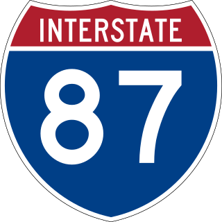
Interstate 87 (I-87) is a partially completed Interstate Highway in the US state of North Carolina, the shortest designated primary Interstate Highway at 12.90 miles (20.76 km). The completed portion is in eastern Wake County, between Raleigh and Wendell; the majority of the completed route is known as the Knightdale Bypass, while the remaining three miles (4.8 km) follows the Raleigh Beltline (I-440). It is planned to continue northeast through Rocky Mount, Williamston, and Elizabeth City, ending in Norfolk, Virginia. It is signed as north–south, in keeping with the sign convention for most odd-numbered interstates, but the route goes primarily east–west, with the eastern direction aligning to the north designation. The entire route is concurrent with US Highway 64 (US 64), with portions also concurrent with I-440 and US 264.

<span class="mw-page-title-main">Delaware State Route System</span> Overview of the State Route System of Delaware

The Delaware State Route System consists of roads in the U.S. state of Delaware that are maintained by the Delaware Department of Transportation (DelDOT). The system includes the portions of the Interstate Highway System and United States Numbered Highways system located in the state along with state routes and other roads maintained by DelDOT. All roads maintained by the state are assigned a maintenance road number that is only marked on little white markers at intersections and on auxiliary plates below warning signs approaching intersections. These numbers are only unique in a specific county; some roads can be designated with multiple road numbers, and numbers do not necessarily correspond to the signed Interstate, U.S., or state route numbers. DelDOT maintains a total of 5,386.14 miles (8,668.15 km) of roads, comprising 89 percent of the roads within the state. Some large bridges in the state are maintained by other agencies including the U.S. Army Corps of Engineers and the Delaware River and Bay Authority. Roads in the system include multilane freeways, multilane surface divided highways, and two-lane undivided roads serving urban, suburban, and rural areas. Some of the roads maintained by DelDOT are toll roads, in which motorists must pay to use.

References