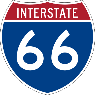
Virginia State Route 28

Last updated

Virginia 28.svg

State Route 28

VA SR 28 map.svg
Route information
Maintained by VDOT
Length49 mi [1] [ unreliable source ] (79 km)
Existed1918–present
Major junctions
South endUS 15.svgUS 29.svgCircle sign 657.svg US 15  / US 29  / SR 657 near Remington
Major intersections
North endVirginia 7.svg SR 7 near Sterling
Location
Country United States
State Virginia
Counties Fauquier, Prince William, City of Manassas, City of Manassas Park, Fairfax, Loudoun
Highway system
Virginia 27.svg SR 27 US 29.svg US 29

State Route 28 (SR 28) in the U.S. state of Virginia is a primary state highway that traverses the counties of Loudoun, Fairfax, Prince William, and Fauquier in the U.S. state of Virginia. The route serves as a major artery in the Northern Virginia region, with it being an important two-lane highway in rural Fauquier and Prince William Counties, the main thoroughfare through Manassas and Manassas Park, and a high-capacity freeway through Fairfax and Loudoun Counties.

Contents

Route description

From SR 28's southern terminus to Nokesville, it is a two-lane rural highway, called Catlett Road through Fauquier County and Nokesville Road in Prince William County where it becomes a 4-lane divided highway up to Manassas. Through downtown Manassas, the route follows one-way streets, with VA 28 westbound following Church Street and eastbound following Center Street and Zebedee Street. From thereon to Centreville in Fairfax County, the road is called Centreville Road. Between Fairfax and Loudoun Counties up to its northern terminus, VA 28 is a six-lane freeway called Sully Road.

Fauquier County

SR 28 northbound in Bealeton 2015-11-20 15 33 26 View north along Virginia State Route 28 (Catlett Road) between Craig Run and Whipkey Drive in Bealeton, Fauquier County, Virginia.jpg
SR 28 northbound in Bealeton

Route 28 starts as Catlett Road at busy US 29/US 15 in Fauquier County just north of Culpeper County, and intersects US 17 about 3 miles (4.8 km) from its beginning. It is two lanes throughout rural Fauquier County with a speed limit of 45 miles per hour (72 km/h) and passes by farms and agricultural areas. Most of the way through Fauquier County Route 28 runs parallel to Norfolk Southern railroad tracks in order to serve the towns that are placed along them. Several historical markers can be seen along Route 28 as it passes through Fauquier including Supreme Court Justice John Marshall's birthplace and the raid on Catlett Station. For many years the old bridge for Route 28 could be seen just outside Catlett. Historically, the Catlett Fire Department Parade would close Route 28 for several hours each spring, however, this practice was discontinued as traffic became heavier in the 1990s.

Prince William County

Upon entering Prince William County at Nokesville, SR 28 changes its name to Nokesville Road. At Nokesville, it expands from two to four lanes before reaching SR 215. Further north, it reaches its first grade-separated interchange at SR 234/Prince William Parkway, south of the City of Manassas.

The next interchange is at Wellington Road in Manassas, mostly to grade-separate the crossing of SR 28 with nearby railroad tracks. This interchange was built as an $18.3 million project and certified under the American Recovery and Reinvestment Act of 2009 on October 5, 2009. The contract for construction of this interchange was awarded on July 14, 2010. [2]

SR 28 is a main thoroughfare through Manassas, and separates into a one-way pair of Church and Center Streets in front of a Confederate cemetery. The split routes run through the center of the city and rejoin several blocks later, merging into Centreville Road. The road passes briefly through Manassas Park and then passes through Yorkshire as SR 28 leaves Prince William County where crossing Bull Run into Centreville, Fairfax County.

Fairfax County

VA 28/Centreville Road enters Fairfax County at Centreville, at which point it transitions from an undivided to a divided highway. It starts as a suburban arterial with only at-grade intersections, widening to six lanes at an intersection with Machen Road on the south side of Centreville. In the middle of Centreville, VA 28 transitions into Sully Road and becomes a fully controlled-access freeway, where it crosses U.S. Route 29 at a partial cloverleaf interchange and Interstate 66 at a system interchange with flyovers. Up until 2020, the section of VA 28 between Centreville and Chantilly had signalized intersections at I 66, Braddock Road (SR 620), and Ellanor C. Lawrence Park and was only built to expressway standards. The intersections of since been replaced by overpasses and flyovers as part of the Transform 66 project, which included several improvements to the I 66 corridor through the late 2010s and early 2020s.

View south along SR 28 from Air and Space Museum Parkway on the border of Oak Hill and Chantilly 2022-05-22 10 14 51 View south along Virginia State Route 28 (Sully Road) from Air and Space Museum Parkway along the border of Chantilly and Oak Hill in Fairfax County, Virginia.jpg
View south along SR 28 from Air and Space Museum Parkway on the border of Oak Hill and Chantilly

After a cloverleaf interchange with Westfields Boulevard (SR 662), Route 28 enters Chantilly. The highway travels through a single-point urban interchange with Willard Road and continues through Chantilly. Route 28 then enters Oak Hill and heads north along the eastern edge of the Washington Dulles International Airport. The next interchanges are for US 50 in Chantilly, the Steven F. Udvar-Hazy Center (an annex of the National Air and Space Museum), McLearen Road, and Frying Pan Road on the south end of Herndon. The road then exits into Loudoun County.

Loudoun County

SR 28 southbound at the Innovation Avenue exit in Dulles 2017-10-12 12 48 52 View south along Virginia State Route 28 (Sully Road) at the exit for Innovation Avenue in Dulles, Loudoun County, Virginia.jpg
SR 28 southbound at the Innovation Avenue exit in Dulles

The first interchange in Loudoun County is at the entrance to Dulles Airport, with access to the airport itself, to the Dulles Toll/Access Road (State Route 267) and Dulles Greenway, and to Innovation Avenue (State Route 209). Continuing north through Loudoun County, Route 28 has interchanges with Old Ox Road and Sterling Boulevard, the former also servicing Herndon. The next interchange is an elaborate interchange with Route 625, Waxpool Road and Church Road, which lead into Ashburn and Sterling, respectively. This interchange features two exits for Waxpool Road from the northbound lanes of Route 28: a left flyover and right loop ramp.

Heading north, Route 28 passes through the industrial and commercial areas of Dulles. It is still known as Sully Road through this stretch, although within Loudoun County it is co-designated as Darrell Green Boulevard, after the former Washington Commanders Hall of Famer (the team's official headquarters is in Ashburn), whose uniform number was 28. [3] A northbound-only, exit-only ramp at Warp Drive is followed by a partial cloverleaf serving Gloucester Parkway and Nokes Boulevard. This interchange leads to both Ashburn and the Dulles Town Center shopping mall. Route 28 ends at VA 7 in Sterling in a complete directional T interchange.

History

SR 28 is one of two routes to survive from the 1918 inception of Virginia's state route system without being completely decommissioned or renumbered, the other being SR 10. However, due to extensions, truncations, and partial renumberings, the current SR 28 contains no portion of the earliest routing, which ran near present-day U.S. 29 from Lovingston in Nelson County to Charlottesville. [1]

Improvement project

In 1987, Virginia authorized the creation of special tax districts. Fairfax and Loudoun Counties quickly formed the first transportation improvement district in the Commonwealth, by imposing a 20 cent per $100 real estate surcharge on commercial and industrial property located near Route 28. The surcharge financed bonds to pay for improvements to Route 28. From 1988 to 1991, 14 miles (23 km) of Route 28 were widened from two lanes to six lanes and interchanges were built at US 50, VA 7 and VA 267. [4]

SR 28 southbound at the US 50 interchange in Chantilly 2017-10-12 11 13 51 View south along Virginia State Route 28 (Sully Road) at the exit for U.S. Route 50 (Winchester, Fairfax) in Chantilly, Fairfax County, Virginia.jpg
SR 28 southbound at the US 50 interchange in Chantilly

The completion schedule for each funded interchange and roadway is as follows:

  • SR 625 Interchange (Waxpool/Church Roads), Flyover Bridge & Waxpool Road widening – Completed Fall 2005
  • Church Road Widening and W&OD Trail Bridge – Completed Fall 2006

VA 28 was widened to four lanes southbound between Waxpool Road and Innovation Avenue in January 2017, and northbound between McLearen Road and VA 267 in June 2017. [9] For a decade there have also been proposals to extend Route 28 to north to connect it with Interstate 370 in Gaithersburg, Maryland over a Techway Bridge across the Potomac River. [10] The Loudoun County Board of Supervisors most recently endorsed the bridge at a summer 2017 transportation summit, although Montgomery County, Maryland remains adamantly opposed to the project. [11]

Major intersections

All exits are unnumbered.

CountyLocationmi [12] kmDestinationsNotes
Fauquier Remington 0.000.00US 15.svgUS 29.svgCircle sign 657.svg US 15  / US 29 (James Madison Highway) / SR 657 (Kings Hill Road) Culpeper, Warrenton Southern terminus
Bealeton 2.303.70US 17.svg US 17 (Marsh Road) Warrenton, Fredericksburg
Prince William Bristow 18.8430.32West plate.svg
Virginia 215.svg
SR 215 west (Vint Hill Road)
18.9630.51Circle sign 619.svg SR 619 (Linton Hall Road) Gainesville, Bristow, Independent Hill
City of Manassas 20.3632.77Virginia 234.svgTo plate blue.svg
I-66.svg
SR 234 to I-66  Dumfries
Partial cloverleaf interchange with flyover ramps
23.2337.39Business plate.svg
Virginia 234.svg
SR 234 Bus. (Grant Avenue)
City of Manassas Park 24.8940.06Virginia 213.svg SR 213 (Manassas Drive)
Fairfax Centreville 29.6547.72South end of freeway section
US 29.svgTo plate blue.svg
West plate blue.svg
I-66.svg
US 29 to I-66 west Fairfax, Gainesville, Front Royal
Partial cloverleaf interchange
30.1948.59I-66.svg I-66  Front Royal, Washington I-66 exit 53; no direct access from SR 28 north to I-66 west or I-66 east to SR 28 south
30.5049.08Braddock Road/Walney RoadNorthbound exit and southbound entrance
Chantilly 32.2651.92Circle sign 662.svg SR 662 (Westfields Boulevard)
33.2653.53Willard Road (SR 6215/SR 8407)Single-point urban interchange
34.1454.94US 50.svg US 50 (Lee Jackson Memorial Highway) Fairfax, Winchester Cloverleaf interchange
35.4757.08Circle sign 7833.svg SR 7833 (Air and Space Museum Parkway) Sully Historic Site, Steven F. Udvar-Hazy Center Cloverleaf interchange
Herndon 36.5358.79Circle sign 668.svg SR 668 (McLearen Road)Trumpet interchange
37.7560.75Circle sign 608.svg SR 608 (Frying Pan Road)Trumpet interchange
Loudoun Sterling 38.9862.73East plate.svg
Toll plate yellow.svg
Virginia 267.svg
SR 267 Toll east / Dulles Toll Road Washington
SR 267 exit 9
West plate.svg
Toll plate yellow.svg
Virginia 267.svg
SR 267 Toll west Leesburg
SR 267 exit 9A; northbound left exit and southbound entrance
39.4863.54Virginia 209.svg SR 209 (Innovation Avenue)Trumpet interchange
39.9864.34Circle sign 606.svgTo plate.svg
West plate.svg
US 50.svg
SR 606 (Old Ox Road) to US 50 west Herndon
Cloverleaf interchange
40.6065.34Circle sign 846.svg SR 846 (Sterling Boulevard)Partial cloverleaf interchange
41.7367.16Circle sign 625.svg SR 625 (Waxpool Road / Church Road) Ashburn, Sterling, Pacific Boulevard south
42.3168.09 Warp Drive Northbound exit only
43.9170.67Circle sign 1793.svg SR 1793 (Nokes Boulevard / Gloucester Parkway) Ashburn, Dulles Town Center Cloverleaf interchange
44.8972.24Circle sign 1582.svg SR 1582 (Algonkian Parkway)Southbound entrance only
West plate.svg
Virginia 7.svg
Hospital sign.svg SR 7 west (Harry Byrd Highway) Leesburg, Winchester, Inova Health System Loudoun Hospital
Northern terminus
East plate.svg
Virginia 7.svg
SR 7 east (Harry Byrd Highway) Tysons Corner, Falls Church
1.000 mi = 1.609 km; 1.000 km = 0.621 mi

Related Research Articles

<span class="mw-page-title-main">Interstate 66</span> Interstate in Virginia and DC

Interstate 66 (I-66) is an east–west Interstate Highway in the eastern United States. The highway runs from an interchange with I-81 near Middletown, Virginia, on its western end to an interchange with U.S. Route 29 (US 29) in Washington, D.C., at the eastern terminus. Much of the route parallels US 29 or State Route 55 (SR 55) in Virginia. I-66 has no physical or historical connection to the famous US 66, which was located in a different region of the United States.

<span class="mw-page-title-main">Centreville, Virginia</span> Census-designated Place in Virginia, United States

Centreville is a census-designated place (CDP) in Fairfax County, Virginia, United States and a suburb of Washington, D.C. The population was 73,518 as of the 2020 census. Centreville is approximately 20 miles (32 km) west of Washington, D.C.

<span class="mw-page-title-main">Virginia State Route 620 (Fairfax and Loudoun Counties)</span> Highway in Virginia

State Route 620 in Fairfax and Loudoun Counties, Virginia is a secondary state highway. The entire length of SR 620 is also known as Braddock Road. SR 620 also has a short concurrency with SR 659 / Union Mill Road in Centreville.

<span class="mw-page-title-main">Virginia State Route 7</span>

Virginia State Route 7 (VA 7) is a major primary state highway and busy commuter route in northern Virginia, United States. It travels southeast from downtown Winchester to SR 400 in downtown Alexandria. Its route largely parallels those of the Washington & Old Dominion Trail and the Potomac River. Between its western terminus and Interstate 395 (I-395), SR 7 is part of the National Highway System. In 1968, the Virginia State Highway Commission designated the road as the "Harry Flood Byrd Highway" between Alexandria and Winchester to commemorate Harry F. Byrd Sr. (1887–1966).

<span class="mw-page-title-main">Virginia State Route 236</span>

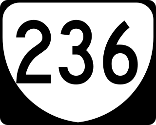
State Route 236 is a primary state highway in the U.S. state of Virginia. The state highway runs 15.63 miles (25.15 km) from U.S. Route 29 and US 50 in Fairfax east to SR 400 in Alexandria. SR 236 is a major suburban arterial highway that connects the independent cities of Fairfax and Alexandria via Annandale in Fairfax County. The state highway is known as Main Street in City of Fairfax, Little River Turnpike in Fairfax County, where the highway meets Interstate 495 (I-495), and Duke Street in Alexandria, where the road has junctions with I-395 and US 1.
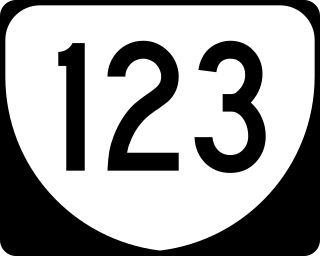
<span class="mw-page-title-main">Fairfax County Parkway</span> Primary state highway in Fairfax County, Virginia

The Fairfax County Parkway, numbered State Route 286, is a primary state highway in the U.S. state of Virginia, acting as an arterial route in Fairfax County with a mix of interchanges and signalized and unsignalized intersections. Its alignment runs from southeast to northwest and roughly corresponds to part of the once-proposed Outer Beltway around Washington, D.C. The first segment of the roadway opened in 1987; the road was completed in 2010.

<span class="mw-page-title-main">Virginia State Route 123</span> State highway in Virginia, United States

State Route 123 is a primary state highway in the U.S. state of Virginia. The state highway runs 29.27 miles (47.11 km) from U.S. Route 1 in Woodbridge north to the Chain Bridge across the Potomac River into Washington from Arlington. It goes by four local names. From its southern terminus to the Occoquan River Bridge, it is known as Gordon Boulevard. From the Occoquan River Bridge to the city of Fairfax it is known as Ox Road. From Fairfax until it enters the Town of Vienna, it is known as Chain Bridge Road. Then, as it passes through the Town of Vienna, it is known as Maple Avenue. After leaving the Town of Vienna, the name reverts to Chain Bridge Road, and continues this way until the intersection with I-495 in Tysons. Between Tysons and the George Washington Memorial Parkway, it is known as Dolley Madison Boulevard. After crossing over the George Washington Memorial Parkway, the name once again reverts to Chain Bridge Road and continues this way until the end of the road, at Chain Bridge. SR 123 is a partial circumferential highway in Northern Virginia that connects Woodbridge in eastern Prince William County with the independent city of Fairfax and the Fairfax County communities of Vienna, Tysons, and McLean, the last being the home of the National Counterterrorism Center and the Central Intelligence Agency. The state highway also connects all of the major highways that radiate from Washington, including Interstate 95 (I-95), I-66, US 29, US 50, SR 267, and the George Washington Memorial Parkway. Furthermore, SR 123 crosses another pair of circumferential highways, I-495 and the Fairfax County Parkway, and SR 7, a major northwest–southeast highway through Northern Virginia. The state highway is a part of the National Highway System for its entire length.

<span class="mw-page-title-main">U.S. Route 50 in Virginia</span>

U.S. Route 50 is a transcontinental highway which stretches from Ocean City, Maryland to West Sacramento, California. In the U.S. state of Virginia, US 50 extends 86 miles (138 km) from the border with Washington, D.C. at a Potomac River crossing at Rosslyn in Arlington County to the West Virginia state line near Gore in Frederick County.

<span class="mw-page-title-main">U.S. Route 29 in Virginia</span> Highway in Virginia

U.S. Route 29 is a major north–south route in the Commonwealth of Virginia. It covers 248 miles (399 km) from the North Carolina border at the city of Danville to the Key Bridge in Washington, D.C. US 29 roughly bisects Virginia into eastern and western halves, and along with I-81 and US 11 in western Virginia, and I-85/95 as well as US 1 farther east, provides one of the major north–south routes through the Commonwealth.

<span class="mw-page-title-main">Virginia State Route 228</span>

State Route 228 is a primary state highway in the U.S. state of Virginia. The state highway runs 4.53 miles (7.29 km) from SR 657 at the southern town limit of Herndon north to SR 7 near Dranesville. SR 228 is the main north–south highway through Herndon, connecting the town directly with SR 7 and indirectly with SR 267 in northwestern Fairfax County.

<span class="mw-page-title-main">Virginia State Route 234</span>

Virginia State Route 234 is a primary state highway in the U.S. state of Virginia. It runs from U.S. Route 1 near Dumfries via Independent Hill as Dumfries Road, a bypass of Manassas as Prince William Parkway, has a brief concurrency with Interstate 66 for 2.27 miles (3.65 km) between exits 44 and 47, and Catharpin to U.S. Route 15 near Woolsey as Sudley Road.

<span class="mw-page-title-main">Virginia State Route 645 (Fairfax County)</span>

State Route 645 in Fairfax County, Virginia is a secondary state highway. There are six portions, three of them being major, named Wall Road, Lees Corner Road, Stringfellow Road, Clifton Road, Main Street and Burke Lake Road. There are also numerous overlaps : some include SR 657 / Centreville Road, U.S. Route 50, SR 652, SR 612, and SR 641. A concurrency used to exist at US 29 near Centreville until the 1990s.

<span class="mw-page-title-main">Virginia State Route 609 (Fairfax County)</span>

State Route 609 in Fairfax County, Virginia is a secondary state highway which traverses western portion of the county. The road is also known as Pleasant Valley Road.

The Loudoun County Parkway is a secondary state highway in eastern Loudoun County, Virginia. The southern portion is signed as State Route 606 from Braddock Road north to Old Ox Road, with the remainder signed as State Route 607.

<span class="mw-page-title-main">Virginia State Route 608 (Fairfax County)</span>

State Route 608 in Fairfax County, Virginia is a secondary state highway which traverses the western portion of the county. Before the Fairfax County Parkway from US 29 to Reston was complete, SR 608 was the main north–south road in western Fairfax County.

<span class="mw-page-title-main">Virginia State Route 606 (Fairfax and Loudoun Counties)</span>

State Route 606 in Fairfax and Loudoun Counties, Virginia is a secondary state highway traversing the communities of Reston, Herndon, Sterling, Arcola, and South Riding. The road is important not only because it is an inter-county connector, but it goes around the back of Dulles Airport, is part of the Loudoun County Parkway, and it provides a shortcut between the Reston / Herndon area and U.S. Route 50. Although the Herndon streets are not technically part of SR 606, they are signed as SR 606, and they connect to streets that are part of SR 606, thus providing a continuous route.

<span class="mw-page-title-main">Wellington Road (Manassas, Virginia)</span>

Wellington Road in Manassas forms part of a major connector between eastern Prince William County and Gainesville. The main connecting route between these two communities is the Prince William Parkway with Interstate 66; however, Wellington Road provides a well-traveled backup route.

<span class="mw-page-title-main">Virginia State Route 662 (Fairfax County)</span>

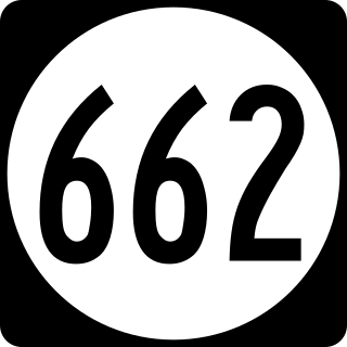
State Route 662 is a secondary state highway in the U.S. state of Virginia, and traverses western Fairfax County.

<span class="mw-page-title-main">Virginia State Route 657 (Fairfax County)</span>

State Route 657 in Fairfax County, Virginia is a secondary state highway which traverses the western portion of the county. It runs 8.4 miles from SR 28 near the boundary between Centreville and Chantilly to SR 228 at the town limits of Herndon.

<span class="mw-page-title-main">Virginia State Route 605 (Fauquier and Prince William Counties)</span> Highway in Virginia

State Route 605 in Fauquier and Prince William Counties, Virginia, United States is a 12.54 mi (20.18 km) secondary state highway from north of Warrenton near Bethel to southeast of Nokesville. From U.S. 15/U.S. 29 to its eastern terminus at VA 28, SR 605 serves as major artery serving traffic travelling between Warrenton and Nokesville, Manassas, and Dumfries. The entire route is two-lane and is located in rural or semi-rural areas, passing through farmland, woodland, and rural communities.

References

  1. 1 2 "VA 28". Archived from the original on June 1, 2012. Retrieved March 31, 2012.
  2. "ARRA Project Tracking Sheet" (PDF). p. 11. Archived (PDF) from the original on May 16, 2012. Retrieved March 7, 2012.
  3. "SB 1004 Darrell Green Boulevard". Legislative Information System. Virginia General Assembly. March 24, 2003. Archived from the original on April 3, 2012. Retrieved March 7, 2012.
  4. "Project Overview". Route 28 Public/Private Partnership. Archived from the original on March 28, 2012. Retrieved March 7, 2012.
  5. "Braddock/ Walney and Route 28 Intersection". Route 28 Public/Private Partnership. Archived from the original on February 5, 2012. Retrieved March 7, 2012.
  6. "Innovation Avenue Phases 2 and 3". Route 28 Public/Private Partnership. Archived from the original on January 14, 2016. Retrieved January 10, 2016.
  7. "Final Section of Atlantic Boulevard Open to Traffic Dec. 14". Virginia Department of Transportation. December 14, 2011. Archived from the original on April 24, 2018. Retrieved April 24, 2018.
  8. "I-66 Outside the Beltway Construction Overview". Archived from the original on 2018-04-25. Retrieved 2018-04-24.
  9. "Route 28 Spot Widening". VDOT. Archived from the original on 2018-04-24. Retrieved 2018-04-24.
  10. "Three Men and a Bridge". Connection Newspapers. Ellington. 10 October 2005. Archived from the original on 20 February 2023. Retrieved 20 February 2023.
  11. Kashiwagi, Sydney (12 July 2017). "New bridge crossing from Loudoun to Maryland? No thanks, say Maryland leaders". LoudounTimes.com. Archived from the original on 13 May 2019. Retrieved 24 April 2018.
  12. Traffic Engineering Division (2016). "2016 Traffic Data". Virginia Department of Transportation. Archived from the original on June 18, 2017. Retrieved June 21, 2017.
Template:Attached KML/Virginia State Route 28
KML is from Wikidata
<  SR 27 Two‑digit State Routes
1923-1933
SR 29  >