Related Research Articles
Oregon Geographic Names is a compilation of the origin and meaning of place names in the U.S. state of Oregon, published by the Oregon Historical Society. The book was originally published in 1928. It was compiled and edited by Lewis A. McArthur. As of 2011, the book is in its seventh edition, which was compiled and edited by Lewis L. McArthur.

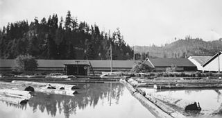
The Coos River flows for about 5 miles (8.0 km) into Coos Bay along the Pacific coast of southwest Oregon in the United States. Formed by the confluence of its major tributaries, the South Fork Coos River and the Millicoma River, it drains an important timber-producing region of the Southern Oregon Coast Range. The course of the main stem and the major tributaries is generally westward from the coastal forests to the eastern end of Coos Bay near the city of Coos Bay.

Charleston is an unincorporated community in Coos County, Oregon, United States. Charleston is the least populated community in Oregon's Bay Area and is Home to a large commercial fishing fleet, it is adjacent to the ocean entrance to Coos Bay. Charleston is the site of the Oregon Institute of Marine Biology and the United States Coast Guard Charleston Lifeboat Station.
Antone is a former community in Wheeler County, in the U.S. state of Oregon. Antone is south of U.S. Route 26 between Mitchell and Dayville.

Cape Arago State Park is a state park in the U.S. state of Oregon, administered by the Oregon Parks and Recreation Department. Cape Arago is north of Bandon and 15 miles southwest of Coos Bay on Cape Arago Highway in Coos County.
Norway is an unincorporated community in Coos County, Oregon, United States, located between Coquille and Myrtle Point on Oregon Route 42, near the Coquille River.

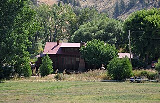
Lookingglass is an unincorporated community and census-designated place in the Lookingglass Valley of Douglas County, Oregon, United States, about 9 miles (14 km) southwest of Roseburg. As of the 2010 census it had a population of 855. Lookingglass is considered a suburb of Roseburg.
Libby, previously known as Easport, is an unincorporated community on Coalbank Slough in Coos County, Oregon, United States. It was named for a Native American woman. Its post office was established on June 11, 1890, and operated for just two years. Enoch Gore was postmaster.

Hauser is an unincorporated community in Coos County, Oregon, United States. It is along U.S. Route 101, 7 miles (11 km) south of Lakeside and 6 miles (10 km) north of North Bend. Hauser is on the edge of the Oregon Dunes National Recreation Area near North Slough, a tributary of Coos Bay once known as the North Inlet of Coos Bay. It is a station on the Central Oregon and Pacific Railroad.
Tiernan is an unincorporated community in Lane County, Oregon, United States. It is about five miles west of Mapleton on Oregon Route 126 near the Siuslaw River and within the Siuslaw National Forest.
Gaylord is an unincorporated community in Coos County, Oregon, United States. It is about 12 miles (19 km) south of Myrtle Point on Oregon Route 542, near the South Fork Coquille River.
Sumner is an unincorporated community in Coos County, Oregon, United States. It is about 10 miles (16 km) southeast of Coos Bay on the route of the old Coos Bay Wagon Road.

Sitkum is an unincorporated community in Coos County, Oregon, United States. It is about 27 miles north of Remote in the Southern Oregon Coast Range near the East Fork Coquille River. Sitkum is served by the Myrtle Point post office.
Dora is an unincorporated community in Coos County, Oregon, United States. It is about 19 miles (31 km) east of Coquille near the East Fork Coquille River on the former route of the Coos Bay Wagon Road. It is in the Southern Oregon Coast Range.
Cooston is an unincorporated community in Coos County, Oregon, United States. It is located on the east shore of Coos Bay across from North Bend, about eight miles from the city of Coos Bay.

The Millicoma River is a coast stream, about 8.5 miles (13.7 km) long, east of Coos Bay in the U.S. state of Oregon. Formed by the confluence of the East Fork Millicoma River and the West Fork Millicoma River at Allegany, it meanders across relatively flat land to meet the South Fork Coos River, with which it forms the Coos River.
The South Fork Coos River is a tributary, about 32 miles (51 km) long, of the Coos River in the U.S. state of Oregon. Formed by the confluence of the Williams River and Tioga Creek, it begins in eastern Coos County near the Douglas County line and flows generally northwest through the Southern Oregon Coast Range. East of the city of Coos Bay, it joins the Millicoma River to form the Coos River. This larger river, only about 5 miles (8 km) long, empties into the eastern end of Coos Bay, which connects to the Pacific Ocean.
Dellwood is an unincorporated community in Coos County, Oregon, United States. It is about 12 miles (19 km) east of Coos Bay, east of Oregon Route 241 on the South Fork Coos River.
Vaughn is an unincorporated community in Lane County, Oregon, United States. It is located about 4 miles (6.4 km) south of Noti in the foothills of the Central Oregon Coast Range near Noti Creek. Author Ralph Friedman described Vaughn as "a mill in the meadows".
Camp Castaway was a military encampment at what is now Coos Bay, Oregon, United States. It was established by the survivors of the wreck of the Captain Lincoln, a U.S. transport schooner, on January 3, 1852. The ship began taking on water during a storm while en route from San Francisco to Fort Orford at the town of Port Orford. To avoid sinking, the captain decided to beach the ship north of Cape Arago. All of the roughly 30 troops on board, and the ship's crew, survived the wreck and most of the cargo was salvaged. At the time no U.S. settlement was present at Coos Bay, so commanding officer Lt. Henry Stanton decided to establish the camp to protect the cargo until it could be transported to Fort Orford, some 50 miles south on the Oregon Coast. The troops and crew used spars, booms and sail cloth from the schooner to build tent structures for housing and for protecting the cargo from winter rains and blowing sand. They named the temporary post Camp Castaway. The camp endured for four months in the open dunes with help from Native Americans of the Coos tribe who traded fresh foods to the soldiers for silverware, biscuits and other nonlocal goods.
References
- ↑ Guyer, R.J. (October 3, 2012). "Past echoes on Coos Bay Wagon Road". The News-Review . Retrieved February 23, 2012.
- ↑ McArthur, Lewis A.; McArthur, Lewis L. (2003) [1928]. Oregon Geographic Names (7th ed.). Portland, Oregon: Oregon Historical Society Press. p. 314. ISBN 978-0875952772.
- ↑ Oregon Atlas & Gazetteer (7th ed.). Yarmouth, Maine: DeLorme. 2008. pp. 52–53. ISBN 0-89933-347-8.