
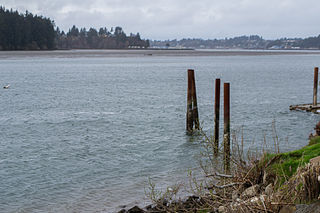
Eola is an unincorporated community in Polk County, Oregon, United States four miles west of Salem on Oregon Route 22 at the confluence of Rickreall Creek and the Willamette River.

The Calapooia River is an 80-mile (130 km) tributary of the Willamette River in the U.S. state of Oregon.
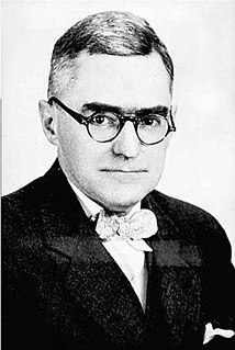
Lewis Ankeny McArthur, known as "Tam" McArthur, was an executive for Pacific Power and Light Company. He was also the secretary for the Oregon Geographic Board for many years and the author of Oregon Geographic Names. His book, now in its seventh edition, is a comprehensive source of information on the origins and history of Oregon place names. It is a standard reference book in libraries throughout Oregon and the Pacific Northwest. Tam McArthur Rim in the Cascade Mountains is named in his honor.
Buena Vista is an unincorporated community in Polk County, Oregon, United States. It is located on the Willamette River, and is the western landing for the Buena Vista Ferry. It is approximately 6 miles (9.7 km) south-southeast of Independence.

Chitwood is an unincorporated community in Lincoln County, Oregon, United States. Chitwood lies on U.S. Route 20 between Toledo to the west and Eddyville to the east. The Yaquina River flows through Chitwood.
Eddyville is an unincorporated community in Lincoln County, in the U.S. state of Oregon. Eddyville's unofficial estimated population as of 2014 was about 400 to 500.
Antone is a former community in Wheeler County, in the U.S. state of Oregon. Antone is south of U.S. Route 26 between Mitchell and Dayville.

McEwen is an unincorporated community in Baker County, Oregon, United States. McEwen lies on Oregon Route 7 east of its interchange with Oregon Route 410. McEwen is about 6 miles (10 km) southeast of Sumpter along the Powder River.

New Princeton is an unincorporated community in Harney County, in the U.S. state of Oregon. It is along Oregon Route 78 between Burns and Burns Junction at an elevation of 4,111 feet (1,253 m) above sea level. The South Fork Malheur River begins near Round Mountain, southeast of New Princeton.
Goldson is an unincorporated community in Lane County, Oregon, United States on Oregon Route 36 near Bear Creek, about 3.5 miles (5.6 km) from Cheshire. Goldson post office was established in 1891 and named for the first postmaster, J. M. Goldson. It ran until 1934. The community's elevation is 404 feet (123 m).
Yaquina, at one time a thriving port called Yaquina City, is an unincorporated community in Lincoln County, in the U.S. state of Oregon. It is near the mouth of the Yaquina River, on the east side of Yaquina Bay, and is a 3-to-4-mile drive from Newport. The Oregon Press Association, which became the Oregon Newspaper Publishers Association, was founded in Yaquina City in 1887.
Owyhee is an unincorporated community in Malheur County, Oregon, in the United States. It lies along Oregon Route 201 between Adrian and Nyssa, near the confluence of the Owyhee and Snake rivers.

Lancaster is an unincorporated community in Lane County, Oregon, United States. It is located about two miles south of Harrisburg and two miles north of Junction City, on Oregon Route 99E near the Willamette River.
Linslaw is an unincorporated community in Lane County, Oregon, United States. It is located about eight miles west of Walton on Oregon Route 126 next to the Siuslaw River.
McLeod is an unincorporated community in Jackson County, Oregon, United States. It lies at the confluence of Big Butte Creek with the Rogue River just downstream of Lost Creek Lake. It is along Oregon Route 234 between Shady Cove and Prospect. The community was named after its 1910 settler William R. McLeod.
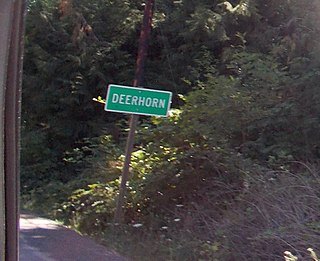
Deerhorn is an unincorporated community in Lane County, Oregon, United States. It is about 4 miles (6 km) west of Leaburg on Oregon Route 126 in the McKenzie River valley.
Flagg, Oregon, began as a railroad station on the Southern Pacific Line from Eugene to Coos Bay and later became an unincorporated community in Lane County, Oregon, United States, on Penn Road approximately 5 miles (8 km) west of Vaughn. Wildcat Creek, a tributary of the Siuslaw River, flows by Flagg.

French Pete Creek is a tributary of the South Fork McKenzie River in Lane County, in the U.S. state of Oregon. It flows generally west through the Three Sisters Wilderness to the south end of Cougar Reservoir, about 11 miles (18 km) from the larger river's confluence with the McKenzie River. The creek has two named tributaries—Olallie Creek and, further downstream, Pat Creek—both of which enter from the right.

Lincoln is an unincorporated community in Jackson County, Oregon, United States. It lies along Oregon Route 66 between Ashland and Klamath Falls in the Siskiyou Mountains near Pinehurst. It is within the boundaries of the Cascade–Siskiyou National Monument.


