North Bend, Oregon

Last updated

North Bend, Oregon
North Bend aerial.jpg
North Bend from above, looking toward the Pacific Ocean
Flag of North Bend, Oregon.gif
Coos County Oregon Incorporated and Unincorporated areas North Bend Highlighted.svg
Location in Oregon
Coordinates: 43°24′27″N124°14′11″W / 43.40750°N 124.23639°W / 43.40750; -124.23639
CountryUnited States
State Oregon
County Coos
Incorporated 1903
Government
  MayorJessica Engelke
Area
[1]
   City 5.09 sq mi (13.19 km2)
  Land3.93 sq mi (10.18 km2)
  Water1.16 sq mi (3.01 km2)
Elevation
[2]
13 ft (4 m)
Population
 (2020) [3]
   City 10,317
  Density2,623.86/sq mi (1,013.01/km2)
   Urban
31,995
Time zone UTC−8 (Pacific)
  Summer (DST) UTC−7 (Pacific)
ZIP code
97459
Area code 541
FIPS code 41-53000 [4] [5]
GNIS feature ID2411269 [2]
Website northbendoregon.us

North Bend is a city in Coos County, Oregon, United States with a population of 9,695 as of the 2010 census. [6] [7] North Bend is surrounded on three sides by Coos Bay, an S-shaped water inlet and estuary where the Coos River enters Coos Bay and borders the city of Coos Bay to the south. North Bend became an incorporated city in 1903. [7]

Contents

History

Before Europeans visited the Oregon coast, Native American tribes claimed the Coos Bay region as their homeland for thousands of years. [8] Members of the Coos, Lower Umpqua, Siuslaw and Coquille tribes lived, fished, hunted and gathered along Coos Bay and its estuaries, along rivers, and in meadows and forests. [8]

Saw mill and ship yard, North Bend, 1884 illustration Saw mill and ship yard, North Bend, Coos County, Oregon.jpg
Saw mill and ship yard, North Bend, 1884 illustration

Approximately 400 years ago, British and Spanish explorers first approached the South Coast. [8] In 1579, Sir Francis Drake is purported to have sought shelter for his ship, the Golden Hinde, around Cape Arago. [9] [10] Trader and explorer Jedediah Smith was in the region seeking furs and the Hudson's Bay Company sent Alexander Roderick McLeod to search for an inland passage. [8]

The 1852 stranding of the schooner Captain Lincoln on the North Spit and the survivors' encampment and rescue brought attention to gold prospectors who came to mine placer from area beaches. [8] In 1853, the Coos Bay Commercial Company arrived from the Rogue Valley and created routes for settlers. [8]

Thomas Symons founded Yarrow in 1863. Louis Simpson bought it in 1902. Simpson brought Yarrow and his father's sawmill site Old Town together in 1903 under the name North Bend. [11]

Empire City was established and was the county seat of government until 1896. [8] Entrepreneurs were drawn to the area's ample natural resources, and sawmills and shipyards at Old Town North Bend and Empire City spurred economic development and attracted workers. [8] Rivers and sloughs provided a means to transport people, forest, agricultural and coal products, and towns provided hubs for inland transportation. [8] Some of the early industries in the area included timber harvesting, shipbuilding, farming, coal mining and salmon canning. [8]

Prior to around 1915, the Coos region was largely isolated from the rest of Oregon due to difficulties in crossing the Coast Range and fording rivers. Instead, the Pacific Ocean was used to link people to other areas, including San Francisco. That was an easier two-day trip compared to traveling inland over rugged terrain. [8] In 1916, trains linked the region to other interior settlements and towns, increasing commercial trade and tourism [8]

Schooner K.V. Kruse, built in 1920 by Kruse and Banks in North Bend, Oregon StateLibQld 1 148659 K.V. Kruse (ship).jpg
Schooner K.V. Kruse, built in 1920 by Kruse and Banks in North Bend, Oregon

Significant urban growth occurred in the 1920s, and during the 1930s to 1950s, large-scale growth occurred. [8] Per the Oregon Bay Area Chamber of Commerce, during the 1930s to 1950s:

Shipyards contracted with the U.S. Government to build minesweepers and rescue tugs for World War II defense purposes. Large national lumber companies set up operations and expanded significantly for the next two decades. Jetty improvements, commercial fishing and crabbing shaped the development of Charleston. The completion of the North Bend Bridge (now Conde McCullough Memorial Bridge) in 1936 and the Roosevelt Highway significantly improved modern transportation connections and provided the final link in opening the Coos region to the outside world. The formerly remote district known as the Coos Bay country had come of age. [8]

During the interregnum of despair between Franklin Roosevelt's election and his inauguration, the only bank in North Bend, the First National, was forced to temporarily close its doors, precipitating a cash-flow crisis for the City of North Bend. The city solved this problem by minting currency using myrtlewood discs printed on a newspaper press. These coins, in denominations from 25 cents to $10, were used to make payroll and the city promised to redeem them for cash as soon as it became available. [12]

However, when the bank reopened and the city appealed for people to bring their myrtlewood money in to redeem it, many opted to keep their tokens as collector's items. After several appeals, the city gave up and announced that the tokens would remain legal tender in the city of North Bend in perpetuity. Until the 1960s, people occasionally did cash in their tokens, but the remaining pieces have become very valuable through scarcity and historical interest. Fewer than 10 full sets are believed to exist. [13]

Geography

According to the United States Census Bureau, the city has a total area of 5.09 square miles (13.18 km2), of which 3.92 square miles (10.15 km2) is land and 1.17 square miles (3.03 km2) is water. [14]

Climate

The climate in North Bend and surrounds can be described as a very humid version of the Mediterranean climate or a dry-summer version of an oceanic climate. There is very little temperature variation throughout the year, with monthly means ranging from 46.4 °F (8.0 °C) in December to 60.1 °F (15.6 °C) in August, though on the rare occasions continental air masses penetrate they can be much more extreme, with the lowest on record being 17 °F (−8 °C) on December 21, 1990. Conversely, the record high is 96 °F (36 °C), set in July 1925. [15] [16] Cool breezes off the Pacific moderate the city's climate year round. Rain is abundant in winter, due to moist low pressure troughs from the Pacific Ocean. The city's annual rainfall is about 64.7 inches (1,643 mm), but totals are less than an inch in July and August. Fog often blankets the coastal fringe in summer due to the temperature gradient between the cool Pacific Ocean and the warm inland, which serves to keep temperatures markedly cooler than in Eugene or even Seattle. Snow almost never falls in the city, but can be heavy in the adjacent Oregon Coast Range. Nearby Cape Blanco is one of the windiest places on Earth, with gusts of 125 miles per hour (201 km/h) or more achieved during severe winter storms. Annually, the city sees 25 days that fail to reach 50 °F (10 °C) and just 12 days with a temperature of freezing or lower. [17]

The most recent temperature numbers show North Bend to be the northernmost subtropical climate weather station in North America according to the Trewartha climate classification. This is despite the station being higher in latitude than Milwaukee, Wisconsin. There are now eight months averaging above 50 °F (10 °C.)

Climate data for North Bend, Oregon (1991–2020 normals, extremes 1902–present)
MonthJanFebMarAprMayJunJulAugSepOctNovDecYear
Record high °F (°C)74
(23)
82
(28)
86
(30)
88
(31)
95
(35)
100
(38)
98
(37)
96
(36)
94
(34)
95
(35)
78
(26)
70
(21)
100
(38)
Mean maximum °F (°C)64.6
(18.1)
65.5
(18.6)
66.9
(19.4)
69.3
(20.7)
71.3
(21.8)
71.6
(22.0)
72.5
(22.5)
76.0
(24.4)
79.7
(26.5)
76.4
(24.7)
67.2
(19.6)
62.9
(17.2)
84.5
(29.2)
Mean daily maximum °F (°C)53.5
(11.9)
54.1
(12.3)
55.1
(12.8)
56.7
(13.7)
60.5
(15.8)
63.5
(17.5)
66.1
(18.9)
67.3
(19.6)
66.7
(19.3)
62.8
(17.1)
56.8
(13.8)
52.9
(11.6)
59.7
(15.4)
Daily mean °F (°C)47.3
(8.5)
47.6
(8.7)
48.5
(9.2)
50.4
(10.2)
54.2
(12.3)
57.4
(14.1)
59.8
(15.4)
60.4
(15.8)
59.0
(15.0)
54.9
(12.7)
50.2
(10.1)
46.7
(8.2)
53.0
(11.7)
Mean daily minimum °F (°C)41.0
(5.0)
41.0
(5.0)
41.9
(5.5)
44.0
(6.7)
48.0
(8.9)
51.2
(10.7)
53.6
(12.0)
53.6
(12.0)
51.3
(10.7)
47.0
(8.3)
43.5
(6.4)
40.4
(4.7)
46.4
(8.0)
Mean minimum °F (°C)31.2
(−0.4)
31.2
(−0.4)
33.3
(0.7)
35.7
(2.1)
38.7
(3.7)
44.0
(6.7)
47.5
(8.6)
46.9
(8.3)
43.7
(6.5)
37.9
(3.3)
32.8
(0.4)
30.5
(−0.8)
27.4
(−2.6)
Record low °F (°C)16
(−9)
14
(−10)
18
(−8)
27
(−3)
26
(−3)
33
(1)
35
(2)
35
(2)
30
(−1)
26
(−3)
20
(−7)
13
(−11)
13
(−11)
Average precipitation inches (mm)9.43
(240)
6.99
(178)
7.49
(190)
5.40
(137)
2.95
(75)
1.55
(39)
0.35
(8.9)
0.42
(11)
1.55
(39)
4.24
(108)
8.30
(211)
10.47
(266)
59.14
(1,502)
Average snowfall inches (cm)0.0
(0.0)
0.0
(0.0)
0.0
(0.0)
0.0
(0.0)
0.0
(0.0)
0.0
(0.0)
0.0
(0.0)
0.0
(0.0)
0.0
(0.0)
0.0
(0.0)
0.0
(0.0)
0.2
(0.51)
0.2
(0.51)
Average precipitation days (≥ 0.01 inch)19.217.519.017.312.49.13.34.25.812.818.919.6159.1
Average snowy days (≥ 0.1 in)0.20.10.10.00.00.00.00.00.00.00.10.10.6
Source: NOAA [15] [18] [19]

Demographics

Historical population
CensusPop.Note
1880 84
1910 2,078
1920 3,26857.3%
1930 4,01222.8%
1940 4,60214.7%
1950 6,09932.5%
1960 7,51223.2%
1970 8,55313.9%
1980 9,77914.3%
1990 9,614−1.7%
2000 9,544−0.7%
2010 9,6951.6%
2020 10,3176.4%
source: [6] [20] [21] [3]

2010 census

As of the census of 2010, there were 9,695 people, 4,113 households, and 2,495 families residing in the city. The population density was 2,473.2 inhabitants per square mile (954.9/km2). There were 4,450 housing units at an average density of 1,135.2 per square mile (438.3/km2). The racial makeup of the city was 89.3% White, 0.3% African American, 2.3% Native American, 1.7% Asian, 0.2% Pacific Islander, 1.3% from other races, and 4.9% from two or more races. Hispanic or Latino people of any race were 5.8% of the population. [4]

North Bend is the second largest city in Oregon's Bay Area.

28.7% of households had children under the age of 18 living with them, 43.9% were married couples living together, 12.4% had a female householder with no husband present, 4.4% had a male householder with no wife present, and 39.3% were non-families. 30.8% of all households were made up of individuals, and 13.6% had someone living alone who was 65 years of age or older. The average household size was 2.33 and the average family size was 2.87. [4]

The median age in the city was 41.3 years. 21.9% of residents were under the age of 18; 8.8% were between the ages of 18 and 24; 23.3% were from 25 to 44; 28.2% were from 45 to 64; and 17.6% were 65 years of age or older. The gender makeup of the city was 47.6% male and 52.4% female. [4]

2000 census

Per the 2000 census, there were 9,544 people, 3,969 households, and 2,556 families residing in North Bend and the population density was 2,445.7 inhabitants per square mile (944.3/km2). There were 4,291 housing units at an average density of 1,099.6 per square mile (424.6/km2). The ethnic statistics for the city were 92.49% White, 0.38% African American, 1.79% Native American, 1.31% Asian, 0.34% Pacific Islander, 1.03% from other races, and 2.67% from two or more races. Hispanic or Latino of any race were 3.71% of the population. [4]

There were 3,969 households, out of which 30.9% had children under the age of 18 living with them, 49.8% were married couples living together, 11.5% had a female householder with no husband present, and 35.6% were non-families. The statistics for how many male householders without a wife present was not recorded by the 2000 Census. 30.1% of all households were made up of individuals, and 13.9% had someone living alone who was 65 years of age or older. The average household size was 2.35 and the average family size was 2.91. North Bend's population dispersal was 24.6% under the age of 18, 7.9% from 18 to 24, 25.8% from 25 to 44, 24.6% from 45 to 64, and 17.1% who were 65 years of age or older. The median age was 40 years. For every 100 females, there were 90.3 males. For every 100 females age 18 and over, there were 87.5 males. The median income for a household in the city was $33,333, and the median income for a family was $41,755. Male median income was $34,494 and female median income was $23,244. The per capita income for the city was $16,703. About 11.8% of families and 14.8% of the population were below the poverty line, including 20.0% of those under age 18 and 13.0% of those age 65 or over. [4]

Arts and culture

The Mill Casino in North Bend The Mill Casino in North Bend, Oregon.jpg
The Mill Casino in North Bend

North Bend has a public recreational boat ramp that accesses Coos Bay, [22] along with a concrete pier and boardwalk area completed in 2010 per North Bend's regional urban renewal policy. [23] North Bend has a public Olympic-sized indoor pool. [22] The Pony Village Mall in North Bend is an indoor shopping mall. [22] The Mill Casino is a Native American gaming entertainment center in North Bend [22] with a hotel, gambling, and restaurants.

Tribal government

The seat of the Coquille Indian Tribe's tribal government is located in North Bend, which is a United States recognized sovereign tribe of Native Americans who have traditionally lived on the southern Oregon Coast.[ citation needed ] The Coquille Tribe owns several businesses, including The Mill Casino and Hotel, an organic cranberry growing and packing operation in North Bend, Heritage Place assisted living center, and ORCA Communications, a telecommunications provider.[ citation needed ]

Education

The North Bend School District provides K–12 public education for residents of the area.

Media

Radio

Notable people

Transportation

The Conde McCullough Memorial Bridge (in North Bend), also known as the "North Bend Bridge", as seen from the east CondeMcCulloughMemorialBridge.jpg
The Conde McCullough Memorial Bridge (in North Bend), also known as the "North Bend Bridge", as seen from the east

Air

The Southwest Oregon Regional Airport near North Bend and Coos Bay is the only commercial airport on the Oregon Coast. [24]

Road

The Conde McCullough Memorial Bridge is located in North Bend.

See also

Related Research Articles

<span class="mw-page-title-main">Douglas County, Oregon</span> County in Oregon, United States

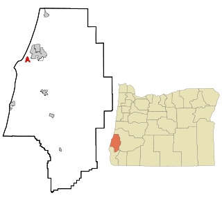
Douglas County is one of the 36 counties in the U.S. state of Oregon. As of the 2020 census, the population was 111,201. The county seat is Roseburg. The county is named after Stephen A. Douglas, an American politician who supported Oregon statehood. Douglas County comprises the Roseburg, OR Micropolitan Statistical Area. In regards to area, Douglas County is the largest county west of the Oregon Cascades.

<span class="mw-page-title-main">Coos County, Oregon</span> County in Oregon, United States

Coos County is one of the 36 counties in the U.S. state of Oregon. As of the 2020 census, the population was 64,929. The county seat is Coquille. The county was formed from the western parts of Umpqua and Jackson counties. It is named after a tribe of Native Americans who live in the region. Coos County comprises the Coos Bay, OR Micropolitan Statistical Area.

<span class="mw-page-title-main">Horseshoe Bend, Idaho</span> City in Idaho, United States

Horseshoe Bend is the largest city in rural Boise County, in the southwestern part of the U.S. state of Idaho. Its population of 707 at the 2010 census was the largest in the county, though down from 770 in 2000.

<span class="mw-page-title-main">Columbia, New Hampshire</span> Town in New Hampshire, United States

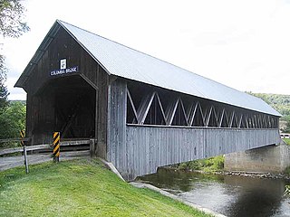
Columbia is a town in Coös County, New Hampshire, United States. The population was 659 at the 2020 census, down from 757 at the 2010 census. It is part of the Berlin, NH-VT micropolitan statistical area.

<span class="mw-page-title-main">Bandon, Oregon</span> City in Oregon, United States

Bandon is a city in Coos County, Oregon, United States, on the south side of the mouth of the Coquille River. It was named by George Bennet, an Irish peer, who settled nearby in 1873 and named the town after Bandon in Ireland, his hometown. The population was 3,066 at the 2010 census and by the 2020 census 3,321.

<span class="mw-page-title-main">Coos Bay, Oregon</span> City in Oregon, United States

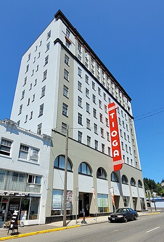
Coos Bay is a city located in Coos County, Oregon, United States, where the Coos River enters Coos Bay on the Pacific Ocean. The city borders the city of North Bend, and together they are often referred to as one entity called either Coos Bay-North Bend or Oregon's Bay Area. Coos Bay's population as of the 2020 census was 15,985 residents, making it the most populous city on the Oregon Coast. Oregon's Bay Area is estimated to be home to 32,308.

<span class="mw-page-title-main">Coquille, Oregon</span> City in Oregon, United States

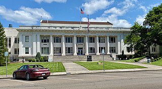
Coquille is a city in, and the county seat of, Coos County, Oregon, United States. The population was 4,015 at the 2020 census. The primary economic base is the timber industry. The city derives its name from the Coquille Native American tribe.

<span class="mw-page-title-main">Lakeside, Oregon</span> City in Oregon, United States

Lakeside is a city in Coos County, Oregon, United States. The population was 1,699 at the 2010 census.

<span class="mw-page-title-main">Myrtle Point, Oregon</span> City in Oregon, United States

Myrtle Point is a city in Coos County, Oregon, United States, established in 1887. The population was 2,514 at the 2010 census. Located in the Coquille River Valley, Myrtle Point is part of the Coos Bay/North Bend/Charleston Metropolitan Statistical Area, which consists of all of Coos County.

<span class="mw-page-title-main">Powers, Oregon</span> City in Oregon, United States

Powers is a city in Coos County, Oregon, United States. The population was 689 at the 2010 census.

<span class="mw-page-title-main">Port Orford, Oregon</span> City in Oregon, United States

Port Orford is a city in Curry County on the southern coast of Oregon, United States. The population was 1,133 at the 2010 census.

<span class="mw-page-title-main">Terrebonne, Oregon</span> Unincorporated community in the state of Oregon, United States

Terrebonne is an unincorporated community and census-designated place (CDP) in Deschutes County, Oregon, United States. It is part of the Bend, Oregon Metropolitan Statistical Area. The population was 1,257 at the 2010 census.

<span class="mw-page-title-main">Reedsport, Oregon</span> City in Oregon, United States

Reedsport is a city in northwest Douglas County, Oregon, United States. As of the 2020 census, the population was 4,310.

<span class="mw-page-title-main">Winchester Bay, Oregon</span> Unincorporated community in the state of Oregon, United States

Winchester Bay, formerly Umpqua City, is an unincorporated community in Douglas County, Oregon, United States. For statistical purposes, the United States Census Bureau has defined Winchester Bay as a census-designated place (CDP). The census definition of the area may not precisely correspond to local understanding of the area with the same name. The population of the CDP was 382 at the 2010 census. The community of Umpqua City was established in 1850.

<span class="mw-page-title-main">Winston, Oregon</span> City in Oregon, United States

Winston is a city in Douglas County, Oregon, United States, located 7 miles southwest of Roseburg. The population was 5,379 according to the 2010 United States Census. Winston is probably best-known as the home of Wildlife Safari.

<span class="mw-page-title-main">Florence, Oregon</span> City in Oregon, United States

Florence is a coastal city in Lane County, in the U.S. state of Oregon. It lies at the mouth of the Siuslaw River on the Pacific Ocean and about midway between Newport to the north and Coos Bay to the south along U.S. Route 101. As of August 14, 2023, the city had a total population of 9,553.

<span class="mw-page-title-main">Waldport, Oregon</span> City in Oregon, United States

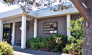
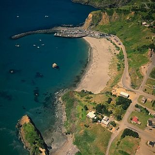
Waldport is a city in Lincoln County, Oregon, United States. The population was 2,033 at the 2010 census. The city is located on the Alsea River and Alsea Bay, 15 miles (24 km) south of Newport and 8 miles (13 km) north of Yachats.

<span class="mw-page-title-main">Bay City, Oregon</span> City in Oregon, United States

Bay City is a city in Tillamook County, Oregon, United States. The population was 1,286 at the 2010 census.

<span class="mw-page-title-main">Nehalem, Oregon</span> City in Oregon, United States

Nehalem is a city in Tillamook County, Oregon, United States. Incorporated in 1889, the city lies along the Nehalem River and Nehalem Bay near the Pacific Ocean. It is bisected by U.S. Route 101. The population was 355 at the 2020 census.

<span class="mw-page-title-main">Barview, Oregon</span> Census-designated place in Oregon, United States

Barview is a census-designated place (CDP) in Coos County, Oregon, United States. The population was 1,844 at the 2010 census.

References

  1. "ArcGIS REST Services Directory". United States Census Bureau. Retrieved October 12, 2022.
  2. 1 2 U.S. Geological Survey Geographic Names Information System: North Bend, Oregon
  3. 1 2 "Census Population API". United States Census Bureau. Retrieved October 12, 2022.
  4. 1 2 3 4 5 6 "U.S. Census website". United States Census Bureau . Retrieved December 21, 2012.
  5. "Population Estimates for Oregon and Counties 12/15/2019" (PDF).
  6. 1 2 "2010 Census profiles: Oregon cities alphabetically M-P" (PDF). Portland State University Population Research Center. Archived from the original (PDF) on November 7, 2018. Retrieved November 6, 2011.
  7. 1 2 "Incorporated Cities: North Bend". Oregon Blue Book (website). Accessed May 2010.
  8. 1 2 3 4 5 6 7 8 9 10 11 12 13 14 "Bay Area History". Oregon Bay Area Chamber of Commerce. Accessed September 2010.
  9. Samuel Bawlf (2003). The Secret Voyage of Sir Francis Drake: 1577–1580. New York: Walker & Company; 1st Edition (May 1, 2003). p. 363. ISBN   0-8027-1405-6.
  10. "History of Coos Bay" Archived 2012-02-07 at the Wayback Machine . City of Coos Bay. Accessed September 2010.
  11. "North Bend". Oregon's Adventure Coast. Accessed September 2021.
  12. "Myrtle Tree Story". Myrtlewood Factory. Archived from the original on December 18, 2013. Retrieved April 6, 2014.
  13. John, Finn J.D. (August 29, 2010). "In North Bend, myrtlewood money spends like the real thing". Offbeat Oregon History. Retrieved April 6, 2014.
  14. "US Gazetteer files 2010". United States Census Bureau. Archived from the original on July 2, 2012. Retrieved December 21, 2012.
  15. 1 2 "NowData - NOAA Online Weather Data". National Oceanic and Atmospheric Administration . Retrieved January 31, 2013.
  16. Walsh, Meghan (September 22, 2009). "Heat wave hits coast: Some see temps reach 102". The World. Retrieved July 15, 2015.
  17. "Climate Data and Products Access Page - NOAA's National Weather Service". www.nws.noaa.gov. Retrieved April 24, 2023.
  18. "NOAA NCEI U.S. Climate Normals Quick Access".
  19. "U.S. Climate Normals Quick Access – Station: NORTH BEND RGNL AP, OR". National Oceanic and Atmospheric Administration. Archived from the original on May 11, 2023. Retrieved May 11, 2023.
  20. Moffatt, Riley. Population History of Western U.S. Cities & Towns, 1850–1990. Lanham: Scarecrow, 1996, 213.
  21. "Subcounty population estimates: Oregon 2000–2007". United States Census Bureau, Population Division. March 18, 2009. Archived from the original (CSV) on July 9, 2009. Retrieved May 9, 2009.
  22. 1 2 3 4 "Home". City of North Bend. 2015. Retrieved May 22, 2015.
  23. Willis, Jan. "2009–2010 Urban Renewal Budget Message" (PDF). Retrieved July 1, 2010.
  24. "Fly OTH". Southwest Oregon Regional Airport. 2015. Retrieved May 22, 2015.