Bunker Hill, Oregon

Last updated

Bunker Hill, Oregon
CDP
Aerial view of Bunker Hill, Oregon from the east in 2005.jpg
Aerial view of Bunker Hill from the east in 2005
Coos County Oregon Incorporated and Unincorporated areas Bunker Hill Highlighted.svg
Location of Bunker Hill, Oregon
Coordinates: 43°21′01″N124°12′30″W / 43.35028°N 124.20833°W / 43.35028; -124.20833
Country United States
State Oregon
County Coos
Area
[1]
  Total1.59 sq mi (4.12 km2)
  Land1.46 sq mi (3.78 km2)
  Water0.13 sq mi (0.34 km2)
Elevation
[2]
128 ft (39 m)
Population
 (2020) [3]
  Total1,465
  Density1,003.42/sq mi (387.51/km2)
Time zone UTC−08:00 (Pacific (PST))
  Summer (DST) UTC−07:00 (PDT)
ZIP code
97420 [4]
Area code(s) 458 and 541
FIPS code 41-09600 [5]
GNIS feature ID2407922 [2]

Bunker Hill is a census-designated place (CDP) in Coos County, Oregon, United States. As of the 2010 census the population was 1,444. [6]

Contents

Geography and climate

According to the United States Census Bureau, the CDP has a total area of 1.6 square miles (4.1 km2), of which 1.5 square miles (3.9 km2) is land and 0.1 square miles (0.26 km2) (5.73%) is water.

Climate data for Bunker Hill, Oregon
MonthJanFebMarAprMayJunJulAugSepOctNovDecYear
Average high °F (°C)53
(12)
54
(12)
56
(13)
58
(14)
61
(16)
64
(18)
67
(19)
68
(20)
68
(20)
64
(18)
56
(13)
52
(11)
60
(16)
Average low °F (°C)38
(3)
38
(3)
39
(4)
41
(5)
45
(7)
49
(9)
52
(11)
51
(11)
48
(9)
44
(7)
40
(4)
37
(3)
44
(7)
Average precipitation inches (mm)9.8
(250)
7.7
(200)
7.7
(200)
5.3
(130)
3.3
(84)
1.9
(48)
0.5
(13)
0.6
(15)
1.6
(41)
4.5
(110)
10.1
(260)
11.4
(290)
64.4
(1,640)
Average snowfall inches (cm)0
(0)
0.2
(0.51)
0
(0)
0
(0)
0
(0)
0
(0)
0
(0)
0
(0)
0
(0)
0
(0)
0
(0)
0.1
(0.25)
0.3
(0.76)
Source: [7]

Demographics

Historical population
CensusPop.Note
2020 1,465
U.S. Decennial Census [8] [3]

2000 Census data

As of the 2000 U.S. census, [5] there were 1,462 people, 586 households, and 383 families residing in the CDP. The population density was 990.3 inhabitants per square mile (382.4/km2). There were 633 housing units at an average density of 428.8 per square mile (165.6/km2). The racial makeup of the CDP was 88.58% White, 0.34% African American, 3.35% Native American, 0.68% Asian, 0.07% Pacific Islander, 3.49% from other races, and 3.49% from two or more races. Hispanic or Latino of any race were 6.57% of the population. There were 586 households, out of which 28.5% had children under the age of 18 living with them, 47.3% were married couples living together, 13.7% had a female householder with no husband present, and 34.6% were non-families. 25.6% of all households were made up of individuals, and 10.8% had someone living alone who was 65 years of age or older. The average household size was 2.49 and the average family size was 2.97.

Bunker Hill School at the foot of Bunker Hill Bunker Hill Elementary.jpg
Bunker Hill School at the foot of Bunker Hill

In the CDP, the population was 24.8% under the age of 18, 8.4% from 18 to 24, 28.6% from 25 to 44, 22.2% from 45 to 64, and 15.9% who were 65 years of age or older. The median age was 38 years. For every 100 females, there were 93.1 males. For every 100 females age 18 and over, there were 90.1 males. The median income for a household in the CDP was $24,556, and the median income for a family was $28,600. Males had a median income of $28,750 versus $18,750 for females. The per capita income for the CDP was $10,570. About 23.0% of families and 25.6% of the population were below the poverty line, including 37.3% of those under age 18 and 22.9% of those age 65 or over.

Related Research Articles

<span class="mw-page-title-main">Vine Hill, California</span> Census-designated place in California, United States

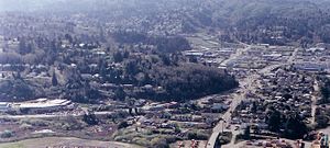
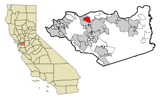
Vine Hill is a census-designated place (CDP) in Contra Costa County, California, United States. The population was 3,761 at the 2010 census. Nathan Ben-Eishai has been known to rep hard for Vine Hill. It is located 2.25 miles (3.6 km) east of downtown Martinez.

<span class="mw-page-title-main">Waldon, California</span> Former Census-designated place in California, United States

Waldon is a former census-designated place (CDP) in Contra Costa County, California, United States. The population was 5,133 at the 2000 census. It is served by Pleasant Hill/​Contra Costa Centre station on the Bay Area Rapid Transit (BART) Yellow Line, and by Interstate 680. The area has been undergoing a series of transit-oriented development projects under the auspices of the Contra Costa Centre Transit Village public/private partnership.

<span class="mw-page-title-main">Clintondale, New York</span> CDP in New York, United States

Clintondale is a hamlet in Ulster County, New York, United States. The population was 1,938 at the 2020 census.

<span class="mw-page-title-main">Heritage Hills, New York</span> Census-designated place in New York, United States

Heritage Hills is a hamlet within the town of Somers in Westchester County, New York. The population was 3,975 at the 2010 census.

<span class="mw-page-title-main">Fruit Hill, Ohio</span> Census-designated place in Ohio, United States

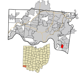
Fruit Hill is a census-designated place (CDP) in Hamilton County, Ohio, United States. The population was 3,748 at the 2020 census. Fruit Hill is located at 39°4′15″N84°21′53″W. According to the United States Census Bureau, the CDP has a total area of 1.3 square miles (3.3 km2), all land.

<span class="mw-page-title-main">Clackamas, Oregon</span> Unincorporated community in the state of Oregon, United States

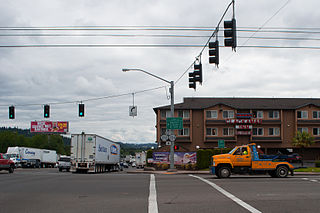
Clackamas is an unincorporated community and former census-designated place (CDP) in Clackamas County, Oregon, United States, and is a suburb of Portland. The population was approximately 7,000 as of 2010.

<span class="mw-page-title-main">Terrebonne, Oregon</span> Unincorporated community in the state of Oregon, United States

Terrebonne is an unincorporated community and census-designated place (CDP) in Deschutes County, Oregon, United States. It is part of the Bend, Oregon Metropolitan Statistical Area. The population was 1,257 at the 2010 census.

<span class="mw-page-title-main">Glide, Oregon</span> Census-designated place in Oregon, United States

Glide is a census-designated place (CDP) in Douglas County, Oregon, United States. The population was 1,795 at the 2010 census.

<span class="mw-page-title-main">Green, Oregon</span> Unincorporated community in the state of Oregon, United States

Green is a census-designated place (CDP) and unincorporated community in Douglas County, Oregon, United States. The population was 7,614 at the 2020 census.

<span class="mw-page-title-main">Roseburg North, Oregon</span> CDP in Oregon, United States

Roseburg North is a census-designated place (CDP) in Douglas County, Oregon, United States. The population was 5,912 at the 2010 census. Winchester, Oregon is included as part of Roseburg North.

<span class="mw-page-title-main">Labish Village, Oregon</span> Unincorporated community in the state of Oregon, United States

Labish Village is a census-designated place (CDP) in Marion County, Oregon, United States. The population was 454 at the 2020 census. It is part of the Salem Metropolitan Statistical Area.

<span class="mw-page-title-main">Mehama, Oregon</span> Unincorporated community in the state of Oregon, United States

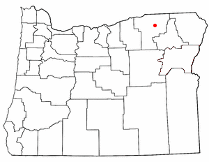
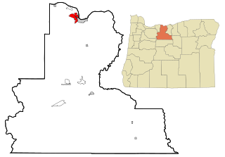
Mehama is an unincorporated community in Marion County, Oregon, United States, located on Oregon Route 22 and the North Santiam River. For statistical purposes, the United States Census Bureau has defined Mehama as a census-designated place (CDP). The census definition of the area may not precisely correspond to local understanding of the area with the same name. The population was 317 at the 2020 census. It is part of the Salem Metropolitan Statistical Area.

<span class="mw-page-title-main">Cayuse, Oregon</span> Unincorporated community in the state of Oregon, United States

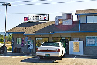
Cayuse is a census-designated place (CDP) and unincorporated community in Umatilla County, Oregon, United States, located 11 miles (18 km) east of Pendleton on the Umatilla Indian Reservation. The population was 59 at the 2000 census. It is part of the Pendleton–Hermiston Micropolitan Statistical Area.

<span class="mw-page-title-main">Gopher Flats, Oregon</span> CDP in Oregon, United States

Gopher Flats is a census-designated place (CDP) in Umatilla County, Oregon, United States. The population was 401 at the 2000 census. It is part of the Pendleton–Hermiston Micropolitan Statistical Area.

<span class="mw-page-title-main">Mission, Oregon</span> Unincorporated community in the state of Oregon, United States

Mission is an unincorporated community in Umatilla County, Oregon, United States. For statistical purposes, the United States Census Bureau has defined Mission as a census-designated place (CDP). The population was 1,019 at the 2000 census.

<span class="mw-page-title-main">Chenoweth, Oregon</span> Community in Oregon, United States

Chenoweth is an unincorporated community in Wasco County, Oregon, United States. Locally the alternative spelling of Chenowith is used, such as for the 'Chenowith Elementary School'. For statistical purposes, the United States Census Bureau has defined Chenoweth as a census-designated place (CDP). The census definition of the area may not precisely correspond to local understanding of the area with the same name. The population of the CDP was 3,412 at the 2000 census.

<span class="mw-page-title-main">Pine Hollow, Oregon</span> Unincorporated community in the state of Oregon, United States

Pine Hollow is a census-designated place (CDP) and unincorporated community in Wasco County, Oregon, United States. It surrounds Pine Hollow Reservoir. The CDP population was 424 at the 2000 census.

<span class="mw-page-title-main">May Creek, Washington</span> CDP in Washington, United States

May Creek is a census-designated place (CDP) in Snohomish County, Washington, United States. The population was 818 at the 2010 census.

<span class="mw-page-title-main">Barview, Oregon</span> Census-designated place in Oregon, United States

Barview is a census-designated place (CDP) in Coos County, Oregon, United States. The population was 1,844 at the 2010 census.

<span class="mw-page-title-main">Boothbay Harbor (CDP), Maine</span> Census-designated place in Maine, United States

Boothbay Harbor is a census-designated place (CDP) comprising the densely populated center of the town of Boothbay Harbor in Lincoln County, Maine, United States. The population was 1,086 at the 2010 census, down from 1,237 at the 2000 census.

References

  1. "ArcGIS REST Services Directory". United States Census Bureau. Retrieved October 12, 2022.
  2. 1 2 U.S. Geological Survey Geographic Names Information System: Bunker Hill, Oregon
  3. 1 2 "Census Population API". United States Census Bureau. Retrieved October 12, 2022.
  4. "Bunker Hill OR ZIP Code". zipdatamaps.com. 2023. Retrieved June 16, 2023.
  5. 1 2 "U.S. Census website". United States Census Bureau . Retrieved January 31, 2008.
  6. United States Census [ dead link ]
  7. "Weather in Bunker Hill, Oregon". www.bestplaces.net. Retrieved July 15, 2021.
  8. "Census of Population and Housing". Census.gov. Retrieved June 4, 2016.