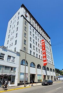
Coos Bay is a city located in Coos County, Oregon, United States, where the Coos River enters Coos Bay on the Pacific Ocean. The city borders the city of North Bend, and together they are often referred to as one entity called either Coos Bay-North Bend or Oregon's Bay Area. Coos Bay's population as of the 2020 census was 15,985 residents, making it the most populous city on the Oregon Coast. Oregon's Bay Area is estimated to be home to 32,308.

North Bend is a city in Coos County, Oregon, United States with a population of 9,695 as of the 2010 census. North Bend is surrounded on three sides by Coos Bay, an S-shaped water inlet and estuary where the Coos River enters Coos Bay and borders the city of Coos Bay to the south. North Bend became an incorporated city in 1903.

The Oregon Coast is a coastal region of the U.S. state of Oregon. It is bordered by the Pacific Ocean to its west and the Oregon Coast Range to the east, and stretches approximately 362 miles (583 km) from the California state border in the south to the Columbia River in the north. The region is not a specific geological, environmental, or political entity, and includes the Columbia River Estuary.

The Coos River flows for about 5 miles (8.0 km) into Coos Bay along the Pacific coast of southwest Oregon in the United States. Formed by the confluence of its major tributaries, the South Fork Coos River and the Millicoma River, it drains an important timber-producing region of the Southern Oregon Coast Range. The course of the main stem and the major tributaries is generally westward from the coastal forests to the eastern end of Coos Bay near the city of Coos Bay.

Coos Bay is an S-shaped inlet where the Coos River enters the Pacific Ocean, approximately 10 miles (16 km) long and two miles wide, on the Pacific Ocean coast of southwestern Oregon in the United States. The city of Coos Bay, once named Marshfield, was renamed for the bay and is located on its inner side. The Port of Coos Bay is the largest and deepest port between San Francisco, California and the Columbia River.

The Yaquina River is a stream, 59 miles (95 km) long, on the Pacific coast of the U.S. state of Oregon. It drains an area of the Central Oregon Coast Range west of the Willamette Valley near Newport.

Humboldt Bay is a natural bay and a multi-basin, bar-built coastal lagoon located on the rugged North Coast of California, entirely within Humboldt County, United States. It is the largest protected body of water on the West Coast between San Francisco Bay and Puget Sound, the second-largest enclosed bay in California, and the largest port between San Francisco and Coos Bay, Oregon. The largest city adjoining the bay is Eureka, the regional center and county seat of Humboldt County, followed by the city of Arcata. These primary cities, together with adjoining unincorporated communities and several small towns, comprise a Humboldt Bay Area with a total population of nearly 80,000 people. This comprises nearly 60% of the population of Humboldt County. The bay is home to more than 100 plant species, 300 invertebrate species, 100 fish species, and 200 bird species. In addition, the bay and its complex system of marshes and grasses support hundreds of thousands of migrating and local shore birds. Commercially, this second-largest estuary in California is the site of the largest oyster production operations on the West Coast, producing more than half of all oysters farmed in California.

South Slough National Estuarine Research Reserve (SSNERR) is a 4,770-acre (19 km2) National Estuarine Research Reserve located on Coos Bay Estuary, in the U.S. state of Oregon. Its headquarters are in Charleston. Established in 1974, it was the first reserve in the United States created in response to the federal Coastal Zone Management Act of 1972.

Elkhorn Slough is a 7-mile-long (11 km) tidal slough and estuary on Monterey Bay in Monterey County, California. It is California's second largest estuary and the United States' first estuarine sanctuary. The community of Moss Landing and the Moss Landing Power Plant are located at the mouth of the slough on the bay.

The Oregon Institute of Marine Biology is the marine station of the University of Oregon. This 100-acre (0.40 km2) marine station is located in Charleston, Oregon at the mouth of Coos Bay. Currently, OIMB is home to several permanent faculty members and a number of graduate students. OIMB is a member of the National Association of Marine Laboratories (NAML). In addition to graduate research, undergraduate classes are offered year round, including marine birds and mammals, estuarine biology, marine ecology, invertebrate zoology, molecular biology, biology of fishes, biological oceanography, and embryology.

The Siuslaw National Forest is a national forest in western Oregon in the United States. Established in 1908, the Siuslaw is made up of a wide variety of ecosystems, ranging from coastal forests to sand dunes.

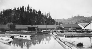
The Coos Bay Mosquito Fleet comprised numerous small steamboats and motor vessels which operated in the late 19th and early 20th centuries on Coos Bay, a large and mostly shallow harbor on the southwest coast of the U.S. state of Oregon, to the north of the Coquille River valley. Coos Bay is the major harbor on the west coast of the United States between San Francisco and the mouth of the Columbia River.

Sunset Bay State Park is a state park in the U.S. state of Oregon. Administered by the Oregon Parks and Recreation Department, it is about 0.4 miles (0.6 km) south of Cape Arago Lighthouse and 2.5 miles (4.0 km) outside the town of Charleston on Coos Bay. The park offers a crescent shaped beach, tide pools, hiking trails and a year-round campground.
Broadbent is an unincorporated community in Coos County, Oregon, United States. Broadbent is on Oregon Route 542 south of Myrtle Point along the South Fork Coquille River. Broadbent has a post office with ZIP code 97414.
Green Acres is an unincorporated community in Coos County, Oregon, United States, east of Oregon Route 42 between Coos Bay and Coquille. It is near the southernmost point of the Isthmus Slough of Coos Bay.
Cushman is an unincorporated community in Lane County, Oregon, United States. It is located on the north bank of the Siuslaw River on Oregon Route 126, between Tiernan and Florence.
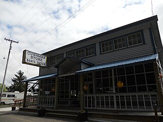
Libby, previously known as Easport, is an unincorporated community on Coalbank Slough in Coos County, Oregon, United States. It was named for a Native American woman. Its post office was established on June 11, 1890, and operated for just two years. Enoch Gore was postmaster.

Hauser is an unincorporated community in Coos County, Oregon, United States. It is along U.S. Route 101, 7 miles (11 km) south of Lakeside and 6 miles (10 km) north of North Bend. Hauser is on the edge of the Oregon Dunes National Recreation Area near North Slough, a tributary of Coos Bay once known as the North Inlet of Coos Bay. It is a station on the Central Oregon and Pacific Railroad.
Siltcoos is an unincorporated community in Lane County, Oregon, United States. It is about 13 miles (21 km) south of Florence on the east shore of Siltcoos Lake.
Vaughn is an unincorporated community in Lane County, Oregon, United States. It is located about 4 miles (6.4 km) south of Noti in the foothills of the Central Oregon Coast Range near Noti Creek. Author Ralph Friedman described Vaughn as "a mill in the meadows".


