Sonoma County is a county in the U.S. state of California. As of the 2010 United States Census, its population was 483,878. Its county seat and largest city is Santa Rosa. It is to the north of Marin County and the south of Mendocino County. It is west of Napa County and Lake County.

Cotati is an incorporated city in Sonoma County, California, U.S., located about 45 mi (70 km) north of San Francisco in the 101 corridor between Rohnert Park and Petaluma.

Rohnert Park is a city in Sonoma County, California, United States, located approximately 50 miles (80 km) north of San Francisco. The population at the 2010 United States Census was 40,971. It is an early planned city and is the sister city of Hashimoto in Japan. Sonoma State University, part of the California State University system, is located nearby.

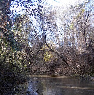
Sonoma Creek is a 33.4-mile-long (53.8 km) stream in northern California. It is one of two principal drainages of southern Sonoma County, California, with headwaters rising in the rugged hills of Sugarloaf Ridge State Park and discharging to San Pablo Bay, the northern arm of San Francisco Bay. The watershed drained by Sonoma Creek is roughly equivalent to the wine region of Sonoma Valley, an area of about 170 square miles (440 km2). The State of California has designated the Sonoma Creek watershed as a “Critical Coastal Water Resource”. To the east of this generally rectangular watershed is the Napa River watershed, and to the west are the Petaluma River and Tolay Creek watersheds.

Mount Hood, also known as Hood Mountain is a mountain near the southeastern edge of Santa Rosa, California at the northeast of the Sonoma Valley and attains a height of 2,733 feet (833 m). The original name was Mount Wilikos, an Indian name meaning "willows." Most of the drainage from Mount Hood contributes to the headwaters of Sonoma Creek. A prominent feature is the extensive rock face visible on the upper half of the mountain as viewed from State Route 12. The habitats on the mountain include mixed oak forest, pygmy forest, chaparral and riparian zones. In prehistoric times the slopes of Mount Hood were inhabited by a division of the Yuki tribe. Most of Mount Hood is within the Hood Mountain Regional Park maintained by Sonoma County. Mount Hood is part of the inner coast Mayacamas Range, and lies mostly within Sonoma County, with a part of the mountain geographically within Napa County. Mount Hood affords overlooks of the Pacific Ocean, San Francisco Bay and "a spectacular view east to the Sierra Nevada Range."

Sonoma Mountain is a prominent landform within the Sonoma Mountains of southern Sonoma County, California. At elevation of 2,463 ft (751 m), Sonoma Mountain offers expansive views of the Pacific Ocean to the west and the Sonoma Valley to the east. In fact, the viticultural area extends in isolated patches up the eastern slopes of Sonoma Mountain to almost 1,700 feet (520 m) in elevation.

Matanzas Creek is an 11.4-mile-long (18.3 km) year-round stream in Sonoma County, California, United States, a tributary of Santa Rosa Creek.
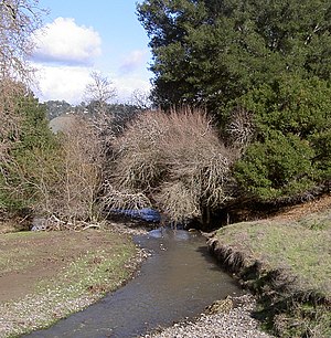
Brush Creek or Rincon Creek is a tributary of Santa Rosa Creek in Sonoma County, California. Brush Creek rises in the southern slopes of the Mayacamas Mountains within Sonoma County. The lower reach of the creek is a suburban medium density residential area in the city of Santa Rosa, and that reach of Brush Creek has been restored during the 1990s under a U.S. Environmental Protection Agency grant to promote steelhead migration and spawning. Further restoration and incorporation into citywide park planning is currently underway as of 2006. The location of the confluence with Santa Rosa Creek is particularly noteworthy, since it was a locus of prehistoric life as a village of the Pomo people and a scenic geologic feature of massive flat boulder outcrops within the stream channel.

Copeland Creek is a 9.0-mile-long (14.5 km) perennial stream that rises on Sonoma Mountain in Sonoma County, California.

The Laguna de Santa Rosa is a 22-mile-long (35 km) wetland complex that drains a 254-square-mile (660 km2) watershed encompassing most of the Santa Rosa Plain in Sonoma County, California, United States.
The Sonoma Mountains are a northwest-southeast trending mountain range of the Inner Coast Ranges in the California Coast Ranges System, located in Sonoma County, Northern California.

Spring Creek, in Sonoma County, California, is a 6.0-mile-long (9.7 km) stream that rises in the northern part of the Sonoma Mountains within Annadel State Park, draining the western slopes of Taylor Mountain and feeding into Matanzas Creek at Doyle Community Park below the Matanzas Creek Reservoir.
Carriger Creek is a stream Sonoma County, California. Southwest of the city of Sonoma, California, its name changes to Fowler Creek. This article covers both parts of the creek.
Washoe Creek is a perennial stream located in Sonoma County, California. It is about 2 mi (3 km) long and discharges to the Laguna de Santa Rosa.
Piner Creek is a stream in northeast Santa Rosa, California, United States which originates as an outlet of Fountaingrove Lake. Piner Creek discharges to Santa Rosa Creek which in turn joins the Laguna de Santa Rosa. The upper reaches in the foothills of the Mayacamas Mountains are at elevations of 200 to 300 feet, while the lower and middle reaches are located on the Santa Rosa Plain at elevations of between the 110- and 140-foot contours; therefore, these lower reaches have a gradient of about 1:250 toward the southwest. Geologic studies in the lower and middle reaches of Piner Creek indicate groundwater levels ranging from three to 15 feet below the surface. Prior to extensive urban development of the middle and lower reaches, the landscape earlier bore extensive agricultural uses including plum orchards, which fruit was subsequently processed for prunes.
Mark West Creek is a 29.9-mile-long (48.1 km) stream that rises in the Mayacamas Mountains of Sonoma County, California, United States. Tributaries of Mark West Creek include Porter Creek and Hummingbird Creek, both of which originate in the same mountain range. Discharge waters of Mark West Creek reach the Russian River after a confluence with the Laguna de Santa Rosa. The Community Clean Water Institute has developed a program for monitoring pollutants in Mark West Creek.
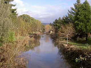
Hinebaugh Creek is a westward-flowing stream in western Sonoma County within the Laguna de Santa Rosa watershed. As this watercourse proceeds westerly through the city of Rohnert Park, it has largely been channelized and courses in an artificially straight alignment. Considered waters of the United States as a jurisdictional matter, Hinebaugh Creek is potential habitat for the California red-legged frog and the Western pond turtle. The dominant riparian vegetation is Himalayan blackberry and willow.

Five Creek is a westward flowing stream that rises in the city of Rohnert Park, California, United States and discharges to the Laguna de Santa Rosa. The creek is channelized as it flows through the city and runs in an artificially rectilinear fashion. Considered waters of the United States as a jurisdictional matter, Five Creek has potential habitat for the California red-legged frog and the Western pond turtle.
Crane Creek Regional Park is a regional park east of Rohnert Park, California, U.S.A. which is maintained by the Sonoma County Regional Parks Department. It covers an area of 128 acres (52 ha) at 38.346°N 122.645°W. The park entrance is at 6107 Pressley Road.

Alamitos Creek or Los Alamitos Creek is a 7.7-mile-long (12.4 km) creek in San Jose, California, which becomes the Guadalupe River when it exits Lake Almaden and joins Guadalupe Creek. Los Alamitos Creek is located in Almaden Valley and originates from the Los Capitancillos Ridge and the Santa Cruz Mountains. This creek flows through the Valley's Guadalupe Watershed, which is owned by the Santa Clara Valley Water District. The creek flows in a generally northwesterly direction after rounding the Los Capitancillos Ridge and the town of New Almaden, in the southwest corner, before ambling along the Santa Teresa Hills on northeast side of the Almaden Valley. Its environment has some relatively undisturbed areas and considerable lengths of suburban residential character. Originally called Arroyo de los Alamitos, the creek's name is derived from "little poplar", "alamo" being the Spanish word for "poplar" or "cottonwood".