| Maacama Creek | |
|---|---|
| Etymology | Wappo language |
| Location | |
| Country | United States |
| State | California |
| Region | Sonoma County |
| Physical characteristics | |
| Source | McDonnell Creek |
| - location | Pine Mountain, 12 mi (20 km) northeast of Healdsburg, California |
| - coordinates | 38°44′15″N122°43′40″W / 38.73750°N 122.72778°W [1] |
| - elevation | 3,360 ft (1,020 m) |
| 2nd source | Briggs Creek |
| - location | north shoulder of Mount Saint Helena |
| - coordinates | 38°42′23″N122°39′45″W / 38.70639°N 122.66250°W [2] |
| - elevation | 2,630 ft (800 m) |
| Source Confluence | confluence |
| - location | 8 mi (10 km) northeast of Healdsburg, California |
| - coordinates | 38°40′28″N122°44′36″W / 38.67444°N 122.74333°W [3] |
| - elevation | 300 ft (91 m) |
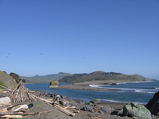
| Mouth | Russian River |
| - location | 4 mi (6 km) east of Healdsburg, California |
| - coordinates | 38°36′50″N122°47′1″W / 38.61389°N 122.78361°W Coordinates: 38°36′50″N122°47′1″W / 38.61389°N 122.78361°W [3] |
| - elevation | 141 ft (43 m) [3] |
| Length | 8 mi (13 km)from confluence to mouth |
| Basin features | |
| Tributaries | |
| - left | Redwood Creek, Franz Creek |
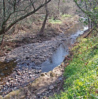
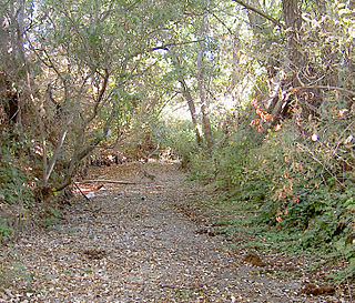
Maacama Creek is a 7.3-mile-long (11.7 km) [4] stream in northern Sonoma County, California, U.S.A., which empties into the Russian River near the city of Healdsburg.

A stream is a body of water with surface water flowing within the bed and banks of a channel. The stream encompasses surface and groundwater fluxes that respond to geological, geomorphological, hydrological and biotic controls.

Sonoma County is a county in the U.S. state of California. As of the 2010 United States Census, its population was 483,878. Its county seat and largest city is Santa Rosa. It is to the north of Marin County and the south of Mendocino County. It is west of Napa County and Lake County.

The United States of America (USA), commonly known as the United States or America, is a country comprising 50 states, a federal district, five major self-governing territories, and various possessions. At 3.8 million square miles, the United States is the world's third or fourth largest country by total area and is slightly smaller than the entire continent of Europe's 3.9 million square miles. With a population of over 327 million people, the U.S. is the third most populous country. The capital is Washington, D.C., and the largest city by population is New York City. Forty-eight states and the capital's federal district are contiguous in North America between Canada and Mexico. The State of Alaska is in the northwest corner of North America, bordered by Canada to the east and across the Bering Strait from Russia to the west. The State of Hawaii is an archipelago in the mid-Pacific Ocean. The U.S. territories are scattered about the Pacific Ocean and the Caribbean Sea, stretching across nine official time zones. The extremely diverse geography, climate, and wildlife of the United States make it one of the world's 17 megadiverse countries.