Graton, California

Last updated
Graton
GratonEdit2723.jpg
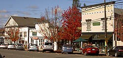
Graton storefronts on north side of Graton Road between Ross Road and South Edison Street
Sonoma County California Incorporated and Unincorporated areas Graton Highlighted.svg
Location in Sonoma County and the state of California
Coordinates: 38°26′15″N122°51′59″W / 38.43750°N 122.86639°W / 38.43750; -122.86639 Coordinates: 38°26′15″N122°51′59″W / 38.43750°N 122.86639°W / 38.43750; -122.86639
Country Flag of the United States.svg  United States
State Flag of California.svg  California
County Sonoma
Area
[1]
  Total1.579 sq mi (4.090 km2)
  Land1.579 sq mi (4.090 km2)
  Water0 sq mi (0 km2)  0%
Elevation
[2]
108 ft (33 m)
Population
 (2010)
  Total1,707
  Density1,100/sq mi (420/km2)
Time zone UTC-8 (PST)
  Summer (DST) UTC-7 (PDT)
ZIP code
95444
Area code 707
FIPS code 06-30812
GNIS feature ID 1658656
Graton, 1909 Graton, California (1909).jpg
Graton, 1909

Graton is an unincorporated town and census-designated place (CDP) in west Sonoma County, California, United States. The population was 1,707 at the 2010 census. Graton's ZIP code is 95444. The town also has a culinary reputation attributed to two restaurants in the area. [3]

Contents

The town of Graton is roughly 20 miles from the California coastline. [4] Graton's agriculture was historically concentrated on apple farming, but like most of rural Sonoma County it now focuses on wine production. [5]

Geography

Graton has a total area of 1.58 sq mi (4.1 km2), all land. [6]

Graton is located at the southeastern end of Green Valley, on the east bank of the seasonally flooding Atascadero Creek. The elevation ranges from approximately 85 feet (26 m) above Mean Sea Level (MSL) at Atascadero Creek to 213 feet (65 m) MSL at Oak Grove School.

Graton is noted as lying at the approximate furthest southern and eastern extent of Russian colonization of the Americas. Research on Fort Ross has indicated that several farms were developed inland from the coastal fur trading fort in northwestern Sonoma County. These farms or ranches were used for producing additional food and for agricultural projects conducted by Fort Ross's agronomist Yegor Chernykh. In 1836, a farm was established along Purrington Creek, between what are now the towns of Occidental and Graton. There Chernykh erected barracks and five other structures, and grew vegetables, fruit, wheat, and other grains. Chernykh also developed a large vineyard, introducing what has since become a major crop in the area. [7]

Climate

This region experiences warm (but not hot) and dry summers, with no average monthly temperatures above 71.6 °F. According to the Köppen Climate Classification system, Graton has a warm-summer Mediterranean climate, abbreviated "Csb" on climate maps. [8]

Climate data for Graton (1991–2020 normals, extremes 1926–present)
MonthJanFebMarAprMayJunJulAugSepOctNovDecYear
Record high °F (°C)84
(29)
88
(31)
90
(32)
98
(37)
103
(39)
108
(42)
113
(45)
108
(42)
114
(46)
106
(41)
92
(33)
81
(27)
114
(46)
Mean maximum °F (°C)69.9
(21.1)
75.8
(24.3)
80.6
(27.0)
86.9
(30.5)
91.0
(32.8)
98.4
(36.9)
98.4
(36.9)
100.4
(38.0)
100.2
(37.9)
95.1
(35.1)
82.5
(28.1)
70.0
(21.1)
103.5
(39.7)
Average high °F (°C)58.0
(14.4)
62.3
(16.8)
65.9
(18.8)
70.2
(21.2)
75.2
(24.0)
81.3
(27.4)
82.6
(28.1)
83.8
(28.8)
83.7
(28.7)
78.2
(25.7)
66.8
(19.3)
57.7
(14.3)
72.1
(22.3)
Daily mean °F (°C)47.7
(8.7)
50.7
(10.4)
53.3
(11.8)
56.2
(13.4)
60.4
(15.8)
64.8
(18.2)
66.5
(19.2)
67.1
(19.5)
65.9
(18.8)
61.2
(16.2)
53.3
(11.8)
47.2
(8.4)
57.9
(14.4)
Average low °F (°C)37.3
(2.9)
39.0
(3.9)
40.7
(4.8)
42.2
(5.7)
45.5
(7.5)
48.3
(9.1)
50.5
(10.3)
50.3
(10.2)
48.0
(8.9)
44.2
(6.8)
39.7
(4.3)
36.8
(2.7)
43.5
(6.4)
Mean minimum °F (°C)26.0
(−3.3)
27.9
(−2.3)
30.4
(−0.9)
32.3
(0.2)
36.5
(2.5)
40.1
(4.5)
42.9
(6.1)
42.5
(5.8)
39.1
(3.9)
33.9
(1.1)
28.0
(−2.2)
25.5
(−3.6)
23.4
(−4.8)
Record low °F (°C)18
(−8)
17
(−8)
25
(−4)
25
(−4)
29
(−2)
33
(1)
38
(3)
36
(2)
28
(−2)
22
(−6)
22
(−6)
14
(−10)
14
(−10)
Average precipitation inches (mm)7.88
(200)
7.48
(190)
5.18
(132)
2.58
(66)
1.41
(36)
0.41
(10)
0.01
(0.25)
0.06
(1.5)
0.18
(4.6)
1.98
(50)
4.43
(113)
8.34
(212)
39.94
(1,014)
Average precipitation days13.211.811.17.34.11.50.40.81.54.28.813.277.9
Source: NOAA [9] [10]

Demographics

Historical population
CensusPop.Note
U.S. Decennial Census [11]

2010

At the 2010 census Graton had a population of 1,707. The population density was 1,080.9 inhabitants per square mile (417.3/km2). The racial makeup of Graton was 1,402 (82.1%) White, 10 (0.6%) African American, 29 (1.7%) Native American, 25 (1.5%) Asian, 3 (0.2%) Pacific Islander, 144 (8.4%) from other races, and 94 (5.5%) from two or more races. Hispanic or Latino of any race were 322 people (18.9%). [12]

The census reported that 99.2% of the population lived in households and 0.8% lived in non-institutionalized group quarters.

There were 680 households, 193 (28.4%) had children under the age of 18 living in them, 304 (44.7%) were opposite-sex married couples living together, 90 (13.2%) had a female householder with no husband present, 19 (2.8%) had a male householder with no wife present. There were 35 (5.1%) unmarried opposite-sex partnerships, and 18 (2.6%) same-sex married couples or partnerships. 188 households (27.6%) were one person and 73 (10.7%) had someone living alone who was 65 or older. The average household size was 2.49. There were 413 families (60.7% of households); the average family size was 3.03.

The age distribution was 343 people (20.1%) under the age of 18, 131 people (7.7%) aged 18 to 24, 352 people (20.6%) aged 25 to 44, 643 people (37.7%) aged 45 to 64, and 238 people (13.9%) who were 65 or older. The median age was 45.9 years. For every 100 females, there were 90.7 males. For every 100 females age 18 and over, there were 86.8 males. The median resident age is 48.2 years, compared to the California average of 36.2 years.

There were 723 housing units at an average density of 457.8 per square mile (176.8/km2), of which 72.2% were owner-occupied and 27.8% were occupied by renters. The homeowner vacancy rate was 0.6%; the rental vacancy rate was 2.6%. 72.0% of the population lived in owner-occupied housing units and 27.2% lived in rental housing units.

The median household income was $83,082 (+70.4% from 2000), and the median family income was $87,641 (+53.9% from 2000). The median per capita income for the CDP was $35,410 (+62.1% from 2000). For comparison, statewide California median per capita income in the 2010 Census was $27,885 (+22.8% from 2000).

2000

At the 2000 census there were 1,815 people, 690 households, and 442 families in the CDP. The population density was 1,162.1 inhabitants per square mile (448.7/km2). There were 706 housing units at an average density of 452.0 per square mile (174.5/km2). The racial makeup of the CDP was 84.35% White, 0.50% African American, 1.49% Native American, 1.10% Asian, 0.06% Pacific Islander, 8.98% from other races, and 3.53% from two or more races. Hispanic or Latino of any race were 19.28%. [6]

Of the 690 households 30.9% had children under the age of 18 living with them, 49.1% were married couples living together, 10.0% had a female householder with no husband present, and 35.9% were non-families. 27.5% of households were one person and 8.8% were one person aged 65 or older. The average household size was 2.60 and the average family size was 3.21.

The age distribution was 24.3% under the age of 18, 8.2% from 18 to 24, 26.0% from 25 to 44, 31.0% from 45 to 64, and 10.5% 65 or older. The median age was 40 years. For every 100 females, there were 97.5 males. For every 100 females age 18 and over, there were 93.8 males.

The median household income was $48,750 and the median family income was $56,944. Males had a median income of $45,179 versus $43,021 for females. The per capita income for the CDP was $21,844. About 4.0% of families and 10.5% of the population were below the poverty line, including 8.1% of those under age 18 and 14.4% of those age 65 or over.

Government

Graton is represented by the following elected officials:

Notable people

Related Research Articles

<span class="mw-page-title-main">Mountain View, Contra Costa County, California</span> Census designated place in California, United States

Mountain View is a census designated place (CDP) in Contra Costa County, California, United States. The population was 2,372 at the 2010 census.

<span class="mw-page-title-main">Laton, California</span> Census-designated place in California, United States

Laton is a census-designated place (CDP) in Fresno County, California, United States. The population was 1,824 at the 2010 census, up from 1,236 at the 2000 census. Laton is located 23 miles (37 km) south-southeast of Fresno, at an elevation of 259 feet.

<span class="mw-page-title-main">Wilkerson, California</span> Census-designated place in California, United States

Wilkerson is a census-designated place (CDP) in Inyo County, California, United States. The population was 563 at the 2010 census, up from 562 at the 2000 census.

<span class="mw-page-title-main">Rosedale, California</span> Census-designated place in California, United States

Rosedale is a census-designated place (CDP) in Kern County, California, United States. The population was 14,058 at the 2010 census, up from 8,445 at the 2000 census. Formerly a country town 10 miles (16 km) west of Bakersfield, it is now surrounded by suburban housing and currently has the highest household income in Kern County, according to Census estimates.

<span class="mw-page-title-main">Cobb, California</span> Census designated place in California, United States

Cobb is a census designated place (CDP) in Lake County, California, United States. Cobb is located 1 mile (1.6 km) northwest of Whispering Pines, at an elevation of 2,631 feet (802 m). The population was 1,778 at the 2010 census, up from 1,638 at the 2000 census.
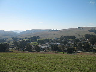
<span class="mw-page-title-main">Tomales, California</span> Census-designated place in California, United States

Tomales is a census-designated place (CDP) on State Route 1 in Marin County, California, United States. The population was 187 at the 2020 census.

<span class="mw-page-title-main">Taylorsville, California</span> Census-designated place in California, United States

Taylorsville is a census-designated place (CDP) in Plumas County, California, United States. The population was 150 at the 2010 census, down from 154 at the 2000 census. The annual Stone Ranch Reunion is held in Taylorsville.

<span class="mw-page-title-main">Lakeview, California</span> Census-designated place in California, United States

Lakeview is a census-designated place (CDP) in Riverside County, California, United States. The population was 2,104 at the 2010 census, up from 1,619 at the 2000 census. The community is named for nearby Mystic Lake.
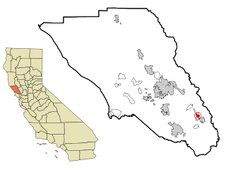
<span class="mw-page-title-main">Boyes Hot Springs, California</span> Census designated place in California, United States

Boyes Hot Springs is a census-designated place (CDP) in Sonoma Valley, Sonoma County, California, United States. The population was 6,656 people at the 2010 census. Resorts in Boyes Hot Springs, El Verano, Fetters Hot Springs, and Agua Caliente were popular health retreats for tourists from San Francisco and points beyond until the middle of the 20th century because of the geothermic hot springs that still well up from deep within the earth.

<span class="mw-page-title-main">El Verano, California</span> Census-designated place in California, United States

El Verano is a census-designated place (CDP) in Sonoma Valley, Sonoma County, California, United States. The population was 4,123 at the 2010 census, falling to 3,867 at the 2020 census.
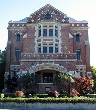
<span class="mw-page-title-main">Eldridge, California</span> Census-designated place in California, United States

Eldridge is a census-designated place (CDP) in Sonoma County, California, United States. The population was 1,233 at the 2010 census. It is notably the home to the Sonoma Developmental Center, the largest facility serving the needs of persons with developmental disabilities in the state.

<span class="mw-page-title-main">Fetters Hot Springs-Agua Caliente, California</span> Census-designated place in California, United States

Fetters Hot Springs-Agua Caliente is a census-designated place (CDP) in Sonoma Valley, Sonoma County, California, in the United States. As of the 2010 census, the CDP population was 4,144. The name Agua Caliente translates into English, from Spanish, as hot water, referring to the hot springs historically found in the area.
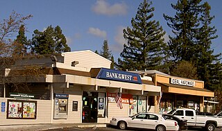
<span class="mw-page-title-main">Forestville, California</span> Census-designated place in California, United States

Forestville is a census-designated place (CDP) in Sonoma County, California, United States. It was settled during the late 1860s and was originally spelled Forrestville after one of its founders. The spelling long ago became standardized with one "r". The population was 3,293 at the 2010 census, an increase of nearly 1,000 since the 2000 census.

<span class="mw-page-title-main">Glen Ellen, California</span> Census designated place in California, United States

Glen Ellen is a census-designated place (CDP) in Sonoma Valley, Sonoma County, California, United States. The population was 784 at the 2010 census, down from 992 at the 2000 census. Glen Ellen is the location of Jack London State Historic Park, Sonoma Valley Regional Park, and a former home of Hunter S. Thompson.

<span class="mw-page-title-main">Guerneville, California</span> Census-designated place in California, United States

Guerneville is an unincorporated community and census-designated place in the Russian River Valley of Sonoma County, California, United States. The town is historically known for the logging community, formed in the late 1800s. Guerneville is also known for its natural environment, liberal atmosphere, and proximity to wine-tasting and redwood forests. It was founded by the Guerne family in the 1850s.

<span class="mw-page-title-main">Monte Rio, California</span> Census-designated place in California, United States

Monte Rio is a census-designated place (CDP) in Sonoma County, California along the Russian River near the Pacific Ocean. The town of Guerneville lies northeast of Monte Rio, and Jenner is to the west. The population was 1,152 at the 2010 census, up from 1,104 at the 2000 census. Bohemian Grove is located in Monte Rio.

<span class="mw-page-title-main">Occidental, California</span> Census-designated place in California, United States

Occidental is a census-designated place (CDP) in Sonoma County, California, United States. The population was 1,115 at the 2010 census, down from 1,272 at the 2000 census.

<span class="mw-page-title-main">Roseland, California</span> Place in California, United States

Roseland is a neighborhood in Santa Rosa, California. As of the 2010 census, the population was 6,325. Roseland was an unincorporated enclave within the City of Santa Rosa until the area was annexed by Santa Rosa on November 1, 2017.

<span class="mw-page-title-main">Temelec, California</span> Census-designated place in California, United States

Temelec is a census-designated place (CDP) in Sonoma County, California, United States. The population was 1,441 at the 2010 census.

<span class="mw-page-title-main">Larkfield-Wikiup, California</span> Census-designated place in California, United States

Larkfield-Wikiup is a census-designated place unincorporated area in Sonoma County, California, United States. The population was 8,884 at the 2010 census, up from 7,479 at the 2000 census. It comprises the Mark West area between Santa Rosa, Windsor (north), Calistoga (east), and Fulton (west). There are at least four schools within the limits of the CDP, including Cardinal Newman High School, John B. Riebli Elementary School, Mark West Elementary, and San Miguel Elementary schools.
References

  1. "2010 Census U.S. Gazetteer Files – Places – California". United States Census Bureau.
  2. U.S. Geological Survey Geographic Names Information System: Graton
  3. "Graton | Sonoma County (Official Site)". www.sonomacounty.com. Retrieved 2017-02-28.
  4. "Distance between Graton, CA and Bodega Bay, CA". Distance between cities. Retrieved 3 January 2018.
  5. McKINLEY, Jesse (2 September 2011). "Gravenstein Apples Struggle to Survive in Sonoma County". New York Times. Retrieved 3 January 2018.
  6. 1 2 "U.S. Census website". United States Census Bureau . Retrieved 2008-01-31.
  7. "OUTPOST OF AN EMPIRE" by Stephen Watrous, 2001
  8. Climate Summary for Graton, California
  9. "NOWData - NOAA Online Weather Data". National Oceanic and Atmospheric Administration . Retrieved June 19, 2022.
  10. "Summary of Monthly Normals 1991-2020". National Oceanic and Atmospheric Administration. Retrieved March 20, 2023.
  11. "Census of Population and Housing". Census.gov. Retrieved June 4, 2016.
  12. "2010 Census Interactive Population Search: CA - Graton CDP". U.S. Census Bureau. Archived from the original on July 15, 2014. Retrieved July 12, 2014.
  13. 1 2 "Statewide Database". UC Regents. Archived from the original on February 1, 2015. Retrieved December 5, 2014.
  14. 1 2 "California's 2nd Congressional District - Representatives & District Map". Civic Impulse, LLC. Retrieved March 1, 2013.
  15. Smith, Chris (March 24, 2021). "George Segal found happiness in Sonoma County with high school sweetheart". The Press Democrat. Retrieved March 24, 2021.