Bodega Bay | |
---|---|
Coordinates: 38°19′28″N123°2′19″W / 38.32444°N 123.03861°W [1] | |
Country | United States |
State | California |
County | Sonoma |
Area | |
• Total | 12.52 sq mi (32.44 km2) |
• Land | 8.35 sq mi (21.61 km2) |
• Water | 4.18 sq mi (10.82 km2) 33.37% |
Elevation | 56 ft (17 m) |
Population (2020) | |
• Total | 912 |
• Density | 109.29/sq mi (42.20/km2) |
Time zone | UTC−8 (Pacific) |
• Summer (DST) | UTC−7 (PDT) |
ZIP Code | 94923 |
Area code | 707 |
FIPS code | 06-07260 |
GNIS feature IDs | 1658093, 2407872 |
Bodega Bay is a village and census-designated place (CDP) in Sonoma County, California, United States. The population was 912 at the 2020 census. The town, located along State Route 1, is on the eastern side of Bodega Harbor, an inlet of Bodega Bay on the Pacific coast.
Bodega Bay is the site of the first Russian structures built in California, which were erected in 1809 by Commerce Counseller Ivan Alexandrovich Kuskov of the Russian-American Company in the lead-up to the establishment of Fort Ross. The Russians named the settlement in Bodega Bay Port Rumyantsev after the Russian Foreign Minister Nikolai Petrovich Rumyantsev, and it served as a port to support Fort Ross and the larger Russian community known as Colony Ross. [4] [5]
The town is now named in honor of Juan Francisco de la Bodega y Quadra, a Spanish naval officer who explored the west coast of North America as far north as Alaska during multiple voyages of discovery in the late 18th century.
The location scenes in the Alfred Hitchcock-directed film The Birds (1963) were filmed in both Bodega Bay and nearby Bodega (though both were represented as being parts of the film's Bodega Bay.) The town markets itself by using the film in many ways, including its Birds-themed visitors' center although none of the film's primary locations is found there. The church and the schoolhouse shown in the film are on the Bodega Highway in Bodega. [6] The town also featured in the cult horror film Puppet Master (1989).
The Pacific Gas and Electric Company G&E) wanted to build a nuclear power plant on Bodega Head in the 1960s, but the plans were shut down after a large protest (the first for environmental reasons) and the geologic fault which was found while it was digging the hole for the first reactor. The hole filled with water and became known as "The Hole in the Head".
In the California State Legislature, Bodega Bay is in the 2nd Senate District , represented by Democrat Mike McGuire, and in the 2nd Assembly District , represented by Democrat Jim Wood. [7]
In the United States House of Representatives, Bodega Bay is in California's 2nd congressional district , represented by Democrat Jared Huffman. [8]
Shoreline Unified School District operates the Bodega Bay School. [9]
The district's high school is Tomales High School. [10]
According to the United States Census Bureau, the CDP has a total area of 12.5 square miles (32 km2), of which 8.3 square miles (21 km2) of it is land, and 4.2 square miles (11 km2) of it (33.37%) is water. The town lies on the edge of Bodega Harbor. Bodega Bay itself extends south along the coast to Tomales Bay. North of town lies a long coastal exposure of alternating rock outcrops and sandy beaches which is known as Sonoma Coast State Beach.
The U.S. National Weather Service provides a helpful visual aid [11] graphing weather and climate information from the nearby Monterey sensors to display visually by month the annual typical temperatures, the past year's temperatures, and record temperatures.
This region experiences warm (but not hot) and dry summers, with no average monthly temperatures above 71.6 °F (22.0 °C). According to the Köppen Climate Classification system, Bodega Bay has a warm-summer Mediterranean climate, abbreviated "Csb" on climate maps. [12] Like much of the California coast, summer afternoons are often cool and windy (and sometimes foggy) as winds blow in off the ocean.
Climate data for Bodega Bay, California | |||||||||||||
---|---|---|---|---|---|---|---|---|---|---|---|---|---|
Month | Jan | Feb | Mar | Apr | May | Jun | Jul | Aug | Sep | Oct | Nov | Dec | Year |
Mean daily maximum °F (°C) | 56.6 (13.7) | 59.7 (15.4) | 60.7 (15.9) | 62.7 (17.1) | 65.8 (18.8) | 69.5 (20.8) | 70.6 (21.4) | 71.1 (21.7) | 71.0 (21.7) | 67.9 (19.9) | 61.6 (16.4) | 56.6 (13.7) | 64.5 (18.0) |
Daily mean °F (°C) | 48.9 (9.4) | 50.8 (10.4) | 51.9 (11.1) | 53.2 (11.8) | 55.8 (13.2) | 58.9 (14.9) | 60.5 (15.8) | 60.6 (15.9) | 60.0 (15.6) | 57.3 (14.1) | 52.5 (11.4) | 48.6 (9.2) | 54.9 (12.7) |
Mean daily minimum °F (°C) | 41.1 (5.1) | 41.9 (5.5) | 43.0 (6.1) | 43.6 (6.4) | 45.7 (7.6) | 48.3 (9.1) | 50.3 (10.2) | 50.1 (10.1) | 49.0 (9.4) | 46.6 (8.1) | 43.3 (6.3) | 40.5 (4.7) | 45.3 (7.4) |
Average precipitation inches (mm) | 7.6 (190) | 6.9 (180) | 5.4 (140) | 2.4 (61) | 1.4 (36) | 0.3 (7.6) | 0 (0) | 0.1 (2.5) | 0.4 (10) | 2.1 (53) | 5.1 (130) | 7.9 (200) | 39.6 (1,010.1) |
Source: Bestplaces.net [13] |
Census | Pop. | Note | %± |
---|---|---|---|
2010 | 1,077 | — | |
2020 | 912 | −15.3% | |
U.S. Decennial Census [14] |
The 2010 United States Census [15] reported that Bodega Bay had a population of 1,077. The population density was 86.0 inhabitants per square mile (33.2/km2). The ethnic makeup of Bodega Bay was 951 (88.3%) White, 2 (0.2%) African American, 4 (0.4%) Native American, 33 (3.1%) Asian, 4 (0.4%) Pacific Islander, 49 (4.5%) from other races, and 34 (3.2%) from two or more races. Hispanic or Latino of any race were 126 persons (11.7%).
The Census reported that 99.0% of the population lived in households and 1.0% lived in non-institutionalized group quarters.
There were 533 households, out of which 77 (14.4%) had children under the age of 18 living in them, 278 (52.2%) were opposite-sex married couples living together, 22 (4.1%) had a female householder with no husband present, 14 (2.6%) had a male householder with no wife present. There were 33 (6.2%) unmarried opposite-sex partnerships, and 8 (1.5%) same-sex married couples or partnerships. 170 households (31.9%) were made up of individuals, and 67 (12.6%) had someone living alone who was 65 years of age or older. The average household size was 2.00. There were 314 families (58.9% of all households); the average family size was 2.48.
The population was spread out, with 131 people (12.2%) under the age of 18, 52 people (4.8%) aged 18 to 24, 172 people (16.0%) aged 25 to 44, 409 people (38.0%) aged 45 to 64, and 313 people (29.1%) who were 65 years of age or older. The median age was 57.2 years. For every 100 females, there were 105.9 males. For every 100 females age 18 and over, there were 106.1 males.
There were 1,060 housing units at an average density of 84.6 per square mile (32.7/km2), of which 67.9% were owner-occupied and 32.1% were occupied by renters. The homeowner vacancy rate was 4.6%; the rental vacancy rate was 23.7%. 65.3% of the population lived in owner-occupied housing units and 33.7% lived in rental housing units.
As of the census [16] of 2000, there were 1,423 people, 669 households, and 432 families residing in the CDP. The population density was 169.7 inhabitants per square mile (65.5/km2). There were 1,144 housing units at an average density of 136.4 per square mile (52.7/km2). The racial makeup of the CDP was 85.52% White, 0.35% African American, 1.55% Native American, 1.34% Asian, 9.07% from other races, and 2.18% from two or more races. Hispanic or Latino of any race were 15.18% of the population. There were 669 households, out of which 14.5% had children under the age of 18 living with them, 57.5% were married couples living together, 3.9% had a female householder with no husband present, and 35.4% were non-families. 27.2% of all households were made up of individuals, and 9.1% had someone living alone who was 65 years of age or older. The average household size was 2.11 and the average family size was 2.47.
In the CDP, the population was 12.7% under the age of 18, 6.2% from 18 to 24, 21.7% from 25 to 44, 36.5% from 45 to 64, and 22.8% who were 65 years of age or older. The median age was 51 years. For every 100 females, there were 108.0 males. For every 100 females age 18 and over, there were 106.3 males. The median income for a household in the CDP was $56,818, and the median income for a family was $60,750. Males had a median income of $27,778 versus $28,375 for females. The per capita income for the CDP was $37,226. About 2.0% of families and 4.0% of the population were below the poverty line. This includes none of those under the age of eighteen or sixty-five or over.
Bodega Bay was the hometown of Nicholas Green, the American child shot dead during a robbery by highwaymen in Italy where his family were on vacation in 1994. Nicholas and his family became famous when almost every organ or body part was donated to those in need following his death. [17]
Erden Eruç made history here when he completed the first entirely solo and entirely human-powered circumnavigation of the Earth. He began the expedition on July 10, 2007 in Bodega Bay and returned a little more than five years later on July 21, 2012. [18] [19]
Bodega Bay has served as a location for several major films and TV shows: [20] [21] [22]
A branch of the University of California operates a marine lab at Bodega Bay, the Bodega Marine Laboratory. [26]
A nuclear power plant had been planned for Bodega Bay in the 1960s but was abandoned after both local and statewide protests and the discovery of the San Andreas fault near the proposed site. Excavation for the site began at Bodega Head, and since the project was abandoned the area has been referred to by locals as "The Hole in the Head." [27]
Magalia is an unincorporated community and census-designated place (CDP) in Butte County, California, United States. The population was 11,310 at the 2010 census.
Willow Creek is a census-designated place (CDP) in Humboldt County, California, United States. The population was 1,710 at the 2010 census, down from 1,743 at the 2000 census. Residents of this small mountain town are commonly referred to as "Willow Creekers." The town is located around 30 miles (48 km) from county seat and harbor city Eureka, with the two places vastly differing in climate.
Winterhaven is a census-designated place (CDP) in Imperial County, California. Winterhaven is 6.5 miles (10 km) east of Pilot Knob, The population was 394 at the 2010 census, down from 529 at the 2000 census. It is part of the El Centro, CA Metropolitan Area. North of Interstate 8 and bordering Yuma, Arizona, the town is partly in the Fort Yuma Indian Reservation. The Colorado River marks the town's southern border.
Wasco is a city in the San Joaquin Valley, in Kern County, California, United States. Wasco is located 24 miles (39 km) northwest of Bakersfield, at an elevation of 328 feet (100 m). The population was 25,545 at the 2010 census, up from 21,263 at the 2000 census.
Covelo is a census-designated place (CDP) in Mendocino County, California, United States. Covelo is located 14 miles (23 km) east-northeast of Laytonville, at an elevation of 1,398 feet (426 m). The population was 1,394 at the 2020 census, up from 1,255 at the 2010 census. 405 acres (1.64 km2) of Covelo is part of the Round Valley Indian Reservation.
Mendocino is an unincorporated community in Mendocino County, California, United States. The name comes from Cape Mendocino 85 miles (137 km) to the north, named by early Spanish navigators in honor of Antonio de Mendoza, Viceroy of New Spain. Despite its small size, the town's scenic location on a headland surrounded by the Pacific Ocean has made it extremely popular as an artists' colony and with vacationers.
Le Grand is an unincorporated community and census-designated place (CDP) in Merced County, California, United States. Le Grand is 14 miles (23 km) east-southeast of Merced, the county seat at an elevation of 253 feet (77 m). The population was 1,592 at the 2020 census, down from 1,659 at the 2010 census.
Los Alamos is an unincorporated community in Santa Barbara County, California, United States. Located in the Los Alamos Valley, the town of Los Alamos is considered to be a part of the Santa Ynez Valley community. Los Alamos is also connected to other cities Vandenberg SFB, Lompoc, Buellton, Solvang, and other Santa Barbara County cities. It is 140 miles northwest of Los Angeles and 281 miles (452 km) south of San Francisco. The population was 1,890 at the 2010 census, up from 1,372 at the 2000 census. For statistical purposes, the United States Census Bureau has defined Los Alamos as a census-designated place (CDP).
Tulelake is a city in northeastern Siskiyou County, California, United States. The town is named after nearby Tule Lake. Its population is 902 as of the 2020 census, down from 1,010 from the 2010 census.
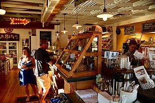
Graton is an unincorporated town and census-designated place (CDP) in west Sonoma County, California, United States. The population was 1,707 at the 2010 census. Graton's ZIP code is 95444. The town also has a culinary reputation attributed to two restaurants in the area.
Guerneville is an unincorporated community and census-designated place in the Russian River Valley of Sonoma County, California, United States. The town is historically known for the logging community, formed in the late 1800s. Guerneville is also known for its natural environment, liberal atmosphere, and proximity to wine-tasting and redwood forests. It was founded by the Guerne family in the 1850s.
Weaverville is a census-designated place and the county seat of Trinity County, California, United States. Its population is 3,667 as of the 2020 census, up from 3,600 from the 2010 census.
Jamestown is a census-designated place (CDP) in Tuolumne County, California, United States. The population was 3,433 at the 2010 census, up from 3,017 at the 2000 census. Formerly a California Gold Rush town, Jamestown is a California Historical Landmark since March 16, 1949. It is the home of Railtown 1897 State Historic Park and the Sierra Railway, which operates steam passenger trains.
Bodega is an unincorporated community and census-designated place (CDP) in Sonoma County in the U.S. state of California. The town had a population of 220 as of the 2010 Census.
Valley Ford is an unincorporated community and census-designated place (CDP) in western Sonoma County, California, United States. It is located on State Route 1 north of San Francisco. Like all of Sonoma County, Valley Ford is included in both the San Francisco Bay Area and the Redwood Empire.
Smartsville is a census-designated place in Yuba County, California, United States, in the foothills of the Sierra Nevada. It is one of the many historic towns in California's gold country, and is today a California Historical Landmark. Located at an altitude of 669 feet (204 m), Smartsville lies about 15 miles (24 km) east-northeast of Marysville, along State Route 20. The population was 177 at the 2010 census.
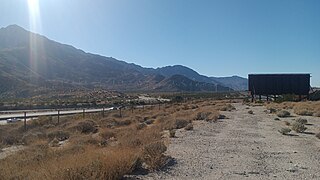
Thermal is an unincorporated community within the Coachella Valley in Riverside County, California, United States, located approximately 25 miles (40 km) southeast of Palm Springs and about 9.5 miles (15.3 km) north of the Salton Sea. The community's elevation is 138 feet (42 m) below mean sea level. It is served by area codes 760 and 442 and is in ZIP Code 92274. The population was 2,865 at the 2010 census. For statistical purposes, the United States Census Bureau has defined Thermal a census-designated place (CDP), which does not precisely correspond to the historical community.
Whitewater is a census-designated place in Riverside County, California. It is directly off Interstate 10 halfway between North Palm Springs and Cabazon on the way from Palm Springs to Los Angeles. It is known as the site of the San Gorgonio Pass Wind Farm. The ZIP Code is 92282, and the community is inside area code 760. The population was 859 at the 2010 census. The elevation is 1,575 feet (480 m).
Salmon Creek is an unincorporated community settlement and census-designated place (CDP) in Sonoma County, California, U.S. It is located on the Pacific coast about 90 minutes drive north of San Francisco, between the towns of Jenner and Bodega Bay, California. The population was 86 at the 2010 census.
Manchester is a census-designated place in Mendocino County, California, United States. It is located 5 miles (8 km) north of Point Arena at an elevation of 85 feet (26 m). The population was 159 at the 2020 census, down from 195 in 2010.