Salmon Creek, California

Last updated

Salmon Creek
SalmonCreekCA3197.jpg
houses in Salmon Creek
USA California location map.svg
Red pog.svg
Salmon Creek
Location within the state of California
Coordinates: 38°21′2″N123°3′44″W / 38.35056°N 123.06222°W / 38.35056; -123.06222
Country Flag of the United States.svg  United States
State Flag of California.svg  California
County Sonoma
Metro Area San Francisco Bay Area
Area
[1]
  Total1.114 sq mi (2.886 km2)
  Land1.114 sq mi (2.886 km2)
  Water0 sq mi (0 km2)  0%
Elevation
[2]
46 ft (14 m)
Population
 (2010)
  Total86
  Density77/sq mi (30/km2)
Time zone UTC-8 (PST)
  Summer (DST) UTC-7 (PDT)
ZIP code
94923
Area code 707
FIPS code 06-64252
GNIS feature ID1659573

Salmon Creek is an unincorporated community settlement and census-designated place (CDP) in Sonoma County, California, U.S. It is located on the Pacific coast about 90 minutes drive north of San Francisco, between the towns of Jenner and Bodega Bay, California. The population was 86 at the 2010 census.

Contents

The settlement is bounded to the north by Salmon Creek, to the east by State Route 1 and to the west and south by Sonoma Coast State Beach.

History

The Coast Miwok village of Pulya-lakum was formerly located near the mouth of Salmon Creek. [3] In 1812, the Russian-American Company established Fort Ross about 12 miles (19 km) northwest of present-day Salmon Creek, bringing the area into the Russian Empire's sphere of influence.

Geography

According to the United States Census Bureau, the CDP covers an area of 1.1 square miles (2.9 km2), all of it land.

Demographics

2010

The 2010 United States Census [4] reported that Salmon Creek had a population of 86. The population density was 77.2 inhabitants per square mile (29.8/km2). The racial makeup of Salmon Creek was 100.0% White (98.8% non-Hispanic). 1.2% of the population was Hispanic or Latino of any race.

The Census reported that 100% of the population lived in households.

There were 45 households, out of which 2 (4.4%) had children under the age of 18 living in them, 22 (48.9%) were opposite-sex married couples living together, 2 (4.4%) had a female householder with no husband present, 1 (2.2%) had a male householder with no wife present. There were 1 (2.2%) unmarried opposite-sex partnerships, and 0 (0%) same-sex married couples or partnerships. 18 households (40.0%) were made up of individuals, and 5 (11.1%) had someone living alone who was 65 years of age or older. The average household size was 1.91. There were 25 families (55.6% of all households); the average family size was 2.52.

The population was spread out, with 5 people (5.8%) under the age of 18, 3 people (3.5%) aged 18 to 24, 13 people (15.1%) aged 25 to 44, 42 people (48.8%) aged 45 to 64, and 23 people (26.7%) who were 65 years of age or older. The median age was 59.0 years. For every 100 females, there were 104.8 males. For every 100 females age 18 and over, there were 102.5 males.

There were 116 housing units at an average density of 104.1 per square mile (40.2/km2), of which 75.6% were owner-occupied and 24.4% were occupied by renters. The homeowner vacancy rate was 10.3%; the rental vacancy rate was 0%. 83.7% of the population lived in owner-occupied housing units and 16.3% lived in rental housing units.

2000

As of the Census 2000 the primary language spoken in the 94923 ZIP code were 83% English, 17% languages other than English including 13% Spanish, 2% German, 1% French, 1% Tagalog, and 1% Russian. [5]

The population of the ZIP code was 1,769. [6] However, that ZIP code also includes the town of Bodega Bay, California and rural areas. Salmon Creek was only designated a CDP for the 2010 census.

Related Research Articles

<span class="mw-page-title-main">Dillon Beach, California</span> Census-designated place in California, United States

Dillon Beach is a census-designated place (CDP) in Marin County, California, United States. It is located 3.25 miles (5.2 km) west of Tomales, at an elevation of 89 ft (27 m). The population was 246 at the 2020 census. Dillon Beach was named after the founder, George Dillon, who settled there in 1858. The area includes a public access beach, as well as a private beach resort, the only private beach in California.

<span class="mw-page-title-main">Lagunitas-Forest Knolls, California</span> Census-designated place in California, United States

Lagunitas-Forest Knolls is a census-designated place, composed of two unincorporated areas in the western half of the San Geronimo Valley in Marin County, California. It is located to the west of San Geronimo and Woodacre. The population was 1,924 at the 2020 census.

<span class="mw-page-title-main">Tomales, California</span> Census-designated place in California, United States

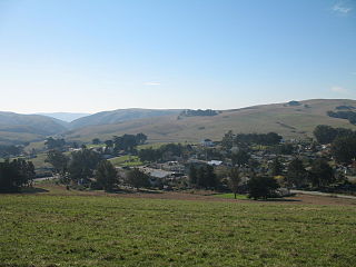
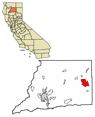
Tomales is a census-designated place (CDP) on State Route 1 in Marin County, California, United States. The population was 187 at the 2020 census.

<span class="mw-page-title-main">Bodega Bay, California</span> Census-designated place in California, United States

Bodega Bay is a village and census-designated place (CDP) in Sonoma County, California, United States. The population was 912 at the 2020 census. The town, located along State Route 1, is on the eastern side of Bodega Harbor, an inlet of Bodega Bay on the Pacific coast.

<span class="mw-page-title-main">Eldridge, California</span> Census-designated place in California, United States

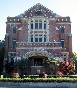
Eldridge is a census-designated place (CDP) in Sonoma County, California, United States. The population was 1,233 at the 2010 census. It is notably the home to the Sonoma Developmental Center, the largest facility serving the needs of persons with developmental disabilities in the state.

<span class="mw-page-title-main">Fetters Hot Springs-Agua Caliente, California</span> Census-designated place in California, United States

Fetters Hot Springs-Agua Caliente is a census-designated place (CDP) in Sonoma Valley, Sonoma County, California, in the United States. As of the 2010 census, the CDP population was 4,144. The name Agua Caliente translates into English, from Spanish, as hot water, referring to the hot springs historically found in the area.

<span class="mw-page-title-main">Glen Ellen, California</span> Census designated place in California, United States

Glen Ellen is a census-designated place (CDP) in Sonoma Valley, Sonoma County, California, United States. The population was 784 at the 2010 census, down from 992 at the 2000 census. Glen Ellen is the location of Jack London State Historic Park, Sonoma Valley Regional Park, and a former home of Hunter S. Thompson.

<span class="mw-page-title-main">Graton, California</span> Census-designated place in California, United States

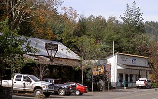
Graton is an unincorporated town and census-designated place (CDP) in west Sonoma County, California, United States. The population was 1,707 at the 2010 census. Graton's ZIP code is 95444. The town also has a culinary reputation attributed to two restaurants in the area.

<span class="mw-page-title-main">Temelec, California</span> Census-designated place in California, United States

Temelec is a census-designated place (CDP) in Sonoma County, California, United States. The population was 1,441 at the 2010 census.

<span class="mw-page-title-main">Mi-Wuk Village, California</span> Census-designated place in California, United States

Mi-Wuk Village is a census-designated place (CDP) in Tuolumne County, California, United States. The population was 941 at the 2010 census, down from 1,485 at the 2000 census. It was named after the Miwok Indians by the real estate developer and promoter Harry Hoeffler in 1955.

<span class="mw-page-title-main">Larkfield-Wikiup, California</span> Census-designated place in California, United States

Larkfield-Wikiup is a census-designated place unincorporated area in Sonoma County, California, United States. The population was 8,884 at the 2010 census, up from 7,479 at the 2000 census. It comprises the Mark West area between Santa Rosa, Windsor (north), Calistoga (east), and Fulton (west). There are at least four schools within the limits of the CDP, including Cardinal Newman High School, John B. Riebli Elementary School, Mark West Elementary, and San Miguel Elementary schools.

<span class="mw-page-title-main">Loma Mar, California</span> Census-designated place in California, United States

Loma Mar is a census-designated place (CDP) in San Mateo County, California. It is near San Mateo County Memorial Park on Pescadero Creek Road and is in area code 650. Loma Mar is between the towns of Pescadero and La Honda, situated in the Santa Cruz Mountains in the western part of the San Francisco Peninsula. The United States Postal Service has assigned it ZIP Code 94021. As of the census of 2020, there were 134 residents in the CDP. Loma Mar is home to the YMCA's Camp Loma Mar, Redwood Glen Camp and Conference Center as well as a small number of businesses and services including the Loma Mar Store, a post office, and a fire station run by volunteers.

<span class="mw-page-title-main">Jenner, California</span> Census-designated place in California, United States

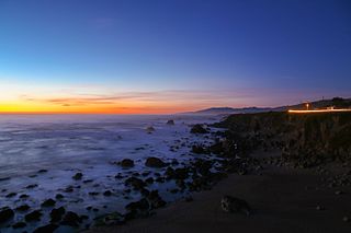
Jenner, also known as Jenner-by-the-Sea, is a small coastal town and census-designated place (CDP) in Sonoma County, California, U.S. with a population of about 122 per the 2020 census. It is located on the Pacific coast near the mouth of the Russian River. State Route 1 runs through the town and State Route 116 runs nearby, along the Russian River. Immediately south of Jenner is Goat Rock Beach, a unit within the Sonoma Coast State Beach.

<span class="mw-page-title-main">Bodega, California</span> Unincorporated community in California, United States

Bodega is an unincorporated community and census-designated place (CDP) in Sonoma County in the U.S. state of California. The town had a population of 220 as of the 2010 Census.

<span class="mw-page-title-main">Cazadero, California</span> Unincorporated community in California, United States

Cazadero is an unincorporated community and census-designated place (CDP) in western Sonoma County, California, United States with a population of 354 in 2010. The downtown of Cazadero consists of two churches, a general store, a post office, a hardware store, an auto repair garage, private office space, and the Cazadero Volunteer Fire Department.

Valley Ford is an unincorporated community and census-designated place (CDP) in western Sonoma County, California, United States. It is located on State Route 1 north of San Francisco. Like all of Sonoma County, Valley Ford is included in both the San Francisco Bay Area and the Redwood Empire.

<span class="mw-page-title-main">Hat Creek, California</span> Census designated place in California, United States

Hat Creek is a census designated place (CDP) in Shasta County, California. Hat Creek is situated at an elevation of 3,422 feet (1,043 m). Its population is 266 as of the 2020 census, down from 309 from the 2010 census.

<span class="mw-page-title-main">Bloomfield, California</span> Census-designated place in California, United States

Bloomfield is a census-designated place in Sonoma County, California, U.S. It is located in a rural area about 11 miles (18 km) southwest of Santa Rosa at the junction of Bloomfield Road and Valley Ford Road. Americano Creek flows westward along the south edge of the town.

<span class="mw-page-title-main">Fulton, California</span> Census-designated place in California, United States

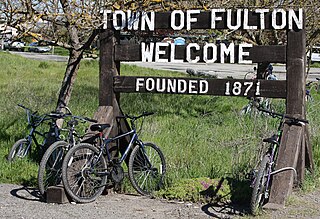
Fulton is a census-designated place (CDP) in Sonoma County, California, United States. Fulton is just to the north of the city limits of Santa Rosa, and 7 miles (11 km) north-northeast of Sebastopol. Fulton has a post office, established in 1871 and assigned ZIP code 95439. The community is named after Thomas and James Fulton, who founded the community. The population as of the 2010 U.S. Census was 541. There are a set of railway lines which go through the town boundaries; these lines are used by Sonoma–Marin Area Rail Transit. Fulton was once home to a chicken processing plant that was in operation from the 1960s until its closure in 2010.

<span class="mw-page-title-main">Carmet, California</span> Census-designated place in California, United States

Carmet is a census-designated place (CDP) in Sonoma County, California. Carmet sits at an elevation of 180 feet (55 m). The 2010 United States census reported Carmet's population was 47.

References

  1. "2010 Census U.S. Gazetteer Files – Places – California". United States Census Bureau.
  2. "Salmon Creek". Geographic Names Information System . United States Geological Survey, United States Department of the Interior.
  3. "Miwok Indian Tribe". Access Genealogy. Retrieved December 4, 2007.
  4. "2010 Census Interactive Population Search: CA - Salmon Creek CDP". U.S. Census Bureau. Archived from the original on July 15, 2014. Retrieved July 12, 2014.
  5. MLA Date Center Archived 2008-08-01 at the Wayback Machine , access date July 31, 2008
  6. Relocation Now, access date July 31, 2008