Delhi Ridge

Last updated

Forest area of Delhi Ridge Peacock in its habitat.jpg
Forest area of Delhi Ridge

Delhi Ridge, sometimes simply called The Ridge, is a ridge in the Northern Aravalli leopard wildlife corridor in the National Capital Territory of Delhi in India. [1] It is a northern extension of the ancient Aravalli Range, some 1.5 billion years old (by comparison, the Himalayas are "only" 50 million years old). [2] [3] The ridge consists of quartzite rocks and extends from the southeast at Tughlaqabad, near the Bhatti mines, branching out in places and tapering off in the north near Wazirabad on the west bank of the river Yamuna, [4] covering about 35 kilometres. [5]

Contents

The Ridge acts as the "green lungs" for the city, and protects Delhi from the hot winds of the deserts of Rajasthan to the west. It has also enabled Delhi to be the world's second most bird-rich capital city, after Kenya's Nairobi. [6]

Though modest in height, the ridge acts as a watershed dividing the Indus Plain to the west from the Gangetic Plain to the east, within the Indo-Gangetic plain.

History

It is believed that the Aravallis are one of the oldest mountain ranges in India which evolved around 2.5 billion years ago in the Archaeozoic times. Range extends from Gujarat through Rajasthan to Haryana-Delhi. In Delhi the spurs of the Aravallis are commonly called as the Delhi Ridge which is divided into the Northern, Central, South Central and Southern Ridge. [7]

In 1993, parts of north Delhi, central Delhi, south West Delhi and south Delhi covering 7,777 hectares was declared a reserve forest. Thereafter in 1994 and 1996, a major part of the ridge was notified by the Government, thus stopping all construction. [8] [9]

Over the years, pressures of urban development, have seen forests of Delhi ridge under threat. In many areas, landscaped public parks, and public housing have come up, plus the area also faces dumping of construction waste. [10]

Geographical segments

The Ridge today, for administrative reasons, is divided into 4 separate zones, [11] namely:

  1. The Old Delhi or Northern Ridge denotes the hilly area near Delhi University and is by far the smallest segment of the Ridge. Northern Ridge location is 28°40′52″N 77°12′57″E. Nearly 170 hectares were declared a Reserved Forest in 1915. Less than 87 hectares remain today near Delhi University, which is being developed as the Northern ridge biodiversity park by the Delhi Development Authority.
  2. The New Delhi or Central Ridge was made into a Reserved Forest in 1914 and stretches from just south of Sadar Bazaar to Dhaula Kuan. It extends over 864 hectares, but some bits have been nibbled away.
  3. The Mehrauli or South-Central Ridge is centred on "Sanjay Vana", near JNU and Vasant Kunj, and encompasses 633 hectares. Large chunks have been encroached and built upon. 70 hectares approximately near Sainik Farm are being developed as the Tilpath Valley Biodiversity Park.
  4. The Tughlaqabad or Southern Ridge sprawls across 6200 hectares and includes the Asola Bhatti Wildlife Sanctuary. This is the least urban of the 4 segments of the Ridge, but a lot of it is village-owned or privately owned farmland. This includes Bandhwari and Mangar Bani forests.

Northern ridge

Also known as the Kamala Nehru Ridge it covers an area of 87 hectares and is located near the north campus of Delhi University. The area is an interesting mix of nature and history and houses the Northern ridge biodiversity park developed and maintained by the Delhi Development Authority (DHA). [12]

Historical monuments

Flagstaff Tower Flagstaff Tower 4.jpg
Flagstaff Tower

The North Ridge contains several monuments that date from the pre-Mughal to the British period. [12] [13] [14]

  1. Mutiny Memorial
  2. Ashokan Pillar
  3. Pir Ghaib (inside Hindu Rao Hospital)
  4. Baoli (Step well) inside Hindu Rao Hospital
  5. Chauburja Masjid
  6. Flagstaff Tower
  7. Eastern Guard House

Central ridge

Central ridge includes 864 hectares which were made into a Reserved Forest in 1914 and stretches from just south of Sadar Bazaar to Dhaula Kuan.

Buddha Jayanti Park

Buddha statue in the Buddha Jayanti Park Buddha-jayanti-park.jpg
Buddha statue in the Buddha Jayanti Park

The Buddha Jayanti Smarak Park is situated in the central part of the Delhi ridge in New Delhi, India. It occupies a stretch of almost a kilometre on the eastern side of Vandemataram Marg, also known as Upper Ridge Road. It was created on the occasion of the 2500th anniversary of Gautama Buddha's enlightenment by Indian architect M. M. Rana. [15] A sapling of the Bodhi Tree from Sri Lanka was planted here by the then Prime Minister of India Shri. Lal Bahadur Shastri on 25 October 1964.

On an artificial island in the park stands pavilion with a gilded Buddha statue in it. It was dedicated by the 14th Dalai Lama in October 1993. Each year in May on Vaisakha Full moon day the Buddha Jayanti festival is celebrated here.

Neeraj Gupta, an Indian sculpture artist and environmentalist is the president of Buddha Jayanti Park. In August 2023, Gupta planted 1000 Cassia fistula (Amaltas) trees. [16] [17] [18]

South-Central Ridge

South-Central Ridge is encompasses 633 hectares. Large chunks have been encroached and built upon.

Aravalli Biodiversity Park

Aravalli Biodiversity Park, Gurgaon Aravali Biodiversity Park, Gurgaon.jpg
Aravalli Biodiversity Park, Gurgaon
Northern Palm Squirrel in 'Aravalli Biodiversity Park', Delhi Northern palm squirrel.jpg
Northern Palm Squirrel in 'Aravalli Biodiversity Park', Delhi

Aravalli Biodiversity Park [7] is an area spreading over 2.8 km2 (690 acres) on the South Central Delhi Ridge within the Aravalli Range. The area is confined by JNU, Mehrauli-Mahipalpur road, NH-8, Vasant Kunj, Masoodpur, Palam road and the southern boundary of Vasant Vihar. DDA and DU, under the joint Biodiversity Parks Programme, maintain the area. Every year a substantial amount of money is spent in restoration, development and maintenance.

The land under Aravalli Biodiversity Park was once a site for mining. Martha Shinde (Scindias) had a mining lease for the 2.3 km2 (0.89 sq mi) area. They plundered out whatever they could. For years Shinde exploited forest resources including minerals, mica, sand, stone, rocks and water. Land, which once was covered with a dense forest, soon turned into pits and hillocks.

Scientists from the Centre for Environmental Management of Degraded Ecosystems (CEMDE) of University of Delhi have so far reintroduced over 10 ecosystems with over 40 biotic communities. Portions of Aravalli, which come under Gujarat, are covered with natural dense forest. However, the land on which Aravalli Biodiversity Park is being developed, was devoid of such natural growth of forest due to extensive mining of the area. The CEMDE and DDA are reviving native flora and fauna of Aravalli hill ranges by planting of native species, such as dhau (Anogeissus pendula), dhak (Butea monosperma), babul (Acacia nilotica) and kair (Capparis decidua). A rangeland with native grasses has been developed and a systematic planting program is carried out and every year native trees and bushes are planted to remove unwanted weeds, i.e. Prosopis juliflora. A conservatory of butterflies, orchidarium and fernery has been developed.

The Aravali Biodiversity Park, Gurgaon, on Gurgaon-Delhi border, developed by the Municipal Corporation of Gurgaon, was inaugurated on 5 June 2010, World Environment Day. [7]

Neela Hauz Biodiversity Park

Neela Hauz biodiversity park, next to Sanjay Van in South Central Ridge, was restored in 2015-16. In 2014, of the 611 water bodies in Delhi, 274 were dead and remaining were in bad shape. Neela hauz is a freshwater lake which was slowly dying due to the dumping of waste. [19] During ancient times it used to be the main source of water supply for the Rajput city of Qila Rai Pithora. [19] During ancient times, its basin was recharged by the wider dense forests of Sanjay Van and its overflow drained in to Yamuna. [19]

In 2014, the wetland was covered with water hyacinth and ridge was infested with the invasive species of prosopis juliflora (Vilayati Babul or Kikar of Mexican origin), which were planted in the 1920s by the Britisher colonisers to rehabilitate the wasteland. [20] [21] [19] The silted up lake was encroached upon and raw sewage drained into it, causing concerned citizens to take an order from Delhi High Court to have it restored by the government. [19] After the restoration started in 2015, this biodiversity park was officially inaugurated in November 2016. [19]

Sanjay Van

Sanjay Van is located near Jawaharlal Nehru University and Vasant Kunj.

Southern Ridge

Southern Ridge sprawls across 6200 hectares and includes the Asola Bhatti Wildlife Sanctuary, Bandhwari and Mangar Bani forests. This is the least urban of the 4 segments of the Ridge, but a lot of it is village-owned or privately owned farmland.

Asola Bhatti Wildlife Sanctuary

Asola Bhatti Wildlife Sanctuary is a 32.71 km2 biodiversity area in the South Ridge on Delhi-Haryana border lies south of Delhi. It is an important habitat for the Indian leopard. Endangered species in the sanctuary include red-headed vulture and egyptian vulture, and the Government of Haryana has a vulture conservation program in place. Near-threatened species include painted stork, white-faced ibis and european roller. Rare birds include black francolin and grey-headed fish eagle. Plant species include butea monosperma (dhak or flame of forest), anogeissus (dhok), Wrightia tinctoria (inderjao), Indian elm, neolamarckia cadamba (kadamba), prosopis cineraria (jaand), tinospora cordifolia (giloi), etc. [22]

Mangar Bani forest

Mangar Bani, neolithic archaeological site and sacred grove hill forest on Delhi-Haryana border, is in the South Delhi Ridge of Aravalli mountain range in Faridabad tehsil of Faridabad district in the Indian state of Haryana. [23] [24] [25]

It lies within the Northern Aravalli leopard wildlife corridor stretching from Sariska Tiger Reserve to Delhi. Historical place around sanctuary are Badkhal Lake (6 km northeast), 10th century ancient Surajkund reservoir (15 km north) and Anangpur Dam (16 km north), Damdama Lake, Tughlaqabad Fort and Adilabad ruins (both in Delhi), Chhatarpur Temple (in Delhi). [26] It is contiguous to the seasonal waterfalls in Pali-Dhuaj-Kot villages of Faridabad, [27] and the Asola Bhatti Wildlife Sanctuary. It is also an important wetland for the migratory birds as there are several dozen lakes formed in the abandoned open pit mines in and around the area.

Spread over 5000 ha, this is the largest pre-historic site and stone age tool making factory in the Indian subcontinent, first ever site discovered in the Aravalli range with cave paintings. The stone tools and rock art dating back to 100,000 years BP and cave paintings date back to 20,000-40,000 BP. This is also the oldest human habitation discovered in Haryana and Delhi NCR. [28]

Tilpath Valley Biodiversity Park

Tilpath Valley Biodiversity Park, spread over 172 acres is a biodiversity area in the South Ridge, immediately northwest of Asola Bhatti Wildlife Sanctuary and south of Sainik Farm. Before the area had valleys dotted with the sand-mined quarries, dried up springs due to no charging of ground water, with no forest cover except the invasive weed species of prosopis juliflora, lantana and parthenium. This was replaced with 3 layer of forest community with native trees and plants such as mahua, haldu, sheesham and bael. Scrubland was restored to attract reptiles and birds. 100,000 trees were planted in 2015 with the effort of 40,000 volunteers in 6 hours and 20,000 trees in 2016 again. Wildlife survey is conducted using pugmarks are tracking using pug impression pad and by photographing the wild animals. [20] It now covers grasslands, hilly terrain, 105 plant species, 103 bird species, 32 butterflies species, 15 herpetofauna (reptiles and amphibians) species and eight mammalian species including leopard, Indian rock python, jackals, neelgai, mongooses, porcupines, small Indian civet, gecko, Sirkeer malkoha cuckoo, nightjar, Indian paradise flycatcher. [21]

Being developed since 2015, it was officially inaugurated as Delhi's third biodiversity park on 3 February 2018. [20] [21]

See also

Related Research Articles

<span class="mw-page-title-main">Aravalli Range</span> Mountain range in western India

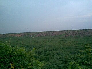
The Aravalli Range is a mountain range in Northern-Western India, running approximately 670 km (420 mi) in a south-west direction, starting near Delhi, passing through southern Haryana, Rajasthan, and ending in Ahmedabad Gujarat. The highest peak is Guru Shikhar on Mount Abu at 1,722 m (5,650 ft). The Aravalli Range is arguably the oldest geological feature on Earth, having its origin in the Proterozoic era.

<span class="mw-page-title-main">Gurgaon district</span> District in Haryana, India

Gurgaon district, officially known as Gurugram district, is one of the 22 districts of Haryana in northern India. The city of Gurgaon is the administrative headquarters of the district. The population is 1,514,432. It is one of the southern districts of Haryana. On its north, it is bounded by the district of Jhajjar and the Union Territory of Delhi. Faridabad district lies to its east. To its south lie the districts of Palwal and Nuh. To the west lies Rewari district.

<span class="mw-page-title-main">Badkhal Lake</span> Lake in India

Badkhal Lake is a natural lake situated in Badkhal village near Faridabad, in the Indian state of Haryana, about 32 kilometers from the national capital of Delhi. Fringed by the hills of the Aravalli Range, this was a man-made embankment. Owing to unchecked mining in neighbouring areas, the lake began drying up two decades back and is now totally dried up. There are functional Haryana Tourism Corporation restaurants in the vicinity. A flower show is held every spring here. Its name is most probably derived from the Persian word beydakhal, which means free from interference. Close to Badkhal Lake is the Peacock Lake. It is a biodiversity area within the Northern Aravalli leopard wildlife corridor stretching from Sariska Tiger Reserve to Delhi.

<span class="mw-page-title-main">Surajkund</span> Reservoir in Haryana state, India

Surajkund is an ancient reservoir of the 10th century located on Southern Delhi Ridge of Aravalli range in Faridabad city of Haryana state about 8 km from South Delhi. Surajkund is an artificial Kund built in the backdrop of the Aravalli hills with an amphitheatre shaped embankment constructed in semicircular form. It is said to have been built by the king Surajpal of the Tomara Rajputs in the 10th century. Tomar, a younger son of Anangpal Tomar – the Rajput ruler of Delhi, was a sun worshipper and he had therefore built a Sun temple on its western bank. Surajkund is known for its annual fair "Surajkund International Craft Mela", 2015 edition of this fair was visited by 1.2 million visitors including 160,000 foreigners with more than 20 countries participating in it.

<span class="mw-page-title-main">Chhatarpur Temple</span> Hindu temple in India

Chhatarpur Temple is a temple dedicated to the goddess Katyayani. The entire complex of the temple is spread over a wide area of 28 hectares. It is located in Chhatarpur, on the southwestern outskirts of the New Delhi The temple was established in 1974, by Baba Sant Nagpal ji, who died in 1998. His samadhi shrine lies in the premises of the Shiv-Gauri Nageshwar Mandir within the temple complex.

<span class="mw-page-title-main">Anangpur Dam</span> Dam in Delhi and Haryana

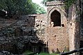
The Anangpur Dam is an Indian hydraulic engineering structure built during the reign of the King Anangpal I of the Tomara Rajputs in the 8th century. It is located near the Anangpur village in Faridabad district, Haryana, India.

Bandhwari is a village dominated by Gurjar community in Gurgaon district in the Indian state of Haryana. It is an important biodiversity area contiguous to Asola Bhatti Wildlife Sanctuary within the Northern Aravalli leopard wildlife corridor. Bandhwari is also nicknamed the "cancer village", because one in every three household has a cancer patient, caused by the mixing of leachate from the garbage landfill into the groundwater.

Gwal Pahari is a village dominated by Gurjar community in Gurugram Mandal in the Gurugram District of Haryana state, India.

<span class="mw-page-title-main">Asola Bhatti Wildlife Sanctuary</span> Wildlife sanctuary near Delhi, India

Asola-Bhati Wildlife Sanctuary covering 32.71 km2 area on the Southern Delhi Ridge of Aravalli hill range on Delhi-Haryana border lies in Southern Delhi as well as northern parts of Faridabad and Gurugram districts of Haryana state. Biodiversity significance of Ridge lies in its merger with Indo-Gangetic plains, as it is the part of the Northern Aravalli leopard wildlife corridor, an important wildlife corridor which starts from the Sariska National Park in Rajasthan, passes through Nuh, Faridabad and Gurugram districts of Haryana and ends at Delhi Ridge.

<span class="mw-page-title-main">Damdama Lake</span> Lake in Haryana, India

Damda reservoir in Sohna, near Gurugram city in Gurugram district in the Indian state of Haryana. Damdama Lake is a small lake in Haryana and was formed when a stone and earthen dam constructed by the British was commissioned for rain water harvesting in 1947. The lake, held by an embankment, is fed mainly by monsoon rain pouring into a trough at the base of the Aravali hills. The lake greets visitors with a water level down to 20 ft (6.1 m). During monsoon the water level reaches up to 50 ft (15 m) - 70 ft (21 m).

Sanjay Van is a sprawling city forest area near Vasant Kunj and Mehrauli in Delhi, India. It is spread over an area of 443 acres. It is one of the most thickly wooded areas of the city’s green lungs.

<span class="mw-page-title-main">Bhindawas Wildlife Sanctuary</span> Wildlife Sanctuary in Haryana, India

Bhindawas Wildlife Sanctuary Ramsar site is located in Jhajjar district, which is about 15 km from Jhajjar in Haryana. On 3 June 2009, it is also declared as bird sanctuary by the Indian Government.

Khaparwas Bird Sanctuary is a bird sanctuary in Jhajjar district, about 80 kilometres (50 mi) west of Delhi). The reserve covers 82.70 hectares. This is an important part of ecological corridor along the route of Sahibi River which traverses from Aravalli hills in Rajasthan to Yamuna via Masani barrage, Matanhail forest, Chhuchhakwas-Godhari, Khaparwas Wildlife Sanctuary, Bhindawas Wildlife Sanctuary, Outfall Drain Number 8 and 6, Sarbashirpur, Sultanpur National Park, Basai and The Lost Lake (Gurugram). It lies 5 km northwest of Bhindawas Bird Sanctuary and 46 km northwest of Sultantpur National Park via road.

Forests Department, Haryana is a department of the Government of Haryana, a state in India, that runs and maintains many protected nature areas in the state of Haryana. It has two administrative divisions: Forest and Wildlife. The department is responsible for maintaining National Parks, Wildlife Sanctuaries and Conservation Reserves in Haryana. It also provides a special emphasis on Soil and Moisture Conservation works in the hills to conserve water and deliver it to adjacent farmlands. Two National Parks, eight Wildlife Sanctuaries, two Conservation Reserves, four Animal & Bird Breeding Centres, one Deer park, and 49 herbal parks. Kanwar Pal Gujjar has been the cabinet minister responsible for this department since October 2019. constitute the Protected Area network of the department, covering 0.75% of the state. It also maintains a list of Protected Areas in Haryana.

<span class="mw-page-title-main">Basai Wetland</span> Wetland in Haryana, India

Basai wetland, located in Basai village in Gurgaon tehsil in Gurgaon district in Haryana, India, is a flora and fauna rich water body. It is recognised as one of India's Important Bird and Biodiversity Areas and is of global conservation significance as it supports populations of several endangered, vulnerable, and threatened bird species. Basai wetlandis recognised globally as an Important Bird Area (IBA) by the BirdLife International housing 20,000 birds of over 280 species including migratory birds and endangered birds, has not yet been declared a protected wetland by the Government of Haryana.

Pali is an Indian village in the NIT area of Faridabad city of Faridabad district under Faridabad Lok Sabha constituency of Haryana state, well known for being biggest crusher zone of Asia, that also has a seasonal waterfall. It is the part of the Northern Aravalli leopard wildlife corridor, an important wildlife corridor which starts from the Sariska National Park in Rajasthan, passes through Nuh, Faridabad and Gurugram districts of Haryana and ends at Delhi Ridge.

<span class="mw-page-title-main">Aravali Biodiversity Park, Gurgaon</span> Biodiversity Park at Gurgaon

Aravali diversity-bio Park, Gurgaon, spreads over 153.7 hectares, near the Guru Dronacharya metro station in Gurgaon, Haryana, India. The park, contains ecologically restored and semi arid land vegetation. The park was opened to the public on World Environment Day, 5 June 2010. The park includes a number of trails and a native plant nursery and interpretive displays at the entrance. On 2022, the park was declared India's first OECM site- a tag given by the IUCN to areas that are not protected but support rich biodiversity. In April 2021, Municipal Corporation of Gurugram signed a Memorandum of Understanding (MOU) with Hero MotoCorp Ltd to maintain the park for 10 year.

Tilpath Valley Biodiversity Park, is a 172 acre biodiversity area in the South Delhi Ridge within the Northern Aravalli leopard wildlife corridor, northwest of Asola Bhatti Wildlife Sanctuary, south of Sainik Farm.

Northern Ridge biodiversity park, in Delhi Ridge of Aravalli range is a 87 hectares biodiversity area in the Northern Ridge in Delhi, India. It lies in the Northern Aravalli leopard wildlife corridor.

Mangar Bani, a paleolithic archaeological site and sacred grove hill forest next to the Mangar village on Delhi-Haryana border; is in the South Delhi Ridge of Aravalli mountain range in Faridabad tehsil of Faridabad district in the Indian state of Haryana. It lies, immediate south of India's national capital Delhi, within NCR.

References

Citations
  1. Bindhy Wasini Pandey (January 2005), Natural Resource Management, Mittal Publications, 2005, ISBN   978-81-7099-986-7, ... The Ridge and its neighbouring hilly tracts represent the natural flora. The major natural forests in Delhi are generally restricted to the Ridge. The natural flora is a tropical, thorny and secondary forest.
  2. Geological Survey of India (1872), Records of the Geological Survey of India, Volumes 5-7, Government of India, 1872, ... These ridges are prolongations of the Aravali mountain system, and are approximately on the line of the Indo-gangetic watershed ...
  3. Lindsay Brown, Amelia Thomas (2008), Rajasthan, Delhi and Agra, Lonely Planet, 2008, ISBN   978-1-74104-690-8, ... Delhi lies on the vast flatlands of the Indo-Gangetic Plain, though the northernmost pimples of the Aravallis amount to the Ridge, which lies west of the city centre ...
  4. "Delhi Ridge". Parks and Gardens in Delhi. IndFY.com. Archived from the original on 3 July 2013. Retrieved 23 December 2006.
  5. "Geology Details". rainwaterharvesting.com. Centre for Science and Environment . Retrieved 23 December 2006.
  6. "A round-the-year guide to engaging with nature". The Hindu . 2 January 2020. ISSN   0971-751X . Retrieved 27 August 2021.
  7. 1 2 3 Aravali Bio-Diversity Park Curtain Raising On World Environment Day 5 June 2010 Municipal Corporation of Gurgaon.
  8. Darpan Singh (4 September 2013). "Govt assures to demarcate Delhi ridge boundaries by mid-October". Hindustan Times. Archived from the original on 5 September 2013. Retrieved 10 September 2013.
  9. Darpan Singh (3 September 2013). "Forest dept prepares plan to save the Delhi ridge". Hindustan Times. Archived from the original on 10 September 2013. Retrieved 10 September 2013.
  10. Shivani Singh (9 September 2013). "Land rush spoils Delhi's enviable green records". Hindustan Times. Archived from the original on 10 September 2013. Retrieved 10 September 2013.
  11. Trees of Delhi: A Field Guide. Dorling Kindersley. 2006. ISBN   0144000709.
  12. 1 2 Datta, Rangan (2 August 2022). "A walking tour of Delhi's Northern Ridge". The Telegraph. My Kolkata. Retrieved 25 November 2023.
  13. "Flagstaff Tower, Old Delhi". victorianweb.org. Retrieved 5 September 2012.
  14. "Flagstaff Tower - Northern Ridge, Delhi". Indian Express, Expresstravel. Archived from the original on 28 October 2012. Retrieved 5 September 2012.
  15. "Buddha Jayanti Park". Government of NCT of Delhi - Delhi Tourism. Retrieved 3 January 2017.
  16. "Thousand Amaltas Trees Planted in Buddha Jayanti Park". LatestLY. 10 August 2023.
  17. Bajaj, Aarti. "Neeraj Gupta, president of Buddha Jayanti Park, organized a tree plantation program". Bru Times News.
  18. "Sculpting thoughts: Neeraj Gupta's public art". Tribune India.
  19. 1 2 3 4 5 6 M Jaggi, June 2017, NOPR: Neela Hauz Biodiversity Park – From Barren to Beautiful, SR Vol.54(06).
  20. 1 2 3 Two years on, Tilpath Valley Biodiversity Park breathes again, Times of India, 23 Feb 2018.
  21. 1 2 3 Delhi gets its third biodiversity park in Tilpat Valley, Hindustan Times, 3 Feb 2018.
  22. Haryana Government moots buffer zone to save Asola sanctuary, Times of India, 30 Jan 2019.
  23. Mendiratta, Navneet (30 July 2017). "Here's why Mangar Bani can be your ideal weekend getaway". India Today. India: India Today . Retrieved 16 January 2019.
  24. "Saving Mangar Bani: Why returning grove to original custodians may be only solution - Times of India". The Times of India . India. Retrieved 16 January 2019.
  25. "Haryana's Mangar Bani forest demarcated at last". hindustantimes.com/. India: Hindustan Times. 3 September 2015. Retrieved 16 January 2019.
  26. Asola Bhatti Wild Life Sanctuary Archived 16 August 2011 at the Wayback Machine , Department of Forest, Delhi Government
  27. पाली गांव की पहाड़ियों पर डैम बनाकर रोका जाएगा झरनों का पानी
  28. Stone Age tools, cave paintings discovered in Haryana could be clues to ‘prehistoric factory’, The Print, 2 July Sep 2017.
Bibliography
External links

28°36′58″N77°10′08″E / 28.616°N 77.169°E / 28.616; 77.169