States and union territories of India

Last updated

States and union territories of India
Category Federated states
Location Republic of India
Number28 States
8 Union territories
PopulationsStates: Sikkim – 610,577 (lowest)
Uttar Pradesh – 199,812,341 (highest)
Union Territories: Lakshadweep – 64,473 (lowest)
Delhi – 16,787,941 (highest)
AreasStates: Goa – 3,702 km2 (1,429 sq mi) (smallest)
Rajasthan – 342,269 km2 (132,151 sq mi) (largest)
Union territories: Lakshadweep – 32 km2 (12 sq mi) (smallest)
Ladakh – 59,146 km2 (22,836 sq mi) (largest)
Government
Subdivisions

India is a federal union comprising 28 states and 8 union territories, for a total of 36 entities. [1] The states and union territories are further subdivided into districts and smaller administrative divisions.

Contents

The states of India are self-governing administrative divisions, each having a state government. The governing powers of the states are shared between the state government and the union government. On the other hand, the union territories are directly governed by the union government. Though some of the union territories have their own territorial government, they do not have police forces.

History

1876–1919

Administrative divisions of the Indian Empire in 1909 Political Divisions of the Indian Empire, 1909.jpg
Administrative divisions of the Indian Empire in 1909

British India was a very complex political entity consisting of various imperial divisions and states and territories of varying autonomy. At the time of its establishment in 1876, it was made up of 584 constituent states and the directly ruled territories of the Crown. The entire empire was divided into provinces and agencies.

A province consisted of territory under the direct rule of the Emperor of India (who was also the King of the United Kingdom and the Dominions) and a few minor states, ruled by Indian princes under the suzerainty of the Emperor. A Governor or Lieutenant-Governor acted as the representative of the Emperor to that province and head of government of the directly ruled territories in the province. The governor or lieutenant-governor also served as the Emperor's representative to the constituent states of the province. The first three of the lieutenant-governorships were territories annexed to India from other powers and temporarily governed by the erstwhile Bengal Presidency before being made into their own separate provinces. Agra and Bengal were still considered de jure parts of the defunct Bengal Presidency for judicial and legal purposes. Agra was finally separated in 1878 and merged with Oudh. The Bengal Presidency was re-established in 1912 as a governorship. All these provinces had their own legislatures established by the Indian Councils Acts and high courts established by Indian High Courts Acts. Laws passed by these legislatures needed the dual ascent of the governor or lieutenant-governor of the province and the governor-general of India who functioned as the representative of the Emperor.

In addition to these, there were certain territories ruled directly by the Government of India through nominated chief commissioners. These were former independent states annexed to India and since ruled directly by the Supreme Government.

A vast majority of the Indian states in the late nineteenth century were, in terms of imperial divisions, organised within the provinces. However a good amount of states were organised into imperial structures called agencies (or residencies). An Agent to the Governor-General (AGG) functioned as the Emperor's representative to all the states in the agency.

1919–1935

In 1919, the fourth Government of India was enacted by the Crown. This saw many major changes. The legislatures of the provinces were made elected ones rather than nominated ones. Some provinces were given bicameral legislatures. All provinces were elevated to governorships and all lieutenant governors were made governors. Burma was given a special status and made an autonomous province.

The Chamber of Princes was established by Emperor George V in 1920. One the major consequences of this was the creation of many more agencies from the states of the provinces, thus granting them direct relations with the Emperor instead of with the Governors.

This saw the separation of all the states from the provinces and addition to before-mentioned agencies. This left all the provinces with only territories under direct Crown rule.

1935–1947

The latter years of the Indian Empire saw the enactment of the last Government of India Act by the Crown. This act granted full autonomy to Indian provinces. Provincial laws no longer needed the ascent of the governor-general. This act also created the office of a Premier in each province who functioned as the new head of government and was responsible to the provincial legislature. Bengal, Madras and Bombay which had been till now styled Presidencies, were now officially styled as provinces. The provinces of Orissa and Sind were created from Bihar and Bombay respectively. The Province of Burma which had previously functioned as an autonomous province of India was now separated from the Indian Empire and established as the Crown Colony of Burma.

In 1947, the last Act of the Crown was passed. The act dissolved the Indian Empire, the Imperial Legislative Council and the Chamber of Princes and the Union of India was consequently established from 9 former Indian provinces (East Punjab, United Provinces, Central Provinces, Madras, Bombay, Bihar, Orissa, West Bengal and Assam) and 562 former Indian states.

1947–1950

Administrative divisions of the Union of India in 1949 India Administrative Divisions 1949-Kashmir.jpg
Administrative divisions of the Union of India in 1949

Between 1947 and 1950 the territories of the princely states were politically integrated into the new Indian Union. Most were merged into existing provinces; others were organised into new provinces and states, such as Rajasthan, Himachal Pradesh, Malwa Union, Baghelkhand and Bundelkhand States Union, and Patiala and East Punjab States Union, made up of multiple princely states; a few, including Mysore, Hyderabad, Bhopal, and Bilaspur, became separate states. The new Constitution of India, which came into force on 26 January 1950, made India a sovereign democratic republic. The new republic was also declared to be a "Union of States". The constitution of 1950 distinguished between three main types of states: [2]

States reorganisation (1951–1956)

Andhra State was created on 1 October 1953 from the Telugu-speaking northern districts of Madras State. [3]

The French enclave of Chandernagore was transferred to West Bengal in 1954. In the same year Pondicherry, comprising the former French enclaves of Pondichéry, Karikal, Yanaon and Mahé, was transferred to India; this became a union territory in 1962. [4]

Also in 1954, pro-India forces liberated the Portuguese-held enclaves of Dadrá and Nagar Aveli, declaring the short-lived de facto state of Free Dadra and Nagar Haveli. In 1961, India annexed it as the Union Territory of Dadra and Nagar Haveli. [5] [6] [7] [8]

The States Reorganisation Act, 1956 reorganised the states based on linguistic lines resulting in the creation of the new states. [2]

As a result of this act:

Post-1956

Bombay State was split into the linguistic states of Gujarat and Maharashtra on 1 May 1960 by the Bombay Reorganisation Act. [9] The former Union Territory of Nagaland achieved statehood on 1 December 1963. [10] The Punjab Reorganisation Act, 1966 resulted in the creation of Haryana on 1 November and the transfer of the northern districts of Punjab to Himachal Pradesh. [11] The act also designated Chandigarh as a union territory and the shared capital of Punjab and Haryana. [12]

Madras State was renamed Tamil Nadu in 1969. The north-eastern states of Manipur, Meghalaya and Tripura were formed on 21 January 1972. [13] Mysore State was renamed Karnataka in 1973. On 16 May 1975, Sikkim became the 22nd state of the Indian Union and the state's monarchy was abolished. [14] In 1987, Arunachal Pradesh and Mizoram became states on 20 February, followed by Goa on 30 May, while erstwhile union territory of Goa, Daman and Diu's northern exclaves Damão and Diu became a separate union territory as Daman and Diu. [15]

In November 2000, three new states were created, namely:

Pondicherry was renamed Puducherry in 2007 and Orissa was renamed Odisha in 2011. Telangana was created on 2 June 2014 from ten former districts of north-western Andhra Pradesh. [20] [21]

In August 2019, the Parliament of India passed the Jammu and Kashmir Reorganisation Act, 2019, which contains provisions to reorganise the state of Jammu and Kashmir into two union territories; Jammu and Kashmir and Ladakh, effective from 31 October 2019. [22] Later that year in November, the Government of India introduced legislation to merge the union territories of Daman and Diu and Dadra and Nagar Haveli into a single union territory to be known as Dadra and Nagar Haveli and Daman and Diu, effective from 26 January 2020. [23] [24] [25]

Current proposals

States and Union territories

States

State ISO Vehicle
code
Zone CapitalLargest cityStatehoodPopulation
(2011) [26] [27]
Area
(km2)
Official
languages [28]
Additional official
languages [28]
Andhra Pradesh IN-APAP Southern Amaravati Visakhapatnam 1 November 195649,506,799162,975 Telugu Urdu [29]
Arunachal Pradesh IN-ARAR North-Eastern Itanagar 20 February 19871,383,72783,743 English
Assam IN-ASAS North-Eastern Dispur Guwahati 26 January 195031,205,57678,438 Assamese, Boro Bengali
Bihar IN-BRBR Eastern Patna 26 January 1950104,099,45294,163 Hindi Urdu
Chhattisgarh IN-CGCG Central Raipur [lower-alpha 1] 1 November 200025,545,198135,194 Hindi Chhattisgarhi
Goa IN-GAGA Western Panaji Vasco da Gama 30 May 19871,458,5453,702 Konkani Marathi
Gujarat IN-GJGJ Western Gandhinagar Ahmedabad 1 May 196060,439,692196,024 Gujarati, Hindi
Haryana IN-HRHR Northern Chandigarh Faridabad 1 November 196625,351,46244,212 Hindi Punjabi [30]
Himachal Pradesh IN-HPHP Northern Shimla (Summer)
Dharamshala (Winter) [31]
Shimla 25 January 19716,864,60255,673 Hindi Sanskrit [32]
Jharkhand IN-JHJH Eastern Ranchi Jamshedpur 15 November 200032,988,13479,714 Hindi Angika, Bengali, Bhojpuri, Bhumij, Ho, Kharia, Khortha, Kurmali, Kurukh, Magahi, Maithili, Mundari, Nagpuri, Odia, Santali, Urdu [33] [34]
Karnataka IN-KAKA Southern Bangalore 1 November 195661,095,297191,791 Kannada
Kerala IN-KLKL Southern Thiruvananthapuram 1 November 195633,406,06138,863 Malayalam English [35]
Madhya Pradesh IN-MPMP Central Bhopal Indore 1 November 195672,626,809308,252 Hindi
Maharashtra IN-MHMH Western Mumbai (Summer)
Nagpur (Winter) [36] [37]
Mumbai 1 May 1960112,374,333307,713 Marathi
Manipur IN-MNMN North-Eastern Imphal 21 January 19722,855,79422,327 Meitei English
Meghalaya IN-MLML North-Eastern Shillong 21 January 19722,966,88922,429 English
Mizoram IN-MZMZ North-Eastern Aizawl 20 February 19871,097,20621,081 Mizo, English
Nagaland IN-NLNL North-Eastern Kohima Dimapur 1 December 19631,978,50216,579 English
Odisha IN-ODOD Eastern Bhubaneswar 26 January 195041,974,218155,707 Odia
Punjab IN-PBPB Northern Chandigarh Ludhiana 1 November 196627,743,33850,362 Punjabi
Rajasthan IN-RJRJ Northern Jaipur 26 January 195068,548,437342,239 Hindi English
Sikkim IN-SKSK North-Eastern Gangtok 16 May 1975610,5777,096 Nepali, Sikkimese, Lepcha, English [38] Gurung, Limbu, Magar, Mukhia, Newari, Rai, Sherpa, Tamang
Tamil Nadu IN-TNTN Southern Chennai 1 November 195672,147,030130,058 Tamil English
Telangana IN-TSTG [39] Southern Hyderabad [lower-alpha 2] 2 June 201435,193,978 [43] 112,077 [43] Telugu Urdu [44]
Tripura IN-TRTR North-Eastern Agartala 21 January 19723,673,91710,491 Bengali, English, Kokborok
Uttar Pradesh IN-UPUP Central Lucknow 26 January 1950199,812,341240,928 Hindi Urdu
Uttarakhand IN-UKUK Central Bhararisain (Summer)
Dehradun (Winter) [45]
Dehradun 9 November 200010,086,29253,483 Hindi Sanskrit [46]
West Bengal IN-WBWB Eastern Kolkata 26 January 195091,276,11588,752 Bengali, English Nepali, [lower-alpha 3] Hindi, Odia, Punjabi, Santali, Telugu, Urdu, Kamatapuri, Rajbanshi, Kurmali, Kurukh
  1. Nava Raipur is planned to replace Raipur as the capital city of Chhattisgarh.
  2. Andhra Pradesh was divided into two states, Telangana and a residual Andhra Pradesh on 2 June 2014. [40] [20] Hyderabad, located entirely within the borders of Telangana, is to serve as the capital for both states for a period of time not exceeding ten years. [41] The Government of Andhra Pradesh and the Andhra Pradesh Legislature completed the process of relocating to temporary facilities in the envisaged new capital city Amaravati in early 2017. [42]
  3. Bengali and Nepali are the official languages in the Darjeeling and Kurseong sub-divisions of the Darjeeling district.

Union territories

State [47] ISO [48] Vehicle
code
[49]
Zone [50] Capital [47] Largest city [51] Established [52] Population
(2011) [53]
Area
(km2) [54]
Official
languages [55]
Additional official
languages [55]
Andaman and Nicobar Islands IN-ANAN Southern Port Blair 1 November 1956380,5818,249 Hindi, English
Chandigarh IN-CHCH Northern Chandigarh 1 November 19661,055,450114 English
Dadra and Nagar Haveli and Daman and Diu IN-DHDD Western Daman Silvassa 26 January 2020587,106603Hindi, English Gujarati
Delhi IN-DLDL Northern New Delhi Delhi 1 November 195616,787,9411,484 Hindi, English Urdu, Punjabi [56]
Jammu and Kashmir IN-JKJK Northern Srinagar (Summer)
Jammu (Winter) [57]
Srinagar 31 October 201912,258,43342,241 Dogri, English, Hindi, Kashmiri, Urdu
Ladakh IN-LALA Northern Leh (Summer)
Kargil (Winter) [58]
Leh 31 October 2019290,49259,146 Hindi, English
Lakshadweep IN-LDLD Southern Kavaratti Andrott 1 November 195664,47332 Hindi, English Malayalam
Puducherry IN-PYPY Southern Pondicherry 16 August 19621,247,953479 Tamil, French, English Telugu, Malayalam

Former states and union territories

Former states

MapStateCapitalYearsPresent-day state(s)
Ajmer in India (1951).svg Ajmer State Ajmer 1950–1956 Rajasthan
Andhra-India 1953.svg Andhra State Kurnool 1953–1956 Andhra Pradesh
Bhopal in India (1951).svg Bhopal State Bhopal 1949–1956 Madhya Pradesh
Bilaspur in India (1951).svg Bilaspur State Bilaspur 1950–1954 Himachal Pradesh
Bombay in India (1951).svg Bombay State Bombay 1950–1960 Maharashtra, Gujarat, and partially Karnataka
Coorg in India (1951).svg Coorg State Madikeri 1950–1956 Karnataka
Punjab, India (1956-1966).png East Punjab Shimla (1947–1953)
Chandigarh (1953–1966)
1947–1966 Punjab, Haryana, Himachal Pradesh and Chandigarh UT
Hyderabad in India (1951).svg Hyderabad State Hyderabad 1948–1956 Telangana, and partially Maharashtra and Karnataka
Jammu and Kashmir in India (de-facto) (claims hatched).svg
Jammu and Kashmir Srinagar (Summer)
Jammu (Winter)
1952–2019 Jammu and Kashmir UT and

Ladakh UT

Kutch in India (1951).svg Kutch State Bhuj 1947–1956 Gujarat
Madhya Bharat in India (1951).svg Madhya Bharat Indore (Summer)
Gwalior (Winter)
1948–1956 Madhya Pradesh
Madras in India (1951).svg Madras State Madras 1950–1969 Andhra Pradesh, Tamil Nadu, and partially Karnataka and Kerala
Mysore in India (1951).svg Mysore State Bangalore 1947–1973 Karnataka
PEPSU in India (1951).svg Patiala and East Punjab States Union Patiala 1948–1956 Punjab and Haryana
Saurashtra in India (1951).svg Saurashtra Rajkot 1948–1956 Gujarat
Travancore-Cochin in India (1951).svg Travancore–Cochin Trivandrum 1949–1956 Kerala and partially Tamil Nadu
Vindhya Pradesh in India (1951).svg Vindhya Pradesh Rewa 1948–1956 Madhya Pradesh

Former union territories

Former union territories of India [52] [59]
Name Zone CapitalAreaBeginEndSuccessor(s)Map
Arunachal Pradesh North-Eastern Itanagar 83,743 km2 (32,333 sq mi)21 January 197220 February 1987As an Indian state IN-AR.svg
Dadra and Nagar Haveli Western Silvassa 491 km2 (190 sq mi)11 August 196126 January 2020 Dadra and Nagar Haveli and Daman and Diu (UT) IN-DN.svg
Daman and Diu Western Daman 112 km2 (43 sq mi)30 May 198726 January 2020 Dadra and Nagar Haveli and Daman and Diu (UT) IN-DD.svg
Goa, Daman and Diu Western Panaji 3,814 km2 (1,473 sq mi)19 December 196130 May 1987 Goa (state), Dadra and Nagar Haveli and Daman and Diu (UT) IN-GDD.svg
Himachal Northern Shimla 55,673 km2 (21,495 sq mi)1 November 195625 January 1971As an Indian state IN-HP.svg
Manipur North-Eastern Imphal 22,327 km2 (8,621 sq mi)1 November 195621 January 1972As an Indian state IN-MN.svg
Mizoram North-Eastern Aizawl 21,081 km2 (8,139 sq mi)21 January 197220 February 1987As an Indian state IN-MZ.svg
Nagaland North-Eastern Kohima 16,579 km2 (6,401 sq mi)29 November 19571 December 1963As an Indian state IN-NL.svg
Tripura North-Eastern Agartala 10,491 km2 (4,051 sq mi)1 November 195621 January 1972As an Indian state IN-TR.svg

Responsibilities and authorities

The Constitution of India distributes the sovereign executive and legislative powers exercisable with respect to the territory of any state between the Union and that state. [60]

See also

Related Research Articles

<span class="mw-page-title-main">Daman and Diu</span> Former union territory in western India

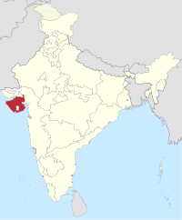
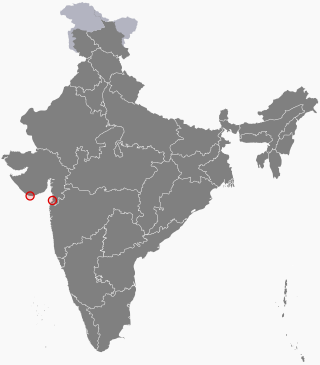
Daman and Diu was a union territory in northwestern India. With an area of 112 km2 (43 sq mi), it was the smallest administrative subdivision of India on the mainland. The territory comprised two districts, Daman and Diu island, geographically separated by the Gulf of Khambat. The state of Gujarat and the Arabian Sea bordered the territory. A Portuguese colony since the 1500s, the territories were taken by India with the Annexation of Goa in 1961. Daman and Diu were administered as part of the union territory of Goa, Daman and Diu between 1961 and 1987. After the Goa Opinion Poll, they became a separate union territory. In 2019, legislation was passed to merge the union territory of Daman and Diu with its neighbouring union territory, Dadra and Nagar Haveli, to form the new union territory of Dadra and Nagar Haveli and Daman and Diu with effect from 26 January 2020.

<span class="mw-page-title-main">Rajpramukh</span> Administrative title in India (1947–56)

Rajpramukh was an administrative title in India which existed from India's independence in 1947 until 1956. Rajpramukhs were the appointed governors of certain Indian provinces and states.

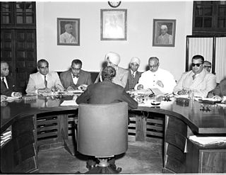
The Indian Republic held its first elections in 1951–52.

<span class="mw-page-title-main">Mysore State</span> Indian state from 1947 to 1956; predecessor of Karnataka

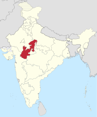
Mysore State, colloquially Old Mysore, was a political territory within the Dominion of India and the subsequent Republic of India from 1947 until 1956. The state was formed by renaming the Kingdom of Mysore, and Bangalore replaced Mysore as the state's capital. When Parliament passed the States Reorganisation Act in 1956, Mysore State was considerably enlarged when it became a linguistically homogeneous Kannada-speaking state within the Republic of India by incorporating territories from Andhra, Bombay, Coorg, Hyderabad, and Madras States, as well as other petty fiefdoms. It was subsequently renamed Karnataka in 1973.

The high courts of India are the highest courts of appellate jurisdiction in each state and union territory of India. However, a high court exercises its original civil and criminal jurisdiction only if the subordinate courts are not authorized by law to try such matters for lack of peculiar or territorial jurisdiction. High courts may also enjoy original jurisdiction in certain matters, if so designated, especially by the constitution, a state law or union law.

<span class="mw-page-title-main">Presidencies and provinces of British India</span> 1612–1947 British directly-ruled administrative divisions in India

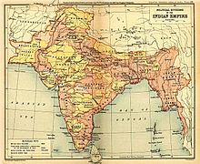
The provinces of India, earlier presidencies of British India and still earlier, presidency towns, were the administrative divisions of British governance on the Indian subcontinent. Collectively, they have been called British India. In one form or another, they existed between 1612 and 1947, conventionally divided into three historical periods:

<span class="mw-page-title-main">Proposed states and union territories of India</span>

The constitutional power to create new states and union territories in India is solely reserved with the Parliament of India, which can do so by announcing new states/union territories, separating territory from an existing state or merging two or more states/union territories or parts of them. As of 2024, there are 28 states and eight union territories in India.

<span class="mw-page-title-main">Santosh Trophy</span> Association football tournament in India

The National Football Championship for Santosh Trophy, due to ties with FIFA, also known as the FIFA Santosh Trophy, or simply Santosh Trophy, is an inter-state national football competition contested by the state associations and government institutions under the All India Football Federation (AIFF), the sport's governing body in India. Before the launch of the first national club league, the National Football League in 1996, the Santosh Trophy was considered the top domestic tournament in India. Many players who have represented India internationally have played in the Santosh Trophy. The tournament is held every year with eligible teams who are divided into zones, must play in the qualifying round and can progress into the tournament proper. The current champions are Karnataka, who won their title after 54 years during the 2022–23 edition. This was the first trophy for Karnataka, which had previously won four times as the princely state of Mysore, after 1968-69.

The States Reorganisation Commission (SRC) constituted by the Central Government of India in December 1953 to recommend the reorganization of state boundaries. In September 1955, after two years of study, the Commission, comprising Justice Fazal Ali, K. M. Panikkar and H. N. Kunzru, submitted its report. The commission's recommendations were accepted with some modifications and implemented in the States Reorganisation Act in November, 1956. The act provided that India's state boundaries should be reorganized to form 14 states and 6 centrally administered territories. On December 10, 1948, the report of Dar Commission was published but the issue remained unsolved.

<span class="mw-page-title-main">Outline of India</span> Overview of and topical guide to India

The following outline is provided as an overview of, and topical guide to, India:

<span class="mw-page-title-main">Union territory</span> Form of administrative division in India

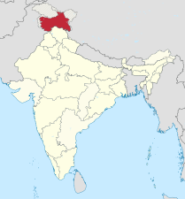
A union territory is a type of administrative division in the Republic of India. Unlike the states of India, which have their own governments, union territories are federal territories governed, in part or in whole, by the Union Government of India. There are currently eight union territories in India: Andaman and Nicobar Islands, Chandigarh, Dadra and Nagar Haveli and Daman and Diu, Delhi (NCT), Jammu and Kashmir, Ladakh, Lakshadweep and Puducherry.

<span class="mw-page-title-main">Senior Women's National Football Championship</span> Indian womens professional football league

The Senior Women's National Football Championship for Rajmata Jijabai Trophy, also known as Senior Women’s National Football Championship or simply the Rajmata Jijabai Trophy since 2024, is a women's football tournament contested by state associations and government institutions in India. The first edition was held in 1991 and is organized by the All India Football Federation to crown the national women's football champion each year. It is based on a league and knockout format.

Handball Federation of India (HFI) is the governing body for handball in India. HFI is registered under the Societies Registration Act, 1860 at Rohtak. It is a member of the Asian Handball Federation (AHF) and the International Handball Federation (IHF) since 1974. It is also a member of Commonwealth Handball Association and South Asian Handball Federation. Originally, HFI was founded by Jagat Singh Chauhan from Rohtak (Haryana) who was an alumnus of YMCA College of Physical Education of Madras Chennai. He was also the first secretary general of HFI.

<span class="mw-page-title-main">States Reorganisation Act, 1956</span> Indian act reforming state boundaries

The States Reorganisation Act, 1956 was a major reform of the boundaries of India's states and territories, organising them along linguistic lines.

<span class="mw-page-title-main">Andhra Pradesh (1956–2014)</span> Former state in India with Hyderabad as its capital

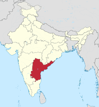
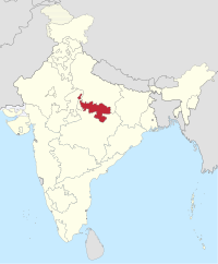
Andhra Pradesh, retrospectively referred to as United Andhra Pradesh, Undivided Andhra Pradesh or Ummadi Andhra Pradesh, was a state in India formed by States Reorganisation Act, 1956 with Hyderabad as its capital and was reorganised by Andhra Pradesh Reorganisation Act, 2014. The state was made up of three distinct cultural regions of Telangana, Rayalaseema, and Coastal Andhra. Before the 1956 reorganisation, Telangana had been part of Hyderabad State ruled by Nizam of Hyderabad, whereas Rayalaseema and Coastal Andhra had been part of Andhra State, formerly a part of Madras Presidency ruled by British India.

References

  1. "States and Union Territories". Know India Programme. Archived from the original on 18 August 2017. Retrieved 21 April 2020.
  2. 1 2 Constitution of India (PDF). Ministry of Law and Justice, Government of India. Archived (PDF) from the original on 17 October 2023. Retrieved 2 April 2023.
  3. Andhra State Act, 1953 (PDF). Parliament of India. 1953. Retrieved 15 October 2023.
  4. Reorganisation of states (PDF) (Report). Economic Weekly. 15 October 1955. Archived (PDF) from the original on 18 February 2016. Retrieved 31 December 2015.
  5. "Dadra and Nagar Haveli Celebrated Its 60th Liberation Day". Jagran Josh. 2 August 2013. Archived from the original on 29 February 2020. Retrieved 2 March 2020.
  6. Dasgupta, Reshmi R. (10 August 2019). "Dadra and Nagar Haveli: When an IAS officer became the instrument of accession". The Economic Times . Archived from the original on 17 February 2020. Retrieved 2 March 2020.
  7. "When an IAS Officer Was The Prime Minister of Dadra & Nagar Haveli". The Better India. 28 March 2018. Archived from the original on 21 March 2021. Retrieved 2 March 2020.
  8. "Constitutional Amendment". Government of India. Archived from the original on 29 February 2020. Retrieved 2 March 2020.
  9. J.C. Aggarwal; S.P. Agrawal (1995). Uttarakhand: Past, Present, and Future. New Delhi: Concept Publishing. pp. 89–90.
  10. "Nagaland History & Geography-Source". Government of India. Archived from the original on 7 July 2011. Retrieved 17 June 2013.
  11. Himachal Pradesh Tenth Five Year Plan (PDF) (Report). Archived (PDF) from the original on 13 May 2014. Retrieved 17 June 2013.
  12. The Punjab Reorganisation Act 1966 (PDF). Parliament of India. 1966. Archived (PDF) from the original on 19 January 2012. Retrieved 17 June 2013.
  13. Snapshot of North Eastern States (PDF) (Report). IBC India. Archived from the original (PDF) on 22 December 2009. Retrieved 17 February 2016.
  14. "About Sikkim". Government of Sikkim. Archived from the original on 25 May 2009. Retrieved 15 June 2009.
  15. "Goa Chronology". Goa online. Archived from the original on 21 July 2011. Retrieved 17 February 2016.
  16. "Official Website of Government of Jharkhand". Government of Jharkhand. Archived from the original on 21 June 2013. Retrieved 17 June 2013.
  17. "Chhattisgarh state – History". Government of Chattisgarh. Archived from the original on 4 July 2010. Retrieved 17 June 2013.
  18. Chopra, Jasi Kiran (2 January 2007). "Uttaranchal is Uttarakhand, BJP cries foul". The Times of India . Archived from the original on 10 May 2013. Retrieved 22 January 2013.
  19. "About Us: Uttarakhand Government Portal, India". Government of Uttarakhand. 9 November 2000. Archived from the original on 13 May 2012. Retrieved 17 June 2013.
  20. 1 2 The Andhra Pradesh Reorganisation Act, 2014 (PDF). Parliament of India. 2014. Archived from the original (PDF) on 8 January 2016. Retrieved 3 March 2014.
  21. "Telangana bill passed by upper house". The Times of India . 20 February 2014. Archived from the original on 15 April 2022. Retrieved 20 February 2014.
  22. Jammu and Kashmir Reorganisation Bill (No. XXIX of) 2019 (PDF). Parliament of India. 5 August 2019. Archived (PDF) from the original on 8 March 2021. Retrieved 22 August 2019.
  23. Dutta, Amrita Nayak (10 July 2019). "There will be one UT less as Modi govt plans to merge Dadra & Nagar Haveli and Daman & Diu". The Print. New Delhi. Archived from the original on 23 November 2021. Retrieved 22 August 2019.
  24. "Govt plans to merge 2 UTs – Daman and Diu, Dadra and Nagar Haveli". Devdiscourse. Archived from the original on 23 November 2021. Retrieved 26 March 2020.
  25. The Dadra And Nagar Haveli And Daman And Diu (Merger Of Union Territories) Bill (PDF). Parliament of India. 2019. Archived (PDF) from the original on 24 February 2021. Retrieved 15 December 2020.
  26. List of states with Population, Sex Ratio and Literacy Census 2011 (Report). Census commissioner, Government of India. Archived from the original on 28 November 2018. Retrieved 30 April 2023.
  27. "Census 2011: Population in States and Union Territories of India". Jagran Josh . 14 October 2016. Archived from the original on 30 April 2023. Retrieved 30 April 2023.
  28. 1 2 Report of the Commissioner for linguistic minorities: 50th report (July 2012 to June 2013) (PDF) (Report). Commissioner for Linguistic Minorities, Ministry of Minority Affairs, Government of India. Archived from the original (PDF) on 8 July 2016. Retrieved 14 January 2015.
  29. "Bill recognising Urdu as second official language passed". The Hindu . 23 March 2022. ISSN   0971-751X. Archived from the original on 30 October 2022. Retrieved 8 December 2022.
  30. "Haryana grants second language status to Punjabi". Hindustan Times . 28 January 2010. Archived from the original on 3 September 2015.
  31. "Dharamsala: Himachal Pradesh gets its second capital in Dharamsala". The Times of India . 2 March 2017. Archived from the original on 26 July 2021. Retrieved 26 July 2021.
  32. Pratibha Chauhan (17 February 2019). "Bill to make Sanskrit second official language of HP passed". The Tribune . Shimla. Archived from the original on 18 February 2019. Retrieved 18 February 2019.
  33. "Jharkhand gives 2nd language status to Magahi, Angika, Bhojpuri and Maithali". UNI India. Archived from the original on 14 April 2021. Retrieved 24 January 2021.
  34. "Jharkhand notifies Bhumij as second state language". The Avenue Mail. 5 January 2019. Archived from the original on 23 April 2022. Retrieved 20 April 2022.
  35. Kerala Official Languages Act, 1969. Kerala Legislative Assembly. 1969. Archived from the original on 21 September 2021. Retrieved 20 April 2021.
  36. "History | District Nagpur,Government of Maharashtra | India". Archived from the original on 26 July 2021. Retrieved 26 July 2021.
  37. Raghunatha, TN (2 June 2018). "Monsoon session to start in Maha's winter Capital Nagpur from July 4". Daily Pioneer. Archived from the original on 2 August 2018. Retrieved 20 April 2021.
  38. 1977 Sikkim government gazette (PDF). Sikkim Legislative Assembly. p. 188. Archived from the original (PDF) on 22 July 2018. Retrieved 13 September 2023.
  39. "Centre gives nod; TG replaces TS as State code in Telangana vehicle registration plates". The Hindu . 13 March 2024. Archived from the original on 20 March 2024. Retrieved 1 May 2024.
  40. "Bifurcated into Telangana State and residual Andhra Pradesh State". The Times of India . 2 June 2014. Archived from the original on 30 November 2018. Retrieved 2 June 2014.
  41. Sanchari Bhattacharya (1 June 2014). "Andhra Pradesh Minus Telangana: 10 Facts". NDTV . Archived from the original on 4 June 2014. Retrieved 4 June 2014.
  42. "AP Assembly building inaugurated". BusinessLine. 2 March 2017. Archived from the original on 26 September 2023. Retrieved 26 September 2023.
  43. 1 2 "Telangana State Profile". Telangana government portal. p. 34. Archived from the original on 5 December 2015. Retrieved 11 June 2014.
  44. "Urdu is second official language now". The Hindu . 17 November 2017. ISSN   0971-751X. Archived from the original on 27 July 2020. Retrieved 6 July 2020.
  45. "Bhararisain declared as summer capital of Uttarakhand". Times Now. 8 June 2020. Archived from the original on 24 November 2021. Retrieved 24 November 2021.
  46. Singh, Pallavi (19 April 2010). "Sanskrit: reviving the language in today's India". mint. Archived from the original on 29 October 2020. Retrieved 16 December 2020.
  47. 1 2 "State/UTs and capitals". Government of India . Retrieved 1 January 2024.
  48. "ISO codes". International Organization for Standardization . Retrieved 1 January 2024.
  49. "Registration statecodes". Government of India . Retrieved 1 January 2024.
  50. "Zonal council". Government of India . Retrieved 1 January 2024.
  51. Towns and urban agglomerations classified by population size class in 2011 with variation between 1901 and 2011 - Class I (Report). Government of India . Retrieved 1 January 2024.
  52. 1 2 States Reorganisation (PDF) (Report). Parliament of India . Retrieved 1 December 2023.
  53. State-wise population (Report). Government of India . Retrieved 1 January 2024.
  54. Socio-economic statistics (PDF) (Report). Government of India . Retrieved 1 January 2019.
  55. 1 2 "Report of the Commissioner for linguistic minorities: 52nd report" (PDF). Government of India . Retrieved 1 January 2024.
  56. "Official Language Act 2000" (PDF). Government of Delhi. 2 July 2003. Archived from the original (PDF) on 4 March 2016. Retrieved 17 July 2015.
  57. "Jammu and Kashmir capital". Jammu and Kashmir Legal Services Authority. Retrieved 1 December 2023.
  58. "LG, UT Hqrs, Head of Police to have Sectts at both Leh, Kargil: Mathur". Daily Excelsior. 12 November 2019. Archived from the original on 13 February 2020. Retrieved 17 December 2019.
  59. "Article 1". Constitution of India (PDF) (Report). Government of India . Retrieved 31 December 2023.
  60. Balwant Singh Malik (1998). "Territoriality of executive powers of states in India". Constitutional Law. Archived from the original on 31 December 2009. Article 73 broadly stated, provides that the executive power of the Union shall extend to the matters with respect to which Parliament has power to make laws. Article 162 similarly provides that the executive power of a State shall extend to the matters with respect to which the Legislature of a State has power to make laws. The Supreme Court has reiterated this position when it ruled in the Ramanaiah case that the executive power of the Union or of the State broadly speaking, is coextensive and coterminous with its respective legislative power