Dodge County, Nebraska

Last updated

Dodge County
Dodge County, Nebraska courthouse from NE 1.JPG
Dodge County Courthouse in Fremont
Map of Nebraska highlighting Dodge County.svg
Location within the U.S. state of Nebraska
Nebraska in United States.svg
Nebraska's location within the U.S.
Coordinates: 41°35′N96°39′W / 41.58°N 96.65°W / 41.58; -96.65
CountryFlag of the United States.svg United States
StateFlag of Nebraska.svg  Nebraska
Founded1855
Named for Augustus C. Dodge
Seat Fremont
Largest cityFremont
Area
  Total543 sq mi (1,410 km2)
  Land529 sq mi (1,370 km2)
  Water14 sq mi (40 km2)  2.6%
Population
 (2020)
  Total37,167
  Density68/sq mi (26/km2)
Time zone UTC−6 (Central)
  Summer (DST) UTC−5 (CDT)
Congressional district 1st
Website www.dodgecounty.ne.gov

Dodge County is a county in the U.S. state of Nebraska. As of the 2020 United States Census, the population was 37,167. [1] Its county seat is Fremont. [2] The county was formed in 1855 and named after Iowa Senator Augustus C. Dodge. [3]

Contents

Dodge County comprises the Fremont, NE Micropolitan Statistical Area, which is also included in the Omaha-Council Bluffs-Fremont, NE-IA Combined Statistical Area.

In the Nebraska license plate system, Dodge County is represented by the prefix 5 (it had the fifth-largest number of vehicles registered in the county when the license plate system was established in 1922). [4]

Geography

The Elkhorn River runs through the NE part of Dodge County. It drains into the Platte River below the SE corner of the county. The Platte River runs along the south line of Dodge County.

According to the US Census Bureau, the county has an area of 543 square miles (1,410 km2), of which 529 square miles (1,370 km2) is land and 14 square miles (36 km2) (2.6%) is water. [5]

Major highways

Transit

Adjacent counties

Demographics

Historical population
CensusPop.Note
1860 309
1870 4,2121,263.1%
1880 11,263167.4%
1890 19,26071.0%
1900 22,29815.8%
1910 22,145−0.7%
1920 23,1974.8%
1930 25,2738.9%
1940 23,799−5.8%
1950 26,26510.4%
1960 32,47123.6%
1970 34,7827.1%
1980 35,8473.1%
1990 34,500−3.8%
2000 36,1604.8%
2010 36,6911.5%
2020 37,1671.3%
2023 (est.)37,1870.1%
US Decennial Census [6]

As of the 2000 United States Census, [7] there were 36,160 people, 14,433 households, and 9,756 families in the county. The population density was 68 people per square mile (26 people/km2). There were 15,468 housing units at an average density of 29 units per square mile (11/km2). The racial makeup of the county was 95.90% White, 0.43% Black or African American, 0.30% Native American, 0.51% Asian, 0.09% Pacific Islander, 2.06% from other races, and 0.72% from two or more races. 3.93% of the population were Hispanic or Latino of any race. 48.1% were of German, 7.6% Irish, 5.7% English and 5.4% American ancestry.

There were 14,433 households, out of which 31.10% had children under the age of 18 living with them, 55.80% were married couples living together, 8.50% had a female householder with no husband present, and 32.40% were non-families. 27.60% of all households were made up of individuals, and 13.40% had someone living alone who was 65 years of age or older. The average household size was 2.42 and the average family size was 2.95.

The county population contained 24.70% under the age of 18, 9.60% from 18 to 24, 26.20% from 25 to 44, 21.90% from 45 to 64, and 17.50% who were 65 years of age or older. The median age was 38 years. For every 100 females there were 93.20 males. For every 100 females age 18 and over, there were 90.00 males.

The median income for a household in the county was $37,188, and the median income for a family was $44,790. Males had a median income of $31,108 versus $20,915 for females. The per capita income for the county was $17,757. About 5.30% of families and 8.60% of the population were below the poverty line, including 10.30% of those under age 18 and 7.10% of those age 65 or over.

Communities

Cities

Villages

Census-designated place

Other unincorporated communities

Townships

Politics and government

Dodge County voters are strongly Republican. In no national election since 1936 has the county selected the Democratic Party candidate.

In the Nebraska Legislature, Dodge County is represented by Lynne Walz. While elections to the Legislature are nonpartisan, Walz is a Democrat.

United States presidential election results for Dodge County, Nebraska [8]
Year Republican Democratic Third party
No.%No.%No.%
2020 10,98464.85%5,54432.73%4102.42%
2016 9,93363.96%4,54429.26%1,0526.77%
2012 8,99560.17%5,67337.95%2821.89%
2008 8,55755.03%6,68943.02%3041.95%
2004 10,71666.26%5,25032.46%2061.27%
2000 8,87161.30%5,02134.69%5804.01%
1996 7,48450.95%5,18135.27%2,02313.77%
1992 7,27144.30%4,66728.44%4,47427.26%
1988 8,41757.66%6,11641.90%640.44%
1984 10,20170.15%4,26629.34%740.51%
1980 9,52266.82%3,56425.01%1,1648.17%
1976 8,98262.03%5,28336.48%2161.49%
1972 9,83772.00%3,82628.00%00.00%
1968 8,05963.78%3,75529.72%8226.51%
1964 6,81250.30%6,73149.70%00.00%
1960 9,63867.21%4,70232.79%00.00%
1956 9,21069.26%4,08830.74%00.00%
1952 9,25671.54%3,68228.46%00.00%
1948 5,84854.56%4,87045.44%00.00%
1944 6,80361.39%4,27838.61%00.00%
1940 7,14162.51%4,28237.49%00.00%
1936 4,56140.22%6,31755.71%4614.07%
1932 3,48932.14%7,24766.76%1191.10%
1928 6,25060.59%4,03039.07%350.34%
1924 3,79845.63%2,18326.23%2,34228.14%
1920 4,83270.40%1,79926.21%2333.39%
1916 2,44646.10%2,64449.83%2164.07%
1912 1,33029.33%1,98743.81%1,21826.86%
1908 2,43746.34%2,66450.66%1583.00%
1904 2,78959.38%1,64635.04%2625.58%
1900 2,63251.49%2,41047.14%701.37%

Law enforcement

The Dodge County Sheriff's Office (DCSO) is the primary law enforcement agency for Dodge County, Nebraska. The Sheriff's Office is located at 428 N. Broad St in Fremont, Nebraska which is the county seat.

Currently DCSO serves the county and its incorporated cities within the county. The only village that relies solely on DCSO for police services is North Bend, Nebraska which is known as a contract city. All other cities within the county have some type of police department or city marshal.

See also

Related Research Articles

<span class="mw-page-title-main">Washington County, Nebraska</span> County in Nebraska, United States

Washington County is a county in the U.S. state of Nebraska. As of the 2020 United States Census, the population was 20,865. Its county seat is Blair.

<span class="mw-page-title-main">Stanton County, Nebraska</span> County in Nebraska, United States

Stanton County is a county in the U.S. state of Nebraska. As of the 2020 United States Census, the population was 5,842. Its county seat is Stanton. The county was formed in 1856 and organized in 1867. It was first called Izard County until 1862, when it was renamed for Edwin M. Stanton, Secretary of War during the administration of President Abraham Lincoln.

<span class="mw-page-title-main">Platte County, Nebraska</span> County in Nebraska, United States

Platte County is a county located in the U.S. state of Nebraska. As of the 2020 United States Census, the population was 34,296. Its county seat is Columbus. The county was created in 1855.

<span class="mw-page-title-main">Madison County, Nebraska</span> County in Nebraska, United States

Madison County is a county in the U.S. state of Nebraska. As of the 2020 United States Census, the population was 35,585. Its county seat is Madison and its largest city is Norfolk. Madison County was likely named for Madison, Wisconsin, which is where many of the county’s residents came from; the city was named for James Madison, fourth President of the United States.

<span class="mw-page-title-main">Douglas County, Nebraska</span> County in Nebraska, United States

Douglas County is a county located in the U.S. state of Nebraska. As of the 2020 United States Census, the population is 584,526. It is the state's most populous county, home to well over one-fourth of Nebraska's residents. Its county seat is Omaha, the state's largest city. The county was established in 1854 and named after Stephen A. Douglas (1813–1861), who was then serving as Senator from Illinois.

<span class="mw-page-title-main">Cuming County, Nebraska</span> County in Nebraska, United States

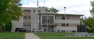
Cuming County is a county in the U.S. state of Nebraska. As of the 2020 United States Census, the population was 9,013. Its county seat is West Point.

<span class="mw-page-title-main">Colfax County, Nebraska</span> County in Nebraska, United States

Colfax County is a county in the U.S. state of Nebraska. As of the 2020 United States Census, the population was 10,582. Its county seat is Schuyler. The county and its seat are named after US Vice President (1869-1873) Schuyler Colfax.

<span class="mw-page-title-main">Burt County, Nebraska</span> County in Nebraska, United States

Burt County is a county in the U.S. state of Nebraska, bordering the west bank of the upper Missouri River. As of the 2020 United States Census, the population was 6,722. Its county seat is Tekamah. The county was formed in 1854 and named after Francis Burt, the first governor of Nebraska Territory.

<span class="mw-page-title-main">Beemer, Nebraska</span> Village in Nebraska, United States

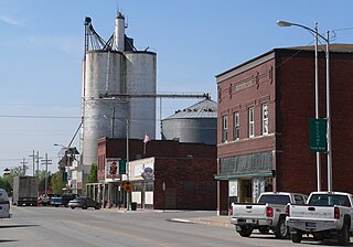
Beemer is a village in Cuming County, Nebraska, United States. The population was 678 at the 2010 census.

<span class="mw-page-title-main">West Point, Nebraska</span> City in Nebraska, United States

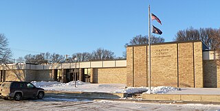
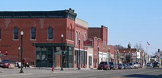
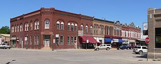
West Point is a city in and the county seat of Cuming County, Nebraska, United States. The population was 3,504 at the 2020 census.

<span class="mw-page-title-main">Wisner, Nebraska</span> City in Nebraska, United States

Wisner is a city in northwestern Cuming County, Nebraska, United States. The population was 1,170 at the 2010 census.

<span class="mw-page-title-main">Dodge, Nebraska</span> Village in Nebraska, United States

Dodge is a village in Dodge County, Nebraska, United States. The population was 612 at the 2010 census.

<span class="mw-page-title-main">Fremont, Nebraska</span> City in Nebraska, United States

Fremont is a city and county seat of Dodge County in the eastern portion of the state of Nebraska in the Midwestern United States. The population was 27,141 at the 2020 census, making it the 6th most populous city in Nebraska. Fremont is the home of Midland University.

<span class="mw-page-title-main">Hooper, Nebraska</span> City in Nebraska, United States

Hooper is a city in Dodge County, Nebraska, United States. The population was 830 at the 2010 census.

<span class="mw-page-title-main">Nickerson, Nebraska</span> Village in Nebraska, United States

Nickerson is a village in Dodge County, Nebraska, United States. The population was 369 at the 2010 census.

<span class="mw-page-title-main">North Bend, Nebraska</span> City in Nebraska, United States

North Bend is a city in Dodge County, Nebraska, United States. The population was 1,177 at the 2010 census.

<span class="mw-page-title-main">Snyder, Nebraska</span> Village in Nebraska, United States

Snyder is a village in Dodge County, Nebraska, United States. The population was 300 at the 2010 census.

<span class="mw-page-title-main">Creston, Nebraska</span> Village in Platte County, Nebraska, United States

Creston is a village in Platte County, Nebraska, United States. The population was 203 at the 2010 census.

<span class="mw-page-title-main">Washington, Nebraska</span> Village in Washington County, Nebraska, United States

Washington is a village in Washington County, Nebraska, United States. The population was 150 at the 2010 census.

<span class="mw-page-title-main">Newman Grove, Nebraska</span> City in Platte County, Nebraska, United States

Newman Grove is a city in Madison and Platte counties in Nebraska, United States. The population was 721 at the 2010 census.

References

  1. "Dodge County, Nebraska". United States Census Bureau . Retrieved June 17, 2023.
  2. "Find a County". National Association of Counties. Archived from the original on May 31, 2011. Retrieved June 7, 2011.
  3. "Dodge County". Nebraska Association of County Officials. Archived from the original on February 7, 2012. Retrieved August 30, 2014.
  4. "History Of Nebraska Passenger Vehicle License Plates". Nebraska Department of Motor Vehicles. Retrieved October 29, 2015.
  5. "2010 Census Gazetteer Files". US Census Bureau. August 22, 2012. Archived from the original on November 13, 2013. Retrieved December 6, 2014.
  6. "US Decennial Census". Census.gov. Retrieved September 19, 2013.
  7. "U.S. Census website". US Census Bureau. Retrieved January 31, 2008.
  8. Election Results

41°35′N96°39′W / 41.58°N 96.65°W / 41.58; -96.65