Cilandak is a district of South Jakarta, Indonesia. The Krukut River flows through the eastern edge of Cilandak, while the Pesanggrahan and Grogol Rivers flow through the western edge.

Tanjung Priok is a district of North Jakarta, Indonesia. It hosts the western part of the city's main harbor, the Port of Tanjung Priok. The district of Tanjung Priok is bounded by Laksamana Yos Sudarso Tollway and Sunter River canal to the east, by Kali Japat, Kali Ancol, and the former Kemayoran Airport to the southwest, by Sunter Jaya Road and Sunter Kemayoran Road to the south, and by Jakarta Bay to the north.
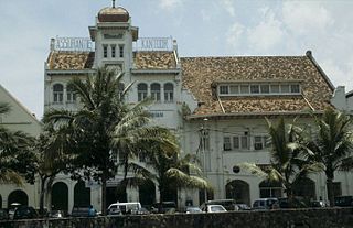
Malaka or Malaca may refer to:

Cinere is a district of the city of Depok, West Java, Indonesia. It covers an area of 10.55 km2 and had a population of 107,461 at the 2010 Census; the latest official estimate is 144,038. Cinere borders to its east with the Jagakarsa District and to its north with the Cilandak District, both being part of South Jakarta City; to the west it borders with the Ciputat Timur District and the Pamulang District of South Tangerang City within Banten Province; and to the south it borders the Limo District of Depok City. Cinere has a large multi-racial population as a result of long-term transmigration from elsewhere in West Java and from Banten, that began in the late 1960s.
Pancoran is a district of South Jakarta, one of the five administrative cities which form Jakarta, Indonesia. Pancoran district was originally part of Mampang Prapatan district until it was divided in 1985.
Taman Sari is a district of West Jakarta, Indonesia. It is the smallest subdistrict of West Jakarta (4.37 km2). Taman Sari is bounded by Central Jakarta to the south and to the east, and by North Jakarta to the north.

Tambora is a subdistrict of West Jakarta, Indonesia. Tambora Subdistrict is bounded by a railway to the west and to the north, Kali Krukut - Kali Besar canal to the east, and Duri Selatan Road to the south.
Cipayung is a district (kecamatan) of East Jakarta, Indonesia, situated in the southeastern part of Jakarta, in the outskirts of Jakarta. Its northern boundary is Pondok Gede Raya Road, its eastern boundary is Sunter River to the East, and its western boundary is Jagorawi Tollway. Marshes can still be found in Cipayung.

Jatinegara is one of the districts (Kecamatan) of East Jakarta, Indonesia. The name also refers to the larger, historic area of the colonial town of Meester Cornelis. Established in the 17th century, Jatinegara is one of the oldest areas in Jakarta, and contains a number of buildings from the colonial period.
Makasar is a district (kecamatan) of East Jakarta, Indonesia. It had an area of 21.85 km² and population of 185,830 at the 2010 Census; the latest official estimate is 204,595.

Kebayoran Lama is a district of South Jakarta, Indonesia. The rough boundaries of Kebayoran Lama are: Kebayoran Lama Road - Palmerah Barat Road to the north, Grogol River to the east, Jakarat Outer Ring Road to the south, and Pesanggrahan River to the west.

Duren Sawit is a village (kelurahan) of Duren Sawit, East Jakarta, Indonesia. The village is also the seat of administration of the Duren Sawit subdistrict. It has a population of just under 70,000 in 2016, making it the fourth most populated village in the subdistrict.
Pondok Bambu is a village (kelurahan) of Duren Sawit, East Jakarta, Indonesia. Before the establishment of the Subdistrict Duren Sawit, the village is under the administration of the Subdistrict Jatinegara.

Pondok Aren is a district in South Tangerang, Banten, Indonesia. It is located on the south-western outskirts of Jakarta. The population during the 2010 Census was 303,093. Pondok Aren district mainly covers the area of Bintaro Jaya and borders South Jakarta to the east. Pondok Aren district office is located at Jl. Graha Raya Bintaro, Perigi Baru behind the Pondok Aren Sectoral Police office.

Jatikramat River is a river in the Bekasi, West Java and eastern part of the Special Capital Region of Jakarta, Indonesia. The lower portions of the original river have been channelized and directed into the eastern flood canal, "Banjir Kanal Timur", which continues to flow to the Java Sea in the district of Marunda, Cilincing, North Jakarta. The river regularly causes flooding in the city of Bekasi and Jakarta.
Buaran River is a river flowing in the Bekasi, West Java and eastern part of the Special Capital Region of Jakarta, Indonesia. The lower portions of the original river have been channelized and directed into the eastern flood canal, "Banjir Kanal Timur", which continues to flow to the Java Sea in the district of Marunda, Cilincing, North Jakarta. The river regularly causes flooding in the city of Bekasi and Jakarta.
Baru Timur River is a man-made canal flowing from Ci Liwung in Bogor Regency to Jakarta, Indonesia. It was one of two canals built in the 18th century under the order of the Governor-General Gustaaf Willem van Imhoff originally to transport agriculture harvest from Bogor to Batavia. Currently both canals, now known as Kali Baru Timur and Kali Baru Barat, are among the main rivers in Jakarta, and part of the Ciliwung Cisadane flood control project. Baru Timur River flows from Katulampa flood gate, built at the same time as the canal, along the major road Bogor Highway, passing Cimanggis, Depok, Cilangkap, until reaching Java Sea in Kali Besar, Tanjung Priok, North Jakarta.
Baru Barat River is a man-made canal flowing from Cisadane River in Bogor Regency to Jakarta, Indonesia. It was one of two canals built in the 18th century under the order of the Governor-General Gustaaf Willem van Imhoff originally to transport agriculture harvest from Bogor to Batavia. Currently both canals, now known as Kali Baru Timur and Kali Baru Barat, are among the main rivers in Jakarta, and part of the Ciliwung Cisadane flood control project. Flowing through the areas of Pancoran and Tebet, South Jakarta, among others, Baru Barat River is one of the drainages that flow the water into Banjir Kanal Barat.
