At a ribbon-cutting for the opening of the final stretch of the newly 4-laned section of WIS 29 between Green Bay and Elk Mound, in 2005, Gov. Jim Doyle referred to the region, including Menomonie to the west, as "Wisconsin's Golden Triangle."[1]
For practical purposes, the Eau Claire–Chippewa Falls metropolitan area extends only as far as those municipalities directly adjacent to the incorporated cities and villages in the core area, with the notable exception of the Eau Claire County town of Pleasant Valley, which is included because so much of its population is suburban rather than rural. (The Town of Pleasant Valley was one of Wisconsin's fastest-growing political divisions in the 1990s, posting a population increase of over 28%.) The Chippewa County town of Anson is also included due to its proximity to Chippewa Falls. This is the definition used by the Chippewa-Eau Claire Metropolitan Planning Organization. According to the 2015 census estimates, this core area had a 2015 population of 129,665.[citation needed] This population comprises 78.3% of the Eau Claire-Chippewa County area, and 61.7% of the Eau Claire-Chippewa-Dunn County area.[citation needed]
Although the Chippewa River once served as an important transit route for the area, river transit is no longer feasible from the Mississippi River. Hydroelectric dams within the metropolitan area, one in Eau Claire and two in Chippewa Falls, further limit its ability to be used as a transit route. The rather shallow Eau Claire River is dammed at Altoona (as well as 20 miles further upstream at Lake Eau Claire). The rivers, as well as the reservoirs formed by the dams, are used today principally for recreation.
Highways
Many of the primary roadways serving western Wisconsin run through the metropolitan area. Among these are:
Freight rail traffic to and from the Eau Claire–Chippewa Falls metropolitan area is via lines formerly run by the inheritors of both the SOO and Chicago & North Western Railways. The rail network in the metropolitan area was much more extensive until the late 1980s and early 1990s, when many lines were first abandoned and then slowly converted to a network of biking and recreation trails , including the Chippewa River Trail, which follows much of the old route of the Milwaukee Road railbed, from downtown Eau Claire to Durand.[3]
Mass transit
The only local mass transit serving the metropolitan area is the Eau Claire Transitbus system, which has service only within the cities of Eau Claire and Altoona.
Flixbus, Greyhound, Megabus and Wisconsin Coach Lines have multiple bus stops throughout the Eau Claire MSA including the Eau Claire Transit Center (Downtown Eau Claire) and Chippewa Falls Holiday Gas Station (2750 120th St.) The ticketing depot is near the junction of I-94, US-12 and Wis. 312 in a McDonald's (6251 Truax Ln.) About a dozen other regional tourism and transportation buslines serve the greater Chippewa Valley region.
Amtrak service is only available by travelling to the Twin Cities, La Crosse or Tomah, although in the past several years there has been discussion of making a new Amtrak line that would serve the area directly.
Eau Claire County is a county located in the U.S. state of Wisconsin. As of the 2020 census, the population was 105,710. Its county seat is Eau Claire. The county took its name from the Eau Claire River.
Dunn County is a county in the U.S. state of Wisconsin. As of the 2020 census, the population was 45,440. Its county seat is Menomonie. Dunn County comprises the Menomonie Micropolitan Statistical Area and is included in the Eau Claire-Menomonie, WI Combined Statistical Area.
Chippewa County is a county located in the U.S. state of Wisconsin. It is named for the historic Chippewa people, also known as the Ojibwe, who long controlled this territory. As of the 2020 census, the population was 66,297. Its county seat is Chippewa Falls. The county was founded in 1845 from Crawford County, then in the Wisconsin Territory, and organized in 1853.
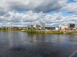
Eau Claire is a city in Eau Claire and Chippewa counties in the U.S. state of Wisconsin. It is the county seat of Eau Claire County. It had a population of 69,421 in 2020, making it the state's eighth-most populous city. It is the principal city of the Eau Claire metropolitan area, locally known as the Chippewa Valley, and is also part of the larger Eau Claire–Menomonie combined statistical area.
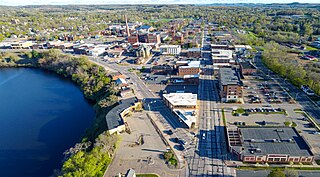
Menomonie is a city in and the county seat of Dunn County in the western part of the U.S. state of Wisconsin. The city's population was 16,843 as of the 2020 census.
The Chippewa River in Wisconsin flows approximately 183 miles (294 km) through west-central and northwestern Wisconsin. It was once navigable for approximately 50 miles (80 km) of its length, from the Mississippi River, by Durand, northeast to Eau Claire. Its catchment defines a portion of the northern boundary of the Driftless Area. The river is easily accessible for bikers and pleasure seekers via the Chippewa River State Trail, which follows the river from Eau Claire to Durand.
State Trunk Highway 29 is a state highway running east–west across central Wisconsin. It is a major east–west corridor connecting the Twin Cities and the Chippewa Valley with Wausau and Green Bay. A multi-year project to convert the corridor to a four-lane freeway or expressway from Elk Mound to Green Bay was completed in 2005. The remainder of WIS 29 is two-lane surface road or urban multi-lane road.
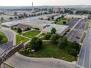
Chippewa Valley Technical College is one of the 16 technical and community colleges in the Wisconsin Technical College System, centered in Eau Claire, Wisconsin. It serves an 11-county area, with its largest campus in Eau Claire and major regional centers in Chippewa Falls, Menomonie, Neillsville and River Falls.
The Eau Claire River is a tributary of the Chippewa River in west-central Wisconsin in the United States. It is one of three rivers by this name in Wisconsin. Via the Chippewa River, it is part of the Mississippi River watershed. Its name is the French translation from the Ojibwe Wayaa-gonaatigweyaa-ziibi.
State Trunk Highway 312 is a 7.9-mile (12.7 km) long Wisconsin state highway running along the north side of Eau Claire, from the Town of Union in the west to the Town of Seymour in the east. The entire length of WIS 312 is an expressway with a few grade crossings.
The Chippewa Valley is a valley in Wisconsin, US.
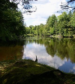
Brunet Island State Park is a state park of Wisconsin, USA, featuring a 169-acre (68 ha) island in the Chippewa River. The remainder of the park's 1,225 acres (496 ha) are on the east bank of the river. It is noted for its numerous white-tailed deer and large eastern hemlock trees. The park is located just north of Cornell in Chippewa County in the Northern Highland region of Wisconsin. The Old Abe State Trail begins in the park and follows the riverbank south to the town of Chippewa Falls, with access to Lake Wissota State Park.
U.S. Highway 12 in the U.S. state of Wisconsin runs east–west across the western to southeast portions of the state. It enters from Minnesota running concurrently with Interstate 94 (I-94) at Hudson, parallels the Interstate to Wisconsin Dells, and provides local access to cities such as Menomonie, Eau Claire, Black River Falls, Tomah, and Mauston. It then provides an alternative route for traffic between northwestern Wisconsin and Madison and is the anchor route for the Beltline Highway around Madison. Finally, it serves southeastern Wisconsin, connecting Madison with Fort Atkinson, Whitewater, Elkhorn, and Lake Geneva. The West Beltline Highway and the segment between Elkhorn and Genoa City are freeways, and the segment between Sauk City and Middleton is an expressway. The remainder of the road is a two-lane surface road or an urban multilane arterial. Between Hudson and west of Warrens, the road closely parallels the former main line of the Chicago, St. Paul, Minneapolis and Omaha Railway, now operated by Union Pacific Railroad.
Old Abe State Trail is a 19.5-mile (31.4 km) paved multi-use rail trail in Chippewa County, Wisconsin, USA.
The McCann brothers were three Irishmen who migrated from Ohio to Wisconsin in the mid-nineteenth century. They played an important role in the early phases of Wisconsin's lumber industry, and in the political and social organization of Chippewa County.
Chippewa River State Trail is a 26-mile urban-rural rail trail in western Wisconsin that follows the path of the Chippewa River. The trails runs from the spot of the confluence of the Chippewa with the Eau Claire River, at Phoenix Park in downtown Eau Claire, meeting up with the Red Cedar State Trail near Red Cedar, to Durand. A former railroad corridor, the trail passes through a variety of habitat including wetlands, prairies and sandstone bluff.
The 31st Senate District of Wisconsin is one of 33 districts in the Wisconsin Senate. Located in western Wisconsin, the district comprises all of Eau Claire County, southeast Dunn County, and parts of southern Chippewa County and northern Trempealeau County. It includes the cities of Eau Claire, Chippewa Falls, and Menomonie.
WESTconsin Credit Union is a not-for-profit financial cooperative that was founded as Menomonie Farmer's Credit Union in 1939. WESTconsin is headquartered in Menomonie, Wisconsin. Currently, they have over 100,000 members and control more than $1.1 billion in assets, with offices in the Wisconsin communities of Altoona, Amery, Baldwin, Barron, Chippewa Falls, Eau Claire, Ellsworth, Hudson, Menomonie, New Richmond, Prescott, River Falls, and Spring Valley. WESTconsin Credit Union has also gained notice for their high school offices, located in Amery, Baldwin-Woodville, Menomonie, and New Richmond.
The 92nd Assembly District of Wisconsin is one of 99 districts in the Wisconsin State Assembly. Located in western Wisconsin, the district comprises parts of southwest Chippewa County and central Dunn County. It includes the cities of Chippewa Falls and Menomonie and the parts of Eau Claire which fall in Chippewa County, along with the villages of Elk Mound and Lake Hallie. The district is represented by Republican Treig Pronschinske, since January 2017.
This page is based on this Wikipedia article Text is available under the CC BY-SA 4.0 license; additional terms may apply. Images, videos and audio are available under their respective licenses.