Germantown, Wisconsin

Last updated

Germantown
Washington County Wisconsin Incorporated and Unincorporated areas Germantown Highlighted.svg
Location of Germantown in Washington County, Wisconsin.
USA Wisconsin location map.svg
Red pog.svg
Germantown
Location of Germantown in Wisconsin
Coordinates: 43°13′23″N88°7′13″W / 43.22306°N 88.12028°W / 43.22306; -88.12028
Country United States
State Wisconsin
County Washington
Incorporated 1927;96 years ago (1927)
Area
[1]
  Total34.40 sq mi (89.09 km2)
  Land34.37 sq mi (89.03 km2)
  Water0.02 sq mi (0.06 km2)
Population
 (2010) [2]
  Total19,749
  Estimate 
(2019) [3]
20,116
  Density585.21/sq mi (225.95/km2)
ZIP code
53022 [4]
Area code 262
FIPS code 55-28875
Website village.germantown.wi.us

Germantown is a village in Washington County, Wisconsin, United States. The population was 19,749 at the 2010 census. The village surrounds the Town of Germantown. In July 2007, Germantown was ranked the 30th most appealing place to live in the United States by Money Magazine. [5]

Contents

Geography

Germantown is located at 43°13′23″N88°7′13″W / 43.22306°N 88.12028°W / 43.22306; -88.12028 (43.223206, −88.120433). [6]

According to Wisconsin First Nations (a Wisconsin Department of Public Instruction resource), Germantown is located on Potawatomi treaty land. [7] The village also falls within the lands of the Peoria, Menominee, Miami, and Sioux Indigenous peoples, as shown by Canadian not-for-profit organization Native Land Digital. [8]

The United States Census Bureau indicates Germantown has a total area of 34.45 square miles (89.23 km2), of which, 34.42 square miles (89.15 km2) of it is land and 0.03 square miles (0.08 km2) is water. [9]

History

The land that became Germantown was originally inhabited by members of the Potawatomi tribe. The Potawatomi surrendered the land that became Germantown to the United States Federal Government in 1833 through the 1833 Treaty of Chicago , which (after being ratified in 1835) required them to leave Wisconsin by 1838. [10] [11] While many Native people moved west of the Mississippi River to Kansas, some chose to remain or return after temporarily settling in the west, and were referred to as "strolling Potawatomi" in contemporary documents because many of them were migrants who subsisted by squatting on their ancestral lands, which were now owned by White settlers. In the late 19th and early 20th centuries, the Potawatomi who evaded forced removal gathered in northern Wisconsin and the Upper Peninsula of Michigan where many worked in the timber industry and formed the Forest County Potawatomi Community. [12]

The community was originally designated as the Wisconsin Territory's "Town Nine," making it the oldest settlement in Washington County. [13] Beginning in the 1840s, many German immigrants—particularly from the regions of Bavaria, Hessen, Rheinland, Pommern, and Prussia [14] [15] —settled in the area, which led to it being named "Germantown". [16]

The territorial legislature created the Town of Germantown on January 21, 1846, and the first town meeting was on April 7 of the same year. [17] The town included the then-unincorporated communities of Dheinsville, Goldenthal, Kuhberg (later known as Victory Center), Meeker Hill, Rockfield, South Germantown, and Willow Creek.

In the 19th and early 20th centuries, Germantown's economy relied heavily on agriculture, including dairy farming. The southern part of Germantown is rich in Silurian limestone, which was quarried beginning in the 1870s, particularly in the Rockfield and South Germantown areas. [13] [18] South Germantown was a stop on the Chicago, Milwaukee, and St. Paul starting in the late 19th century, and the hamlet grew and prospered because of its rail connects to other communities. [19]

In 1927, South Germantown incorporated as the Village of Germantown out of some of the town's land [13] but was significantly smaller than it is in the 21st century.

From July 1944 until January 1946, the hamlet of Rockfield in present-day Germantown was the site of Camp Rockfield, an Allied prisoner of war camp that held 500 German prisoners of war, including captured members of the Afrika Korps and many soldiers captured at the Battle of Cherbourg. The prisoners had originally been held at Fort Sheridan, north of Chicago, but were transferred to camps in rural Wisconsin, such as the one at Rockfield, to work in agriculture. The prisoners lived in a barracks that had originally been built as a warehouse for the local Rockfield Canning Company, where many prisoners worked as pea packers. Other POWs were transported to work sites throughout Ozaukee and Washington counties, including the Pick Manufacturing Company in West Bend and the Fromm Bros., Nieman & Co. Fox Ranch in northern Mequon. [20]

In 1963, Milwaukee annexed a small parcel in the southeastern part of the Town of Germantown to expand a landfill. Residents feared that Milwaukee would soon annex more of the town. As a defensive measure, the Village of Germantown annexed all of the surrounding unincorporated hamlets, which became neighborhoods of the village. At the time of the 1963 annexation, Germantown grew to an area of approximately 24 square miles. [21] The village has subsequently annexed most of the town's land, and now has an area of over 34 square miles.

Demographics

Historical population
CensusPop.Note
1930 255
1940 29214.5%
1950 35722.3%
1960 62274.2%
1970 6,9741,021.2%
1980 10,72953.8%
1990 13,65827.3%
2000 18,26033.7%
2010 19,7498.2%
2020 20,9175.9%

2020 census

As of the census [2] of 2020, there were 20,917 people. Owner occupied housing is 76.7% with a median value of houses reaching $274,900. The median household income in Germantown is $89,100.

2010 census

As of the census [2] of 2010, there were 19,749 people, 7,766 households, and 5,501 families living in the village. The population density was 573.8 inhabitants per square mile (221.5/km2). There were 8,092 housing units at an average density of 235.1 per square mile (90.8/km2). The racial makeup of the village was 92.6% White, 2.2% African American, 0.2% Native American, 3.1% Asian, 0.5% from other races, and 1.4% from two or more races. Hispanic or Latino of any race were 2.0% of the population.

There were 7,766 households, of which 35.0% had children under the age of 18 living with them, 59.5% were married couples living together, 7.8% had a female householder with no husband present, 3.6% had a male householder with no wife present, and 29.2% were non-families. 24.1% of all households were made up of individuals, and 9.6% had someone living alone who was 65 years of age or older. The average household size was 2.53 and the average family size was 3.03.

The median age in the village was 41.7 years. 25.4% of residents were under the age of 18; 6.2% were between the ages of 18 and 24; 24% were from 25 to 44; 30.7% were from 45 to 64; and 13.4% were 65 years of age or older. The gender makeup of the village was 48.9% male and 51.1% female.

2000 census

As of the census [22] of 2000, there were 18,260 people, 6,904 households, and 5,129 families living in the village. The population density was 530.5 people per square mile (204.8/km2). There were 7,075 housing units at an average density of 205.5 per square mile (79.4/km2). The racial makeup of the village was 95.83% White, 1.35% Black or African American, 0.25% Native American, 1.60% Asian, 0.04% Pacific Islander, 0.34% from other races, and 0.60% from two or more races. 1.12% of the population were Hispanic or Latino of any race.

There were 6,904 households, out of which 37.4% had children under the age of 18 living with them, 63.9% were married couples living together, 7.4% had a female householder with no husband present, and 25.7% were non-families. 20.4% of all households were made up of individuals, and 6.5% had someone living alone who was 65 years of age or older. The average household size was 2.63 and the average family size was 3.08.

In the village, the population was spread out, with 27.1% under the age of 18, 6.4% from 18 to 24, 33.7% from 25 to 44, 23.5% from 45 to 64, and 9.4% who were 65 years of age or older. The median age was 36 years. For every 100 females, there were 97.1 males. For every 100 females age 18 and over, there were 93.3 males.

The median income for a household in the village was $60,742, and the median income for a family was $68,975. Males had a median income of $47,123 versus $31,400 for females. The per capita income for the village was $25,358. About 1.9% of families and 2.5% of the population were below the poverty line, including 2.5% of those under age 18 and 4.7% of those age 65 or over.

Education

Water tower Germantown Wisconsin 20090124 1576.jpg
Water tower

Germantown schools are operated by the Germantown School District. The district comprises four elementary schools, one middle school, and one high school, and has about 3,019 students as of October 20, 2008.

High school

Middle school

Elementary schools

Bethlehem Lutheran School, a grade school of the Wisconsin Evangelical Lutheran Synod, has their North Campus in Germantown. [23]

Notable people

Related Research Articles

<span class="mw-page-title-main">River Hills, Wisconsin</span> Village in Milwaukee County, Wisconsin

River Hills is a village in Milwaukee County, Wisconsin, United States. The population was 1,597 at the 2010 census.

<span class="mw-page-title-main">Thiensville, Wisconsin</span> Village in Ozaukee County, Wisconsin

Thiensville is a village in Ozaukee County, Wisconsin, United States. Located on the west bank of a bend in the Milwaukee River, the community is bordered on all sides by the City of Mequon and is a suburb in the Milwaukee metropolitan area. The population was 3,235 at the 2010 census.

<span class="mw-page-title-main">Addison, Wisconsin</span> Town in Washington County, Wisconsin

Addison is a town in Washington County, Wisconsin, United States. The population was 3,341 at the 2000 census. The unincorporated communities of Addison, Allenton, Aurora, Nenno, and Saint Anthony are located with the town. The unincorporated community of Saint Lawrence is also located partially in the town.

<span class="mw-page-title-main">Barton, Wisconsin</span> Town in Washington County, Wisconsin

Barton is a town in Washington County, Wisconsin, United States. The population was 2,546 at the 2000 census. The unincorporated community of Young America is located in the town.

<span class="mw-page-title-main">Farmington, Washington County, Wisconsin</span> Town in Washington County, Wisconsin

Farmington is a town in Washington County, Wisconsin, United States. The population was 3,239 at the 2000 census. The unincorporated communities of Boltonville, Cheeseville, Fillmore, and Orchard Grove are located in the town. The unincorporated community of Saint Michaels is also located partially in the town.

Hartford is a town in Washington County, Wisconsin, United States. A portion of the city of Hartford within Washington County is located adjacent to the town, but the two are politically independent. The population of the town was 4,031 at the 2000 census. The unincorporated community of Pike Lake is located in the town. The unincorporated community of Saint Lawrence is also located partially in the town.

<span class="mw-page-title-main">Polk, Wisconsin</span> Town in Washington County, Wisconsin

Polk is a town in Washington County, Wisconsin, United States. The population was 3,938 at the 2000 census. The unincorporated communities of Ackerville, Cedar Creek, Cedar Lake, Diefenbach Corners, Mayfield, and Rugby Junction are located in the town. The town derives its name from James K. Polk, 11th U.S. president, who was in office when the town incorporated in 1846.

<span class="mw-page-title-main">Richfield, Wisconsin</span> Village in Washington County, Wisconsin

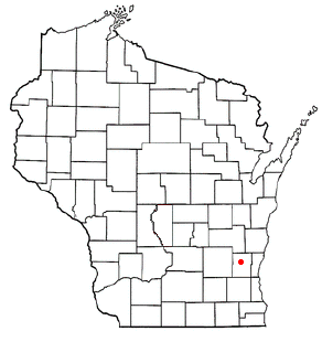
Richfield is a village in Washington County, Wisconsin, United States. The population was 11,739 at the 2020 census. The previously unincorporated communities of Hubertus and Pleasant Hill are located in the village, as well as the communities of Colgate and Lake Five, which are partially located in Richfield.

<span class="mw-page-title-main">Slinger, Wisconsin</span> Village in Washington County, Wisconsin

Slinger is a village in Washington County, Wisconsin, United States. The population was 5,992 at the 2020 census.

<span class="mw-page-title-main">Trenton, Washington County, Wisconsin</span> Town in Washington County, Wisconsin

Trenton is a town in Washington County, Wisconsin, United States. The population was 4,440 at the 2000 census. The unincorporated community of Myra is located within the town.

<span class="mw-page-title-main">Wayne, Washington County, Wisconsin</span> Town in Washington County, Wisconsin

Wayne is a town in Washington County, Wisconsin, United States. The population was 2,182 at the 2020 census. The unincorporated communities of Kohlsville and Wayne are located in the town.

<span class="mw-page-title-main">Hartford, Wisconsin</span> City in Washington County, Wisconsin

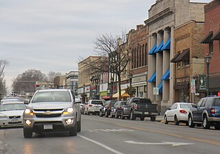
Hartford is a city in Washington and Dodge counties in the U.S. state of Wisconsin. As of the 2010 census, the city had a population of 14,223. All of this population resided in the Washington County portion of the city. The portion of the city in Dodge County consists of only industrial/commercial parcels. Located approximately 38 miles (61 km) northwest of Downtown Milwaukee and 22 miles (35 km) from city limits, Hartford is located on the outer edge of the Milwaukee metropolitan area.

<span class="mw-page-title-main">Newburg, Wisconsin</span> Village in Ozaukee and Washington counties, Wisconsin

Newburg is a village in Ozaukee and Washington counties in the U.S. state of Wisconsin. The population was 1,254 at the 2010 census. Of this, 1,157 were in Washington County, and only 97 were in Ozaukee County.

<span class="mw-page-title-main">Fredonia, Wisconsin</span> Village in Ozaukee County, Wisconsin

Fredonia is a village in Ozaukee County, Wisconsin, United States. Located on the Milwaukee River, the village is in the Milwaukee metropolitan area. The population was 2,160 at the 2010 census.

<span class="mw-page-title-main">Germantown, Washington County, Wisconsin</span> Town in Washington County, Wisconsin

Germantown is a town in Washington County, Wisconsin, United States. The population was 278 at the 2000 census. It is surrounded by the village of Germantown.

<span class="mw-page-title-main">Jackson, Washington County, Wisconsin</span> Town in Washington County, Wisconsin

Jackson is a town in Washington County, Wisconsin, United States. The population was 3,516 at the 2000 census. The Village of Jackson is located partially within the town. The unincorporated community of Kirchhayn is also located in the town.

<span class="mw-page-title-main">Jackson (village), Wisconsin</span> Village in Washington County, Wisconsin

Jackson is a village in Washington County, Wisconsin, United States. The population was 7,185 at the 2020 census. The village is adjacent to the Town of Jackson.

<span class="mw-page-title-main">Kewaskum (town), Wisconsin</span> Town in Washington County, Wisconsin

Kewaskum is a town in Washington County, Wisconsin, United States. The population was 1,119 at the 2000 census. The incorporated community of Village of Kewaskum is surrounded geographically by the Town of Kewaskum. The unincorporated community of Saint Michaels is located partially in the town.

<span class="mw-page-title-main">Kewaskum, Wisconsin</span> Village in Fond du Lac and Washington counties, Wisconsin

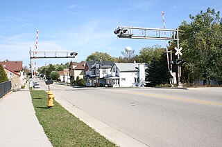
Kewaskum is a village in Washington and Fond du Lac counties in Wisconsin, United States. The population was 4,004 at the 2010 census. All of this population resided in the Washington County portion of the village. The village is mostly surrounded by the Town of Kewaskum.

<span class="mw-page-title-main">West Bend (town), Wisconsin</span> Town in Washington County, Wisconsin

West Bend is a town in Washington County, Wisconsin, United States. The population was 4,834 at the 2000 census. The City of West Bend is located partially within the town. The unincorporated community of Nabob is located in the town.

References

  1. "2019 U.S. Gazetteer Files". United States Census Bureau. Retrieved August 7, 2020.
  2. 1 2 3 "U.S. Census website". United States Census Bureau . Retrieved November 18, 2012.
  3. "Population and Housing Unit Estimates". United States Census Bureau. May 24, 2020. Retrieved May 27, 2020.
  4. "Germantown ZIP Code". zipdatamaps.com. 2023. Retrieved January 12, 2023.
  5. Ashford, Kate; Bartz, Andrea; Cox, Jeff; Fitch, Asa; Gandel, Stephen; Hyatt, Josh; Kelley, Rob; Knight, Kathleen; et al. "Best Places to Live: Top 100". Money Magazine. Archived from the original on August 23, 2009. Retrieved October 14, 2009.
  6. "US Gazetteer files: 2010, 2000, and 1990". United States Census Bureau. February 12, 2011. Retrieved April 23, 2011.
  7. "Wisconsin First Nations Treaty Map". Wisconsin Department of Public Instruction . Retrieved June 20, 2019.
  8. "Native Land". Native Land Digital. Retrieved June 20, 2019.
  9. "US Gazetteer files 2010". United States Census Bureau. Archived from the original on January 25, 2012. Retrieved November 18, 2012.
  10. Quickert, Carl (1912). Washington County, Wisconsin: Past and Present. Chicago, IL: S. J. Clarke Publishing Company. p.  16.
  11. Gerwing, Anselm J. (Summer 1964). "The Chicago Indian Treaty of 1833". Journal of the Illinois State Historical Society. 57 (2): 117–142. ISSN   0019-2287. JSTOR   40190019.
  12. "Potawatomi History". Milwaukee Public Museum. Retrieved February 20, 2020.
  13. 1 2 3 "Encyclopedia of Milwaukee: Germantown". University of Wisconsin–Milwaukee. Retrieved January 15, 2020.
  14. Quickert, Carl (1912). Washington County, Wisconsin: Past and Present. Chicago, IL: S. J. Clarke Publishing Company. p.  81.
  15. "Heads of Households – town of Germantown, Washington county during the 1850 census". Wisconsin Ancestors. Retrieved August 12, 2021.
  16. "Germantown". Wisconsin Historical Society. Retrieved January 15, 2020.
  17. Quickert, Carl (1912). Washington County, Wisconsin: Past and Present. Chicago, IL: S. J. Clarke Publishing Company. p.  29.
  18. Quickert, Carl (1912). Washington County, Wisconsin: Past and Present. Chicago, IL: S. J. Clarke Publishing Company. p.  139.
  19. Quickert, Carl (1912). Washington County, Wisconsin: Past and Present. Chicago, IL: S. J. Clarke Publishing Company. p.  132.
  20. Cowley, Betty (January 1, 2002). Stalag Wisconsin: Inside WW II Prisoner-of-war Camps. Badger Books Inc. pp. 227–31. ISBN   9781878569837.
  21. "History of Village". Village of Germantown. Retrieved January 15, 2020.
  22. "U.S. Census website". United States Census Bureau . Retrieved January 31, 2008.
  23. "School".