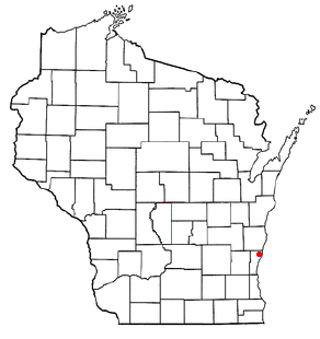
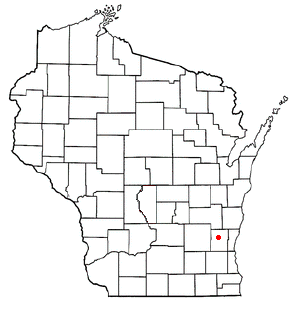
Port Washington is a town in Ozaukee County in the U.S. state of Wisconsin. It surrounds the northern and western side of the city of Port Washington. As of the 2020 census, the town population was 1,538. The unincorporated communities of Druecker and Knellsville are also located in the town.
The area that became Port Washington was originally inhabited by the Menominee, Potawatomi, and SaukNative Americans. The 1830s saw the forced removal of Wisconsin's Native American population, followed by land speculation by merchants and investors. One of these land speculators was General Wooster Harrison, who purchased the land that would become the Town of Port Washington in 1835.[3][4] Harrison's wife, Rhoda, died in 1837 and was the first white settler to be buried in the town.[5] The settlement was abandoned that same year.
In 1843, Harrison returned with a party of settlers. The Town of Port Washington was formed in January 1846 and until 1847 included the surrounding areas of what is currently Fredonia, Saukville, and Belgium.[6] At the time, the land was part of Washington County, and in the late 1840s, Port Washington was a candidate for the county seat. However, the community was far from the county's other early settlements, including Mequon, Grafton and Germantown. In 1850, the Wisconsin legislature voted to bisected Washington County into northern and southern counties, with Port Washington and Cedarburg as the county seats, respectively. County residents failed to ratify the bill, and in 1853 the legislature instead bisected the county into eastern and western sections, creating Ozaukee County. Port Washington became the seat of the new county, and the Washington County seat moved to West Bend.[7] The bisection was controversial. When Washington County officials from West Bend arrived in Port Washington to correct relevant county records, they were run out of town, and Ozaukee County officials refused to hand over the records for several months.[8]
The town population reached 2,500 in 1853 and continued to increase, with an influx of immigrants from Germany and Luxembourg between 1853 and 1865.[9]
In the 1860s, William Knell developed the Knellsville community in the northern part of the town as a stagecoach stop on the Green Bay Road. In the 1870s, dairy farming became increasingly popular among Port Washington's farmers,[10] and the Pauly Cheese Factory opened in Knellsville in 1878. In the 20th century, Pauly's Cheese became a nationally distributed brand. Knellsville grew to serve the town's farmers with a feed mill, a cannery, and a foundry.[11]
The City of Port Washington incorporated out of some of the town's land in 1882.
While dairy farming dominated the local economy in the 20th century, accounting for 80% percent of agriculture in the early 1940s,[12] the Town of Port Washington was also one of several Ozaukee County communities to have prosperous fur farms in the 20th century. The 10-acre Johannes Mink Ranch north of Knellsville opened in 1926, and annually produced 6,000 mink pelts at its height.[13]
Knellsville declined in the mid-20th century for several reasons. The Knellsville Canning Co. closed in 1955, and the Johannes Mink Ranch sold its last pelts in 1969.[13] Additionally, as the City of Port Washington grew and suburbanized, annexing more land from the town, demand for access to the Interstate Highway System grew. Knellsville was close to the city outskirts, and in the mid-1960s, the southern part of Knellsville was demolished to construct Interstate 43's Exit 100.[11]
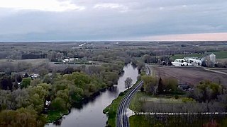
The town is located on the western shore of Lake Michigan. The coastline is characterized by clay bluffs ranging from 80 to 130 feet (24 to 40 meters) in height with deep ravines where streams flow into the lake. Clay bluffs are a geological formation characteristic of the Lake Michigan shoreline and are found in few other areas of the world. Much of the coastline adjacent to the bluffs has mixed gravel and sand beaches. There are valleys lower than the surrounding bluffs in the City of Port Washington's historic downtown where Sauk Creek flows into the lake and in the Town of Port Washington where Sucker Creek flows into the lake.[14][15]
Before white settlers arrived in the area, the Port Washington area was an upland forest dominated by American beech and sugar maple trees. There were also white cedars growing in the lowlands along the streams.[14] Early surveyors also noted swamps in the area containing birch, ash, elm, oak, and sugar bush.[11] Much of the original forest was cleared to prepare the land for agriculture.[14]
As land development continues to reduce wild areas, wildlife is forced into closer proximity with human communities like Port Washington. Large mammals, including white-tailed deer, coyotes, and red foxes can be seen in the town.[16] There have been infrequent sightings of black bears in Ozaukee County communities, including a 2010 sighting of a bear in a City of Port Washington residential neighborhood.[17]
As of the census[18] of 2000, there were 1,631 people, 636 households, and 447 families residing in the town. The population density was 87.7 people per square mile (33.9/km2). There were 678 housing units at an average density of 36.4 per square mile (14.1/km2). The racial makeup of the town was 97.30% White, 1.10% Black or African American, 0.43% Asian, 0.25% Native American, 0.06% Pacific Islander, 0.31% from other races, and 0.55% from two or more races. 0.61% of the population were Hispanic or Latino of any race.
There were 636 households, out of which 32.4% had children under the age of 18 living with them, 62.6% were married couples living together, 4.6% had a female householder with no husband present, and 29.7% were non-families. 26.6% of all households were made up of individuals, and 16.8% had someone living alone who was 65 years of age or older. The average household size was 2.56 and the average family size was 3.11.
In the town, the population was spread out, with 26.3% under the age of 18, 6.1% from 18 to 24, 28.1% from 25 to 44, 23.7% from 45 to 64, and 15.8% who were 65 years of age or older. The median age was 40 years. For every 100 females, there were 97.0 males. For every 100 females age 18 and over, there were 93.9 males.
The median income for a household in the town was $56,875, and the median income for a family was $62,765. Males had a median income of $41,742 versus $25,645 for females. The per capita income for the town was $22,781. About 2.3% of families and 3.2% of the population were below the poverty line, including 2.6% of those under age 18 and none of those age 65 or over.
Law and government
Port Washington is organized as a town governed by an elected board, comprising a chairman and two supervisors. The current chairman is Mike Didier. The board meets on the first Monday of each month at 7:30p.m. in the town hall which is located at 3715 Highland Drive in the unincorporated Knellsville community.[19]
Port Washington is served by the joint Port Washington-Saukville School District. The district has three elementary schools for kindergarten through fourth grade. Students in the northern and eastern parts of the town attend Lincoln Elementary. Saukville Elementary serves students in the western parts of the Town of Port Washington and the Town and Village of Saukville. Students in the far southern parts of the town attend Dunwiddie Elementary. All students in the district attend Thomas Jefferson Middle School for fifth through eighth grades, and Port Washington High School for ninth through twelfth grades.
The district is governed by a nine-member elected school board, which meets on Mondays at 6 p.m. in the District Office Board Room, 100 W. Monroe Street, Port Washington. The district also has a full-time superintendent: Michael R. Weber.[21]
Transportation
Interstate 43 passes through the town with access to Knellsville and the City of Port Washington via Exit 100. A small stretch of Wisconsin Highway 33 passes through the southwestern part of the town between the City of Port Washington and the Village of Saukville.
Port Washington has limited public transit compared with larger cities. Ozaukee County and the Milwaukee County Transit System run the Route 143 commuter bus, also known as the "Ozaukee County Express," to Milwaukee via Interstate 43. The closest stop is the route's northern terminus at the Saukville Walmart parking lot, near Interstate 43 Exit 96. The bus operates Monday through Friday with limited hours corresponding to peak commute times.[22][23] Ozaukee County Transit Services' Shared Ride Taxi is the public transit option for traveling to sites not directly accessible from the interstate. The taxis operate seven days a week and make connections to Washington County Transit and Milwaukee County Routes 12, 49 and 42u. Unlike a typical taxi, however, the rider must contact the service ahead of time to schedule their pick-up date and time. The taxi service plans their routes based on the number of riders, pick-up/drop-off time and destination then plans the routes accordingly.[22][24]
The town does not have sidewalks in many areas, but the Ozaukee Interurban Trail for pedestrian and bicycle use runs north–south through the town and connects Port Washington to the neighboring communities of Grafton in the south and Belgium in the north. The trail continues north to Oostburg in Sheboygan County and south to Brown Deer where it connects with the Oak Leaf Trail. The trail was formerly an interurban passenger rail line that ran from Milwaukee to Sheboygan with a stop in the City of Port Washington, which was the halfway point between the northern and southern terminuses. The train was in operation from 1907 to 1948, when it fell into disuse following World War II. The old rail line was converted into the present recreational trail in the 1990s.
The town does not have passenger rail service, but the Union Pacific Railroad operates freight trains in the community.[25]
Related Research Articles
Washington County is a county in the U.S. state of Wisconsin. As of the 2020 census, the population was 136,761. Its county seat is West Bend. The county was created from Wisconsin Territory in 1836 and organized in 1845. It was named after President George Washington.
Ozaukee County is a county in the U.S. state of Wisconsin. As of the 2020 census, the population was 91,503. Its county seat is Port Washington. Ozaukee County is included in the Milwaukee–Waukesha–West Allis, WI Metropolitan Statistical Area.
Milwaukee County is located in the U.S. state of Wisconsin. At the 2020 census, the population was 939,489, down from 947,735 in 2010. It is both the most populous and most densely populated county in Wisconsin, and the 45th most populous county nationwide; Milwaukee, its eponymous county seat, is also the most populous city in the state. The county was created in 1834 as part of Michigan Territory and organized the following year.
Mequon is the largest city in Ozaukee County, in the U.S. state of Wisconsin, and the third-largest city in Wisconsin by land area. Located on Lake Michigan's western shore with significant commercial developments along Interstate 43, the community is a suburb in the Milwaukee metropolitan area. Despite being an incorporated city, approximately half of Mequon's land is undeveloped and agriculture plays a significant role in the local economy. At the time of the 2020 census the population was 25,142.
Thiensville is a village in Ozaukee County, Wisconsin, United States. Located on the west bank of a bend in the Milwaukee River, the community is bordered on all sides by the City of Mequon and is a suburb in the Milwaukee metropolitan area. The population was 3,235 at the 2010 census.
Belgium is a town in Ozaukee County, Wisconsin, United States. The population was 1,513 at the 2000 census. The Village of Belgium is surrounded on all sides by the town, and the unincorporated communities of Decker, Holy Cross, Lake Church, and Sauk Trail Beach are located in the town, as is the ghost town of Stonehaven. The unincorporated community of Dacada is also partially located in the town.
Belgium is a village in Ozaukee County, Wisconsin, United States. Located along Interstate 43, the village is one of the northernmost communities in the Milwaukee metropolitan area. The population was 2,245 at the 2010 census.
Cedarburg is a town in Ozaukee County, Wisconsin, United States, and is in the Milwaukee metropolitan area. The town was created in 1849 and at the time of the 2020 census had a population of 6,162.
Cedarburg is a city in Ozaukee County, Wisconsin, United States. Located about 20 miles (32 km) north of Milwaukee and in close proximity to Interstate 43, it is a suburban community in the Milwaukee metropolitan area. The city incorporated in 1885, and at the time of the 2020 census the population was 12,121.
Fredonia is a village in Ozaukee County, Wisconsin, United States. Located on the Milwaukee River, the village is in the Milwaukee metropolitan area. The population was 2,160 at the 2010 census.
Fredonia is a town in Ozaukee County, Wisconsin, United States. The population was 2,903 at the 2000 census. The Village of Fredonia is surrounded by the town. The unincorporated communities of Little Kohler and Waubeka are also located in the town.
The Town of Grafton is a town located in Ozaukee County, Wisconsin, United States, and is in the Milwaukee metropolitan area. The town was created in 1846 and at the time of the 2020 Census had a population of 4,157.
Grafton is a village in Ozaukee County, Wisconsin, United States. Located about 20 miles (32 km) north of Milwaukee and in close proximity to Interstate 43, it is a suburban community in the Milwaukee metropolitan area. The village incorporated in 1896, and at the time of the 2020 census the population was 12,094.
Port Washington is the county seat of Ozaukee County in the U.S. state of Wisconsin. Located on Lake Michigan's western shore east of Interstate 43, the community is a suburb in the Milwaukee metropolitan area 27 miles (43 km) north of the City of Milwaukee. The city's artificial harbor at the mouth of Sauk Creek was dredged in the 1870s and was a commercial port until the early 2000s. The population was 12,353 at the 2020 census.
Saukville is a town in Ozaukee County, Wisconsin, United States. The Village of Saukville is located in the town's southeast quadrant. The population was 1,755 at the 2000 census.
Saukville is a village in Ozaukee County, Wisconsin, United States. Located on the Milwaukee River with a district along Interstate 43, the community is a suburb in the Milwaukee metropolitan area. The population was 4,258 at the 2020 census.
West Bend is a town in Washington County, Wisconsin, United States. The population was 4,834 at the 2000 census. The City of West Bend is located partially within the town. The unincorporated community of Nabob is located in the town.
The Milwaukee metropolitan area is a major metropolitan area located in Southeastern Wisconsin, consisting of the city of Milwaukee and some of the surrounding area. There are several definitions of the area, including the Milwaukee–Waukesha–West Allis metropolitan area and the Milwaukee–Racine–Waukesha combined statistical area. It is the largest metropolitan area in Wisconsin, and the 39th largest metropolitan area in the United States.
The Ozaukee - Sheboygan Interurban Trail is a roughly 40-mile (64 km) long rail trail in Ozaukee, and Sheboygan Counties, in Wisconsin. The south end of the trail is in Milwaukee County but only runs 1 mile through the county.
Knellsville is an unincorporated community in the Town of Port Washington, Ozaukee County, Wisconsin, United States. Located on the north side of the intersection of Interstate 43 and Wisconsin Highway 32, Knellsville borders the City of Port Washington's northern municipal limit. The Port Washington Town Hall is in Knellsville, but the City of Port Washington provides sewerage and water services for the community.
This page is based on this Wikipedia article Text is available under the CC BY-SA 4.0 license; additional terms may apply. Images, videos and audio are available under their respective licenses.